Mobile phones and satellite imaging are transforming farming in Sudan
By Abby Waldorf
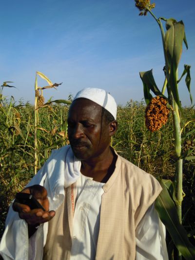
In central Sudan, nestled between the Blue and White Nile rivers lies Gezira. Literally ‘island’, it is home to thousands of farmers and a sophisticated irrigation system dating back almost 100 years. Gezira’s cotton farms were once the centerpiece of Sudan’s economy. Now, the land is too degraded to grow cotton, so farmers have switched to other cash crops, such as sorghum, but productivity continues to decline due to poor management.
However, there is hope. In the age of technology, a new short message service (SMS) system developed by researchers from the Hydraulics Research Center (HRC) in Sudan can help farmers increase crop yields by improving on-farm water management.

Photo: Abby Waldorf
The system collects plot-specific data, such as soil moisture, crop growth and minerals, using remote sensing and satellite imagery, and pairs this information with a five-day weather forecast. This is then analyzed by eLeaf, a company based in the Netherlands, and recommendations on when to irrigate are sent to farmers via SMS. The weekly texts are tailored to the conditions on each farmer’s field.
With improved irrigation practices, some farmers have seen increases of over 60% in farm productivity.
The project started 3 years ago in the Gash River Basin of northeastern Sudan, and in three other sites in Ethiopia, Egypt and Ghana. Implemented by the International Water Management Institute (IWMI) and HRC, the project has now expanded into Gezira.
The government and the manager of the Gezira Irrigation Scheme have requested for a trial run in Gezira before scaling up the technology throughout the entire scheme, which spans over 2.1 million feddans (0.9 million hectares) with about 150,000 farmers.
With the pilot already well established, news of the SMS service is already spreading quickly. “Farmers told us that their neighbors were coming over and asking, ‘are you going to irrigate today’? They followed the advice that our farmers were receiving and achieved an increase of about 60% in production,” explained Dr. Younis, Director of Dams and River Engineering at the HRC in Sudan.
“One farmer used to harvest six bags of wheat. After he was included in the study, he harvested 18 bags simply by improving his irrigation practices,” said Dr. Younis.
Beneath the surface
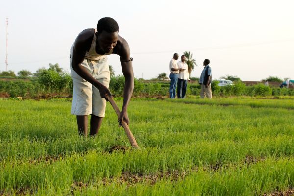
To the un-trained eye, farm fields in Gezira look identical. However, using remote sensing, researchers saw large differences in productivity, water-use efficiency and nitrogen levels (i.e., fertilizer application) between farms.
Even though most farmers were using similar farming techniques, many of which have existed for centuries, differences in water usage have caused great disparities between fields in terms of soil moisture, fertility and productivity.

Photo: Abby Waldorf
Hidden inside the data are some illuminating trends. Farms that have hired laborers, for instance, see a decrease in productivity that researchers have attributed to over-watering. “One farmer in the study is handicapped,” said Dr. Younis. “He isn’t able to travel to his farm, so he hires people to work on it. Now that we are able to monitor his farm through satellite data, the farmer is able to tell his laborers exactly when to irrigate. His farm is more productive now.”
This kind of remote messaging is especially helpful to the many farmers with multiple businesses. They can manage their farms while engaging in off-farm activities.
It can also assist irrigation canal managers. With satellite images of the entire irrigation scheme, managers can see how much water is lost and how much is consumed by crops in different sections of the scheme. With this information, managers can improve how water is distributed within a canal system to maximize water-use efficiency. With more efficient distribution, canal systems may be able to supply water more equitably between sections and also to adjoining properties that suffer from lack of water.
This analysis on the irrigation scheme level is supported by a newly funded project, Accounting for Nile Waters, of which IWMI is a partner. The project is part of the work carried out by the CGIAR Research Program on Water, Land and Ecosystems (WLE) in the Nile River Basin and East Africa.
At scale
But why stop at just one irrigation scheme? With the satellite imaging system in place, the cost of increasing the number of farmers who receive the SMS service is marginal. In fact, as the number of participating farmers increases, the cost per farmer decreases.
Dr. Yasir Mohamed, Director at HRC, recently met with the Sudanese Ministry of Agriculture and Forestry, and the Ministry of Irrigation and Water Resources. Based on the ongoing success of the current pilot project, government officials are eager to scale out the technology with support from HRC and partners.
Related posts:
Blog: Connecting farmers in Sudan with real-time flood management information
News story: Who can you call?

