In 2020, the International Water Management Institute (IWMI) launched the Digital Innovations for a Water Secure Africa (DIWASA) project, and researchers have been mapping the state of water across Africa since.
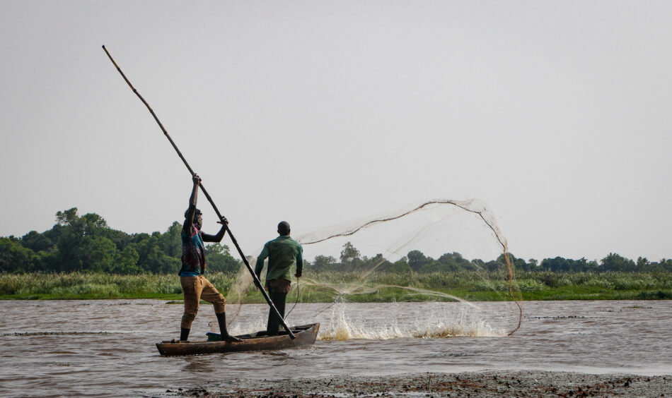
Africa has significant but underutilized water resources. The lack of water infrastructure, weak water governance and poor water resource management practices, however, are causing water insecurity on most of the continent. With the number of Africans facing water scarcity expected to substantially increase by 2050, Africa needs immediate water resource management interventions, at different scales and relevant to local needs.
Many African countries are embarking on ambitious small-scale, smallholder irrigation projects, but in most places, data on available water resources and actual water withdrawals for agriculture is just not available. Without data, countries attempt to formulate water resource management policies without a comprehensive grasp of the diverse uses, requirements, and shortfalls of water across sectors.
Filling the gaps
DIWASA’s primary emphasis lies in filling the critical water data gaps for improving water resource management decisions in Africa. It has two components, water accounting and resilience applications covering a diverse range of products in the four priority countries of Burkina Faso, Ethiopia, Ghana, and Zambia.
DIWASA uses earth observation data gathered from satellites, weather forecasting and other sources to address these critical water data gaps. Digital innovations such as remote sensing, cloud computing, open data initiatives and machine learning are used to enhance the accessibility of water data throughout the African continent.
Habtamu Itefa, Ethiopia’s Minister of Water and Energy, requested IWMI’s support to build his Ministry’s capacity to use earth observation data, to address the existing gaps in his country. He was speaking at the DIWASA event co-convened by IWMI and the Ethiopian Ministry of Water and Energy at COP28 last year.
Also at COP28, Rashid Mbazira, Executive Secretary of the African Ministers’ Council on Water (AMCOW) said DIWASA water data products and tools provided great opportunity to fill critical data gaps in AMCOW’s Water and Sanitation Sector Monitoring system (WASSMO). He expressed his keen interest to explore this further with IWMI.
Users of the DIWASA system can access water accounts for any area they choose, scaling from river basin to national and administrative regions, via an online dashboard. The platform also maps climatological, meteorological, and hydrological hazards for the whole of Africa. Once ready, this will include drought, wildfires, storms, extreme temperatures, floods, and landslides. The mapping provides decision making support for the management of flood, drought, and other risks.
Forewarned is forearmed
Africa’s river basins have experienced major droughts and extreme flood events. DIWASA generates probabilistic drought hazard maps specifically highlighting areas with severe drought levels. This is an innovative approach and crucial for environmental monitoring, agricultural planning, water resource management, and informing policy decisions related to climate change and disaster preparedness. IWMI has set up early warning systems for both flood and drought for the four target countries.
Reliable and systematic analysis-ready water data products on water use, demand, water availability, and scarcity are generated using a new scale invariant water accounting plus (SIWA+) framework. SIWA+ underpins the generation of information on the state of water across Africa at multiple spatial scales. Water accounts and applications created using this data are then shared through Digital Earth Africa and the Africa Geoportal to support water management decisions on the continent.
Several water data products have been developed to address Africa’s water security challenges. These include the river discharge for over 60,000 river segments in Africa, rainfall datasets, per capita water availability, and indicators on agricultural water use and stress. The data provides crucial information as competition for water resources increases on the continent as population growth, agricultural activities, and irrigation expansion continue to climb.
All data in the system is open source and available for use by other entities to produce their own tools and products.
The DIWASA project will continue expanding water data availability in Africa into 2025 and beyond thanks to user demands and new funding. A key focus will be on closer end user collaboration, enhanced and targeted user engagement through product co-design sessions, training and the fostering of continent-wide user communities. Plans also include the implementation of a prototype digital twin for the Limpopo River Basin. IWMI will evaluate the twin’s uses for enhancing water management decisions.