Mapping groundwater from the air in Southern Africa
Assessing groundwater resources presents scientists with a tricky challenge. Invisible from the surface, aquifers were traditionally mapped using boreholes and conventional surveying techniques. But the rise of digital technology has ushered in a new age of subsurface mapping. For instance, groundwater stocks can now be assessed from space by detecting tiny changes in the Earth’s gravity, and there are high hopes that this approach can be developed further.

For researchers on terra firma, however, subsurface mapping has remained complex and time consuming. Ground based methods can produce highly accurate three dimensional (3D) data sets, but are slow and difficult to employ in hilly terrain or populated areas. But now a system developed by Danish technologists promises a quicker and more accurate approach that could revolutionise groundwater management.
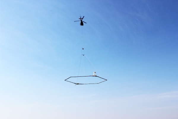
First deployed just over a decade ago, SkyTEM picks up variations in electrical resistivity to map the Earth’s subsurface. The system consists of a transmitter loop, about twice the area of a tennis court, suspended below a helicopter. The system flies over the study area at a height of 30m, and emits an electromagnetic field into the ground and a receiver coil measures the response. Various rocks and soil types have different electrical characteristics and each responds differently to the transmitted signal, giving indications about geologic structure. Interpretations of the subsurface material are used to produce a 3D geologic model of the earth to depths of up to 350 meters. It allows for detailed analysis of the subsurface geology and can contribute to the development of a groundwater model for the area. In addition, the subsurface mapping provides an insight into where to locate and drill wells, and to identify potential recharge areas. It’s quick too: The helicopter can potentially cover 300 kilometers in a day.

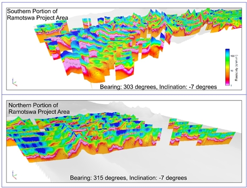
The technique was recently used by IWMI scientists to produce the first ever 3D maps of the Ramotswa Aquifer on the border between South Africa and Botswana. For a week the water exploration company XRI Blue (USA), led by Andrew Genco, in association with SkyTEM (Denmark), and Savannah Helicopters (South Africa) flew over the border area to map the subsurface.
“This is tremendously useful for us,” said IWMI’s Karen Villholth who leads the initiative. “By digitally mapping the subsurface in this way we can work out where the important aquifers are located, how large and deep they are, how they are delimited by other geologic formations. From this we can determine where it would make sense to further explore the aquifer through traditional means to identify good sites for drilling and managed aquifer recharge.”
 3D subsurface resistivity (preliminary inversion results based on close-to-real-time data)
Credit: XRI Blue
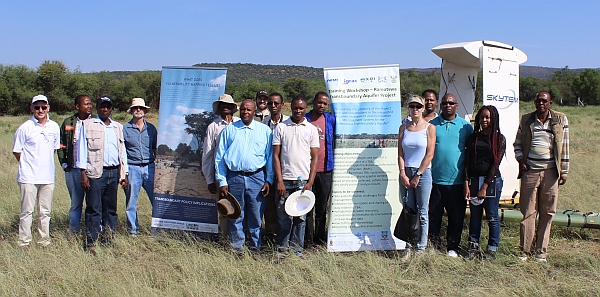
The mapping is taking place as part of the Ramotswa Transboundary Aquifer Project. Funded by United States Agency for International Development (USAID). The aim is to generate new information about groundwater to facilitate its sustainable management and support water security and resilience for the two countries sharing the aquifer, South Africa and Botswana.
Project partners:
- Department of Water and Sanitation, South Africa
- Department of Water Affairs, Botswana
- University of Botswana
- University of the Free State
- University of Pretoria
- University of the Witwatersrand
- Resilience in the Limpopo River Basin program (RESILM)
This work is supported by the CGIAR Research Program on Water Land and Ecosystems.
RAMOTSWA Project website: http://ramotswa.iwmi.org/

