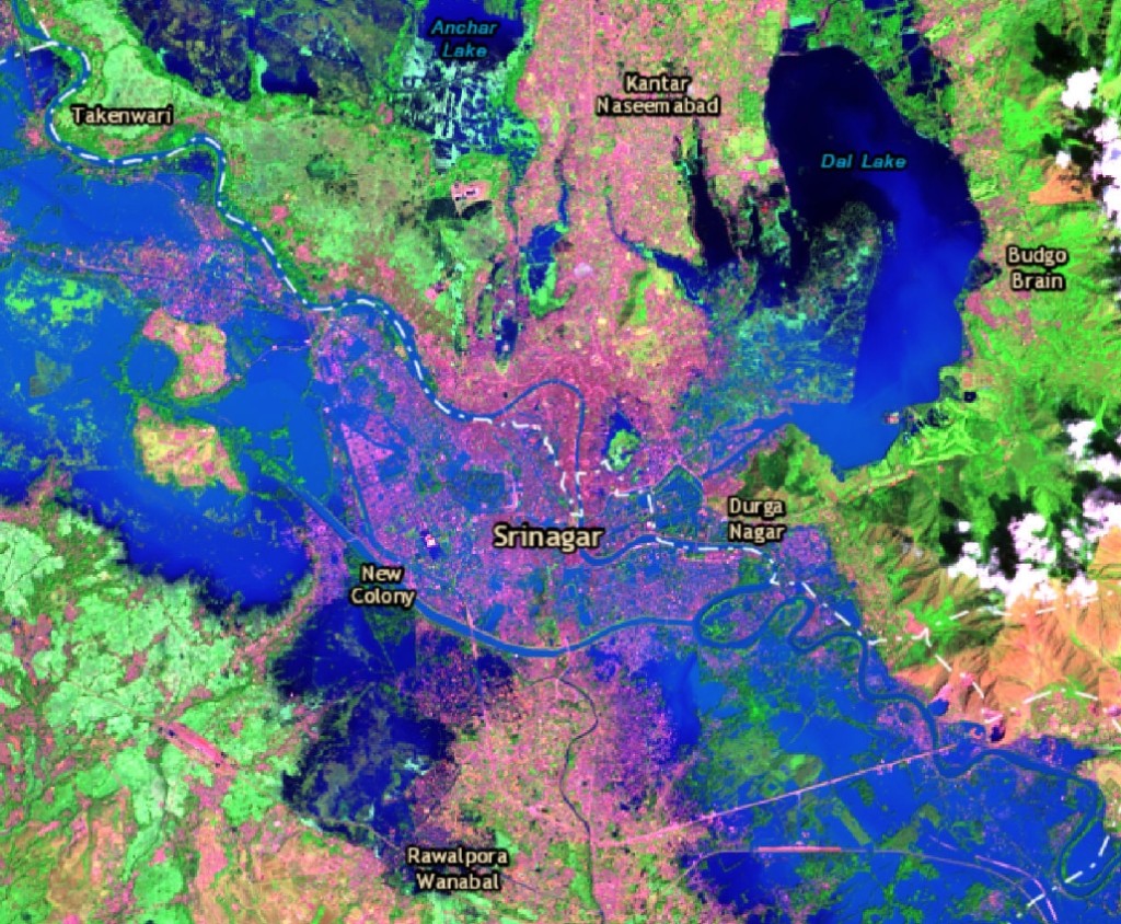
IWMI has released a series of maps showing the extent of the catastrophic flooding in Kashmir.
Heavy monsoon rains have caused the most severe floods in over a century, after the Jhelum River burst its banks. So far around 450 people have died, and up to one million people have been displaced. Approximately 550 sq km have been affected in the administrative areas of Srinagar (pictured), Baramulla, Pulwama, Badgam and Anantnag.
The high-resolution maps, produced by IWMI using data from the US Geological Survey, are based on satellite images captured on Wednesday (September 10th).
The IWMI maps provide a more detailed picture of the affected areas and the likely impact of the floods.
Yesterday evening the maps were passed to the United Nations to help with the coordination of relief efforts on the ground.
“The maps clearly show the affected residential areas in pink, different depths of floodwater in shades of blue, and as you zoom in you can see damaged bridges and flooded roads,” said IWMI’s Giriraj Amarnath, a remote sensing and water resources expert.
[pullquote type=”pullquote1″ content=”This is critical information for relief agencies trying to access the area, especially because the flooding has destroyed a lot of the telecommunications infrastructure there.” quote_icon=”yes” align=”center” textcolor=”#131d3a”]This is critical information for relief agencies trying to access the area, especially because the flooding has destroyed a lot of the telecommunications infrastructure there.[/pullquote]
The maps are publicly available via the United Nations Office for the Coordination of Humanitarian Affairs (UNOCHA)’s ReliefWeb portal, an open-access site for sharing information on humanitarian disasters.
The IWMI team aims to develop maps for downstream areas as soon as the satellite images become available.


