Smartphone apps improve access to resources
By Carolyn Fry
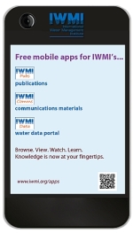 Donors wanting to see project findings at a glance, journalists seeking a new angle on an environmental story and researchers or university students wanting maps illustrating scientific data will all find a use for the International Water Management Institute’s (IWMI’s) new collection of apps, launched today at World Water Week in Stockholm, Sweden. Developed by IWMI’s Information and Knowledge Group in Colombo, Sri Lanka, these apps provide easy access from mobile devices to the Institute’s information systems: Communications resources, publications and the Water Data Portal.
[blockquote variation=”blue” cite=”Yasoma Jayasinghe, Senior Systems Analyst, IWMI.”]We wanted to provide different apps as avenues for each of our information systems[/blockquote]
“We launched the ‘IWMI Comms’ app at Stockholm World Water Week 2012 and have now released the ‘IWMI Publications’ and ‘IWMI Data’ apps. All three apps are available for iPhone and Android phones.”
Yasoma Jayasinghe and Salman Siddiqui, Manager-GIS, RS and Data Management Unit, IWMI, started by developing a simple design for the ‘IWMI Comms’ app that would work within the restricted memory and data download speeds available on mobile phones. They wanted to provide the information that would be most useful to mobile phone users, without overloading them. An external app development company worked towards bringing Yasoma and Salman’s design to fruition through a simple user interface.
The result is a user-friendly app that enables the user to choose one of the following options: photos, powerpoints, success stories, videos and more. The ‘photos’ option provides access to IWMI’s 2,500-strong image bank, along with information such as where and when each photo was taken and who the photographer was. Images can be saved to the photo folder on the mobile device or emailed, as required. Similar information is provided for videos, along with links to where they can be viewed.
The ‘powerpoints’ option provides access to entire presentations on topics ranging from Unlocking the potential of smallholder agriculture to Food security and water challenges. Meanwhile, the ‘success stories’ option provides information on IWMI’s successes on themes such as mapping water scarcity and changing our thinking on ‘water wars’. A summary of each success story is provided, together with information on where related texts have been published and whether the particular success was included among CGIAR Performance Indicator Outcomes. The ‘more’ option leads to posters, audio files, maps, logos and media cuttings, along with contact information. Straightforward to use, the app provides an at-a-glance overview of IWMI’s varied media resources.
The ‘IWMI Publications’ app works similarly, using the Institute’s existing publications database. A simple menu directs the user to various types of publications, such as research reports, success stories, newsletters and so on. Once a particular document has been selected, e.g., the success story, Influencing climate change policy in Sri Lanka, this is downloadable as a PDF file. The users can also locate publications via a straightforward search under ‘author’, ‘title’, ‘keyword’, ‘publication year’ or ‘all fields’ by selecting the ‘IWMI Catalog’ menu option.
The ‘IWMI Data’ app is slightly different from the other two apps, as it offers both a text search and a map-based search. The former provides searches under the headings ‘all data’, ‘spatial data’, ‘non-spatial data’, ‘basin kits’ and ‘water, land and ecosystem data’. Searching under ‘all data’ for ‘Vietnam’ yields seven records ranging from ‘Monthly rainfall’ to ‘Landsat-TM 30-m resolution images for single dates’. A search under ‘spatial data’ requires the user to first touch two points on a scalable map to define the area of the search. Searching an area of central Sri Lanka brings up 234 resources, including ‘Daily rainfall data from 579 stations’ and ‘Area, yield and production of oil seed by state’.
In time, the plan is to develop a similar app to showcase IWMI’s past and ongoing projects and, possibly, to develop a remote-sensing and data-collection app. Anyone will be able to quickly access, for free, a range of data and publications, whether in the field, office or laboratory.
Photos of IWMI’s mobile apps being launched at World Water Week 2013 in Stockholm:
[fsg_gallery id=”2″]