
Publicly accessible satellite data gives water accounting a boost
“I never wanted to be an accountant,” says Wim Bastiaanssen, recalling his boyhood ambitions. Sadly for the ebullient Dutch professor, that is exactly what he has become. He is not complaining. Bastiaanssen is one of the world’s leading authorities on water accounting (WA) and his presence at the recent Mekong Forum attracted an enthusiastic audience to a morning workshop on why this approach to measuring water use matters.
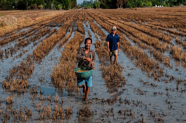
Water accounting essentially tries to measure where water goes in a river basin. Using data from a range of sources, water accountants work out how much water is coming into a system, and then how much is taken out. Ultimately the goal is to be able to give water managers precise indications of where and when water is being “used” and allow them to plan accordingly. Only when water supply and demand can be accurately established, can sustainable use be assured.
Based at the Delft University of Technology, Bastiaanssen’s team contributes to a major WA scheme for the Mekong region that is part of the CGIAR Research Program on Water Land and Ecosystems. Other key partners are the International Water Management Institute, the Food and Agriculture Organization of the United Nations (UN), and the UN Educational, Scientific and Cultural Organization Institute for Water Education (UNESCO-IHE) . They call their approach Water Accounting+ (WA+) and it differs from more traditional approaches by combining ground measurements with satellite remote sensing. The process generates simple summary information sheets that can help policy makers effectively manage water demand in a given river basin.
In the past WA relied on field measurements – essentially water flow and depth in rivers and canals. In many developing countries, however, obtaining this information can be problematic. Often the data do not exist. Even when available, many countries refuse to share the information they have, believing water resources to be a strategic asset. It is not uncommon to find that data is not even shared between different ministries in the same national governments.
But remote sensing (RS) is transforming this situation. Satellite images can easily show visually where water is in rivers, canals, lakes and ponds. However, new techniques in RS are able to reveal a lot more about water use and distribution. Groundwater, invisible to satellite cameras, can be mapped by measuring tiny variations in the Earth’s gravity field. Rainfall droplets per km can be assessed using radar. Even the evapo-transpiration (ET) of plants can now be assessed. Combining all these elements allows for detailed, time sequenced patterns of water flow to be combined into “water accounts” for entire river basins.
“Water accounts are open access,” says Bastiaanssen. “Sharing is very poor in many developing world institutions. That makes country wide water resources assessments very difficult. But now we can get a get standard system for all basins in Mekong area. This will include monthly reports and basic information sheets for decision makers.”
Evapo-transformations
The ability to measure ET has been a game changer. This can give accurate estimates of water use in agriculture and ecosystems and help assess whether or not plants are thriving. Water depth and levels will soon also be measurable. Measuring ET also allows researchers to look at energy within the system bringing a whole new dimension to natural resource accounting.
“In the Nile Basin 96% of water goes into ET, only 4% goes into river,” says Bastiaanssen. “Yet all people talk about is water in the river. So a change in mindset is needed”
River basin managers have two main options when confronted with resource challenges: either changing water flows or land use. A good example of how these new approaches can change thinking is the Ca Basin in Vietnam. Using WA+ approaches detailed data-rich maps have been developed. These clearly show that there is little rainfall in the upper part of the catchment. Most downpours are over agricultural land nearer the delta. This would suggest that there is little point in building large upstream dams for water storage. It would be better to store water further downstream either as groundwater or in wetlands.
Bastiaanssen is upbeat about the future prospects for WA+. “We will never have complete data,” he says, “But if we can use the water and energy balances together in this way, then we can solve problems.”
The session was organized by MK27 Inclusive development paths for healthy Red River landscapes based on ecosystem services, part of the CGIAR Research Program on Water Land and Ecosystems.
Read more about Water Accounting+
Related event
Related contents


Blog Post 

Blog Post 


