Displaying 586 publications
Moges, A.; Yakob, G.; Girma, R.; Teshale, T.; Mekuria, Wolde; Haile, Alemseged Tamiru. 2023.
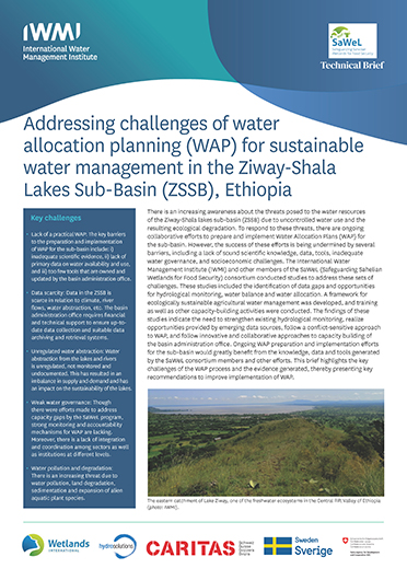
Forest and landscape restoration opportunities in the western catchment of Lake Ziway, Central Rift Valley, Ethiopia: technical report. Addis Ababa, Ethiopia: International Water Management Institute (IWMI) 64p.
[DOI] More... |
Fulltext (1.41 MB)
Forest and landscape restoration measures could address landscape degradation, increase ecosystem services, and improve livelihoods. However, mapping potential areas for forest and landscape restoration measures and identifying enabling and constraining factors is crucial for effective implementation. This study was conducted in the western catchment of Lake Ziway, Central Rift Valley, Ethiopia, to identify potential forest and landscape restoration options, map potential areas, assess the benefits and cost of options, and investigate success and failure factors for implementing interventions. The study adopted the Restoration Opportunities Assessment Methodology (ROAM), which enables selecting and mapping forest and landscape restoration options. Data were collected using field surveys, key informant interviews, focus group discussion and literature reviews. We also employed GIS and remote sensing methods to characterize the long-term land use and land-cover dynamics and changes in the status of land degradation. Cost–benefit analysis was conducted to assess the economic viability of identified restoration options. The results suggested that over the last 20 years (2002 to 2022), the western catchment of Lake Ziway experienced severe forest and landscape degradation due to anthropogenic and climatic factors, resulting in multiple environmental and socioeconomic consequences. This study identified seven context-specific forest and landscape restoration measures to address the problem. They vary in cost, trajectory and specific economic and social outcomes. Most options were economically viable with additional environmental and social benefits. For example, the benefit of carbon sequestration for home garden agroforestry was estimated at USD 27,032.5 ha-1 over 20 years. It was also found that a considerable portion of the catchment area was potentially suitable for agroforestry practices (40%), particularly for scattered trees on farmlands. However, the potential areas suitable for full afforestation or reforestation and tree buffers are smaller (6%). Integrating multiple forest and landscape restoration measures in the catchment could maximize the environmental and socioeconomic outcomes. Opportunities to effectively implement and scale up the identified forest and landscape restoration options include the availability of adequate active labor, the diverse benefits of measures, and the existence of supporting policies and strategies, multiple potential financing mechanisms and active development of governmental and non-governmental organizations. However, the absence of guidelines for implementing legal issues, weak coordination among responsible institutions, and inadequate finance and incentives have been identified as major constraints to scale up forest and landscape restoration measures. The findings of this study may serve as a guide for the planning, design and implementation of restoration measures in the study catchment and similar futur
Rainfall / Vegetation / Water conservation / Biodiversity / Freshwater ecosystems / Communities / Remote sensing / Restoration / Ecosystem services / Economic viability / Cost benefit analysis / Carbon sequestration / Farmland / Socioeconomic aspects / Agroforestry / Watersheds / Landforms / Land productivity / Land degradation / Land cover / Land use / Landscape conservation / Forests
Record No:H052314
Gwal, S.; Gupta, S.; Sena, Dipaka Ranjan; Singh, S. 2023.
Geospatial modeling of hydrological ecosystem services in an ungauged upper Yamuna Catchment using SWAT. Ecological Informatics, 78:102335. (Online first)
[DOI] More... Hydrological ecosystem services (HES) are vital for resource allocation, conservation prioritization, and climate change adaptation. However, research gaps persist due to limited understanding of complex hydrological systems and inadequate ground-station data, especially in ungauged watersheds with complex terrains. The present study addresses these gaps by estimating and mapping HES descriptors using regionalization techniques in an ungauged Aglar watershed. Additionally, it conducts a temporal analysis of hydrological fluxes using Soil and Water Assessment Tool (SWAT). Aglar is a constituent sub-watershed of a gauged watershed named Bausan having two discharge observation stations located at Naugaon and Bausan sites in Uttarakhand, India. A nested parameterization approach was adopted to represent the hydrological variabilities over the Bausan watershed with one outlet at Aglar. The stream flow derived from the calibrated Bausan watershed was used as synthetic observations in SWAT model setup for Aglar and found to yield very good statistical results. Calibration yielded coefficient of determination (R2 ) = 0.91, Nash Sutcliff Efficiency (NSE) = 0.91, and standardized root mean square error (RSR) = 0.29, while the validation yielded R2 = 0.68, NSE = 0.50, and RSR = 0.37. Parameters related to base flow or stream flow were the most sensitive in the model’s output. Water balance analysis reveals 36% of precipitation transformed into stream flow, with direct runoff accounting for 72% and base flow for 28%. Forest cover contributed approximately 50.68% of precipitation through evapotranspiration. The study identifies a maximum sediment load of approximately 26 t/ha, indicating fragility of the landscape. Non-parametric tests such as Mann Kendall and Sen’s slope indicated increasing trends in surface runoff, lateral flow, water yield, and groundwater recharge. The analysis of the empirical cumulative distribution function demonstrated that all hydrological components exhibit trends similar to precipitation. Spatially and temporally, variations in HES provisioning were observed, with forests surpassing non-forest areas. These findings emphasize the value of HES descriptors in analyzing spatiotemporal changes in HES provisioning and offer valuable insights for policymakers for future policy dialogues. This study lays the groundwork for further investigations into the hydrological processes of ungauged watersheds.
Sensitivity analysis / Watersheds / Hydrological modelling / Ecosystem services
Record No:H052335
Devenish, A. J. M.; Schmitter, Petra; Jellason, N. P.; Esmail, N.; Abdi, N. M.; Adanu, S. K.; Adolph, B.; Al-Zu’bi, Maha; Amali, A. A.; Barron, J.; Chapman, A. S. A.; Chausson, A. M.; Chibesa, M.; Davies, J.; Dugan, E.; Edwards, G. I.; Egeru, A.; Gebrehiwot, T.; Griffiths, G. H.; Haile, A.; Hunga, H. G.; Igbine, L.; Jarju, O. M.; Keya, F.; Khalifa, M.; Ledoux, W. A.; Lejissa, L. T.; Loupa, P.; Lwanga, J.; Mapedza, Everisto D.; Marchant, R.; McLoud, T.; Mukuyu, Patience; Musah, L. M.; Mwanza, M.; Mwitwa, J.; Neina, D.; Newbold, T.; Njogo, S.; Robinson, E. J. Z.; Singini, W.; Umar, B. B.; Wesonga, F.; Willcock, S.; Yang, J.; Tobias, J. A. 2023.
One hundred priority questions for the development of sustainable food systems in Sub-Saharan Africa. Land, 12(10):1879. (Special issue: Social and Environmental Trade-Offs in African Agriculture: Achieving Sustainable Development Goals)
[DOI] More... |
Fulltext (1.62 MB)
Sub-Saharan Africa is facing an expected doubling of human population and tripling of food demand over the next quarter century, posing a range of severe environmental, political, and socio-economic challenges. In some cases, key Sustainable Development Goals (SDGs) are in direct conflict, raising difficult policy and funding decisions, particularly in relation to trade-offs between food production, social inequality, and ecosystem health. In this study, we used a horizon-scanning approach to identify 100 practical or research-focused questions that, if answered, would have the greatest positive impact on addressing these trade-offs and ensuring future productivity and resilience of food-production systems across sub-Saharan Africa. Through direct canvassing of opinions, we obtained 1339 questions from 331 experts based in 55 countries. We then used online voting and participatory workshops to produce a final list of 100 questions divided into 12 thematic sections spanning topics from gender inequality to technological adoption and climate change. Using data on the background of respondents, we show that perspectives and priorities can vary, but they are largely consistent across different professional and geographical contexts. We hope these questions provide a template for establishing new research directions and prioritising funding decisions in sub-Saharan Africa.
knowledge / Indigenous Peoplesapos / Natural resources management / Climate change / Urbanization / Investment / Policies / Land-use planning / Postharvest technology / Technology adoption / Food production / Women / Gender equality / Social inclusion / Food security / Environmental impact / Agroecosystems / Agricultural development / Sustainable Development Goals / Food systems
Record No:H052331
Mekuria, Wolde; Gedle, A.; Tesfaye, Y.; Phimister, E. 2023.
Implications of changes in land use for ecosystem service values of two highly eroded watersheds in Lake Abaya Chamo Sub-basin, Ethiopia. Ecosystem Services, 64:101564. (Online first)
[DOI] More... Ecosystems provide a variety of ecosystem services and functions for mankind, and their sustainable use plays an important role in livelihoods. However, the resulting land degradation due to land use and land cover changes leads to loss of valuable ecosystems and associated ecosystem functions and services. This study takes two highly degraded watersheds, Aba-Bora and Guder, in Ethiopia and uses the value transfer valuation method to estimate changes in ecosystem service values. The study shows how loss of cropland and grazing lands can significantly affect ecosystem services even when plantations and shrubland increase. The results suggest that over a period of 41 years, the ecosystem service value of exclosures/shrublands and plantations increased, whereas that of crop and grazing lands decreased. The loss of ecosystem service values due to the decrease in cropland and grazing lands outweigh the gains due to the expansion of plantations and exclosures and resulted in a total loss of ecosystem service values of US$ 1.6 million in Aba-Bora watershed and US$ 24.4 million in Guder. In both watersheds, the greatest contributor to ecosystem service loss was a decline in supporting services, while the increase in plantation and shrublands (mainly through establishment of exclosures) meant that regulating ecosystem services suffered the smallest loss. Given their importance to livelihoods in these areas, the loss in crop and grazing lands significantly increase the vulnerability to shocks and narrow future livelihood options for many households. Given that severe gully erosion is the major contributor to the reduction in crop and grazing lands, catchment management that integrates the conservation of upstream areas using diverse sustainable land management practices, and gully rehabilitation measures in downstream areas could be an important option to reducing the expansion of big gullies, and conserving crop and grazing lands and ecosystem service values. However, the results suggest that the risks to livelihoods may be underestimated while the effectiveness of current actions to address land degradation over-estimated by communities.
Landscape conservation / Shrublands / Exclosures / Land degradation / Livelihoods / Gully erosion / Grazing lands / Farmland / Watershed management / Ecosystem services / Land cover / Land use
Record No:H052329
Fenta, H. M.; Aynalem, D. W.; Malmquist, L.; Haileslassie, Amare; Tilahun, Seifu A.; Barron, J.; Adem, A. A.; Adimassu, Z.; Zimale, F. A.; Steenhuis, T. S. 2023.
A critical analysis of soil (and water) conservation practices in the Ethiopian Highlands: implications for future research and modeling. Catena, 234:107539. (Online first)
[DOI] More... Soil and water conservation have been traditionally part of farming practices for thousands of years. Despite massive efforts to implement modern soil and water conservation practices (SWCPs) in the Ethiopian Highlands, soil erosion increased after the 1970s when social and political events led to a remarkable change in land use. This review aims to critically analyze the impact of conservation practices on soil loss and crop yield and highlight research and modeling gaps. In doing so, 120 published articles on experimental and simulated soil losses in the Ethiopian Highlands were retrieved from the refereed literature. We found that most published experimental studies evaluating SWCPs lasted less than five years in areas of less than 100 ha. Most modeling studies were over short periods, too; some models simulated soil loss over large areas. The literature analysis for these short-term experimental studies showed that SWCP decreased soil loss on individual sites and increased crop yield in semi-arid regions. Simulated sediment concentration increased as a function of watershed size, while observed soil losses did not follow this trend. Moreover, the decrease in soil loss due to the soil and water conservation practices on small plots was also greatly overestimated. Consequently, past research and current modeling techniques are inconclusive on the effectiveness of SWCPs in large catchments over periods exceeding five years and those with active gullies. Additional long-term experimental studies in catchments are required to evaluate whether SWCPs can decrease sediment loads.
Modelling / Crop yield / Land use / Environmental monitoring / Ecosystem services / Sediment / Erosion / Soil loss / Highlands / Water conservation / Soil conservation
Record No:H052323
Pinto, U.; Dickens, Chris; Babel, M.; Maheshwari, B. 2023.
Urban river health assessment and management. In Shinde, V. R.; Mishra, R. R.; Bhonde, U.; Vaidya, H. (Eds.). Managing urban rivers: from planning to practice. Amsterdam, Netherlands: Elsevier. pp.283-299.
[DOI] More... River systems in the world are under enormous pressure due to urbanization together with agricultural and industrial development and the effects of climate variability and change. Especially the urban segments of river systems are prone to additional pressures due to multiple points and nonpoint source discharges and impervious catchments that lead to rapid stormwater runoff of generally polluted water, all of which leads to degradation of river health. River health has been defined in many ways, often focusing on environmental aspects and ignoring social, cultural, and economic dimensions. This is mainly because natural river systems are distributed over a large geographical space with unique biotic and abiotic characteristics, where socio-economic and cultural perspectives of communities change vastly. In an urban context, however, for rivers to be sustainable, management strategies need to consider the broader meaning of river health to include socio-cultural aspects with the physio-chemical and biological nature of the river water.; This chapter reviews a wide range of single and multimetric indicators and overarching frameworks used in different jurisdictions to assess the health of river systems and provide best practice recommendations for urban river health management. The chapter proposes systematic and integrated monitoring to understand the system’s health better. It promotes the understanding of urban river systems and recommends implementing a transdisciplinary approach for river management by harmonizing policy, involving active and passive users, with targeted monitoring and research efforts to reduce pressures and improve the condition of urban rivers.
Ecological factors / Frameworks / Monitoring / Biotic indices / Indicators / Water quality / Freshwater ecosystems / Aquatic ecosystems / Urban areas / Assessment / Environmental health / Rivers
Record No:H052317
Assefa, T. T.; Taye, Meron Teferi; Ebrahim, Girma Yimer; Lautze, Jonathan; Seid, Abdulkarim Hussein. 2023.
Water storages in Tana-Beles Sub-basin of Ethiopia: what do we know, and where should we go? SN Applied Sciences, 5:275.
[DOI] More... |
Fulltext (2.28 MB)
The Tana-Beles sub-basin, a strategic economic growth corridor in Ethiopia, relies on water storage to provide a suite of key services to agriculture, drinking water supply, energy, and ecosystems. While there are a range of storage options (e.g., from large dams to subsurface aquifers) that can be utilized to provide these services, a systematic stock-take of literature on water storage in the Tana-Beles has not been undertaken. This knowledge gap constrains the identification of the relative contribution of different storage types in the Tana-Beles. Accordingly, in this study, we conducted a systematic review of literature on the surface and sub-surface storages to examine key issues of the different storage types and their linkages in the Tana-Beles sub-basin. Peer-reviewed and grey publications from various databases were considered for the systematic review. The results indicate that literature in the Tana-Beles sub-basin is more focused on natural storage like wetlands and Lake Tana than built storage types like human-made reservoirs. Overall, the analysis revealed three key points. First, storage volume and water quality in those storages are declining. Second, the causal factors for storage loss and water quality deterioration are agricultural expansion, land degradation, sedimentation, and increasing water withdrawals. Third, the storage gap will increase because of climate change, population, and economic growth while current management options are fragmented. Therefore, the need for more integrated nexus approaches is paramount to optimize storage resources in water, food, energy, and ecosystems in light of population-driven growth in demand and the ongoing global climate crisis.
Systematic reviews / Economic growth / Population growth / Climate change / Sedimentation / Land degradation / Agricultural development / Ponds / Groundwater / Reservoirs / Wetlands / Biodiversity / Nexus approaches / Ecosystems / Food security / Energy / Water quality / Water storage
Record No:H052315
Jain, S. K.; Sikka, Alok K.; Alam, Mohammad Faiz. 2023.
Water-energy-food-ecosystem nexus in India—A review of relevant studies, policies, and programmes. Frontiers in Water, 5:1128198.
[DOI] More... |
Fulltext (1.41 MB)
Current approaches for utilization of resources in water-energy-food-ecosystem (WEFE) sectors appear to be unsustainable and sub-optimal because of silo-based approaches that ignore interconnectedness across these interdependent sectors. A nexus approach that considers the interactions and interdependence among the sectors helps overcome weaknesses of silo-based approaches to better address synergies and trade-offs. This paper discusses the concept of the WEFE nexus-based approach for achieving water, energy, food, and environment security in India and presents a review of recent relevant literature. The paper critically reviews the key Indian government policies and programmes in the WEFE sector to assess the synergies and trade-offs among them. More than ˜ 40 programmes across WEFE sectors were studied to understand the efforts underway in these sectors to attain the respective policy goals. Although the implementation of the nexus concept will depend upon the enabling government policies and programmes, we find that discussions on these aspects are missing in the literature. Our review shows that the policies of different sectors give inadequate consideration to the impacts of decisions on the other related sectors. Although the various programmes are appreciably contributing to the policy goals and security for respective sectors, there are significant overlaps among the programmes which could positively or negatively impact other sector(s). There is a need to quantify the trade-offs by using an integrated approach including modeling with the WEFE nexus lens. The study also discusses the key challenges and barriers in implementing the nexus concept in India and how to overcome them.
Sustainable Development Goals / Water security / Government / Programmes / Policies / Nexus approaches / Ecosystems / Food security / Energy security / Water resources
Record No:H052238
Lamizana, B.; Drechsel, Pay. 2023.
Ecological risks and risk mitigation measures related to water quality and agriculture. In Drechsel, Pay; Marjani Zadeh, S.; Salcedo, F. P. (Eds.). Water quality in agriculture: risks and risk mitigation. Rome, Italy: FAO; Colombo, Sri Lanka: International Water Management Institute (IWMI). pp.109-117.
More... |
Fulltext (3.12 MB)
Physicochemical properties / Freshwater ecosystems / Good agricultural practices / Contamination / Risk reduction / Ecological factors / Agricultural pollution / Water pollution / Water quality
Record No:H052245
Kuehne, L. M.; Dickens, Chris; Tickner, D.; Messager, M. L.; Olden, J. D.; O’Brien, G.; Lehner, B.; Eriyagama, Nishadi. 2023.
The future of global river health monitoring. PLOS Water, 2(9):e0000101.
[DOI] More... |
Fulltext (1.33 MB)
Rivers are the arteries of human civilisation and culture, providing essential goods and services that underpin water and food security, socio-economic development and climate resilience. They also support an extraordinary diversity of biological life. Human appropriation of land and water together with changes in climate have jointly driven rapid declines in river health and biodiversity worldwide, stimulating calls for an Emergency Recovery Plan for freshwater ecosystems. Yet freshwater ecosystems like rivers have been consistently under-represented within global agreements such as the UN Sustainable Development Goals and the UN Convention on Biological Diversity. Even where such agreements acknowledge that river health is important, implementation is hampered by inadequate global-scale indicators and a lack of coherent monitoring efforts. Consequently, there is no reliable basis for tracking global trends in river health, assessing the impacts of international agreements on river ecosystems and guiding global investments in river management to priority issues or regions. We reviewed national and regional approaches for river health monitoring to develop a comprehensive set of scalable indicators that can support “top-down” global surveillance while also facilitating standardised “bottom-up” local monitoring efforts. We evaluate readiness of these indicators for implementation at a global scale, based on their current status and emerging improvements in underlying data sources and methodologies. We chart a road map that identifies data and technical priorities and opportunities to advance global river health monitoring such that an adequate monitoring framework could be in place and implemented by 2030, with the potential for substantial enhancement by 2050. Lastly, we present recommendations for coordinated action and investment by policy makers, research funders and scientists to develop and implement the framework to support conservation and restoration of river health globally.
Sustainable Development Goals / Policies / Agreements / Environmental restoration / Surface water / Hydrology / Biology / Habitats / Water quality / Indicators / Biodiversity / Freshwater ecosystems / Frameworks / Monitoring / Environmental health / Rivers
Record No:H052227
Lynch, A. J.; Hyman, A. A.; Cooke, S. J.; Capon, S. J.; Franklin, P. A.; Jahnig, S. C.; McCartney, Matthew; Hoa, N. P.; Owuor, M. A.; Pittock, J.; Samways, M. J.; Silva, L. G. M.; Steel, E. A.; Tickner, D. 2023.
Future-proofing the emergency recovery plan for freshwater biodiversity. Environmental Reviews, 16p. (Online first)
[DOI] More... |
Fulltext (3.72 MB)
Freshwater biodiversity loss is accelerating globally, but humanity can change this trajectory through actions that enable recovery. To be successful, these actions require coordination and planning at a global scale. The Emergency Recovery Plan for global freshwater biodiversity aims to reduce the risk for freshwater biodiversity loss through six priority actions: (1) accelerate implementation of environmental flows; (2) improve water quality to sustain aquatic life; (3) protect and restore critical habitats; (4) manage exploitation of freshwater species and riverine aggregates; (5) prevent and control nonnative species invasions in freshwater habitats; and (6) safeguard and restore freshwater connectivity. These actions can be implemented using future-proofing approaches that anticipate future risks (e.g., emerging pollutants, new invaders, and synergistic effects) and minimize likely stressors to make conservation of freshwater biodiversity more resilient to climate change and other global environmental challenges. While uncertainty with respect to past observations is not a new concern for freshwater biodiversity, future-proofing has the distinction of accounting for the uncertainty of future conditions that have no historical baseline. The level of uncertainty with respect to future conditions is unprecedented. Future-proofing of the Emergency Recovery Plan for freshwater biodiversity will require anticipating future changes and developing and implementing actions to address those future changes. Here, we showcase future-proofing approaches likely to be successful using local case studies and examples. Ensuring that response options within the Emergency Recovery Plan are future-proofed will provide decision makers with science-informed choices, even in the face of uncertain and potentially new future conditions. We are at an inflection point for global freshwater biodiversity loss; learning from defeats and successes can support improved actions toward a sustainable future.
Uncertainty / Strategies / Resilience / Protected areas / Rivers / Ecosystem restoration / Invasive species / Habitats / Water quality / Environmental flows / Climate change / Risk reduction / Biodiversity conservation / Freshwater ecosystems
Record No:H052163
Dickens, Chris; Whitney, C.; Luedeling, E.; Dlamini, V.; Oapos;Brien, G.; Greffiths, Ikhothatseng Jacob. 2023.
Environmental flows in support of sustainable intensification of agriculture in the Letaba River Basin, South Africa. Colombo, Sri Lanka: International Water Management Institute (IWMI) 51p.
(IWMI Working Paper 205) [DOI] More... |
Fulltext (2.47 MB)
This study evaluates the socioecological consequences of the potential trade-offs between maintaining environmental flows (e-flows) and providing water for sustainable subsistence agriculture and livelihoods to the vulnerable human communities living along the lower Great Letaba River in South Africa. Implementation of e-flows is now generally recognized as an essential part of water resources management as they are designed to ensure that sufficient water is retained in a river to protect river ecosystems and all the beneficiaries of services that arise from those ecosystems. Understanding the relationship between e-flows and the use of water for small-scale agriculture is important for the management of trade-offs.
The Letaba River Basin and itapos;s tributary, the Great/Groot Letaba, are located in the eastern part of the Limpopo province in South Africa. This is one of the most important river basins in the region supporting both large-scale commercial and small-scale farmers. The river sustains many vulnerable human communities who depend on the ecosystem services provided by the river. Yet, the water resources of the Letaba River are heavily overutilized due to expanding developments, including upstream dams with associated offtakes mostly for irrigation.
The findings of the study indicate that irrigation water demand from subsistence agriculture in the Great Letaba Basin amounted to around 2 million cubic meters annually with median demand not exceeding 300,000 cubic meters per month. This means that irrigation water demand from smallholder agriculture only amounts to about one-tenth of the estimated e-flow requirement. However, small-scale farmers contend with an increasing crop water gap which limits irrigated agriculture, especially during the dry season. Given the need to sustainably maintain e-flows for ecological purposes, crop water gaps are only likely to increase and compromise the sustainability of irrigated agriculture. With active upstream supplementation of river flows from dams to maintain both environmental and livelihoods-oriented river flows, the crop water gap can be fully eliminated. This supplementation is not assured due to competing uses.
Modelling / Land rights / Water rights / Sustainable Development Goals / Food security / Policies / Rural communities / Risk / Women / Gender / Farmers / Smallholders / Livestock / Fishing / Catchment areas / River flow / Ecosystem services / Crop yield / Water requirements / Crop water use / Subsistence farming / Irrigated farming / Irrigation water / Water demand / Water availability / Water management / Water resources / River basins / Livelihoods / Small-scale farming / Sustainable intensification / Sustainable agriculture / Environmental flows
Record No:H052105
Arthington, A. H.; Tickner, D.; McClain, M. E.; Acreman, M. C.; Anderson, E. P.; Babu, S.; Dickens, Chris W. S.; Horne, A. C.; Kaushal, N.; Monk, W. A.; O’Brien, G. C.; Olden, J. D.; Opperman, J. J.; Owusu, Afua G.; Poff, N. L.; Richter, B. D.; Salinas-Rodrguez, S. A.; Shamboko Mbale, B.; Tharme, R. E.; Yarnell, S. M. 2023.
Accelerating environmental flow implementation to bend the curve of global freshwater biodiversity loss. Environmental Reviews, 27p. (Online first)
[DOI] More... |
Fulltext (1.91 MB)
Environmental flows (e-flows) aim to mitigate the threat of altered hydrological regimes in river systems and connected waterbodies and are an important component of integrated strategies to address multiple threats to freshwater biodiversity. Expanding and accelerating implementation of e-flows can support river conservation and help to restore the biodiversity and resilience of hydrologically altered and water-stressed rivers and connected freshwater ecosystems. While there have been significant developments in e-flow science, assessment, and societal acceptance, implementation of e-flows within water resource management has been slower than required and geographically uneven. This review explores critical factors that enable successful e-flow implementation and biodiversity outcomes in particular, drawing on 13 case studies and the literature. It presents e-flow implementation as an adaptive management cycle enabled by 10 factors: legislation and governance, financial and human resourcing, stakeholder engagement and co-production of knowledge, collaborative monitoring of ecological and social-economic outcomes, capacity training and research, exploration of trade-offs among water users, removing or retrofitting water infrastructure to facilitate e-flows and connectivity, and adaptation to climate change. Recognising that there may be barriers and limitations to the full and effective enablement of each factor, the authors have identified corresponding options and generalizable recommendations for actions to overcome prominent constraints, drawing on the case studies and wider literature. The urgency of addressing flow-related freshwater biodiversity loss demands collaborative networks to train and empower a new generation of e-flow practitioners equipped with the latest tools and insights to lead adaptive environmental water management globally. Mainstreaming e-flows within conservation planning, integrated water resource management, river restoration strategies, and adaptations to climate change is imperative. The policy drivers and associated funding commitments of the Kunming–Montreal Global Biodiversity Framework offer crucial opportunities to achieve the human benefits contributed by e-flows as nature-based solutions, such as flood risk management, floodplain fisheries restoration, and increased river resilience to climate change.
Case studies / Training / Capacity development / Human resources / Infrastructure / Ecological factors / Socioeconomic aspects / Funding / Monitoring / Regulations / Legislation / Constraints / Climate change / Stakeholders / Water users / Water availability / Rivers / Resilience / Ecosystem services / Biodiversity / Freshwater / Environmental flows
Record No:H052092
Adimassu, Zenebe; Tamene, L. 2023.
Benefits of selected land management practices on ecosystem services: case studies in four watersheds of Ethiopia. International Journal of Environmental Science and Technology, 20(2):1919-1936.
[DOI] More... Investments in land management practices, such as stone and soil bunds, are a key strategy to recover degraded lands in Ethiopia. However, the benefits of these practices in relation to ecosystem services are not properly assessed and documented. Therefore, the objective of this study was to assess the benefits of land management practices in relation to provisioning, supporting and regulating ecosystem services. The study was conducted in four watersheds with selected indicators of provisioning, supporting and regulating ecosystem service. Generally, the results show that provisioning services (e.g. yield of crops), regulating services (e.g. organic matter accumulation) and supporting services (e.g. soil nutrient content) were improved with age of stone and soil bunds except in Jawe-gumbura watershed. Accordingly, in Alekit-wonz watershed, the grain yield of barley recorded from 4-year-old stone bunds was higher than the yield recorded from 2-year old soil bund. Similarly, in Borodo watershed, the grain yield of wheat from 5-year-old soil bunds was higher than the yield obtained from the control treatment. The results also showed that highest regulating and supporting ecosystem services were recorded in the accumulation zones in all watersheds compared with erosion zone. Similarly, the highest provisioning services were recorded at the accumulation zone in all watersheds. This shows that land management practices are effective to improve supporting, regulating and provisioning ecosystem services. Hence, more investments in land management are needed to enhance ecosystem services from degraded lands of Ethiopia.
Case studies / Soil properties / Nutrients / Crop yield / Water conservation / Soil conservation / Agroecological zones / Watersheds / Ecosystem services / Land management
Record No:H051078
Bangira, T.; Mutanga, O.; Sibanda, M.; Dube, T.; Mabhaudhi, Tafadzwanashe. 2023.
Remote sensing grassland productivity attributes: a systematic review. Remote Sensing, 15(8):2043.
[DOI] More... |
Fulltext (3.26 MB)
A third of the land on the Earth is composed of grasslands, mainly used for forage. Much effort is being conducted to develop tools to estimate grassland productivity (GP) at different extents, concentrating on spatial and seasonal variability pertaining to climate change. GP is a reliable indicator of how well an ecosystem works because of its close connection to the ecological system equilibrium. The most commonly used proxies of GP in ecological studies are aboveground biomass (AGB), leaf area index (LAI), canopy storage capacity (CSC), and chlorophyll and nitrogen content. Grassland science gains much information from the capacity of remote sensing (RS) techniques to calculate GP proxies. An overview of the studies on RS-based GP prediction techniques and a discussion of current matters determining GP monitoring are critical for improving future GP prediction performance. A systematic review of articles published between 1970 and October 2021 (203 peer-reviewed articles from Web of Science, Scopus, and ScienceDirect databases) showed a trend in the choice of the sensors, and the approaches to use are largely dependent on the extent of monitoring and assessment. Notably, all the reviewed articles demonstrate the growing demand for high-resolution sensors, such as hyperspectral scanners and computationally efficient image-processing techniques for the high prediction accuracy of GP at various scales of application. Further research is required to attract the synthesis of optical and radar data, multi-sensor data, and the selection of appropriate techniques for GP prediction at different scales. Mastering and listing major uncertainties associated with different algorithms for the GP prediction and pledging to reduce these errors are critical.
Vegetation index / Nitrogen content / Chlorophylls / Canopy / Above ground biomass / Leaf area index / Ecosystem services / Techniques / Monitoring / Estimation / Remote sensing / Prediction / Productivity / Grasslands
Record No:H051841
Saha, D.; Taron, Avinandan. 2023.
Economic valuation of restoring and conserving ecosystem services of Indian Sundarbans. Environmental Development, 46:100846.
[DOI] More... Conservation of forest ecosystem is fundamental for economic-ecological sustainability. Indian Sundarbans provide several ecosystem services, which needs sustainable exploitation since forest dwellers are heavily dependent on the forest. In our study, we attempt to estimate the option value of the forest dwellers through a non-market based valuation technique. Using contingent valuation, we seek to estimate the contribution forest fringe dwellers are ready to provide for restoration and conservation of the ecosystem services. Assuming a random utility framework, mean willingness to pay is estimated from the forest dwellers’ responses to the Dichotomous Choice bidding as well as open-ended bidding question using socio-economic variables which determine the value towards forest ecosystem services. The results indicate that forest dwellers have a positive option value and hence are willing to forgo present extraction of forest resources for future use. This value the forest dwellers associate with non-use ecosystem services indicates their willingness to participate in forest conservation. The study therefore concludes that institutions like Joint Forest Management should be promoted for efficient management of the mangrove in providing livelihood and ecosystem services.
Mangroves / Participatory approaches / Communities / Socioeconomic aspects / Households / Livelihoods / Willingness to pay / Economic value / Contingent valuation / Environmental restoration / Forest conservation / Ecosystem services
Record No:H051824
Steinbach, S.; Hentschel, E.; Hentze, K.; Rienow, A.; Umulisa, V.; Zwart, Sander J.; Nelson, A. 2023.
Automatization and evaluation of a remote sensing-based indicator for wetland health assessment in East Africa on national and local scales. Ecological Informatics, 75:102032.
[DOI] More... |
Fulltext (8.71 MB)
To avoid wetland degradation and promote sustainable wetlands use, decision-makers and managing institutions need quantified and spatially explicit information on wetland ecosystem condition for policy development and wetland management. Remote sensing holds a significant potential for wetland mapping, inventorying, and monitoring. The Wetland Use Intensity (WUI) indicator, which is not specific to a particular crop and which requires little ancillary data, is based on the Mean Absolute Spectral Dynamics (MASD), which is a cumulative measure of reflectance change across a time series of optical satellite images. It is sensitive to the compound effects of land cover changes caused by different agricultural practices, flooding or burning. The more frequent and intrusive management practices are on the land cover, the stronger the WUI signal. WUI thus serves as a surrogate indicator to measure pressure on wetland ecosystems.
We developed a new and automated approach for WUI calculation that is implemented in the Google Earth Engine (GEE) cloud computing environment. Its automatic calculation, use of regular Sentinel-2 derived time series, and automatic cloud and cloud shadow masking renders WUI applicable for wetland management and produces high quality results with minimal user requirements, even under cloudy conditions. For the first time, we quantitatively tested the capacity of WUI to contribute to wetland health assessment in Rwanda on the national and local scale. On the national scale, we analyzed the discriminative power of WUI between different wetland management categories. On the local scale, we evaluated the possible contribution of WUI to a wetland ecosystem health scoring system. The results suggest that the adapted WUI indicator is informative, does not overlap with existing indicators, and is applicable for wetland management. The possibility to measure use intensity reliably and consistently over time with satellite data is useful to stakeholders in wetland management and wetland health monitoring, and can complement established field-based wetland health assessment frameworks.
Satellite imagery / Gomorphology / Vegetation / Water quality / Surface water / Land use / Datasets / Earth observation satellites / Indicators / Remote sensing / Assessment / Environmental health / Ecosystems / Wetlands
Record No:H051812
Lynch, A. J.; Cooke, S. J.; Arthington, A. H.; Baigun, C.; Bossenbroek, L.; Dickens, Chris; Harrison, I.; Kimirei, I.; Langhans, S. D.; Murchie, K. J.; Olden, J. D.; Ormerod, S. J.; Owuor, M.; Raghavan, R.; Samways, M. J.; Schinegger, R.; Sharma, S.; Tachamo-Shah, R.-D.; Tickner, D.; Tweddle, D.; Young, N.; Jahnig, S. C. 2023.
People need freshwater biodiversity. WIREs Water, 10(3):e1633.
[DOI] More... |
Fulltext (16.7 MB)
Freshwater biodiversity, from fish to frogs and microbes to macrophytes, provides a vast array of services to people. Mounting concerns focus on the accelerating pace of biodiversity loss and declining ecological function within freshwater ecosystems that continue to threaten these natural benefits. Here, we catalog nine fundamental ecosystem services that the biotic components of indigenous freshwater biodiversity provide to people, organized into three categories: material (food; health and genetic resources; material goods), nonmaterial (culture; education and science; recreation), and regulating (catchment integrity; climate regulation; water purification and nutrient cycling). If freshwater biodiversity is protected, conserved, and restored in an integrated manner, as well as more broadly appreciated by humanity, it will continue to contribute to human well-being and our sustainable future via this wide range of services and associated nature-based solutions to our sustainable future.
Catchment areas / Nutrient cycles / Water purification / Recreation / Cultural factors / Climate change / Genetic resources / Education / Health / Fisheries / Nature-based solutions / Ecosystem services / Biodiversity conservation / Freshwater ecosystems
Record No:H051734
Foudi , S.; McCartney, Matthew; Markandya, A.; Pascual, U. 2023.
The impact of multipurpose dams on the values of nature’s contributions to people under a water-energy-food nexus framing. Ecological Economics, 206:107758.
[DOI] More... The paper proposes a probabilistic approach to the assessment of the impacts of multipurpose dams. It is framed around the notion of Nature’s Contributions to People (NCP) in the setting of the Water-Energy-Food nexus. The socio-ecological context of the Tana River Basin in Kenya and the construction of two multipurpose dams are used to highlight co-produced positive and negative NCP under alternative river regimes. These regimes produce both damaging floods that ought to be controlled and beneficial floods that ought to be allowed. But the river regime that results from hydropower generation and flood risk reduction may not be the one that is most conducive to food and feed-based NCP. The approach relates the economic value of river-based NCP coproduction to the probability of flooding to derive the expected annual value of NCP and a NCP value-probability curve. The relation between NCP flows and flood characteristics is tested and estimated based on regression analyses with historical data. Results indicate that the net economic value of key NCP associated with multipurpose dams for local people and associated social equity effects largely depend on the frequency of flood events and on the way impacts are distributed across communities, economic sectors and time.
Communities / Ecological factors / Social aspects / Hydroelectric power generation / Hydrology / Floods / Economic value / River basins / Equity / Ecosystem services / Natural environment / Nexus approaches / Food systems / Energy / Water resources / Reservoirs / Dams
Record No:H051684
Degefa, H.; Tolera, M.; Kim, D.-G.; Mekuria, Wolde. 2023.
Effects of exclosures on woody species composition and carbon stocks: lessons drawn from the Central Rift Valley, Ethiopia. Land Degradation and Development, 34(7):2073-2087.
[DOI] More... Effects of exclosures on restoring degraded lands may vary with soil type, exclosure age, and conditions before the establishment of exclosures. Yet, studies investigating the effectiveness of exclosures in restoring degraded lands under different environmental conditions are lacking. This study aims at investigating the changes in woody species richness and diversity, and ecosystem carbon stocks after implementing exclosures in the Central Rift Valley, Ethiopia. Vegetation and soil data were gathered from 120 nested plots established in exclosures of eight and 30-years-old and adjacent grazing lands. Results showed that exclosures contained a higher number of economically important woody species compared to their respective adjacent grazing lands. However, the exclosures and respective adjacent grazing lands did not differ significantly in the diversity of tree and shrub species, and both the exclosures and adjacent grazing lands were dominated by few tree and shrub species. The older exclosure (30 years old) displayed significantly (p lt; 0.01) higher soil organic carbon and soil total nitrogen content and stocks than the adjacent grazing land, whereas the youngest exclosure (8 years old) did not show a significant difference in these variables. The results suggest that a longer time (e.g., =10 years) is needed to detect significant differences in soil organic carbon and total soil nitrogen. However, exclosures could bring considerable changes in woody species density in a relatively shorter period (e.g., =10 years) and support to restore degraded native woody species.
Biomass / Watersheds / Total nitrogen / Vegetation / Ecosystems / Woody plants / Soil organic carbon / Grazing lands / Degraded forest land / Carbon stock assessments / Exclosures
Record No:H051667
DeClerck, F. A. J.; Koziell, I.; Benton, T.; Garibaldi, L. A.; Kremen, C.; Maron, M.; Del Rio, C. R.; Sidhu, A.; Wirths, J.; Clark, M.; Dickens, Chris; Carmona, N. E.; Fremier, A. K.; Jones, S. K.; Khoury, C. K.; Lal, R.; Obersteiner, M.; Remans, R.; Rusch, A.; Schulte, L. A.; Simmonds, J.; Stringer, L. C.; Weber, C.; Winowiecki, L. 2023.
A whole earth approach to nature-positive food: biodiversity and agriculture. In von Braun, J.; Afsana, K.; Fresco, L. O.; Hassan, M. H. A. (Eds.). Science and innovations for food systems transformation. Cham, Switzerland: Springer. pp.469-496.
[DOI] More... |
Fulltext (630 KB)
Agriculture is the largest single source of environmental degradation, responsible for over 30% of global greenhouse gas (GHG) emissions, 70% of freshwater use and 80% of land conversion: it is the single largest driver of biodiversity loss (Foley JA, Science 309:570–574, 2005, Nature 478:337–342, 2011; IPBES. Global assessment report on biodiversity and ecosystem services of the Intergovernmental Science-Policy Platform on Biodiversity and Ecosystem Services. IPBES Secretariat, Bonn, 2019; Willett W et al. The Lancet 393:447–492, 2019). Agriculture also underpins poor human health, contributing to 11 million premature deaths annually. While too many still struggle from acute hunger, a growing number of individuals, including in low to middle-income countries (LMICs), struggle to access healthy foods. Greater consideration for, and integration of, biodiversity in agriculture is a key solution space for improving health, eliminating hunger and achieving nature-positive development objectives.
This rapid evidence review documents the best available evidence of agriculture’s relationships with biodiversity, drawing on the contributions of leading biodiversity experts, and recommends actions that can be taken to move towards more biodiversity/nature-positive production through the delivery of integrated agricultural solutions for climate, biodiversity, nutrition and livelihoods. The analysis, which takes a whole-of-food-system approach, brings together a large body of evidence. It accounts for aspects not typically captured in a stand-alone primary piece of research and indicates where there are critical gaps.
Environmental factors / Climate change / Ecosystem services / Food security / Dietary diversity / Healthy diets / Nutrition / Nature-based solutions / Agriculture / Biodiversity / Food systems
Record No:H051666
Teklu, B. M.; Haileslassie, Amare; Mekuria, Wolde. 2022.
Pesticides as water pollutants and level of risks to environment and people: an example from Central Rift Valley of Ethiopia. Environment, Development and Sustainability, 24(4):5275-5294.
[DOI] More... Sustainable agriculture focuses using agricultural resources with minimum possible negative environmental externality to produce more food. The present study reports the environmental and health risks associated with the use, management and handling of agrochemical in the Central Rift Valley, Ethiopia. Six Woredas (or districts) covering both upstream and downstream areas and major ecosystems were selected. Data were collected using focus group discussion, key informant interviews, field observation and literature review. Pesticide Risks in the Tropics for Man, Environment and Trade tool was used to analyse data. Results indicated that local community’s awareness on use, handling and management of pesticides was low. Applications of insecticides, fungicides and herbicides polluted surface water systems and affected aquatic animals and plants with different level of risk (i.e. from no or insignificant risk to acute and chronic levels). The level of risks of using agrochemical on aquatic animals, human and the environment increased when the agricultural practices changed from good to non-good practices (i.e. increasing frequency of application). The types of agrochemicals determined the levels of risks on aquatic animals, human and the environment. For example, copper hydroxide and Lambda pose high risk, whereas Chlorpyrifos poses possible risk on fish under good agricultural practices. Also, the results indicated that the level of risks of using agrochemicals on fish and aquatic vertebrates was high for few pesticides (e.g. Chlorpyrifos) under both good and bad agricultural practices. The results of the present study support decision makers, practitioners and farmers to put corrective measures when importing agrochemicals, provide targeted risk management schemes including training on safety measures and screen agrochemicals on the market, respectively.
Aquatic animals / Agrochemicals / Surface water / Awareness / Local communities / Environmental impact / Pesticide toxicity / Aquatic ecosystems / Water pollution
Record No:H050604
Kibret, K. S.; Haileslassie, Amare; Mekuria Bori, Wolde; Schmitter, Petra. 2022.
Multicriteria decision-support system to assess the potential of exclosure-based conservation in Ethiopia. Renewable Agriculture and Food Systems, 37(S1):S88-S102. (Special issue: Restoring Degraded Landscapes and Fragile Food Systems)
[DOI] More... |
Fulltext (1.33 MB)
Land degradation is a global challenge that affects lives and livelihoods in many communities. Since 1950, about 65% of Africa’s cropland, on which millions of people depend, has been affected by land degradation caused by mining, poor farming practices and illegal logging. One-quarter of the land area of Ethiopia is severely degraded. As part of interventions to restore ecosystem services, exclosures have been implemented in Ethiopia since the 1980s. But the lack of tools to support prioritization and more efficient targeting of areas for large-scale exclosure-based interventions remains a challenge. Within that perspective, the overarching objectives of the current study were: (i) to develop a Geographic Information System-based multicriteria decision-support tool that would help in the identification of suitable areas for exclosure initiatives; (ii) to provide spatially explicit information, aggregated by river basin and agroecology, on potential areas for exclosure interventions and (iii) to conduct ex-ante analysis of the potential of exclosure areas for improving ecosystem services in terms of increase in above-ground biomass (AGB) production and carbon storage. The results of this study demonstrated that as much as 10% of Ethiopia’s land area is suitable for establishing exclosures. This amounts to 11 million hectares (ha) of land depending on the criteria used to define suitability for exclosure. Of this total, a significant proportion (0.5–0.6 million ha) is currently under agricultural land-use systems. In terms of propriety river basins, we found that the largest amount of suitable area for exclosures falls in the Abay (2.6 million ha) and Tekeze (2.2 million ha) river basins, which are hosts to water infrastructure such as hydropower dams and are threatened by siltation. Ex-ante analysis of ecosystem services indicated that about 418 million tons of carbon can be stored in the AGB through exclosure land use. Ethiopia has voluntarily committed to the Bonn Challenge to restore 15 million ha of degraded land by 2025. The decision-support tool developed by the current study and the information so generated go toward supporting the planning, implementation and monitoring of these kinds of local and regional initiatives.
Models / Erosion / Agroecology / Carbon sequestration / Biomass / Water conservation / Lakes / Watersheds / River basins / Ecosystem services / Land use planning / Decision support systems / Exclosures / Land degradation / Soil conservation
Record No:H049536
Al-Zu’bi, Maha; Dejene, S. W.; Hounkpe, J.; Kupika, O. L.; Lwasa, S.; Mbenge, M.; Mwongera, C.; Ouedraogo, N. S.; Toure, N. E. 2022.
African perspectives on climate change research. Nature Climate Change, 12(12):1078-1084.
[DOI] More... |
Fulltext (2.02 MB)
The 27th Conference of the Parties (COP27) is being held in November 2022 in Sharm el-Sheikh, Egypt. Having a climate summit hosted in an African country makes it timely to highlight climate change research from the continent. We asked a selection of researchers to share their thoughts on current research questions and how they affect African responses to climate change.
Aerosols / Farmers / Smallholders / Ecosystem services / Biodiversity / Cities / Urbanization / Energy / Agriculture / Research / Climate resilience / Climate change mitigation / Climate change adaptation
Record No:H051556
Matthews, N.; Dalton, J.; Matthews, J.; Barclay, H.; Barron, J.; Garrick, D.; Gordon, L.; Huq, S.; Isman, T.; McCornick, P.; Meghji, A.; Mirumachi, N.; Moosa, S.; Mulligan, M.; Noble, A.; Petryniak, O.; Pittock, J.; Queiroz, C.; Ringler, C.; Smith, Mark; Turner, C.; Vora, S.; Whiting, L. 2022.
Elevating the role of water resilience in food system dialogues. Water Security, 17:100126.
[DOI] More... |
Fulltext (551 KB)
Ensuring resilient food systems and sustainable healthy diets for all requires much higher water use, however, water resources are finite, geographically dispersed, volatile under climate change, and required for other vital functions including ecosystems and the services they provide. Good governance for resilient water resources is a necessary precursor to deciding on solutions, sourcing finance, and delivering infrastructure. Six attributes that together provide a foundation for good governance to reduce future water risks to food systems are proposed. These attributes dovetail in their dual focus on incorporating adaptive learning and new knowledge, and adopting the types of governance systems required for water resilient food systems. The attributes are also founded in the need to greater recognise the role natural, healthy ecosystems play in food systems. The attributes are listed below and are grounded in scientific evidence and the diverse collective experience and expertise of stakeholders working across the science-policy interface: Adopting interconnected systems thinking that embraces the complexity of how we produce, distribute, and add value to food including harnessing the experience and expertise of stakeholders s; adopting multi-level inclusive governance and supporting inclusive participation; enabling continual innovation, new knowledge and learning, and information dissemination; incorporating diversity and redundancy for resilience to shocks; ensuring system preparedness to shocks; and planning for the long term. This will require food and water systems to pro-actively work together toward a socially and environmentally just space that considers the water and food needs of people, the ecosystems that underpin our food systems, and broader energy and equity concerns.
Information dissemination / Learning / Ecosystems / Climate change / Water resources / Policies / Participation / Decision making / Innovation / Water systems / Water governance / Resilience / Water management / Food systems
Record No:H051489
Haileslassie, Amare; Mekuria, Wolde; Uhlenbrook, Stefan; Ludi, Eva; Schmitter, Petra. 2022.
Gap analysis and methodological framework to assess and develop water centric sustainable agricultural intensification pathways in Sub-Saharan Africa. Frontiers in Water, 4:747610.
[DOI] More... |
Fulltext (5.11 MB)
The sustainable agricultural intensification (SAI) debate, partly rooted in discussions over the Green Revolution, was developed in the 1990s in the context of smallholder agriculture in Africa. In many Sub-Saharan African (SSA) countries, production is still largely rainfed, with the prevalence of significant yield gaps and rapid environmental degradation. Projections indicate that climate and demographic changes will further intensify the competition for freshwater resources. Currently, SAI is centered around predominantly rain-fed agricultural systems, often at a farm and plot scales. There has been increased attention to the improved role of agricultural water management (AWM) to address the daunting challenges of climate change, land degradation and food and nutritional insecurity in SSA. Nonetheless, the supporting frameworks and tools remain limited and do not connect the sustainability assessment and the development of intensification pathways (SIP) along multiple scales of the rainfed irrigation continuum. This paper reviews the gaps in concepts and practices of SAI and suggests a methodological framework to design context-specific and water-centered SIP for the SSA region. Accordingly, the proposed methodological framework demonstrates: (a) how to couple sustainability assessment methods to participatory SIPs design and adaptive management approach; (b) how contextualized sustainability domains and indicators can help in AWM centered SIP development; (c) the approaches to handle multiple scales and water-related indicators, the heterogeneity of biophysical and social settings when tailoring technology options to local contexts; and (d) the principles which enable the SIP designs to enable synergies and complementarities of SAI measures to reinforce the rainfed-irrigation continuum. This methodological framework allows researchers to integrate the sustainability assessment and SIP design, and guides policymakers and practitioners in planning, implementing and monitoring SAI initiatives (e.g., Framework for Irrigation Development and Agricultural Water Management in Africa) across multiple scales.
Social aspects / Environmental sustainability / Economic aspects / Farmers / Food security / Climate change / Water use efficiency / Water resources / Ecosystem services / Food systems / Indicators / Assessment / Water management / Sustainable intensification / Sustainable agriculture
Record No:H051488
Orr, A.; Ahmad, B.; Alam, U.; Appadurai, A. N.; Bharucha, Z. P.; Biemans, H.; Bolch, T.; Chaulagain, N. P.; Dhaubanjar, S.; Dimri, A. P.; Dixon, H.; Fowler, H. J.; Gioli, G.; Halvorson, S. J.; Hussain, A.; Jeelani, G.; Kamal, S.; Khalid, I. S.; Liu, S.; Lutz, A.; Mehra, M. K.; Miles, E.; Momblanch, A.; Muccione, V.; Mukherji, Aditi; Mustafa, D.; Najmuddin, O.; Nasimi, M. N.; Nusser, M.; Pandey, V. P.; Parveen, S.; Pellicciotti, F.; Pollino, C.; Potter, E.; Qazizada, M. R.; Ray, S.; Romshoo, S.; Sarkar, S. K.; Sawas, A.; Sen, S.; Shah, A.; Ali Shah, M. Azeem; Shea, J. M.; Sheikh, A. T.; Shrestha, A. B.; Tayal, S.; Tigala, S.; Virk, Z. T.; Wester, P.; Wescoat, J. L. Jr. 2022.
Knowledge priorities on climate change and water in the Upper Indus Basin: a horizon scanning exercise to identify the top 100 research questions in social and natural sciences. Earthapos;s Future, 10(4):e2021EF002619.
[DOI] More... |
Fulltext (2.20 MB)
River systems originating from the Upper Indus Basin (UIB) are dominated by runoff from snow and glacier melt and summer monsoonal rainfall. These water resources are highly stressed as huge populations of people living in this region depend on them, including for agriculture, domestic use, and energy production. Projections suggest that the UIB region will be affected by considerable (yet poorly quantified) changes to the seasonality and composition of runoff in the future, which are likely to have considerable impacts on these supplies. Given how directly and indirectly communities and ecosystems are dependent on these resources and the growing pressure on them due to ever-increasing demands, the impacts of climate change pose considerable adaptation challenges. The strong linkages between hydroclimate, cryosphere, water resources, and human activities within the UIB suggest that a multi- and inter-disciplinary research approach integrating the social and natural/environmental sciences is critical for successful adaptation to ongoing and future hydrological and climate change. Here we use a horizon scanning technique to identify the Top 100 questions related to the most pressing knowledge gaps and research priorities in social and natural sciences on climate change and water in the UIB. These questions are on the margins of current thinking and investigation and are clustered into 14 themes, covering three overarching topics of “governance, policy, and sustainable solutions”, “socioeconomic processes and livelihoods”, and “integrated Earth System processes”. Raising awareness of these cutting-edge knowledge gaps and opportunities will hopefully encourage researchers, funding bodies, practitioners, and policy makers to address them.
Mountains / Glaciers / Ecosystems / Hydroclimatology / Natural disasters / Agriculture / Gender / Socioeconomic aspects / Poverty / Vulnerability / Livelihoods / Sustainability / Policies / Governance / River basins / Water availability / Water management / Water resources / Climate change adaptation
Record No:H051443
Uhlenbrook, Stefan; Ringler, C.; Lautze, Jonathan; McCartney, Matthew; Hafeez, Mohsin. 2022.
On the role of water resources management to transform water, energy, food and ecosystem (WEFE) systems in transboundary river basins [Abstract only]. Paper presented at the IAHS-AISH Scientific Assembly 2022, Montpellier, France, 29 May-3 June 2022. 1p.
[DOI] More... |
Fulltext (96.8 KB)
Nexus approaches / Ecosystems / Foods / Energy / Water management / Water resources / River basins / Transboundary waters
Record No:H051440
Bunting, P.; Rosenqvist, A.; Hilarides, L.; Lucas, R. M.; Thomas, N.; Tadono, T.; Worthington, T. A.; Spalding, M.; Murray, N. J.; Rebelo, Lisa-Maria. 2022.
Global mangrove extent change 1996–2020: Global Mangrove Watch version 3.0. Remote Sensing, 14(15):3657. (Special issue: Advances in Remote Sensing of Land-Sea Ecosystems)
[DOI] More... |
Fulltext (12.0 MB)
Mangroves are a globally important ecosystem that provides a wide range of ecosystem system services, such as carbon capture and storage, coastal protection and fisheries enhancement. Mangroves have significantly reduced in global extent over the last 50 years, primarily as a result of deforestation caused by the expansion of agriculture and aquaculture in coastal environments. However, a limited number of studies have attempted to estimate changes in global mangrove extent, particularly into the 1990s, despite much of the loss in mangrove extent occurring pre-2000. This study has used L-band Synthetic Aperture Radar (SAR) global mosaic datasets from the Japan Aerospace Exploration Agency (JAXA) for 11 epochs from 1996 to 2020 to develop a long-term time-series of global mangrove extent and change. The study used a map-to-image approach to change detection where the baseline map (GMW v2.5) was updated using thresholding and a contextual mangrove change mask. This approach was applied between all image-date pairs producing 10 maps for each epoch, which were summarised to produce the global mangrove time-series. The resulting mangrove extent maps had an estimated accuracy of 87.4% (95th conf. int.: 86.2–88.6%), although the accuracies of the individual gain and loss change classes were lower at 58.1% (52.4–63.9%) and 60.6% (56.1–64.8%), respectively. Sources of error included misregistration in the SAR mosaic datasets, which could only be partially corrected for, but also confusion in fragmented areas of mangroves, such as around aquaculture ponds. Overall, 152,604 km2 (133,996–176,910) of mangroves were identified for 1996, with this decreasing by -5245 km2 (-13,587–1444) resulting in a total extent of 147,359 km2 (127,925–168,895) in 2020, and representing an estimated loss of 3.4% over the 24-year time period. The Global Mangrove Watch Version 3.0 represents the most comprehensive record of global mangrove change achieved to date and is expected to support a wide range of activities, including the ongoing monitoring of the global coastal environment, defining and assessments of progress toward conservation targets, protected area planning and risk assessments of mangrove ecosystems worldwide.
Mapping / Observation / SAR (radar) / Satellite imagery / Landsat / Estimation / Time series analysis / Coastal erosion / Datasets / Ecosystems / Mangroves
Record No:H051368
Strauch, A.; Bunting, P.; Campbell, J.; Cornish, N.; Eberle, J.; Fatoyinbo, T.; Franke, J.; Hentze, K.; Lagomasino, D.; Lucas, R.; Paganini, M.; Rebelo, Lisa-Maria; Riffler, M.; Rosenqvist, A.; Steinbach, S.; Thonfeld, F.; Tottrup, C. 2022.
The fate of wetlands: can the view from space help us to stop and reverse their global decline? In Kavvada, A.; Cripe, D.; Friedl, L. (Eds.). Earth observation applications and global policy frameworks. Washington, DC, USA: American Geophysical Union (AGU); Hoboken, NJ, USA: John Wiley. pp.85-104.
(Geophysical Monograph Series 274) [DOI] More... Wetlands are among the most vulnerable, threatened, valuable, diverse, and heterogeneous ecosystems existing on our planet. While they provide invaluable ecosystem services to our society, they have been declining globally for many centuries. Monitoring of these changes is necessary for implementing efficient conservation policies and sustainable management schemes. Earth observation techniques can support the effort of monitoring, assessing, and inventorying wetlands at different scales with ever growing capabilities and toolsets. While the GEO-Wetlands initiative provides a framework for collaboratively increasing and utilizing these capabilities, global stakeholders like the Ramsar Convention on Wetlands and U.N. Environment are starting to adopt EO-based methods in their guidelines and technical reports. Many challenges still remain, although different projects and case studies successfully demonstrate the opportunities provided by the growing data archives, analysis algorithms, and processing capabilities. Many of these demonstrations focus on local wetland sites. The mapping and inventorying, specifically of vegetated wetlands, on national or even global scales remains a challenge for the wetlands and EO communities for years to come. Collaboration and partnership between different stakeholders of both communities are key for success. Initiatives like GEO-Wetlands, in cooperation with global stakeholders, need to provide the framework for this collaborative effort.
Case studies / Normalized difference vegetation index / Land cover / Land use / Mangroves / Water quality / Surface water / Water resources / Ecosystem services / Stakeholders / Sustainable Development Goals / Mapping / Datasets / Landsat / Earth observation satellites / Frameworks / Collaboration / Monitoring / Wetlands
Record No:H051369
Shrestha, M.; Nepal, Santosh. 2022.
Quantifying water-related ecosystem services potential of the Kangchenjunga Landscape in the eastern Himalaya: a modeling approach. Hydrology Research, 53(6):892-907.
[DOI] More... |
Fulltext (1.25 MB)
Quantifying water-related ecosystem services (WES) helps to secure limited and valuable water resources sustainably. Mainstreaming these ecosystem services into policy and decision-making requires accurate information at the local level. This paper aims to quantify provisioning and regulating freshwater ecosystem services potential in the Kangchenjunga Landscape using a hydro-ecological model. This study is the first to use the J2000 hydrological model to estimate annual and seasonal WES. The model output was validated against snow-cover and river discharge, after conducting a sensitivity analysis of the input parameter. High precipitation and low evapotranspiration resulted in rich water availability in the landscape. It was found that the precipitation amount in the landscape is highly seasonal, resulting in high variation in water availability. Snowfall, accounting for 4% of the total precipitation still plays an important role in regulating water resources. Nearly 100% of the discharge during the dry period originates from groundwater and melt runoff. This study highlights the importance of the presence of snow and glacier to sustain the ecosystem in the landscape. This model-derived information could further be used for decision-making and evaluating the impact of climatic and land use changes.
Indicators / Discharge / Rivers / Snowmelt / Snow cover / Glaciers / Precipitation / Regulating services / Hydrological modelling / Water yield / Ecosystem services / Water availability
Record No:H051235
Chitakira, M.; Nhamo, L.; Torquebiau, E.; Magidi, J.; Ferguson, W.; Mpandeli, S.; Mearns, K.; Mabhaudhi, Tafadzwanashe. 2022.
Opportunities to improve eco-agriculture through transboundary governance in transfrontier conservation areas. Diversity, 14(6):461. (Special issue: The Human Dimension of Biodiversity Protection)
[DOI] More... |
Fulltext (906 KB)
Transfrontier Conservation Areas (TFCAs) are critical biodiversity areas for the conservation and sustainable use of biological and cultural resources while promoting regional peace, cooperation, and socio-economic development. Sustainable management of TFCAs is dependent on the availability of an eco-agriculture framework that promotes integrated management of conservation mosaics in terms of food production, environmental protection or the conservation of natural resources, and improved human livelihoods. As a developmental framework, eco-agriculture is significantly influenced by existing legal and governance structures at all levels; this study assessed the impact of existing legal and governance frameworks on eco-agriculture implementation in the Lubombo TFCA that cuts across the borders between Mozambique, Eswatini, and South Africa. The assessment used a mixed research method, including a document review, key informant interviews, and focus group discussions. Although the three countries have no eco-agriculture policies, biodiversity practices are directly or indirectly affected by some policies related to environmental protection, agriculture improvement, and rural development. The assessment found that South Africa has the most comprehensive policies related to eco-agriculture; Mozambican policies mainly focus on equity and involvement of disadvantaged social groups, while Eswatini is conspicuous for explicitly making it the responsibility of each citizen to protect and safeguard the environment. The protection of conservation areas is critical to preserving natural habitats and ensuring the continued provision of ecosystem services. The lack of transboundary governance structures results in the Lubombo TFCA existing as a treaty on paper, as there are no clear processes for transboundary cooperation and collaboration.
Local communities / Landscape approaches / Legislation / Policies / Sustainable livelihoods / Poverty alleviation / Resource conservation / Sustainable Development Goals / Ecosystems / Biodiversity conservation / Governance / Conservation areas / Eco-agriculture
Record No:H051227
Oapos;Brien, G.; Dickens, Chris; Wade, M.; Stassen, R.; Wepener, V.; Diedericks, G.; MacKenzie, J.; Kaiser, A.; van der Waal, B.; Villholth, Karen; Ebrahim, Girma; Dlamini, V.; Magombeyi, Manuel. 2022.
E-flows for the Limpopo River Basin: risk of altered flows to the ecosystem services. Project report prepared by the International Water Management Institute (IWMI) for the United States Agency for International Development (USAID). : Colombo, Sri Lanka: International Water Management Institute (IWMI); Washington, DC, USA: USAID 144p.
(E-flows for the Limpopo River Basin: Report 8) [DOI] More... |
Fulltext (6.84 MB)
Models / Cultural services / Fish / Ecological factors / Water quality / Water resources / Risk assessment / Ecosystem services / River basins / Environmental flows
Record No:H051957
Oapos;Brien, G.; Dickens, Chris; Wade, M.; Stassen, R.; Diedericks, G.; MacKenzie, J.; Kaiser, A.; van der Waal, B.; Wepener, V.; Villholth, Karen; Ebrahim, Girma; Dlamini, V.; Magombeyi, Manuel. 2022.
E-flows for the Limpopo River Basin: environmental flow determination. Project report prepared by the International Water Management Institute (IWMI) for the United States Agency for International Development (USAID). : Colombo, Sri Lanka: International Water Management Institute (IWMI); Washington, DC, USA: USAID 209p.
(E-flows for the Limpopo River Basin: Report 7) [DOI] More... |
Fulltext (5.75 MB)
Ecological factors / Water quality / Groundwater / Riparian vegetation / Invertebrates / Fish / Hydrology / Ecosystem services / River basins / Environmental flows
Record No:H051956
Oapos;Brien, G.; Dickens, Chris; Diedericks, G.; Kaiser, A.; Barendze, C.; Pearson, H.; LeRoux, H.; MacKenzie, J.; Gerber, S.; Petersen, R.; Dlamini, V. 2022.
E-flows for the Limpopo River Basin: present ecological state - ecological response to change. Project report prepared by the International Water Management Institute (IWMI) for the United States Agency for International Development (USAID). : Colombo, Sri Lanka: International Water Management Institute (IWMI); Washington, DC, USA: USAID 223p.
(E-flows for the Limpopo River Basin: Report 6) [DOI] More... |
Fulltext (9.22 MB)
Surface water / Groundwater / Water quality / Livelihoods / Riparian vegetation / Macroinvertebrates / Fish / Ecosystem services / Ecological factors / River basins / Environmental flows
Record No:H051955
Oapos;Brien, G.; Dickens, Chris; Stassen, R.; Erasmus, H.; Herselman, S.; van der Waal, B.; Wepener, V.; Pearson, H.; LeRoux, H.; Villholth, Karen; Ebrahim, Girma; Magombeyi, Manuel; Riddell, E.; Petersen, R. 2022.
E-flows for the Limpopo River Basin: present ecological state - drivers of ecosystem change. Project report prepared by the International Water Management Institute (IWMI) for the United States Agency for International Development (USAID). : Colombo, Sri Lanka: International Water Management Institute (IWMI); Washington, DC, USA: USAID 296p.
(E-flows for the Limpopo River Basin: Report 5) [DOI] More... |
Fulltext (10.8 MB)
Water quality / Geomorphology / Hydraulics / Surface water / Groundwater / Hydrology / Ecological factors / Ecosystems / River basins / Environmental flows
Record No:H051954
Mabhaudhi, Tafadzwanashe; Senzanje, A.; Modi, A.; Jewitt, G.; Massawe, F. 2022.
Water - energy - food nexus narratives and resource securities: a global south perspective. Amsterdam, Netherlands: Elsevier 332p.
[DOI] More...
Case studies / Modelling / Spatial data / SADC countries / Capacity development / Farmers / Smallholders / Financing / Ecosystems / Environmental health / Public health / Catchment areas / Transboundary waters / Goal 7 Affordable and clean energy / Goal 6 Clean water and sanitation / Goal 2 Zero hunger / Sustainable Development Goals / Nexus / Food security / Energy resources / Water resources
Record No:H051168
Smith, Mark. 2022.
If not now, when? Converging needs for water security, systemic change, and finance and investment. In Leflaive, X.; Dominique, K.; Alaerts, G. J. (Eds.). Financing investment in water security: recent developments and perspectives. Amsterdam, Netherlands: Elsevier. pp.3-16.
[DOI] More...
Ecosystems / Risk / Climate change adaptation / Water policies / Integrated water resources management / Sustainable Development Goals / Frameworks / Economic value / Water resources / Water management / Systemic action / Investment / Financing / Water security
Record No:H051150
Ringler, C.; Belete, A. A.; Mathetsa, S. M.; Uhlenbrook, Stefan. 2022.
Rural clean energy access: accelerating climate resilience. In International Food Policy Research Institute (IFPRI). 2022 Global food policy report: climate change and food systems. Washington, DC, USA: International Food Policy Research Institute (IFPRI). pp.82-89.
(Global Food Policy Report) [DOI] More... |
Fulltext (442 KB)
Globally, the energy sector accounts for almost three-quarters of total greenhouse gas (GHG) emissions and is thus responsible for the majority of adverse climate change impacts on rural livelihoods, including growing water, energy, and food insecurity and environmental degradation. According to a recent report from the Intergovernmental Panel on Climate Change, annual investments of US$2.4 trillion (2010 dollars) in energy systems are needed to limit global warming to 1.5C. Such investments would support decarbonizing the largest polluters and improving energy efficiency. More and cheaper clean energy technologies and greater energy efficiency are equally critical for accelerating access to energy in underserved rural areas in ways that promote ecosystem health and inclusivity.
Incentives / Women / Livelihoods / Ecosystems / Environmental impact / Water resources / Investment / Innovation / Solar energy / Food security / Resilience / Climate change / Rural areas / Energy technology
Record No:H051148
Ringler, C.; Agbonlahor, M.; Barron, J.; Baye, K.; Meenakshi, J. V.; Mekonnen, D. K.; Uhlenbrook, Stefan. 2022.
The role of water in transforming food systems. Global Food Security, 33:100639.
[DOI] More... |
Fulltext (1.49 MB)
The United Nations Food Systems Summit aimed to chart a path toward transforming food systems toward achieving the Sustainable Development Goals. Despite the essentiality of water for food systems, however, the Summit has not sufficiently considered the role of water for food systems transformation. This focus is even more important due to rapidly worsening climate change and its pervasive impacts on food systems that are mediated through water. To avoid that water “breaks” food systems, key food systems actors should 1) Strengthen efforts to retain water-dependent ecosystems, their functions and services; 2) Improve agricultural water management; 3) Reduce water and food losses beyond the farmgate; 4) Coordinate water with nutrition and health interventions; 5) Increase the environmental sustainability of food systems; 6) Explicitly address social inequities; and 7) Improve data quality and monitoring for water-food system linkages.
Social aspects / Data quality / Monitoring / Diets / Public health / Goal 6 Clean water and sanitation / Goal 2 Zero hunger / Sustainable Development Goals / Climate change / Environmental sustainability / Ecosystems / Nutrition security / Food security / Water management / Water systems / Water security / Transformation / Food systems
Record No:H051147
Akpoti, Komlavi; Groen, T.; Dossou-Yovo, E.; Kabo-bah, A. T.; Zwart, Sander J. 2022.
Climate change-induced reduction in agricultural land suitability of West-Africa’s inland valley landscapes. Agricultural Systems, 200:103429.
[DOI] More... CONTEXT: Although rice production has increased significantly in the last decade in West Africa, the region is far from being rice self-sufficient. Inland valleys (IVs) with their relatively higher water content and soil fertility compared to the surrounding uplands are the main rice-growing agroecosystem. They are being promoted by governments and development agencies as future food baskets of the region. However, West Africa’s crop production is estimated to be negatively affected by climate change due to the strong dependence of its agriculture on rainfall.
OBJECTIVE: The main objective of the study is to apply a set of machine learning models to quantify the extent of climate change impact on land suitability for rice using the presence of rice-only data in IVs along with bioclimatic indicators.
METHODS: We used a spatially explicit modeling approach based on correlative Ecological Niche Modeling. We deployed 4 algorithms (Boosted Regression Trees, Generalized Linear Model, Maximum Entropy, and Random Forest) for 4-time periods (the 2030s, 2050s, 2070s, and 2080s) of the 4 Representative Concentration Pathways (RCP2.6, RCP4.5, RCP6.0, and RCP8) from an ensemble set of 32 spatially downscaled and bias-corrected Global Circulation Models climate data.
RESULTS AND CONCLUSIONS: The overall trend showed a decrease in suitable areas compared to the baseline as a function of changes in temperature and precipitation by the order of 22–33% area loss under the lowest reduction scenarios and more than 50% in extreme cases. Isothermality or how large the day to night temperatures oscillate relative to the annual oscillations has a large impact on area losses while precipitation increase accounts for most of the areas with no change in suitability. Strong adaptation measures along with technological advancement and adoption will be needed to cope with the adverse effects of climate change on inland valley rice areas in the sub-region. SIGNIFICANCE: The demand for rice in West Africa is huge. For the rice self-sufficiency agenda of the region, “where” and “how much” land resources are available is key and requires long-term, informed planning. Farmers can only adapt when they switch to improved breeds, providing that they are suited for the new conditions. Our results stress the need for land use planning that considers potential climate change impacts to define the best areas and growing systems to produce rice under multiple future climate change uncertainties.
Uncertainty / Machine learning / Ecological niche modelling / Forecasting / Precipitation / Temperature / Self-sufficiency / Agroecosystems / Rice / Rainfed farming / Agricultural landscape / Valleys / Climate change / Land suitability / Farmland
Record No:H051146
Mabhaudhi, Tafadzwanashe; Hlahla, S.; Chimonyo, V. G. P.; Henriksson, R.; Chibarabada, T. P.; Murugani, V. G.; Groner, V. P.; Tadele, Z.; Sobratee, N.; Slotow, R.; Modi, A. T.; Baudron, F.; Chivenge, P. 2022.
Diversity and diversification: ecosystem services derived from underutilized crops and their co-benefits for sustainable agricultural landscapes and resilient food systems in Africa. Frontiers in Agronomy, 4:859223.
[DOI] More... |
Fulltext (2.48 MB)
There are growing calls to adopt more sustainable forms of agriculture that balance the need to increase production with environmental, human health, and wellbeing concerns. Part of this conversation has included a debate on promoting and mainstreaming neglected and underutilized crop species (NUS) because they represent a more ecologically friendly type of agriculture. We conducted a systematic review to determine the ecosystem services derived from NUS and assess their potential to promote functional ecological diversity, food and nutritional security, and transition to more equitable, inclusive, sustainable and resilient agricultural landscapes and food systems in Africa. Our literature search yielded 35 articles for further analysis. The review showed that NUS provide various provisioning, regulating, cultural, and supporting ecosystem services and several environmental and health co-benefits, dietary diversity, income, sustainable livelihood outcomes, and economic empowerment, especially for women. Importantly, NUS address the three pillars of sustainable development- ecological, social, and economic. Thus, NUS may provide a sustainable, fit-for-purpose transformative ecosystem-based adaptation solution for Africa to transition to more sustainable, healthy, equitable, and resilient agricultural landscapes and food systems.
Systematic reviews / Policies / Cultural services / Habitats / Ecological factors / Climate change / Sustainable Development Goals / Socioeconomic development / Income / Role of women / Gender equality / Resilience / Food systems / Agricultural landscape / Sustainable livelihoods / Poverty alleviation / Nutrition security / Food security / Sustainable agriculture / Diversification / Crops / Underutilized species / Ecosystem services / Biodiversity
Record No:H051093
Dossou-Yovo, E. R.; Devkota, K. P.; Akpoti, Komlavi; Danvi, A.; Duku, C.; Zwart, Sander J. 2022.
Thirty years of water management research for rice in Sub-Saharan Africa: achievement and perspectives. Field Crops Research, 283:108548.
[DOI] More... Rice is one of the major staple foods in sub-Saharan Africa (SSA) and is mainly grown in three environments: rainfed upland and rainfed and irrigated lowlands. In all rice-growing environments, the yield gap (the difference between the potential yield in irrigated lowland or water-limited yield in rainfed lowland and upland and the actual yield obtained by farmers) is largely due to a wide range of constraints including water-related issues. This paper aims to review water management research for rice cultivation in SSA. Major water-related constraints to rice production include drought, flooding, iron toxicity, and soil salinity. A wide range of technologies has been tested by Africa Rice Center (AfricaRice) and its partners for their potential to address some of the water-related challenges across SSA. In the irrigated lowlands, the system of rice intensification and alternate wetting and drying significantly reduced water use, while the pre-conditions to maintain grain yield and quality compared to continuous flooding were identified. Salinity problems caused by the standing water layer could be addressed by flushing and leaching. In the rainfed lowlands, water control structures, Sawah rice production system, and the Smart-Valleys approach for land and water development improved water availability and grain yield compared to traditional water management practices. In the rainfed uplands, supplemental irrigation, mulching, and conservation agriculture mitigated the effects of drought on rice yield. The Participatory Learning and Action Research (PLAR) approach was developed to work with and educate communities to help them implement improved water management technologies. Most of the research assessed a few indicators such as rice yield, water use, water productivity at the field level. There has been limited research on the cost-benefit of water management technologies, enabling conditions and business models for their large-scale adoption, as well as their impact on farmers’ livelihoods, particularly on women and youth. Besides, limited research has been conducted on water management design for crop diversification, landscape-level water management, and iron toxicity mitigation, particularly in lowlands. Filling these research gaps could contribute to sustainable water resources management and sustainable intensification of rice-based systems in SSA.
Rainfed farming / Irrigated land / Soil salinity / Drought / Ecosystem services / Crop yield / Oryza / Water productivity / Sustainable intensification / Rice / Research / Water management
Record No:H051081
Groner, V. P.; Nicholas, O.; Mabhaudhi, Tafadzwanashe; Slotow, R.; Akcakaya, H. R.; Mace, G. M.; Pearson, R. G. 2022.
Climate change, land cover change, and overharvesting threaten a widely used medicinal plant in South Africa. Ecological Applications, 32(4):e2545.
[DOI] More... |
Fulltext (846 KB)
Medicinal plants contribute substantially to the well-being of people in large parts of the world, providing traditional medicine and supporting livelihoods from trading plant parts, which is especially significant for women in low-income communities. However, the availability of wild medicinal plants is increasingly threatened; for example, the Natal Lily (Clivia miniata), which is one of the most widely traded plants in informal medicine markets in South Africa, lost over 40% of individuals over the last 90 years. Understanding the species’ response to individual and multiple pressures is essential for prioritizing and planning conservation actions. To gain this understanding, we simulated the future range and abundance of C. miniata by coupling Species Distribution Models with a metapopulation model (RAMAS-GIS). We contrasted scenarios of climate change (RCP2.6 vs. RCP8.5), land cover change (intensification vs. expansion), and harvesting (only juveniles vs. all life stages). All our scenarios pointed to continuing declines in suitable habitat and abundance by the 2050s. When acting independently, climate change, land cover change, and harvesting each reduced the projected abundance substantially, with land cover change causing the most pronounced declines. Harvesting individuals from all life stages affected the projected metapopulation size more negatively than extracting only juveniles. When the three pressures acted together, declines of suitable habitat and abundance accelerated but uncertainties were too large to identify whether pressures acted synergistically, additively, or antagonistically. Our results suggest that conservation should prioritize the protection of suitable habitat and ensure sustainable harvesting to support a viable metapopulation under realistic levels of climate change. Inadequate management of C. miniata populations in the wild will likely have negative consequences for the well-being of people relying on this ecosystem service, and we expect there may be comparable consequences relating to other medicinal plants in different parts of the world.
Models / Biodiversity / Conservation / Habitat loss / Species / Ecosystem services / Resource depletion / Medicinal plants / Land cover change / Climate change
Record No:H051023
Gleeson, T.; Huggins, X.; Connor, R.; Arrojo-Agudo, P.; Sune, E. V.; Villholth, Karen; Rohde, M.; van der Gun, J.; Kreamer, D.; Manzano, M.; Scrinzi, L.; Arduino, G.; Resende, T. C.; Moosdorf, N.; Walsh, V.; Harjung, A. 2022.
Groundwater and ecosystems. In UNESCO World Water Assessment Programme (WWAP). The United Nations World Water Development Report 2022: groundwater: making the invisible visible. Paris, France: UNESCO. pp.89-100.
More... |
Fulltext
Contamination / Water quality / Ecosystem services / Groundwater
Record No:H051031
McCartney, Matthew; Rex, William; Yu, Winston; Uhlenbrook, Stefan; von Gnechten, Rachel. 2022.
Change in global freshwater storage. Colombo, Sri Lanka: International Water Management Institute (IWMI) 25p.
(IWMI Working Paper 202) [DOI] More... |
Fulltext (0.99 MB)
Freshwater in both natural and man-made stores is critical for socioeconomic development. Globally, cumulative reduction in terrestrial water storage from 1971 to 2020 is estimated to be of the order of 27,079 Bm3. Although insignificant in comparison to the total volume stored, the decrease in ‘operational’ water stored (i.e., the proportion of water storage that is sustainably utilizable by people) is estimated to be of the order of 3% to 5% since 1971. In many places, both natural and man-made water storage are declining simultaneously, exacerbating water stress. Conjunctive use of different water stores is a prerequisite for water security and it is vital that natural water stores are fully integrated, alongside man-made water infrastructure, in future water resources planning and management.
Ecosystem services / Hydropower / Irrigation / Water use / Satellite observation / Sedimentation / Estimates / Water budget / Water management / Water supply / Climate change / Anthropogenic changes / Resilience / Water security / Sea level / Soil moisture / Paddy fields / Wetlands / Lakes / Dams / Reservoirs / Water depletion / Groundwater / Permafrost / Glaciers / Water storage / Freshwater resources
Record No:H051016
International Water Management Institute (IWMI). 2022.
IWMI Annual report 2021. Colombo, Sri Lanka: International Water Management Institute (IWMI) 58p.
[DOI] More... |
Fulltext (5.44 MB)
Partnerships / Women / Social inclusion / Gender equality / Water law / Climate resilience / Climate change / Ecosystems / Innovation / Agrifood systems / Irrigation systems / Environmental flows / Sustainable Development Goals / Weather index insurance / Solar powered irrigation systems / Farmer-led irrigation / Research programmes / Water security / Water management
Record No:H051770
Kleinschroth, F.; Mekuria, Wolde; Schwatke, C.; McCartney, Matthew. 2022.
Ecosystem services in changing social-ecological systems. In Lautze, Jonathan; McCartney, Matthew; Gibson, J. (Eds.). The Omo-Turkana Basin: cooperation for sustainable water management. Abingdon, Oxon, UK: Routledge - Earthscan. pp.78-101.
(Earthscan Series on Major River Basins of the World) [DOI] More...
Water resources / International cooperation / Ecological factors / Social aspects / Water management / River basins / Ecosystem services
Record No:H050962
Atampugre, Gerald; Mensah, E.; Mabhaudhi, Tafadzwanashe; Cofie, Olufunke. 2022.
Towards a framework for assessing the sustainability of social-ecological landscapes. Colombo, Sri Lanka: International Water Management Institute (IWMI). CGIAR Initiative on West and Central African Food Systems Transformation 30p.
More... |
Fulltext (1.07 MB)
The report proposes a framework for assessing the sustainability of social-ecological landscapes (SEL) to be used by the West and Central African Food Systems Transformation (TAFS-WCA) initiative for research, planning, and implementation of its Work Package 3 (WP3). It builds on existing assessment frameworks from relevant fields (e.g., Eco agriculture, Agroecology, Integrated Landscape Management, etc.). At the center of a Sustainable Social-Ecological Landscape (SSEL) is the improvement of the management of land and the natural resource base in such a way that land use concurrently meets three goals: (i) provision of products (e.g., food) and services on a sustainable basis, (ii) support for sustainable livelihoods for all social groups and (iii) conservation of the full complement of biodiversity and ecosystem services. Globally, SSEL related approaches like eco-agriculture, agroecology, and landscape approaches are already being applied, with promising results, especially in places where food production, poverty alleviation, and conservation of biodiversity, water, and ecosystem services are all high priorities. However, a comprehensive framework for measuring/monitoring landscape status and performance vis-a-vis competing landscape uses and management interventions has not been given much priority in the literature. Different forms of land use, such as forestry, agriculture, extraction of minerals, conservation/protected areas, and settlements, are interdependent. Therefore, landscape performance and monitoring frameworks that focus exclusively on protecting natural resources or the intensification of agriculture and other land uses can only give an incomplete viewpoint/overview of landscapes with all their uses and stakeholders. Considering the SSEL goals above, a holistic conceptual framework for landscape-based assessment is needed; such a framework must consider the drivers and effects of land use and the individual management interventions as well as the complex interactions among different land uses and interventions across the landscape. The present study proposes the Drivers-Pressure-State-Impact-Response (DPSIR) framework for SEL. It is important to emphasize that this study recognizes that different individuals and organizations under the TAFS-WCA initiative may have different interests in understanding the status and performance of selected SELs. The research envisages two important applications of a framework for measuring and understanding SEL: i) it can facilitate inclusive decision-making by multiple stakeholders working in the same landscape by explaining interactions, synergies, and trade-offs among SSEL goals and landscape components, and ii) when SSEL-related management innovations are successful (or otherwise), the framework can help document the same, reinforcing the case for adopting and scaling up innovations.
Livelihoods / Agroecology / Ecosystem services / Biodiversity / Frameworks / Sustainability / Ecological factors / Social aspects / Landscape approaches
Record No:H051655
Sarpong, D. B.; Mabhaudhi, Tafadzwanashe; Minh, Thai; Cofie, Olufunke. 2022.
Sustainable financing ecosystem for cocoa irrigation in Ghana: a literature review. Colombo, Sri Lanka: International Water Management Institute (IWMI). CGIAR Initiative on West and Central African Food Systems Transformation 64p.
More... |
Fulltext (1.25 MB)
Based on a systematic literature review using scientific database search engines and an opportunistic review of published and unpublished government, international and nongovernmental organization reports on cocoa from the internet, the paper explores sustainable irrigation financing feasibility and the potential for different cocoa systems. We design a conceptual framework and propose a sustainable financing ecosystem for supplemental irrigated cocoa farming in Ghana and a qualitative data collection tool based on the conceptual framework and insights from the literature review.
Smallholders / Farmer-led irrigation / Stakeholders / Ecosystem conservation / Forest ecosystems / Agricultural sector / Financing / Sustainability / Irrigated farming / Cocoa industry
Record No:H051654
Atampugre, Gerald; Mensah, E.; Boateng, E.; Mabhaudhi, Tafadzwanashe; Cofie, Olufunke. 2022.
Situational analysis of a social-ecological landscape in the Ahafo Ano Southwest District of Ghana. Colombo, Sri Lanka: International Water Management Institute (IWMI). CGIAR Initiative on West and Central African Food Systems Transformation 57p.
More... |
Fulltext (2.76 MB)
A Social-Ecological Landscape (SEL) comprises a set of important resources (e.g., natural, socioeconomic, and cultural) whose flow and use are controlled by a mix of ecological and social subsystem dynamics. In developing countries, drivers of SEL changes are complex, and SEL pressures are growing. Areas endowed with natural resources (e.g., fertile soils, forests, water, minerals, etc.) tend to have high population growth rates and high poverty incidence. These tend to culminate in high demand for livelihood capitals (e.g., access to livelihood alternatives, education, food, health, water, forest resources, dwellings, roads, agriculture/aquaculture spaces, etc.). Further, multiple national and global stakeholders have continuedly to place a high demand on exploiting natural resources at the subnational.
Agriculture / Policies / Land cover / Land use / Biodiversity / Livelihoods / Ecosystem services / Socioeconomic aspects / Ecological factors / Natural resources
Record No:H051653
Wade, M.; Kaizer, A.; McNeil, T.; O’Brien, G. 2022.
Digital technology to construct 3D hydrodynamic models for monitoring environmental flows. Colombo, Sri Lanka: International Water Management Institute (IWMI). CGIAR Initiative on Digital Innovation 15p.
More... |
Fulltext (1.18 MB)
To support the implementation of environmental flows (e-flows), we piloted a three-dimensional digital modeling approach to monitor the changes in river ecosystems. A high-resolution 3D model of study sites in the Crocodile River, South Africa, was constructed and used to test its utility and value to monitor changes in river ecosystem structure over time. The initial demonstration of the approach shows highly detailed 3D models of nine tracks across the study sites. The output represents the velocity-depth and bathymetry variability of each site in 3D. The dataset successfully demonstrated the potential value of adopting the approach for e-flow implementation to monitor the habitat dynamism to support the timely management of river health. In the next phase, this assessment will integrate the 3D modeling approach into a hydrodynamic modeling framework to investigate dynamic relationships between flow-ecosystem and ecosystem services.
Discharges / Habitats / Ecosystems / Rivers / Models / Hydrodynamics / Digital technology / Monitoring / Environmental flows
Record No:H051645
Asirifi, I.; Kaetzl, K.; Werner, S.; Saba, C. K. S.; Abagale, F. K.; Amoah, Philip; Marschner, B. 2021.
Pathogen and heavy metal contamination in urban agroecosystems of northern Ghana: influence of biochar application and wastewater irrigation. Journal of Environmental Quality, 50(5):1097-1109.
[DOI] More... |
Fulltext (993 KB)
The benefit of biochar as a soil fertility enhancer is well known and has been broadly investigated. Equally, many tropical and subtropical countries use wastewater for irrigation in urban agriculture. To assess the related health risks, we determined pathogen and heavy metal fate associated with biochar application and wastewater irrigation in the urban agriculture of northern Ghana. Rice (Oryza L.) husk biochar (20 t ha-1), N–P–K 15–15–15 fertilizer (212.5 kg ha-1), and their combinations were evaluated in a field-based experiment. Untreated wastewater and tap water served as irrigation water. Red amaranth (Amaranthus cruentus L.) was used as a test crop and was grown in wet (WS) and dry (DS) cropping seasons. Irrigation water, soil, and vegetables were analyzed for heavy metals, Escherichia coli, fecal coliform, helminth eggs, and Salmonella spp. Unlike the pathogens, analyzed heavy metals from irrigation water and soil were below the FAO/WHO permissible standard for agricultural activities. Wastewater irrigation caused E. coli concentrations ranging from 0.5 to 0.6 (WS) and from 0.7 to 0.8 (DS) log10 colony forming units per gram fresh weight (CFU gFW-1) on vegetables and from 1.7 to 2.1 (WS) and from 0.6 to 1.0 (DS) log10CFU per gram dry weight (gDW-1) in soil. Average log10CFU gFW-1 rates of 6.19 and 3.44 fecal coliform were found on vegetables, whereas in soil, 4.26 and 4.58 log10CFU gDW-1 were observed in WS and DS, respectively. Helminth egg populations were high in wastewater and were transferred to the crops and soil. Biochar did not affect bacteria contamination. Pathogen contamination on vegetables and in soil were directly linked to the irrigation water, with minimal or no difference observed from biochar application.
Biochar / Vegetables / Escherichia coli / Faecal coliforms / Helminth eggs / Wastewater irrigation / Agroecosystems / Urban agriculture / Contamination / Heavy metals / Pathogens
Record No:H050674
Ringler, C.; Agbonlahor, M.; Baye, K.; Barron, J.; Hafeez, Mohsin; Lundqvist, J.; Meenakshi, J. V.; Mehta, L.; Mekonnen, D.; Rojas-Ortuste, F.; Tankibayeva, A.; Uhlenbrook, Stefan. 2021.
Water for food systems and nutrition. Food Systems Summit Brief. In von Braun, J.; Afsana, K.; Fresco, L. O.; Hassan, M. (Eds.). Science and innovations for food systems transformation and summit actions: papers by the Scientific Group and its partners in support of the UN Food Systems Summit 2021. Bonn, Germany: University of Bonn. Center for Development Research (ZEF). pp.251-259.
More... |
Fulltext (29.4 MB)
Access to sufficient and clean freshwater is essential for all life. Water is also essential for food system functioning: as a key input into food production, but also in processing and preparation, and as a food itself. Water scarcity and pollution are growing, affecting poorer populations, particularly food producers. Malnutrition levels are also on the rise, and this is closely linked to water scarcity. The achievement of Sustainable Development Goal (SDG) 2 and SDG 6 are co-dependent. Solutions to jointly improve food systems and water security outcomes that the United Nations Food Security Summit (UNFSS) should consider include: 1) strengthening efforts to retain water-based ecosystems and their functions; 2) improving agricultural water management for better diets for all; 3) reducing water and food losses beyond the farmgate; 4) coordinating water with nutrition and health interventions; 5) increasing the environmental sustainability of food systems; 6) explicitly addressing social inequities in water-nutrition linkages; and 7) improving data quality and monitoring for water-food system linkages, drawing on innovations in information and communications technology (ICT).
Ecosystems / Environmental sustainability / Climate change / Health / Malnutrition / Water pollution / Water scarcity / Irrigation / Water management / Agriculture / Goal 2 Zero hunger / Goal 6 Clean water and sanitation / Sustainable Development Goals / Food security / Nutrition / Food systems / Water security
Record No:H050672
Vorosmarty, C. J.; Stewart-Koster, B.; Green, P. A.; Boone, E. L.; Florke, M.; Fischer, G.; Wiberg, David A.; Bunn, S. E.; Bhaduri, A.; McIntyre, P. B.; Sadoff, C.; Liu, H.; Stifel, David. 2021.
A green-gray path to global water security and sustainable infrastructure. Global Environmental Change, 70:102344.
[DOI] More... |
Fulltext (11.2 MB)
Sustainable development demands reliable water resources, yet traditional water management has broadly failed to avoid environmental degradation and contain infrastructure costs. We explore the global-scale feasibility of combining natural capital with engineering-based (green-gray) approaches to meet water security threats over the 21st century. Threats to water resource systems are projected to rise throughout this period, together with a significant expansion in engineering deployments and progressive loss of natural capital. In many parts of the world, strong path dependencies are projected to arise from the legacy of prior environmental degradation that constrains future water management to a heavy reliance on engineering-based approaches. Elsewhere, retaining existing stocks of natural capital creates opportunities to employ blended green-gray water infrastructure. By 2050, annual engineering expenditures are projected to triple to $2.3 trillion, invested mainly in developing economies. In contrast, preserving natural capital for threat suppression represents a potential $3.0 trillion in avoided replacement costs by mid-century. Society pays a premium whenever these nature-based assets are lost, as the engineering costs necessary to achieve an equivalent level of threat management are, on average, twice as expensive. Countries projected to rapidly expand their engineering investments while losing natural capital will be most constrained in realizing green-gray water management. The situation is expected to be most restrictive across the developing world, where the economic, technical, and governance capacities to overcome such challenges remain limited. Our results demonstrate that policies that support blended green-gray approaches offer a pathway to future global water security but will require a strategic commitment to preserving natural capital. Absent such stewardship, the costs of water resource infrastructure and services will likely rise substantially and frustrate efforts to attain universal and sustainable water security.
Economic aspects / Frameworks / Investment / Forecasting / Environmental degradation / Sustainable Development Goals / Ecosystem services / Natural capital / Infrastructure / Water management / Water resources / Water security
Record No:H050666
O’Brien, G. C.; Dickens, Chris W. S.; Mor, C.; England, M. I. 2021.
Towards good e-flows practices in the small-scale hydropower sector in Uganda. Frontiers in Environmental Science, 9:579878.
[DOI] More... |
Fulltext (2.72 MB)
Stakeholders of the small-scale (lt;50 MW generation capacity) hydropower sector in Uganda recognise the importance of sustainable development of the resources that have social and ecological importance. Uganda is experiencing a boom in hydropower projects resulting in over generation of electricity and its exportation to neighbouring nations. Limited policies are currently available in Uganda to direct the sustainable development of this sector. Environmental flows (e-flows) practices established for the Nile Basin region and international good e-flows practices can contribute to sustainable management of hydropower developments in Uganda. The paper defines and explains e-flows, identifies water resource attributes of importance for e-flows determination associated with hydropower and threat associated with this activity in Uganda, and provides good e-flows determination and management practices based on regional and international information. The determination and management of e-flows in the hydropower sector in Uganda is largely dependent on the availability of and quality of hydrology, hydraulic and flow-ecosystem and flow-ecosystem service relationship information. This review of good-practice e-flows practice for the small hydropower sector in Uganda provides guidance to support multiple stakeholders of water resources in Uganda for a better future for all of its vulnerable communities and the environments they depend on.
Ecosystem services / Rivers / Water management / Water resources / Sustainability / Environmental flows / Small scale systems / Hydropower
Record No:H050614
Kuppannan, Palanisami; Thangavel, M. 2021.
Sustaining tank irrigation in South India through time-tested measures. In Fujita, K.; Mizushima, T. (Eds.). Sustainable development in India: groundwater irrigation, energy use, and food production. Oxon, UK: Routledge. pp.88-108.
(Routledge New Horizons in South Asian Studies) More... The century old irrigation tanks mostly found in south India account for about 1/3 of rice irrigated areas and largely benefit the small and marginal farmers. The current performance of these tanks is below the 50 percent level. Major factors contributing to their declining performance are: erratic rainfall pattern and reduced inflows (hydrology side); poor management of the tanks (tank side); ineffective water control amp; poor groundwater development (farmers’ side). Given the future impacts of climate change on water resources, sustaining tank irrigation is considered important. Evidence shows that developing an interface between tank ecosystems and wells is expected to augment water supplies, improve tank management and boost tank irrigation. This paper outlines a five-pronged strategy to achieve this: a) partial rehabilitation (partial desilting); b) full scale tank rehabilitation; c) converting tanks into percolation ponds; d) converting non-system tanks into system tanks; e) full scale groundwater development (tapping the full groundwater potential). Financial viability of the strategy also varies according to the scale and size of the investments and the expected benefits. There is an important need for policy reforms converging ongoing as well as proposed programs (by national and international funding agencies) on tank rehabilitation; these can be planned in a phased manner by prioritizing the investment scenarios.
Sustainability / Agroecosystems / Soil types / Wells / Rainfall patterns / Aquifers / Groundwater / Tank irrigation
Record No:H050616
Mekuria, Wolde; Getnet, Kindie; Yami, M.; Langan, Simon; Amare, D. 2021.
Perception of communities when managing exclosures as common pool resources in northwestern Ethiopia. Land Degradation and Development, 32(1):35-48.
[DOI] More... Understanding the different perceptions of the local community regarding the use and management of common pool resources, such as exclosures, could better support targeted interventions by government and development partners. Here, we report on a study conducted in the Gomit watershed, northwestern Ethiopia, using a survey and key informant interviews, to examine community perceptions on (a) the biophysical condition (i.e., challenge of land degradation and restoration), (b) the action situations (userapos;s access to and control over resources and decision-making processes involved in taking actions in managing the exclosure), (c) actorsapos; interactions (formal and informal institutions involved in the management of exclosures), and (d) perceived outcomes (benefits and tradeoffs of managing exclosures). Many people in the Gomit watershed recognize land degradation as a serious problem and believe that exclosures support restoration of degraded landscapes and improve ecosystem services. Informal institutions play a key role in managing exclosures by improving benefit sharing and mobilizing the local community for collective action. However, some community members have concerns about recent expansion of exclosures because of (a) limited short-term derived benefits, (b) reductions in fuelwood availability, (c) increased degradation of remaining communal grazing lands, and (d) poor participation of marginalized groups in decision making. Addressing such concerns through the promotion of short-term benefits of exclosures and increasing community participation in decision-making and benefit sharing is crucial. The study provides evidence to support government and development partners on the establishment and management of exclosures through identifying the benefits and drawbacks as perceived by different sectors of the community.
Households / Living standards / Decision making / Women / Gender / Nongovernmental organizations / Government agencies / Sustainability / Vegetation / Grazing lands / Common lands / Ecosystem services / Watersheds / Public opinion / Local communities / Erosion / Land degradation / Natural resources management / Exclosures
Record No:H049938
DeClerck, F. A. J.; Koziell, I.; Sidhu, A.; Wirths, J.; Benton, T.; Garibaldi, L. A.; Kremen, C.; Maron, M.; Rumbaitis del Rio, C.; Clark, M.; Dickens, Chris; Estrada-Carmona, N.; Fremier, A. K.; Jones, S. K.; Khoury, C. K.; Lal, R.; Obersteiner, M.; Remans, R.; Rusch, A.; Schulte, L. A.; Simmonds, J.; Stringer, L. C.; Weber, C.; Winowiecki, L. 2021.
Biodiversity and agriculture: rapid evidence review. Colombo, Sri Lanka: International Water Management Institute (IWMI). CGIAR Research Program on Water, Land and Ecosystems (WLE) 70p.
[DOI] More... |
Fulltext (7.29 MB)
Developing countries / Genetic diversity (as resource) / Pest control / Pollination / Soil fertility / Agricultural landscape / Investment / Policies / Sustainable Development Goals / Resilience / Climate change mitigation / Water security / Water quality / Environmental security / Habitats / Ecosystem services / Agroecology / Diversification / Food production / Food security / Livelihoods / Nutrition / Healthy diets / Agricultural productivity / Food systems / Agrobiodiversity
Record No:H050605
Elias, M.; Joshi, Deepa; Meinzen-Dick, R. 2021.
Restoration for whom, by whom? A feminist political ecology of restoration. Ecological Restoration, 39(1-2):3-15. (Special issue: Restoration for Whom, by Whom?)
[DOI] More... |
Fulltext (275 KB)
The UN Decade on Ecosystem Restoration (2021–2030) frames restoration as a momentous nature-based solution for achieving many of the ecological, economic, and social objectives outlined in the Sustainable Development Goals. Yet, a critical void lies at the heart of this agenda: the lack of attention to social and political dimensions of nature and restoration initiatives. At this critical juncture, urgent attention is needed to the power and politics that shape the values, meanings, and science driving restoration; and to the uneven experiences of these processes as national restoration pledges touch down in diverse and unequal contexts. In this introduction to the special issue on “Restoration for Whom, by Whom?”, we critically examine the social inclusivity of restoration agendas, policies, and practices as these unfold across ecological and geographic scales. We argue that feminist political ecology (FPE), with its focus on gendered power relations, scale integration, and historical awareness, and its critique of the commodification of nature, offers a valuable lens through which to examine the socio-political and economic dynamics of restoration. Taking an FPE perspective, we elucidate how the ten papers comprising the special issue challenge mainstream narratives of environmental sustainability and suggest more grounded and nuanced ways forward for inclusive restoration initiatives. In conclusion, we highlight the urgency of addressing the systemic fault lines that create exclusions in restoration policies and practice; and the need to legitimize the plural voices, values, situated knowledges, and paths to sustainably transform degraded landscapes.
Economic aspects / Policies / Livelihoods / Sustainability / Degraded land / Ecosystems / Inclusion / Social aspects / Political ecology / Women / Gender / Ecological restoration
Record No:H050549
Dickens, Chris; McCartney, Matthew. 2021.
Water-Related Ecosystems. In Filho, W. L.; Azul, A. M.; Brandli, L.; Salvia, A. L.; Wall, T. (Eds.). Clean water and sanitation. Cham, Switzerland: Springer. 10p. (Online first)
(Encyclopedia of the UN Sustainable Development Goals) [DOI] More...
Development indicators / Water quality / Rivers / Wetlands / Environmental flows / Biodiversity / Aquatic ecosystems / Goal 15 Life on land / Goal 13 Climate action / Goal 6 Clean water and sanitation / Sustainable Development Goals / Ecosystem services / Freshwater ecosystems
Record No:H050496
Hernandez-Chea, R.; Mahdad, M.; Minh, Thai Thi; Hjortso, C. N. 2021.
Moving beyond intermediation: how intermediary organizations shape collaboration dynamics in entrepreneurial ecosystems. Technovation, 108:102332.
[DOI] More... |
Fulltext (0.99 MB)
Recently, increasing attention has been paid to entrepreneurial ecosystems and the process of their formation and function. Researchers have noted the important role that intermediary organizations such as incubators play in connecting various actors within ecosystems. Yet our understanding of this role is limited to a few empirical insights. Using resource dependence and embeddedness as theoretical lenses, the present research examines the role of incubators in entrepreneurial ecosystem formation and function, and analyzes how intermediation activities shape collaboration patterns embedded within entrepreneurial ecosystems. Our findings are based on an empirical investigation of two entrepreneurial ecosystems, one in Kenya and one in Uganda. Our analysis of 38 semi-structured interviews with entrepreneurial actors in these ecosystems reveals the underlying structural, operational, and relational conditions that influence the actors’ interaction with each other. We propose three collaboration patterns that emerge among actors in entrepreneurial ecosystems under these conditions: one-sided dependency-based, joint dependency-based, and mutual dependency-based collaborations. We discuss these patterns in detail and identify the circumstances in which each is most likely to occur. This empirical setting clearly shows that beyond their primary roles of providing space, network, and advice to entrepreneurs, intermediary organizations in entrepreneurial ecosystems play a significant role in orchestrating collaborations. Finally, we reflect on the limitations of this study and offer implications for future research.
Case studies / Economic aspects / Markets / Innovation / Resource management / Technology transfer / Research organizations / Universities / Agroindustrial sector / Collaboration / Entrepreneurship
Record No:H050495
Ringler, C.; Agbonlahor, M.; Baye, K.; Barron, J.; Hafeez, Mohsin; Lundqvist, J.; Meenakshi, J. V.; Mehta, L.; Mekonnen, D.; Rojas-Ortuste, F.; Tankibayeva, A.; Uhlenbrook, Stefan. 2021.
Water for food systems and nutrition. Food Systems Summit Brief prepared by research partners of the Scientific Group for the Food Systems Summit 2021. Bonn, Germany: University of Bonn. Center for Development Research (ZEF) in cooperation with the Scientific Group for the United Nations Food Systems Summit 2021 13p.
[DOI] More... |
Fulltext (0.98 MB)
Access to sufficient and clean freshwater is essential for all life. Water is also essential for food system functioning: as a key input into food production, but also in processing and preparation, and as a food itself. Water scarcity and pollution are growing, affecting poorer populations, particularly food producers. Malnutrition levels are also on the rise, and this is closely linked to water scarcity. Achievement of Sustainable Development Goal 2 (SDG 2) and Sustainable Development Goal 6 (SDG 6) are co-dependent. Solutions to jointly improve food systems and water security outcomes that the United Nations Food Security Summit (UNFSS) should consider include: 1) Strengthening efforts to retain water-based ecosystems and their functions; 2) Improving agricultural water management for better diets for all; 3) Reducing water and food losses beyond the farmgate; 4) Coordinating water with nutrition and health interventions; 5) Increasing the environmental sustainability of food systems; 6) Explicitly addressing social inequities in water-nutrition linkages; and 7) Improving data quality and monitoring for water-food system linkages, drawing on innovations in information and communications technology (ICT).
Ecosystems / Environmental sustainability / Climate change / Health / Malnutrition / Water pollution / Water scarcity / Water management / Agriculture / Goal 2 Zero hunger / Goal 6 Clean water and sanitation / Sustainable Development Goals / Nutrition / Food systems / Water security
Record No:H050435
Otte, A.; Coates, D.; Connor, R.; Roder, G.; Hebart-Coleman, D.; Klimes, M.; Yaari, E.; Gutierrez, M. T.; Crawhall, N.; Kinna, R.; de Souza, M.; Mach, E.; van Koppen, Barbara; Webley, N. 2021.
Culture and the values of water. In UNESCO World Water Assessment Programme (WWAP); UN-Water. The United Nations World Water Development Report 2021: valuing water. Paris, France: UNESCO. pp.97-106.
More... |
Fulltext (15.9 MB)
Decision making / International cooperation / International waters / Cultural heritage / Indigenous peoples / Customary law / Ecosystem services / Sustainable Development Goals / Valuation / Water resources / Cultural values
Record No:H050381
de Souza, M.; Koo-Oshima, S.; Kahil, T.; Wada, Y.; Qadir, M.; Jewitt, G.; Cudennec, C.; Uhlenbrook, Stefan; Zhang, L. 2021.
Food and agriculture. In UNESCO World Water Assessment Programme (WWAP); UN-Water. The United Nations World Water Development Report 2021: valuing water. Paris, France: UNESCO. pp.67-78.
More... |
Fulltext (15.9 MB)
Costs / Diets / Poverty alleviation / Groundwater / Ecosystems / Water quality / Wastewater irrigation / Intensification / Irrigated farming / Rainfed farming / Water pricing / Water supply / Water productivity / Water use efficiency / Water scarcity / Water management / Water resources / Multiple use water services / Food production / Sustainable agriculture / Food security
Record No:H050380
Welling, R.; Filz, P.; Dalton, J.; Smith, Douglas Mark; de Silva, J.; Manyara, P. 2021.
Governing resilient landscapes across the source-to-sea continuum. Water International, 46(2):264-282. (Special issue: Source-to-Sea Management)
[DOI] More... The source-to-sea continuum links the interconnected ecosystems of the water cycle with the associated socioeconomic processes, demands and pressures. Maximizing benefits and protecting existing resources through integrated water management and governance at scale capitalizes on existing institutional and governmental asymmetries by developing an outcome-driven management that builds on existing local, national and transboundary legal frameworks to enhance connectivity. This paper presents how to action this through focusing on three areas of governance: benefit-sharing dialogues for shared visioning; a multi-stakeholder platform to increase coordination in decision-making both up- and downstream; and improved agency coordination between basins and coasts.
Sustainable Development Goals / Ecosystem services / International waters / Coastal areas / River basins / Coordination / Benefits / Cooperation / Agencies / Institutions / Learning / Decision making / Multi-stakeholder processes / Resilience / Marine environment / Freshwater / Water management / Water resources / Integrated management / Water governance
Record No:H050310
Rathod, Roshan; Kumar, Manish; Mukherji, Aditi; Sikka, Alok; Satapathy, K. K.; Mishra, A.; Goel, S.; Khan, M. 2021.
Resource book on springshed management in the Indian Himalayan Region: guidelines for policy makers and development practitioners. : New Delhi, India: International Water Management Institute (IWMI); New Delhi, India: NITI Aayog, Government of India; New Delhi, India: Swiss Agency for Development and Cooperation (SDC) 40p.
[DOI] More... |
Fulltext (17.8 MB)
Isotope analysis / Villages / Livelihoods / Social inclusion / Gender equality / Awareness-raising / Capacity development / Citizen science / Community involvement / Participatory approaches / Stakeholders / Government agencies / Civil society organizations / Water user groups / Payments for ecosystem services / Discharges / Hydrogeology / Databases / Data management / Scaling / Impact assessment / Geographical information systems / Remote sensing / Monitoring / Groundwater recharge / Water budget / Aquifers / Water security / Funding / Financial analysis / Technology / Policies / Best practices / Guidelines / Water management / Water springs
Record No:H050807
Pakhtigian, E. L.; Jeuland, M.; Bharati, Luna; Pandey, Vishnu Prasad. 2021.
The role of hydropower in visions of water resources development for rivers of western Nepal. International Journal of Water Resources Development, 37(3):531-558. (Special issue: Hydropower-based Collaboration in South Asia: Socio-economic Development and the Electricity Trade)
[DOI] More... Water resources can play significant roles in development pathways for water-endowed, low-income countries like Nepal. This article describes three visions for water resource development in the Karnali and Mahakali Basins of Western Nepal: state-led development, demand-driven development and preservation of ecosystem integrity. The analysis calls attention to water use trade-offs, including those resulting from national priorities such as infrastructure-based hydropower and irrigation, from local drinking water demand, and from environmental conservation concerns. While these visions of water resources development do diverge, common trends appear, including acknowledgment of water management’s role in expanding energy access and increasing agricultural productivity.
Households / Ecosystems / Natural resources / State intervention / Prioritization / Stakeholders / Water use / Sustainability / Water management / Hydroelectric power / Energy generation / River basins / Hydropower / Planning / Water resources development
Record No:H049416
Satterthwaite, E. V.; Bax, N. J.; Miloslavich, P.; Ratnarajah, L.; Canonico, G.; Dunn, D.; Simmons, S. E.; Carini, R. J.; Evans, K.; Allain, V.; Appeltans, W.; Batten, S.; Benedetti-Cecchi, L.; Bernard, A. T. F.; Bristol, S.; Benson, A.; Buttigieg, P. L.; Gerhardinger, L. C.; Chiba, S.; Davies, T. E.; Duffy, J. E.; Giron-Nava, A.; Hsu, A. J.; Kraberg, A. C.; Kudela, R. M.; Lear, D.; Montes, E.; Muller-Karger, F. E.; O’Brien, T. D.; Obura, D.; Provoost, P.; Pruckner, S.; Rebelo, Lisa-Maria; Selig, E. R.; Kjesbu, O. S.; Starger, C.; Stuart-Smith, R. D.; Vierros, M.; Waller, J.; Weatherdon, L. V.; Wellman, T. P.; Zivian, A. 2021.
Establishing the foundation for the global observing system for marine life. Frontiers in Marine Science, 8:737416.
[DOI] More... |
Fulltext (3.69 MB)
Maintaining healthy, productive ecosystems in the face of pervasive and accelerating human impacts including climate change requires globally coordinated and sustained observations of marine biodiversity. Global coordination is predicated on an understanding of the scope and capacity of existing monitoring programs, and the extent to which they use standardized, interoperable practices for data management. Global coordination also requires identification of gaps in spatial and ecosystem coverage, and how these gaps correspond to management priorities and information needs. We undertook such an assessment by conducting an audit and gap analysis from global databases and structured surveys of experts. Of 371 survey respondents, 203 active, long-term (gt;5 years) observing programs systematically sampled marine life. These programs spanned about 7% of the ocean surface area, mostly concentrated in coastal regions of the United States, Canada, Europe, and Australia. Seagrasses, mangroves, hard corals, and macroalgae were sampled in 6% of the entire global coastal zone. Two-thirds of all observing programs offered accessible data, but methods and conditions for access were highly variable. Our assessment indicates that the global observing system is largely uncoordinated which results in a failure to deliver critical information required for informed decision-making such as, status and trends, for the conservation and sustainability of marine ecosystems and provision of ecosystem services. Based on our study, we suggest four key steps that can increase the sustainability, connectivity and spatial coverage of biological Essential Ocean Variables in the global ocean: (1) sustaining existing observing programs and encouraging coordination among these; (2) continuing to strive for data strategies that follow FAIR principles (findable, accessible, interoperable, and reusable); (3) utilizing existing ocean observing platforms and enhancing support to expand observing along coasts of developing countries, in deep ocean basins, and near the poles; and (4) targeting capacity building efforts. Following these suggestions could help create a coordinated marine biodiversity observing system enabling ecological forecasting and better planning for a sustainable use of ocean resources.
Developing countries / Technology transfer / Capacity development / Funding / Spatial analysis / Access to information / Best practices / Datasets / Metadata standard / Data management / Algae / Corals / Sea grasses / Mangroves / Coastal zones / Climate change / Sustainability / Environmental monitoring / Time series analysis / Biodiversity / Ocean observations / Global observing systems / Marine ecosystems
Record No:H050793
Modak, S.; Ghosh, Surajit. 2021.
Floods as agents of vitality: reaffirming human-nature synergies. Neuotting, Germany: Water Science Policy (WSP) 7p.
(Water Science Policy Brief) [DOI] More... |
Fulltext (1.72 MB)
Monsoons / Nutrients / Wetlands / Ecosystems / International waters / Water resources / Risk reduction / Communities / Riparian zones / Hydrological factors / River basins / Regulations / Zoning / Policies / Governance / Flood control / Floodplains / Flooding
Record No:H050792
Kefale, T.; Hagos, Fitsum; van Rooijen, Daniel; Haileslassie, Amare. 2021.
Farmers’ willingness to pay for alternative resource management practices in the Bale Eco-Region, Ethiopia: an application of choice experiment. Heliyon, 7(10):E08159.
[DOI] More... |
Fulltext (1.07 MB)
The purpose of this study is to investigate the preferences of people in the Bale Eco-Region (BER) for better ecosystem services and to calculate their mean Willingness to Pay (WTP) for selected attributes of conservation practices to maintain watershedapos;s ecosystem functions, using a choice modeling approach. Results from reforestation attributes revealed that the average WTP for reforestation characteristics were 3,053 ($145.38), 2,516 ($119.83), and 1,827 ($87) Ethiopian Birr (ETB)/year for higher, medium, and low impact improvement scenarios respectively, to midland communities. Lowland respondentsapos; mean WTP for exclosure attributes were estimated at 882 ($42), 1,558 ($74.19), and 2,383 ($113) ETB yearly for low, medium, and high impact improvement scenarios respectively. This indicates that respondents from both lowland and midland communities are willing to spend a substantial amount of resource and time (measured in terms of money) on to improve ES in the BER. The study provides valuable input to carry out a cost-benefit analysis of possible interventions conserving natural resources in the BER. Moreover, using this study was an important step for initiating the process of Payment for Ecosystem Services in the BER where local communities, in Ethiopia and beyond could contribute to rehabilitating Ecosystem Services.
Households / Communities / Socioeconomic environment / Exclosures / Reforestation / Ecosystem services / Resource management / Willingness to pay / Farmers
Record No:H050730
Gonzalez, J. M.; Matrosov, E. S.; Obuobie, E.; Mul, M.; Pettinotti, L.; Gebrechorkos, S. H.; Sheffield, J.; Bottacin-Busolin, A.; Dalton, J.; Smith, D. Mark; Harou, J. J. 2021.
Quantifying cooperation benefits for new dams in transboundary water systems without formal operating rules. Frontiers in Environmental Science, 9:596612.
[DOI] More... |
Fulltext (9.16 MB)
New dams impact downstream ecosystems and water infrastructure; without cooperative and adaptive management, negative impacts can manifest. In large complex transboundary river basins without well codified operating rules and extensive historical data, it can be difficult to assess the benefits of cooperating, in particular in relation to new dams. This constitutes a barrier to harmonious development of river basins and could contribute to water conflict. This study proposes a generalised framework to assess the benefits of cooperation on the management of new dams in water resource systems that do not have formal sharing arrangements. Benefits are estimated via multi-criteria comparison of historical reservoir operations (usually relatively uncooperative) vs. adopting new cooperative rules which would achieve the best results for riparian countries as evaluated by a water resources simulator and its performance metrics. The approach is applied to the Pwalugu Multipurpose Dam (PMD), which is being built in Ghana in the Volta river basin. The PMD could impact downstream ecosystems and infrastructure in Ghana and could itself be impacted by how the existing upstream Bagre Dam is managed in Burkina Faso. Results show that with cooperation Ghana and Burkina Faso could both increase energy production although some ecosystem services loss would need to be mitigated. The study confirms that cooperative rules achieve higher overall benefits compared to seeking benefits only for individual dams or countries.
Simulation models / Irrigation / Environmental flows / Ecosystem services / Hydropower / Water policies / Reservoir operation / River basins / Infrastructure / International cooperation / Water systems / International waters / Dams
Record No:H050729
McCartney, Matthew; Dickens, Chris. 2021.
Landscape regeneration and the role of water. In Filho, W. L.; Azul, A. M.; Brandli, L.; Salvia, A. L.; Wall, T. (Eds.). Clean water and sanitation. Cham, Switzerland: Springer. 10p. (Online first).
(Encyclopedia of the UN Sustainable Development Goals) [DOI] More...
Land degradation / Water quality / Flooding / Runoff / Rivers / Wetlands / Grasslands / Forests / Sustainable Development Goals / Freshwater ecosystems / Water resources / Environmental restoration / Landscape conservation
Record No:H050016
Steinbach, S.; Cornish, N.; Franke, J.; Hentze, K.; Strauch, A.; Thonfeld, F.; Zwart, Sander J.; Nelson, A. 2021.
A new conceptual framework for integrating earth observation in large-scale wetland management in East Africa. Wetlands, 41(7):93.
[DOI] More... |
Fulltext (5.27 MB)
Wetlands are abundant across the African continent and provide a range of ecosystem services on different scales but are threatened by overuse and degradation. It is essential that national governments enable and ensure the sustainable use of wetland resources to maintain these services in the long run. As informed management decisions require reliable, up-to-date, and large coverage spatial data, we propose a modular Earth observation-based framework for the geo-localisation and characterization of wetlands in East Africa. In this study, we identify four major challenges in spatial data supported wetland management and present a framework to address them. We then apply the framework comprising Wetland Delineation, Surface Water Occurrence, Land Use/Land Cover classification and Wetland Use Intensity for the whole of Rwanda and evaluate the ability of these layers to meet the identified challenges. The layers’ spatial and temporal characteristics make them combinable and the information content, of each layer alone as well as in combination, renders them useful for different wetland management contexts.
Spatial data / Decision making / Large scale systems / Ecosystems / Land cover / Land use / Surface water / Environmental protection / Food security / Sustainable use / Earth observation satellites / Environmental management / Wetlands
Record No:H050718
Dickens, Chris; O’Brien, G. 2021.
Water quality: standards and indicators. In Filho, W. L.; Azul, A. M.; Brandli, L.; Salvia, A. L.; Wall, T. (Eds.). Clean water and sanitation. Cham, Switzerland: Springer. 11p. (Online first)
(Encyclopedia of the UN Sustainable Development Goals) [DOI] More...
Databases / Ecosystems / Water users / Goal 6 Clean water and sanitation / Sustainable Development Goals / Drinking water / Monitoring / Indicators / Water quality standards
Record No:H051028
Joshi, Deepa; Braaten, Y.; Hakhu, Arunima; Pradhan, Rubina; Gallant, Bryce. 2021.
Gender and inclusion in the CGIAR Research Program on Water, Land and Ecosystems (WLE): an end of program reflection and evaluation. Colombo, Sri Lanka: International Water Management Institute (IWMI). CGIAR Research Program on Water, Land and Ecosystems (WLE) 30p.
(WLE Legacy Series 5) [DOI] More... |
Fulltext (2.87 MB)
The growing relevance of research on gender and social inclusion in agricultural research for development calls for systemic, transformative change processes. Transformative gender ambitions can stand at odds with personal biases and experiences that shape diverse understandings of gender, institutional values, structures and cultures that tend to reward technological quick-fix solutions, and other practical challenges to ‘doing’ gender on the ground. Very little is known about these challenges. How are these challenges navigated by (relatively small) teams of gender researchers, who are often caught between the demand for tangible fast gains on gender, and the intractable challenges of deep-rooted and complex, intersectional gender inequalities? This was the focus of the CGIAR Research Program on Water, Land and Ecosystems (WLE) End of Program Reflection and Evaluation (EoPRE) to assess how gender and inclusion research is pursued, and the key barriers to knowing and doing gender in eight research projects. Adopting a reflexive, self-analytical feminist approach to evaluation, this EoPRE facilitated eight project teams, diverse and with an uneven focus on gender, to connect the dots between the processes of knowing and doing gender research. A key finding of this evaluation is that the need for change is foremost internal. We need to begin by fixing our personal biases and assumptions, and fixing institutional cultures, values and structures instead of just trying to fix things out there, including fixing poor and marginalized women. A key recommendation is to seek more regular and open conversations across researcher disciplines and hierarchies, and between CGIAR and external partners and stakeholders, including feminist grassroots actors and networks – on what works well (and does not) and why. This would allow us to grasp why we start with different meanings and conceptualizations of gender; how agile we are (or not) in adapting to changes on the ground; and how, through a culture of reflection and learning, we might shift pathways to more transformative change processes in a fast evolving and increasingly unequal world.
Impact assessment / Diversification / Policies / Stakeholders / Corporate culture / Institutions / Learning / Norms / Social change / Marginalization / Women / Gender-transformative approaches / Agricultural research for development / Project evaluation / Research programmes / CGIAR / Social inclusion / Gender equality
Record No:H050977
Fabricius, C.; Novellie, P.; Ringler, C.; Uhlenbrook, Stefan; Wright, D. 2021.
Resilience in agro-ecological landscapes: process principles and outcome indicators. Colombo, Sri Lanka: International Water Management Institute (IWMI). CGIAR Research Program on Water, Land and Ecosystems (WLE) 36p.
(WLE Legacy Series 4) [DOI] More... |
Fulltext (1.16 MB)
This paper explores outcome indicators and process principles to evaluate landscape resilience in agro-ecosystems, drawing on outcome indicator case studies of the CGIAR Research Program on Water, Land and Ecosystems (WLE). Four questions are addressed: (1) which outcome indicators and process principles feature most prominently in the seminal literature on resilient agro-ecological landscapes? (2) to what extent are these principles represented in CGIAR Outcome Impact Case Reports (OICRs) and selected peer-reviewed studies? (3) how does the use of process principles in the case studies compare to their occurrence in the theoretical literature? and (4) which process principles co-occur with related outcome indicators in the OICRs? The findings enable researchers and practitioners to be more specific about the outcomes and processes that drive resilience in agro-ecosystems, thereby informing adaptive program management. Seven novel research themes are proposed.
Stakeholders / Institutions / Governance / Livelihoods / Social inclusion / Gender equity / Farm income / Land rights / Land access / Biodiversity / Ecosystem services / Agroecosystems / Soil management / Agrifood systems / Production systems / Sustainability / Meta-analysis / Case studies / Monitoring / Impact assessment / Research programmes / CGIAR / Indicators / Ecosystem resilience / Agricultural landscape / Agroecology
Record No:H050974
Magalhaes, M.; Ringler, C.; Verma, Shilp; Schmitter, Petra. 2021.
Accelerating rural energy access for agricultural transformation: contribution of the CGIAR Research Program on Water, Land and Ecosystems to transforming food, land and water systems in a climate crisis. Colombo, Sri Lanka: International Water Management Institute (IWMI). CGIAR Research Program on Water, Land and Ecosystems (WLE) 26p.
(WLE Legacy Series 3) [DOI] More... |
Fulltext (2.33 MB)
With adverse impacts of climate change growing in number and intensity, there is an urgent need to reduce emissions from food systems to net zero. This can only be achieved if rural areas in low- and middle-income countries gain access to clean energy. A review of the research and capacity building contributions of the CGIAR Research Program on Water, Land and Ecosystems (WLE) over the last 10 years suggests important contributions in the areas of energy policy and energy investment planning, cost and feasibility frameworks, and business models for clean energy technology uptake. WLE has also conducted successful pilot projects on solar irrigation to provide an evidence base for scaling up innovative energy initiatives. Finally, the program also considered non-agricultural uses of energy where relevant to food systems, and implemented capacity building activities.
Going forward, CGIAR has a key role to play in providing information, supporting access and piloting innovative, scalable clean energy interventions to support the achievement of multiple impacts for the poorest and most food-insecure women and men farmers and entrepreneurs.
Food security / Women / Farmers / Smallholders / Capacity development / Business models / Income generation / Reuse / Resource recovery / Emission reduction / Environmental sustainability / Pilot projects / Innovation / Investment / Technology / Pumps / Electricity / Groundwater / Irrigation systems / Solar energy / Energy consumption / Climate change / Water systems / Land use / Agrifood systems / Research programmes / CGIAR / Rural areas / Energy policies / Transformation / Agriculture
Record No:H050910
Mekuria, Wolde; Diyasa, M.; Tengberg, A.; Haileslassie, Amare. 2021.
Effects of long-term land use and land cover changes on ecosystem service values: an example from the Central Rift Valley, Ethiopia. Land, 10(12):1373.
[DOI] More... |
Fulltext (11.2 MB)
Changes in land use and land cover (LULC) are the leading contributors to the decline and loss of ecosystem services in the world. The present study covered the Central Rift Valley lakes basin in Ethiopia, focusing on the valley floor and the East and West escarpments, to analyze changes in LULC and to estimate associated losses in ecosystem service values (ESVs). Covering both upstream and downstream areas in the basin, the study addressed major gaps in existing studies by connecting the sources and sinks of material (e.g., sediment and water) in source-to-lake systems. Additionally, the study facilitated the identification of critical areas for conserving natural resources and reversing the decline of associated ESVs in the Central Rift Valley. A post-classification comparison approach was used to detect LULC changes between 1973 and 2020 using four Landsat images from 1973, 1990, 2005 and 2020. The value transfer valuation method was used to estimate the changes in ESVs due to LULC changes. Among the seven major identified LULC classes, farmlands, settlements, and bare lands showed positive changes, while forestlands, grasslands, shrublands and waterbodies showed negative changes over the last 47 years. The expansion of farmlands, for example, has occurred at the expense of grasslands, forestlands and shrublands. The changes in LULC over a period of 47 years resulted in a total loss of US $62,110.4 × 106 in ESVs. The contributors to the overall loss of ESVs in decreasing order are provisioning services (US $33,795.1 × 106 ), cultural services (US $28,981.5 × 106 ) and regulating services (US $652.9 × 10⁶ ). The results imply that addressing the degradation of land and water resources is crucial to reversing the loss of ecosystem services and achieving the national Sustainable Development Goals (SDGs) related to food and water security (SDGs 2 and 6) and life on land (SDG 15).
Grasslands / Forest land / Farmland / Satellite imagery / Landsat / Water resources / Sustainable Development Goals / Ecosystem services / Land cover change / Land use
Record No:H050902
International Water Management Institute (IWMI). 2020.
IWMI Annual report 2019. Colombo, Sri Lanka: International Water Management Institute (IWMI) 60p.
[DOI] More... |
Fulltext (3.65 MB)
Partnerships / Collaboration / Research programmes / CGIAR / Economic aspects / Agriculture / Crop insurance / Disaster risk management / Farm income / Farmers / Smallholders / Water use / Resource recovery / Irrigation programs / Wastewater / Groundwater management / Water resources / Digital innovation / Women / Inclusion / Gender / Resilience / Climate change adaptation / Ecosystems / Food security / Sustainable Development Goals / Water management
Record No:H049940
Alam, Mohammad Faiz; Pavelic, Paul. 2020.
Underground Transfer of Floods for Irrigation (UTFI): exploring potential at the global scale. Colombo, Sri Lanka: International Water Management Institute (IWMI) 58p.
(IWMI Research Report 176) [DOI] More... |
Fulltext (6.21 MB)
This report presents a spatial analysis conducted at global scale to identify areas of high suitability for implementing the Underground Transfer of Floods for Irrigation (UTFI) approach. The study used multiple global spatial datasets, and the related data were arranged under three categories – water supply, water demand and water storage – to assess global UTFI suitability. Among the river basins with high suitability, the Awash in Ethiopia, Ramganga in India (one of the major tributaries of the Ganges River Basin) and Chao Phraya in Thailand were selected for the economic analysis in this study. The results from this study are intended to provide a first step towards identifying the broad areas (at the river basin or country scale) where more detailed investigation would be worthwhile to ascertain the technical and economic feasibility of UTFI, with greater confidence.
Models / Rural areas / Urban areas / Socioeconomic environment / Monsoon climate / Rain / Land use / Crop production / Pumps / Wells / Infrastructure / Groundwater irrigation / Stakeholders / Policies / Food security / Water security / Climate change / Water availability / Surface water / Water management / Water resources / Watershed management / Ecosystem services / Mitigation / Disaster risk reduction / Flood control / Benefit-cost ratio / Cost benefit analysis / Economic analysis / Drought / Water demand / Water supply / Water storage / Aquifers / Groundwater recharge / River basins / Flood irrigation
Record No:H050008
Dickens, Christopher; McCartney, Matthew; Tickner, D.; Harrison, I. J.; Pacheco, P.; Ndhlovu, Brown. 2020.
Evaluating the global state of ecosystems and natural resources: within and beyond the SDGs. Sustainability, 12(18):7381.
[DOI] More... |
Fulltext (480 KB)
The Sustainable Development Goals (SDGs) purport to report holistically on progress towards sustainability and do so using more than 231 discrete indicators, with a primary objective to achieve a balance between the environment, social and economic aspects of development. The research question underpinning the analyses presented in this paper is: are the indicators in the SDGs sufficient and fit for purpose to assess the trajectory of natural resources towards sustainability? We extracted the SDG indicators that monitor the state of natural resources, or alternately support policy or governance for their protection, and determined whether these are adequate to provide the essential data on natural resources to achieve the aims of the SDGs. The indicators are clustered into four natural resource categories—land, water (both marine and freshwater), air and biodiversity. Indicators for monitoring land resources show that the most comprehensive land resource indicator for degraded land is not fully implemented and that missing from land monitoring is an evaluation of vegetation health outside of forests and mountains, the condition of soils, and most importantly the overall health of terrestrial ecosystems. Indicators for monitoring water resources have substantial gaps, unable to properly monitor water quality, water stress, many aspects of marine resources and, most significantly, the health of fresh and salt water ecosystems. Indicators for monitoring of air have recently become more comprehensive, but linkage to IPCC results would benefit both programs. Monitoring of biodiversity is perhaps the greatest weakness of the SDG Agenda, having no comprehensive assessment even though narrow aspects are monitored. Again, deliberate linkages to other global biodiversity programs (e.g., CBD and the Post-2020 Biodiversity Framework, IPBES, and Living Planet) are recommended on condition that data can be defined at a country level. While the SDG list of indicators in support of natural resource is moderately comprehensive, it lacks holistic monitoring in relation to evaluation of ecosystems and biodiversity to the extent that these missing but vital measures of sustainability threaten the entire SDG Agenda. In addition, an emerging issue is that even where there are appropriate indicators, the amount of country-level data remains inadequate to fully evaluate sustainability. This signals the delicate balance between the extent and complexity of the SDG Agenda and uptake at a country level.
Economic development / Social development / Development indicators / Freshwater / Marine environment / Monitoring / Air quality / Biodiversity / Land resources / Water quality / Water resources / Evaluation / Natural resources management / Ecosystems / Sustainable Development Goals
Record No:H049942
Hurford, A. P.; McCartney, Matthew P.; Harou, J. J.; Dalton, J.; Smith, D. Mark; Odada, E. 2020.
Balancing services from built and natural assets via river basin trade-off analysis. Ecosystem Services, 45:101144.
[DOI] More... |
Fulltext (17.1 MB)
Built water infrastructure impacts the balance of services provided by a river and its flow regime. Impacts on both commercial and subsistence activities should be considered in water management decision-making. Various methods used to define mandatory minimum environmental releases do not account for the inherent and often complex trade-offs and synergies which must be considered in selecting a balance of ecosystem and engineered services. This paper demonstrates the value and use of optimised many-objective trade-off analysis for managing resource-systems providing diverse and sometimes competing services. Using Kenya’s Tana River basin as a demonstration it shows controlled releases from multi-reservoir systems can be optimised using multiple performance metrics, representing individual provisioning ecosystem and engineered services at different locations and relating to different time periods. This enables better understanding the interactions between natural and built assets, and selecting river basin interventions that appropriately trade-off their services. Our demonstration shows prioritising Kenya’s statutory minimum environmental ‘reserve’ flows degrades flood-related provisioning services. Low overall flow regime alteration correlates negatively with consistency of hydropower generation, but positively with other provisioning services.
Models / Decision making / Costs / Assets / Fisheries / Floodplains / Flood control / Water management / Water resources / Water storage / Dams / Reservoirs / Infrastructure / Hydropower / Energy generation / Environmental flows / River basins / Ecosystem services
Record No:H049875
International Water Management Institute (IWMI). 2020.
IWMI Gender and Inclusion Strategy 2020-2023: new landscapes of water equality and inclusion. Colombo, Sri Lanka: International Water Management Institute (IWMI) 16p.
[DOI] More... |
Fulltext (1.16 MB)
Capacity building / Knowledge management / Policies / Stakeholders / Intervention / Research institutions / CGIAR / Research programmes / Agricultural research for development / Multiple use / Water use / Ecosystems / Food systems / Risk reduction / Resilience / Climate change / Structural change / Empowerment / Social development / Women / Equity / Social inequalities / Sustainable Development Goals / Data management / Digital innovation / Water systems / Water security / Organizational change / Strategies / Inclusion / Gender equality
Record No:H049876
Adem, A. A.; Mekuria, Wolde; Belay, Y.; Tilahun, S. A.; Steenhuis, T. S. 2020.
Exclosures improve degraded landscapes in the sub-humid Ethiopian highlands: the Ferenj Wuha Watershed. Journal of Environmental Management, 270:110802.
[DOI] More... Land resources in developing countries are facing intense degradation due to deforestation and subsequent loss of organic matter from continuous tillage that causes soil erosion and gulley formation. The Ethiopian highlands are especially and severely affected. One of the land and water management practices to counteract this problem, fenced areas to prevent livestock access (called exclosures), has been in practice for the last few decades in the semi-arid highlands of Ethiopia but its effect on degraded landscapes has not been well researched – especially in the sub-humid and humid highlands. The aim of this study is to evaluate the effects of exclosures on improving degraded landscapes in the sub-humid highlands. The research was carried out in the Ferenj Wuha watershed, in the northwestern sub-humid Ethiopian highlands, where land and water management practices were implemented starting in 2011. Vegetation was inventoried and aboveground biomass, carbon and nutrient stock determined for communal grazing land, exclosures and for other uses. In addition, soil samples were collected for nutrient analysis. Our results show that exclosures have a richer and more diverse set of plant species compared to communal grazing land. Establishment of an exclosure also enhanced organic carbon, total nitrogen and available phosphorus. Over a six-year period, aboveground biomass increased by 54 Mg ha 1 (or 81%) at the watershed scale because of the conversion of communal grazing land to exclosures. The improvement in soil nutrients due to exclosures, in turn, increased carbon and nutrient stock. The results support regeneration of degraded landscapes by restoring vegetation, soil fertility, carbon and nutrient stocks in the Northwestern highlands of Ethiopia. However, additional research is required to more accurately quantify these improvements because current research efforts that sample only the surface soils seem to indicate that the capacity of exclosures to increase soil carbon storage is decreasing when annual rainfall is increasing.
Communities / Biomass / Soil fertility / Grazing lands / Ecosystem services / Carbon sequestration / Land restoration / Water management / Land management / Watersheds / Subhumid zones / Highlands / Exclosures / Land degradation
Record No:H049935
Eriyagama, Nishadi; Smakhtin, V.; Udamulla, L. 2020.
How much artificial surface storage is acceptable in a river basin and where should it be located: a review. Earth-Science Reviews, 208:103294.
[DOI] More... |
Fulltext (2.30 MB)
A key question in sustainable development is how much alteration in natural systems, such as river basins, is acceptable? One of the ways by which humans alter a river basin is by building water storage infrastructure. While storage reservoirs deliver numerous benefits, they can also induce social and environmental costs by displacing people, fragmenting river networks and altering downstream flow regimes. In such a context, merely capping total water withdrawal from rivers for human consumption is not sufficient. River basin plans should also identify optimal (acceptable) limits to surface storage capacities, and optimal numbers, degrees of distribution and locations of storage infrastructure. It remains largely unclear, however, whether it is possible to define a hydrologically, ecologically and socially justified ‘surface water storage boundary’ for a river basin. An associated question is what would be the ‘best’ arrangement of this bounding storage capacity in the basins river network (in terms of numbers, sizes and locations of reservoirs) to maximize water storage benefits and minimize environmental and social costs. The main objective of this review is to examine contemporary knowledge on surface water storage development with a focus on tools and approaches that may help to answer the above questions of a ‘surface water storage boundary’ and its ‘optimum arrangement’ for a river basin. In order to achieve this objective, our review introduces two novel concepts: the ‘storage scale’ and the ‘sustainable storage development framework.’ The ‘storage scale’ has four elements – capacity, number, distribution and location – individual scales that help visualize a ‘surface water storage boundary’ and its ‘optimum arrangement’ for a typical river basin. The ‘sustainable storage development framework’ consists of three dimensions – economic benefits, ecosystems and society- and a set of indicators quantifying each dimension. This review shows that optimal levels of the elements of the ‘storage scale’ may be identified using the ‘sustainable storage development framework’.
Indicators / Economic aspects / Social aspects / Sediment / Flooding / Environmental flows / Hydropower / Ecosystem services / Ecological factors / Water supply / Infrastructure / Dams / Reservoirs / Water resources / Sustainable development / River basins / Water storage / Surface water
Record No:H049809
Hassaballah, K.; Mohamed, Y.; Omer, A.; Uhlenbrook, Stefan. 2020.
Modelling the inundation and morphology of the seasonally flooded Mayas Wetlands in the Dinder National Park-Sudan. Environmental Processes, 7(3):723-747.
[DOI] More... |
Fulltext (2.83 MB)
Understanding the spatiotemporal dynamics of surface water in varied, remote and inaccessible isolated floodplain lakes is difficult. Seasonal inundation patterns of these isolated lakes can be misestimated in a hydrodynamic model due to the short time of connectivity. The seasonal and annual variability of the Dinder River flow has great impact on what is so called Mayas wetlands, and hence, on the habitats and the ecological status of the Dinder National Park. This variability produces large morphological changes due to sediment transported within the river or from the upper catchment, which affects inflows to Mayas wetlands and floodplain inundation in general. In this paper, we investigated the morphological dimension using a quasi-3D modelling approach to support the management of the valuable Mayas wetlands ecosystems, and in particular, assessment of hydrological and morphological regime of the Dinder River as well as the Musa Maya. Six scenarios were developed and tested. The first three scenarios consider three different hydrologic conditions of average, wet and dry years under the existing system with the constructed connection canal. While the other three scenarios consider the same hydrologic conditions but under the natural system without an artificial connection canal. The modelling helps to understand the effect of human intervention (connection canal) on the Musa Maya. The comparison between the simulated scenarios concludes that the hydrodynamics and sedimentology of the Maya are driven by the two main factors: a) the hydrological variability of Dinder River; and b) deposited sediment plugs in the connection canal.
Ecosystems / National parks / Rivers / Canals / Erosion / Sediment / Water levels / Morphology / Hydrological factors / Modelling / Hydrodynamics / Flooding / Floodplains / Wetlands
Record No:H049807
Sadoff, Claudia; Grey, D.; Borgomeo, Edoardo. 2020.
Water security. In Oxford University Press. Oxford research encyclopedia of environmental science. New York, NY, USA: Oxford University Press. 19p.
[DOI] More... Water security has emerged in the 21st century as a powerful construct to frame the water objectives and goals of human society and to support and guide local to global water policy and management. Water security can be described as the fundamental societal goal of water policy and management. This article reviews the concept of water security, explaining the differences between water security and other approaches used to conceptualize the water-related challenges facing society and ecosystems and describing some of the actions needed to achieve water security. Achieving water security requires addressing two fundamental challenges at all scales: enhancing water’s productive contributions to human and ecosystems’ well-being, livelihoods and development, and minimizing water’s destructive impacts on societies, economies, and ecosystems resulting, for example, from too much (flood), too little (drought) or poor quality (polluted) water.
Indicators / Risks / Investment / Environmental effects / Ecosystems / Water governance / Water policy / Conflicts / Water pollution / Drought / Flooding / Water management / Water resources / Sustainable development / Water scarcity / Water stress / Water security
Record No:H049747
Dixon, J.; Boffa, J.-M.; Williams, Timothy Olalekan; de Leeuw, J.; Fischer, G.; van Velthuizen, H. 2020.
Farming and food systems potentials. In Dixon, J.; Garrity, D. P.; Boffa, J.-M.; Williams, Timothy Olalekan; Amede, T.; Auricht, C.; Lott, R.; Mburathi, G. (Eds.). Farming systems and food security in Africa: priorities for science and policy under global change. Oxon, UK: Routledge - Earthscan. pp.535-561.
(Earthscan Food and Agriculture Series) More... |
Fulltext (181 KB)
Ecosystem services / Natural resources management / Technology / Policies / Institutions / Strategies / Labour mobility / Living standards / Households / Poverty / Market access / Livestock / Nonfarm income / Farm size / Farmers / Agricultural population / Diversification / Intensification / Yield gap / Agricultural productivity / Nutrition security / Food security / Food systems / Farming systems
Record No:H049741
Williams, Timothy Olalekan; Faures, J.-M.; Namara, R.; Snyder, K. 2020.
Large-scale irrigated farming system: the potential and challenges to improve food security, livelihoods and ecosystem management. In Dixon, J.; Garrity, D. P.; Boffa, J.-M.; Williams, Timothy Olalekan; Amede, T.; Auricht, C.; Lott, R.; Mburathi, G. (Eds.). Farming systems and food security in Africa: priorities for science and policy under global change. Oxon, UK: Routledge - Earthscan. pp.423-449.
(Earthscan Food and Agriculture Series) More... |
Fulltext (4.05 MB)
Strategies / Gender / Farmers / Poverty / Population / Households / Institutions / Energy / Water management / Investment / Policies / Markets / Rice / Sustainability / Agricultural productivity / Ecosystems / Living standards / Food security / Irrigated farming / Large scale farming / Farming systems
Record No:H049740
Dixon, J.; Garrity, D. P.; Boffa, J.-M.; Williams, Timothy Olalekan; Amede, T.; Auricht, C.; Lott, R.; Mburathi, G. 2020.
Farming systems and food security in Africa: priorities for science and policy under global change. Oxon, UK: Routledge - Earthscan 638p.
(Earthscan Food and Agriculture Series) More... |
Fulltext (103 MB)
Strategies / Resilience / Ecosystem services / Maize / Root crops / Cereal crops / Tubers / Tree crops / Yield gap / Households / Socioeconomic environment / Hunger / Poverty / Living standards / Farmers / Smallholders / Women / Gender / Agricultural population / Human capital / Trade / Market access / Investment / Technology / Energy / Nutrition security / Natural resources / Water management / Soil fertility / Fertilizers / Drylands / Highlands / Forests / Agricultural extension / Fish culture / Livestock / Land tenure / Farm size / Diversification / Intensification / Agricultural productivity / Perennials / Agropastoral systems / Mixed farming / Large scale systems / Irrigated farming / Sustainable development / Peri-urban agriculture / Urban agriculture / Policies / Climate change / Food security / Farming systems
Record No:H049739
Kookana, R. S.; Drechsel, Pay; Jamwal, P.; Vanderzalm, J. 2020.
Urbanisation and emerging economies: issues and potential solutions for water and food security. Science of the Total Environment, 732:139057.
[DOI] More... |
Fulltext (2.44 MB)
Urbanisation will be one of the 21st centuryapos;s most transformative trends. By 2050, it will increase from 55% to 68%, more than doubling the urban population in South Asia and Sub-Saharan Africa. Urbanisation has multifarious (positive as well as negative) impacts on the wellbeing of humans and the environment. The 17 UN Sustainable Development Goals (SDGs) form the blueprint to achieve a sustainable future for all. Clean Water and Sanitation is a specific goal (SDG 6) within the suite of 17 interconnected goals. Here we provide an overview of some of the challenges that urbanisation poses in relation to SDG 6, especially in developing economies. Worldwide, several cities are on the verge of water crisis. Water distribution to informal settlements or slums in megacities (e.g. N50% population in the megacities of India) is essentially non-existent and limits access to adequate safe water supply. Besides due to poor sewer connectivity in the emerging economies, there is a heavy reliance on septic tanks, and other on-site sanitation (OSS) system and by 2030, 4.9 billion people are expected to rely on OSS. About 62–93% of the urban population in Vietnam, Sri Lanka, the Philippines and Indonesia rely on septic tanks, where septage treatment is rare. Globally, over 80% of wastewater is released to the environment without adequate treatment. About 11% of all irrigated croplands is irrigated with such untreated or poorly treated wastewater. In addition to acute and chronic health effects, this also results in significant pollution of often-limited surface and groundwater resources in Sub-Saharan Africa and Asia. Direct and indirect water reuse plays a key role in global water and food security. Here we offer several suggestions to mitigate water and food insecurity in emerging economies.
Behavioural changes / Sustainable Development Goals / Rural urban relations / Groundwater recharge / Aquifers / Ecosystems / Environmental health / Suburban agriculture / Wastewater irrigation / Water scarcity / Water supply / Indicators / Monitoring / Water quality / Health hazards / Public health / Water reuse / Sanitation / Septic tanks / Costs / Wastewater treatment / Waste treatment / Waste management / Food security / Water security / Economic development / Urbanization
Record No:H049719
Mekuria, Wolde; Gebregziabher, Gebrehaweria; Lefore, Nicole. 2020.
Exclosures for landscape restoration in Ethiopia: business model scenarios and suitability. Agricultural Water Management – Making a Business Case for Smallholders. Colombo, Sri Lanka: International Water Management Institute (IWMI) 62p.
(IWMI Research Report 175) [DOI] More... |
Fulltext (2.88 MB)
Land degradation is a critical problem around the world. Intensive rain-fed and irrigated crop and livestock systems have contributed to the degradation of land and natural resources. Numerous institutional and socioeconomic challenges complicate attempts to reverse land degradation, including the lack of short-term incentives for investment; low investment by communities in natural resources management that offers little immediate financial reward; failure of public sector institutions to invest sufficiently in natural resources management because of low, immediate political rewards; and sectoral fragmentation, among others. In poor communities, the incentive to extract short-term economic returns from land and natural resources often outweighs perceived benefits from investing in long-term environmental restoration, and related economic and ecosystem returns.
Restoring degraded ecosystems through the establishment of exclosures – areas that are excluded from woodcutting, grazing and agricultural activities – is an increasingly common practice in the Ethiopian Highlands, and regional states are also following this practice. This report proposes and applies an adapted business model to explore the feasibility of exclosures for land restoration. It aims to identify short-term revenue streams from activities that can be carried out within exclosures, such as beekeeping, harvesting fodder for livestock fattening, and cultivating high-value plant species, including fruits and herbs. These are feasible, sustainable economic activities that could allow for the restoration of ecosystem services over the long term. Mobilization of financial resources, engagement of local communities, provision of training and continuous follow-up, as well as facilitation of market opportunities in the value chain for local communities and enterprises (e.g., creating market linkages and establishing innovation platform to engage with market actors) could support the sustainable implementation of the revenue streams.
Living standards / Women / Gender / Farmers / Smallholders / Local communities / Rural areas / Feasibility studies / Nongovernmental organizations / Government agencies / Private sector / Multi-stakeholder processes / Policies / Regulations / Strategies / Institutions / Investment / Economic viability / Cost benefit analysis / Cash flow / Incentives / Income / Financing / Supply chain / Markets / Integrated systems / Environmental sustainability / Horticulture / Land cover / Land use / Grazing lands / Forage yield / Feed production / Fattening / Livestock production / Honey production / Apiculture / Trees / Fruits / Crop production / Ecosystem services / Natural resources management / Sustainable land management / Land degradation / Business models / Exclosures / Landscape conservation
Record No:H049614
Smakhtin, V.; Perera, D.; Qadir, M.; Aureli, A.; Carvalho-Resende, T.; Dhot, N.; Findikakis, A.; Villholth, Karen G.; Gurdak, J. J.; Zandaryaa, S.; Hulsmann, S.; Medlicott, K.; Connor, R.; Timmerman, J. 2020.
Water availability, infrastructure and ecosystems. In UNESCO World Water Assessment Programme (WWAP); UN-Water. The United Nations World Water Development Report 2020: water and climate change. Paris, France: UNESCO. pp.46-57.
More... |
Fulltext (37.7 MB)
This chapter establishes linkages between climate change and various aspects of water management. Adaptation and resilience-building options are presented with respect to water storage – including groundwater – and water supply and sanitation infrastructure, and unconventional water supply options are described. Mitigation options for water management systems are also presented.
Aquifers / Wetlands / Coastal area / Sanitation / Wastewater treatment / Water reuse / Water supply / Water security / Water scarcity / Water storage / Resilience / Groundwater / Water resources / Climate change mitigation / Water management / Climate change adaptation / Ecosystems / Infrastructure / Water availability
Record No:H049601
Abera, W.; Tamene, L.; Tibebe, D.; Adimassu, Zenebe; Kassa, H.; Hailu, H.; Mekonnen, K.; Desta, G.; Sommer, R.; Verchot, L. 2020.
Characterizing and evaluating the impacts of national land restoration initiatives on ecosystem services in Ethiopia. Land Degradation and Development, 31(1):37-52.
[DOI] More... Land restoration is considered to be the remedy for 21st century global challenges of land degradation. As a result, various land restoration and conservation efforts are underway at different scales. Ethiopia is one of the countries with huge investments in land restoration. Tremendous land management practices have been implemented across the country since the 1970s. However, the spatial distribution of the interventions has not been documented, and there is no systematic, quantitative evidence on whether land restoration efforts have achieved the restoration of desired ecosystem services. Therefore, we carried out a meta-analysis of peer-reviewed scientific literature related to land restoration efforts and their impacts in Ethiopia. Results show that most of the large-scale projects have been implemented in the highlands, specifically in Tigray and Amhara regions covering about 24 agroecological zones, and land restoration impact studies are mostly focused in the highlands but restricted in about 11 agroecological zones. The highest mean effect on agricultural productivity is obtained from the combination of bunds and biological interventions followed by conservation agriculture practices with 170% and 18% increases, respectively. However, bunds alone, biological intervention alone, and terracing (fanya juu) reveal negative effects on productivity. The mean effect of all land restoration interventions on soil organic carbon is positive, the highest effect being from “bunds + biological” (139%) followed by exclosure (90%). Reduced soil erosion and runoff are the dominant impacts of all interventions. The results can be used to improve existing guidelines to better match land restoration options with specific desired ecosystem functions and services. Although the focus of this study was on the evaluation of the impacts of land restoration efforts on selected ecosystem services, impacts on livelihood and national socioeconomy have not been examined. Thus, strengthening socioeconomic studies at national scale to assess the sustainability of land restoration initiatives is an essential next step.
Case studies / Highlands / Soil erosion / Agroecological zones / Projects / Sustainable land management / Impact assessment / Landscape conservation / Land degradation / Ecosystem services / Land restoration
Record No:H049428
Shah, R. D. T.; Sharma, S.; Bharati, Luna. 2020.
Water diversion induced changes in aquatic biodiversity in monsoon-dominated rivers of western Himalayas in Nepal: implications for environmental flows. Ecological Indicators, 108:105735
[DOI] More... Water diversion projects across the world, for drinking water, energy production and irrigation, have threatened riverine ecosystems and organisms inhabiting those systems. However, the impacts of such projects on aquatic biodiversity in monsoon-dominated river ecosystems are little known, particularly in Nepal. This study examines the effects of flow reduction due to water diversion projects on the macroinvertebrate communities in the rivers of the Karnali and Mahakali basins in the Western Himalayas in Nepal. Macroinvertebrates were sampled during post-monsoon (November), baseflow (February) and pre-monsoon (May) seasons during 2016 and 2017. Nonmetric Multidimensional Scaling (NMDS) was performed to visualize clustering of sites according to percentage of water abstractions (extraction of water for various uses) and Redundancy Analysis (RDA) was used to explore environmental variables that explained variation in macroinvertebrate community composition. A significant pattern of macroinvertebrates across the water abstraction categories was only revealed for the baseflow season. NMDS clustered sites into three clumps: “none to slight water abstraction (lt; 30% – Class 1)”, “moderate water abstraction (gt; 30% to lt; 80% – Class 2)” and “heavy water abstraction (gt; 80% – Class 3)”. The study also showed that water abstraction varied seasonally in the region (Wilk’s Lambda = 0.697, F(2, 28) = 4.215, P = 0.025, n2 = 0.23). The RDA plot indicated that taxa such as Acentrella sp., Paragenetina sp., Hydropsyche sp., Glossosomatinae, Elmidae, Orthocladiinae and Dimesiinae were rheophilic i.e. positively correlated with water velocity. Taxa like Torleya sp., Caenis sp., Cinygmina sp., Choroterpes sp., Limonidae and Ceratopogoniidae were found in sites with high proportion of pool sections and relative high temperature induced by flow reduction among the sites. Indicator taxonomic groups for Class 1, 2 and 3 water abstraction levels, measured through high relative abundance values, were Trichoptera, Coleoptera, Odonata and Lepidoptera, respectively. Macroinvertebrate abundance was found to be the more sensitive metric than taxonomic richness in the abstracted sites. It is important to understand the relationship between flow alterations induced by water abstractions and changes in macroinvertebrates composition in order to determine sustainable and sound management strategies for river ecosystems.
Indicators / Invertebrates / Hydropower / Irrigation programs / Environmental flows / Monsoon climate / Biodiversity / Aquatic ecosystems / River basins / Water extraction
Record No:H049425
Pakhtigian, E. L.; Jeuland, M.; Dhaubanjar, Sanita; Pandey, Vishnu Prasad. 2020.
Balancing intersectoral demands in basin-scale planning: the case of Nepal’s western river basins. Water Resources and Economics, 30:100152.
[DOI] More... Basin-wide planning requires tools and strategies that allow comparison of alternative pathways and priorities at relevant spatial and temporal scales. In this paper, we apply a hydroeconomic model–the Western Nepal Energy Water Model–that better accounts for feedbacks between water and energy markets, to optimize water allocations across energy, agriculture, municipal, and environmental sectors. The model maximizes total economic benefits, accounting for trade-offs both within and across sectors. In Western Nepal, we find that surface water availability is generally sufficient to meet existing and growing demands in energy and agricultural sectors; however, expansion of water storage and irrigation infrastructure may limit environmental flows below levels needed to maintain the full integrity of important aquatic ecosystems. We also find substantial trade-offs between irrigation in Nepal and satisfaction of the institutional requirements implied by international water-use agreements with the downstream riparian India. Similar trade-offs do not exist with hydropower, however. Model results and allocations are sensitive to future domestic and international energy demands and valuations.
Environmental effects / Sensitivity analysis / Models / Hydrology / Water allocation / Costs / Infrastructure / Agricultural sector / Irrigation programs / Hydropower / Energy generation / Economic value / Ecosystems / Prioritization / Economic development / Planning / Water resources development / River basins
Record No:H049415
Chapungu, L.; Nhamo, Luxon; Gatti, R. C. 2020.
Estimating biomass of savanna grasslands as a proxy of carbon stock using multispectral remote sensing. Remote Sensing Applications: Society and Environment, 17:100275
[DOI] More... Limited research has been done to estimate the root biomass (belowground biomass) of savanna grasslands. The advent of remote sensing and related products have facilitated the estimation of biomass in terrestrial ecosystems, providing a synoptic overview on ecosystems biomass. Multispectral remote sensing was used in this study to estimate total biomass (belowground and aboveground) of selected tropical savanna grassland species. Total biomass was estimated by assessing the relationship between aboveground and belowground biomass, the Normalised Difference Vegetation Index (NDVI) and belowground biomass, and NDVI and total biomass. Results showed a positive significant relationship (p ¼ 0.005) between belowground and aboveground biomass. NDVI was significantly correlated (p ¼ 0.0386) to aboveground biomass and the Root Mean Square Error (RMSE) was 18.97 whilst the model BIAS was 0.019, values within acceptable ranges. A significant relationship (p ¼ 0) was found between belowground biomass and NDVI and the RMSE was 5.53 and the model BIAS was 0.0041. More so, a significant relationship (p ¼ 0.054) was observed between NDVI and total biomass. The positive relationships between NDVI and total grass biomass and the lack of bias in the model provides an opportunity to routinely monitor carbon stock and assess seasonal carbon storage fluctuations in grasslands. There is great potential in the ability of remote sensing to become an indispensable tool for assessing, monitoring and inventorying carbon stocks in grassland ecosystems under tropical savanna conditions.
Models / Landsat / Satellite imagery / Ecosystems / Greenhouse gas emissions / Climate change / Remote sensing / Estimation / Biomass / Grasslands / Savannas / Carbon stock assessments
Record No:H049412
Srinet, R.; Nandy, S.; Padalia, H.; Ghosh, Surajit; Watham, T.; Patel, N. R.; Chauhan, P. 2020.
Mapping plant functional types in Northwest Himalayan foothills of India using random forest algorithm in Google Earth Engine. International Journal of Remote Sensing, 41(18):7296-7309.
[DOI] More... Plant functional types (PFTs) have been widely used to represent the vegetation characteristics and their interlinkage with the surrounding environment in various earth system models. The present study aims to generate a PFT map for the Northwest Himalayan (NWH) foothills of India using seasonality parameters, topographic conditions, and climatic information from various satellite data and products using Random Forest (RF) algorithm in Google Earth Engine (GEE) platform. The seasonality information was extracted by carrying out a harmonic analysis of Normalized Difference Vegetation Index (NDVI) time-series (2008 to 2018) from Moderate Resolution Imaging Spectroradiometer (MODIS) Terra surface reflectance 8 day 500 m data (MOD09A1). For topographic information, Shuttle Radar Topography Mission (SRTM) digital elevation model (DEM) derived aspect and Multi-Scale Topographic Position Index (MTPI) were used, whereas, for climatic variables, WorldClim V2 Bioclimatic (Bioclim) variables were used. RF, a machine learning classifier, was used to generate a PFT map using these datasets. The overall accuracy of the resulting PFT map was found to be 83.33% with a Kappa coefficient of 0.71. The present study provides an effective approach for PFT classification using different well-established, freely available satellite data and products in the GEE platform. This approach can also be implemented in different ecological settings by using various meaningful variables at varying resolutions.
Mapping / Climatic factors / Digital elevation models / Moderate resolution imaging spectroradiometer / Time series analysis / Ecosystems / Normalized difference vegetation index / Highlands / Forests
Record No:H050791
Nguyen-Khoa, S.; McCartney, Matthew; Funge-Smith, S.; Smith, L.; Senaratna Sellamuttu, Sonali; Dubois, M. 2020.
Increasing the benefits and sustainability of irrigation through the integration of fisheries: a guide for water planners, managers and engineers. : Rome, Italy: FAO; Penang, Malaysia: WorldFish; Colombo, Sri Lanka: International Water Management Institute (IWMI) 92p.
[DOI] More... |
Fulltext (2.84 MB)
There is increasing recognition of the need to bring about changes across the full spectrum of agricultural practices to ensure that, in future, food production systems are more diverse, sustainable and resilient. In this context, the objectives of irrigation need to be much more ambitious, shifting away from simply maximizing crop yields to maximizing net benefits across a range of uses of irrigation water, including ecosystems and nature-based solutions. One important way to achieve this is by better integrating fisheries into the planning, design, construction, operation and management of irrigation systems. Irrigation – a major contributor to the Green Revolution – has significantly improved agricultural production worldwide, with consequent benefits for food security, livelihoods and poverty alleviation. Today, irrigated agriculture represents about 21 percent of cultivated land, but contributes approximately 40% of the total global crop production. Many governments continue to invest in irrigation as a cornerstone of food security and rural development. Investments in irrigation often represent a pragmatic form of adaptation to changing climatic conditions. This guide focuses on how to sustainably optimize and broaden the range of benefits from irrigation development - not only economic but also social and environmental benefits. It emphasizes the opportunities that fisheries could provide to increase food production and economic returns, enhance livelihoods and public health outcomes, and maintain key ecosystem services. The guide considers possible trade-offs between irrigation and fisheries, and provides recommendations on how these could be minimized.
Floodplains / Rivers / Water reservoirs / Rural areas / Conflicts / Stakeholders / Institutions / Water governance / Participatory approaches / Community management / Sustainable Development Goals / Trends / Environmental Impact Assessment / Monitoring and evaluation / Socioeconomic environment / Nutrition security / Food security / Livelihoods / Infrastructure / Irrigated farming / Aquaculture / Habitats / Aquatic ecosystems / Irrigation management / Guidelines / Water management / Water resources / Integrated management / Irrigation systems / Sustainability / Fishery production
Record No:H050111
Warner, S.; Chapman, D.; Dickens, Chris. 2020.
Good ambient water quality. In Filho, W. L.; Azul, A. M.; Brandli, L.; Salvia, A. L.; Wall, T. (Eds.). Clean water and sanitation. Cham, Switzerland: Springer. 11p. (Online first).
(Encyclopedia of the UN Sustainable Development Goals) [DOI] More...
Wastewater / Assessment / Monitoring / Topography / Biological processes / Anthropogenic factors / Ecosystems / Geology / Freshwater / Lakes / Rivers / Groundwater / Water resources / Development indicators / Sustainable Development Goals / Water quality
Record No:H050048
Haileslassie, Amare; Mekuria, Wolde; Schmitter, Petra; Uhlenbrook, Stefan; Ludi, Eva. 2020.
Changing agricultural landscapes in Ethiopia: examining application of adaptive management approach. Sustainability, 12(21):8939.
[DOI] More... |
Fulltext (657 KB)
Ethiopia has decades of experience in implementing land and water management interventions. The overarching objectives of this review were to synthesize evidences on the impact of implementation of land and water management practices on agricultural landscapes in Ethiopia and to evaluate the use of adaptive management (AM) approaches as a tool to manage uncertainties. We explored how elements of the structures and functions of landscapes have been transformed, and how the components of AM, such as structured decision-making and learning processes, have been applied. Despite numerous environmental and economic benefits of land and water management interventions in Ethiopia, this review revealed gaps in AM approaches. These include: (i) inadequate evidence-based contextualization of interventions, (ii) lack of monitoring of bio-physical and socioeconomic processes and changes post implementation, (iii) lack of trade-off analyses, and (iv) inadequacy of local community engagement and provision of feedback. Given the many uncertainties we must deal with, future investment in AM approaches tailored to the needs and context would help to achieve the goals of sustainable agricultural landscape transformation. The success depends, among other things, on the ability to learn from the knowledge generated and apply the learning as implementation evolves.
Socioeconomic aspects / Foreign investment / Indicators / Decision making / Livelihoods / Biodiversity / Carbon sequestration / Water harvesting / Water conservation / Soil conservation / Farmland / Exclosures / Land restoration / Land degradation / Land cover / Land use / Ecosystem services / Water management / Land management / Agricultural landscape
Record No:H050044
Haileslassie, Amare; Ludi, Eva; Roe, M.; Button, C. 2020.
Water values: discourses and perspective. In Filho, W. L.; Azul, A. M.; Brandli, L.; Salvia, A. L.; Wall, T. (Eds.). Clean water and sanitation. Cham, Switzerland: Springer. 10p. (Online first).
(Encyclopedia of the UN Sustainable Development Goals) [DOI] More...
Policies / Frameworks / Decision making / Stakeholders / Ecosystem services / Ecological factors / Sustainable Development Goals / Economic value / Cultural values / Social values / Valuation / Water systems / Water management / Water resources
Record No:H050045
Sharma, Akriti; Karki, Emma; Eriyagama, Nishadi; Shrestha, Gitta; Jeuland, M.; Bharati, Luna. 2020.
Whose river is it?: an assessment of livelihood and cultural water flow requirements for the Karnali Basin. Ecology and Society, 25(3):22.
[DOI] More... |
Fulltext (1.07 MB)
The term “environmental flows” refers to a combination of features, including quantity, quality, and timing of water flows required to sustainably maintain a river’s health, balancing both ecological and societal needs. Incorporating basic human livelihood and sociocultural aspects in environmental flow assessments alongside ecological concerns provides a more holistic perspective on water flow management. Here, we provide an assessment that complements an ecosystem functioning lens by focusing solely on quantifying the flows associated with livelihood activities and spiritual water requirements of local riparian communities in the Karnali basin in Western Nepal. This assessment is based on the first social survey related to environmental flows conducted in the Karnali basin. We collected data using mixed methods, including social surveys, key informant interviews, and focus group discussions, across six locations in the Karnali basin that provide us with a rich and dynamic perspective on the relationship between rivers and their surrounding communities, and the challenges faced by those communities. Among the subsistence and spiritual requirements of local communities are uses for activities that include drinking, small-scale irrigation, domestic needs, fishing, and ceremonial usage. All communities we visited most strongly associated the following activities with water flow variation: small-scale irrigation, fishing, ceremonial usage, domestic needs, and tourism. The water flows required for these key activities were quantified, and results from the six sites are presented in the form of a qualitative scale of minimum water levels (ranging across poor, acceptable, and ideal) required to meet vital local needs. The minimum acceptable water flow requirement to satisfy social criteria is just gt; 20% of the mean annual runoff at the visited locations. These requirements are particularly vital to consider, given ongoing efforts to tap the vast hydropower potential in Nepal through construction of major storage projects. Such projects would change the flow regime of affected rivers and potentially raise concerns that existing demands might be compromised.
Socioeconomic aspects / Sustainable development / Women / Local communities / Riparian zones / Tourism / Household consumption / Irrigation / Fisheries / Water use / Water pollution / Biodiversity / Ecosystems / Water levels / Flow discharge / Water management / Assessment / Sociocultural environment / Livelihoods / River basins / Environmental flows
Record No:H050015
O’Brien, G. C.; Dickens, Chris; Baker, C.; Stassen, R.; van Weert, F. 2020.
Sustainable floodplains: linking e-flows to floodplain management, ecosystems, and livelihoods in the Sahel of North Africa. Sustainability, 12(24):10578. (Special issue: Durable Protections for Free-Flowing Rivers)
[DOI] More... |
Fulltext (16.1 MB)
Floodplains are particularly important in the semi-arid region of the Sub-Sahelian Africa. In this region, water governance is still being developed, often without adequate information and technical capacity for good, sustainable water resource management. However, water resources are being allocated for use with minimal sustainability considerations. Environmental flows (e-flows) include the quantity and timing of flows or water levels needed to meet the sustainable requirements of freshwater and estuarine ecosystems. Holistic regional scale e-flows linked to floodplain management can make a noticeable contribution to sustainable floodplain management. The Inner Niger Delta (IND) in Mali is an example of a vulnerable, socio-ecologically important floodplain in the Sahel region of North Africa that is being developed with little understanding of sustainability requirements. Although integrally linked to the Upper Niger River catchment, the IND sustains a million and half people within the region and exports food to surrounding areas. The flooding of the Delta is the engine of the socio-economic development as well as its ecological integrity. This paper aims to demonstrate the contribution that holistic regional e-flow assessment using the PROBFLO approach has to achieving floodplain sustainability. This can be achieved through the determining the e-flow requirements to maintain critical requirements of the ecosystems and associated services used by local vulnerable human communities for subsistence and describing the socio-ecological consequences of altered flows. These outcomes can contribute to the management of the IND. In this study, the socio-ecological consequences of altered flows have been evaluated by assessing the risk of alterations in the volume, duration, and timing of flows, to a number of ecological and social endpoints. Based on the risk posed to these endpoints by each scenario of change, an e-flow of 58% (26,685 million cubic meters (MCM) of water annually) was determined that would protect the ecosystem and maintain indicator components at a sustainable level. These e-flows also provide sustainable services to local communities including products for subsistence and limit any abnormal increases in diseases to the vulnerable African communities who live in the basin. Relative risk outputs for the development scenarios result in low-to-high-risk probabilities for most endpoints. The future development scenarios include insufficient flows to maintain sustainability during dry or low-flow periods with an increase in zero flow possibilities. Although unsuitable during the low-flow or dry periods, sufficient water is available through storage in the basin to meet the e-flows if these scenarios were considered for implementation. The IND is more vulnerable to changes in flows compared to the rivers upstream of the IND. The e-flow outcomes and consequences of altered flow scenarios has contributed to the management of vulnerable IND f
Uncertainty / Models / Rivers / Deltas / Habitats / Communities / Stakeholders / Ecological factors / Social aspects / Flooding / Water resources / Risk assessment / Livelihoods / Ecosystem services / Water management / Environmental flows / Sustainability / Floodplains
Record No:H050174
Dickens, Chris; Oapos;Brien, G.; Magombeyi, Manuel; Mukuyu, Patience; Ndlovu, B.; Eriyagama, Nishadi; Kleynhans, N. 2020.
E-flows for the Limpopo River Basin: basin report. Project report prepared by the International Water Management Institute (IWMI) for the United States Agency for International Development (USAID). : Colombo, Sri Lanka: International Water Management Institute (IWMI); Washington, DC, USA: USAID 134p.
(E-flows for the Limpopo River Basin: Report 2) [DOI] More... |
Fulltext (4.87 MB)
Boreholes / Aquifers / Catchment areas / Power plants / Dams / Infrastructure / Flooding / Drought / Runoff / Tributaries / Ecosystems / Hydrology / Water demand / Water balance / Water supply / Rainfall / Climate change / Water policies / Water quality / Water availability / Surface water / Groundwater recharge / Water use / Water resources / Socioeconomic aspects / Water requirements / Transboundary waters / River basin management / Environmental flows
Record No:H051951
Anderson, E. P.; Jackson, S.; Tharme, R. E.; Douglas, M.; Flotemersch, J. E.; Zwarteveen, M.; Lokgariwar, C.; Montoya, M.; Wali, A.; Tipa, G. T.; Jardine, T. D.; Olden, J. D.; Cheng, L.; Conallin, J.; Cosens, B.; Dickens, Chris; Garrick, D.; Groenfeldt, D.; Kabogo, J.; Roux, D. J.; Ruhi, A.; Arthington, A. H. 2019.
Understanding rivers and their social relations: a critical step to advance environmental water management. WIREs Water, 6(6):1-21.
[DOI] More... |
Fulltext (3.57 MB)
River flows connect people, places, and other forms of life, inspiring and sustaining diverse cultural beliefs, values, and ways of life. The concept of environmental flows provides a framework for improving understanding of relationships between river flows and people, and for supporting those that are mutually beneficial. Nevertheless, most approaches to determining environmental flows remain grounded in the biophysical sciences. The newly revised Brisbane Declaration and Global Action Agenda on Environmental Flows (2018) represents a new phase in environmental flow science and an opportunity to better consider the co-constitution of river flows, ecosystems, and society, and to more explicitly incorporate these relationships into river management. We synthesize understanding of relationships between people and rivers as conceived under the renewed definition of environmental flows. We present case studies from Honduras, India, Canada, New Zealand, and Australia that illustrate multidisciplinary, collaborative efforts where recognizing and meeting diverse flow needs of human populations was central to establishing environmental flow recommendations. We also review a small body of literature to highlight examples of the diversity and interdependencies of human-flow relationships—such as the linkages between river flow and human well-being, spiritual needs, cultural identity, and sense of place—that are typically overlooked when environmental flows are assessed and negotiated. Finally, we call for scientists and water managers to recognize the diversity of ways of knowing, relating to, and utilizing rivers, and to place this recognition at the center of future environmental flow assessments.
Case studies / Declarations / Ecosystems / Ecological factors / Cultural values / Living standards / Indigenous peoples / Water governance / Water allocation / Freshwater / Social conditions / Human relations / Water management / Environmental flows / Rivers
Record No:H049329
McCartney, Matthew P.; Whiting, L.; Makin, Ian; Lankford, B. A.; Ringler, C. 2019.
Rethinking irrigation modernisation: realising multiple objectives through the integration of fisheries. Marine and Freshwater Research, 70(9):1201-1210.
[DOI] More... |
Fulltext (256 KB)
Irrigation has been, and will remain, instrumental in addressing water security (Sustainable Development Goal (SDG) 6), food insecurity (SDG 2) and poverty (SDG 1) goals. However, the global context in which irrigation takes place is changing rapidly. A call for healthier and more sustainable food systems is placing new demands on how irrigation is developed and managed. Growing pressures from competing water uses in the domestic and industrial sectors, as well increasing environmental awareness, mean irrigation is increasingly called on to perform better, delivering acceptable returns on investment and simultaneously improving food security, rural livelihoods and nutrition, as well as supporting environmental conservation. Better integration of fisheries (including aquaculture) in irrigation planning, investment and management can contribute to the modernisation of irrigation and the achievement of the multiple objectives that it is called on to deliver. A framework illustrating how fisheries can be better integrated with irrigation, and how the two can complement each other across a range of scales, from scheme to catchment and, ultimately, national level, is presented.
Farmers / Infrastructure / Trends / Frameworks / Sustainable agriculture / Sustainable Development Goals / Ecosystems / Aquaculture / Integrated management / Modernization / Irrigation systems / Inland fisheries
Record No:H049311
Lynch, A. J.; Baumgartner, L. J.; Boys, C. A.; Conallin, J.; Cowx, I. G.; Finlayson, C. M.; Franklin, P. A.; Hogan, Z.; Koehn, J. D.; McCartney, Matthew P.; O’Brien, G.; Phouthavong, K.; Silva, L. G. M.; Tob, C. A.; Valbo-Jorgensen, J.; Vu, A. V.; Whiting, L.; Wibowo, A.; Duncan, P. 2019.
Speaking the same language: can the Sustainable Development Goals translate the needs of inland fisheries into irrigation decisions? Marine and Freshwater Research, 70(9):1211-1228.
[DOI] More... |
Fulltext (1.36 MB)
Irrigated agriculture and inland fisheries both make important contributions to food security, nutrition, livelihoods and wellbeing. Typically, in modern irrigation systems, these components operate independently. Some practices, commonly associated with water use and intensification of crop production can be in direct conflict with and have adverse effects on fisheries. Food security objectives may be compromised if fish are not considered in the design phases of irrigation systems. The 2030 Agenda for Sustainable Development provides a framework that can serve as a backdrop to help integrate both sectors in policy discussions and optimise their contributions to achieving the Sustainable Development Goals (SDGs). Inland fisheries systems do play an important role in supporting many SDG objectives, but these contributions can sometimes be at odds with irrigated agriculture. Using case studies of two globally important river catchments, namely the Lower Mekong and Murray–Darling basins, we highlight the conflicts and opportunities for improved outcomes between irrigated agriculture and inland fisheries. We explore SDG 2 (Zero Hunger) as a path to advance our irrigation systems as a means to benefit both agriculture and inland fisheries, preserving biodiversity and enhancing the economic, environmental and social benefits they both provide to people.
Case studies / River basins / Decision making / Integrated management / Living standards / Social aspects / Ecological factors / Ecosystem services / Aquatic ecosystems / Irrigation systems / Food security / Sustainable Development Goals / Irrigated farming / Inland fisheries
Record No:H049308
International Water Management Institute (IWMI). 2019.
IWMI Strategy 2019-2023: innovative water solutions for sustainable development. Colombo, Sri Lanka: International Water Management Institute (IWMI) 36p.
[DOI] More... |
Fulltext (2.26 MB)
Data management / Sustainable Development Goals / Reuse / Resource recovery / Urbanization / Poverty / Agricultural productivity / Economic growth / Resilience / Natural resources / Communication / Models / Research and development / Partnerships / Empowerment / Women / Gender equity / Environmental impact assessment / Digital technology / Nexus / Food security / Food systems / Climate change / Ecosystems / Water availability / Water policy / Water use / Water supply / Water security / Water governance / Water scarcity / Water management / Water resources / Research institutes / Strategy planning
Record No:H049297
Mekuria, Wolde. 2019.
Restoring degraded landscapes for improved ecosystem services. In Hadgu, K. M.; Bishaw, B.; Iiyama, M.; Birhane, E.; Negussie, A.; Davis, C. M.; Bernart, B. (Eds.). Climate-smart agriculture: enhancing resilient agricultural systems, landscapes, and livelihoods in Ethiopia and beyond. Nairobi, Kenya: World Agroforestry (ICRAF). pp.75-80.
More... |
Fulltext (13.1 MB)
Case studies / Living standards / Carbon / Vegetation / Erosion / Soil properties / Resilience / Sustainability / Ecosystem services / Degraded land / Landscape conservation
Record No:H049272
International Water Management Institute (IWMI). 2019.
Assessment of environmental flows for river health. Colombo, Sri Lanka: International Water Management Institute (IWMI) 4p.
(IWMI Success Stories 025) [DOI] More... |
Fulltext (364 KB)
Models / Calculators / Computer software / Assessment / Water resources / Sustainable Development Goals / Environmental health / Ecosystems / River basins / Environmental flows
Record No:H049217
Sood, Aditya; Nicol, Alan; Arulingam, Indika. 2019.
Unpacking the water-energy-environment-food nexus: working across systems. Colombo, Sri Lanka: International Water Management Institute (IWMI) 43p.
(IWMI Working Paper 186) [DOI] More... |
Fulltext (1.28 MB)
The increasing demand for water, energy and food, and the interdependence of these systems could lead to potential human conflict in the future. This was seen in the food crisis of 2008, which stirred a renewed interest in taking a quot;systemsquot; approach to managing resources. The initial flurry of activities led to many nexus frameworks, but there remains a gap between theory and its implementation. This paper tries to look at various frameworks and unpacks the concept of nexus in order to develop matrices to help quantify and understand the interlinkages between the nexus systems. It suggests multi-level and multi-system indices to measure the health of nexus systems and to identify the weak links. It is hoped that such frameworks can be used at country level, and eventually be used to measure and rank countries on the health of their systems. The paper suggests a questionnaire that can be used (after modifying for local conditions) to collect country-level institutional and political-economy data (which is difficult to get from online resources) to be used in the framework.
Decision making / Resource allocation / Resource management / Legislation / Sustainability / Risk management / Environmental impact assessment / Socioeconomic environment / Stakeholders / Ecosystem services / Nexus / Water governance / Water policy / Water institutions / Water security / Water availability / Energy sources / Energy generation / Food security / Food production
Record No:H049196
McCartney, Matthew; Foudi, S.; Muthuwatta, Lal; Sood, Aditya; Simons, G.; Hunink, J.; Vercruysse, K.; Omuombo, C. 2019.
Quantifying the services of natural and built infrastructure in the context of climate change: the case of the Tana River Basin, Kenya. Colombo, Sri Lanka: International Water Management Institute (IWMI) 61p.
(IWMI Research Report 174) [DOI] More... |
Fulltext (2.31 MB)
This report presents findings from a study conducted to explore the synergies and trade-offs between built (i.e., engineered) and natural (i.e., ecological systems) infrastructure in the Tana River Basin, Kenya. The study considered hydrological, ecological and economic processes in order to value flow-related ecosystem services. It provides quantitative insights into the links between flow and the benefits derived from both built and natural infrastructure. The results provide initial perspectives not just on the monetary values of a number of ecosystem services (and how they change as flows vary and are altered by large dams) but also, importantly, aspects of equity and social inclusion, that also need to be considered in decision-making.
Land management / Decision making / Grazing / Smallholders / Ecosystem services / Cost benefit analysis / River basins / Sediment / Coastal area / Flood irrigation / Inland fisheries / Estuarine fisheries / Marine fisheries / Reservoirs / Soils / Hydrological factors / Hydroelectric power / Economic impact / Economic analysis / Flow discharge / Flood control / Floodplains / Dam construction / Downstream / Upstream / Infrastructure / Manmade structures / Natural environment / Climate change
Record No:H049163
Arulingam, Indika; Nigussie, Likimyelesh; Senaratna Sellamuttu, Sonali; Debevec, Liza. 2019.
Youth participation in small-scale fisheries, aquaculture and value chains in Africa and the Asia-Pacific. Penang, Malaysia: CGIAR Research Program on Fish Agri-Food Systems 66p.
(CGIAR Research Program on Fish Agri-Food Systems Program Report: FISH-2019-14) More... |
Fulltext (10.0 MB)
IWMI, a managing partner of FISH, conducted an assessment of youth participation in SSF, aquaculture and value chains between November 2017 and May 2018. The assessment was conducted in Africa and the Asia-Pacific, with a particular focus on the FISH focal countries of Egypt, Nigeria, Tanzania and Zambia in Africa and Bangladesh, Cambodia, Myanmar and Solomon Islands in the Asia-Pacific. The objectives of this study were to (i) assess the participation of youth in fisheries and aquaculture, including opportunities and challenges for participation, (ii) understand what WorldFish and key partners (government organizations, nongovernmental organizations [NGOs] and others) are doing in the focal countries in relation to youth participation, and (iii) (based on the former two points) provide potential areas for further research that could support improved youth participation in aquaculture, SSF and value chains. In this report, definitions of SSF and aquaculture are adopted from WorldFish.
Ecosystems / Agricultural sector / Political aspects / Economic aspects / International organizations / Stakeholders / State intervention / Working conditions / Social status / Decision making / Living standards / Technology / Strategies / Policies / Income generation / Financing / Land access / Education / Access to information / s empowerment / Womenapos / Gender / Fishers / Value chains / Aquaculture / Participation / Youth employment / Small-scale fisheries
Record No:H049615
Scott, C. A.; Zhang, F.; Mukherji, A.; Immerzeel, W.; Mustafa, D.; Bharati, Luna; Zhang, H.; Albrecht, T.; Lutz, A.; Nepal, S.; Siddiqi, A.; Kuemmerle, H.; Qadir, M.; Bhuchar, S.; Prakash, A.; Sinha, R. 2019.
Water in the Hindu Kush Himalaya. In Wester, P.; Mishra, A.; Mukherji, A.; Shrestha, A. B. (Eds.). The Hindu Kush Himalaya assessment: mountains, climate change, sustainability and people. Cham, Switzerland: Springer. pp.257-299.
More... |
Fulltext (28.3 MB)
Decision making / International cooperation / International waters / Environmental flows / Ecosystems / Urbanization / Contaminants / Sanitation / Drinking water / Plains / Mountains / Lowland / Groundwater management / Water institutions / Water governance / Water pollution / Water quality / Water use / Water springs / Sedimentation / Flow discharge / River basin management / Precipitation / Water availability
Record No:H049103
Mabhaudhi, T.; Chimonyo, V. G. P.; Hlahla, S.; Massawe, F.; Mayes, S.; Nhamo, Luxon; Modi, A. T. 2019.
Prospects of orphan crops in climate change. Planta, 250(3):695-708.
[DOI] More... |
Fulltext (988 KB)
Orphan crops play an important role in global food and nutrition security, and may have potential to contribute to sustainable food systems under climate change. Owing to reports of their potential under water scarcity, there is an argument to promote them to sustainably address challenges such as increasing drought and water scarcity, food and nutrition insecurity, environmental degradation, and employment creation under climate change. We conducted a scoping review using online databases to identify the prospects of orphan crops to contribute to (1) sustainable and healthy food systems, (2) genetic resources for future crop improvement, and (3) improving agricultural sustainability under climate change. The review found that, as a product of generations of landrace agriculture, several orphan crops are nutritious, resilient, and adapted to niche marginal agricultural environments. Including such orphan crops in the existing monocultural cropping systems could support more sustainable, nutritious, and diverse food systems in marginalised agricultural environments. Orphan crops also represent a broad gene pool for future crop improvement. The reduction in arable land due to climate change offers opportunities to expand the area under their production. Their suitability to marginal niche and low-input environments offers opportunities for low greenhouse gas (GHG) emissions from an agro-ecosystems, production, and processing perspective. This, together with their status as a sub-set of agro-biodiversity, offers opportunities to address socio-economic and environmental challenges under climate change. With research and development, and policy to support them, orphan crops could play an important role in climate-change adaptation, especially in the global south.
Land use / Diversification / Research and development / Socioeconomic environment / Agrobiodiversity / Agroecosystems / Greenhouse gas emissions / Water use efficiency / Water scarcity / Cropping systems / Sustainability / Genetic diversity / Nutrition / Food systems / Food insecurity / Food security / Climate change adaptation
Record No:H049145
Akpoti, K.; Kabo-bah, A. T.; Zwart, Sander J. 2019.
Agricultural land suitability analysis: state-of-the-art and outlooks for integration of climate change analysis. Agricultural Systems, 173:172-208.
[DOI] More... Agricultural land suitability analysis (ALSA) for crop production is one of the key tools for ensuring sustainable agriculture and for attaining the current global food security goal in line with the Sustainability Development Goals (SDGs) of United Nations. Although some review studies addressed land suitability, few of them specifically focused on land suitability analysis for agriculture. Furthermore, previous reviews have not reflected on the impact of climate change on future land suitability and how this can be addressed or integrated into ALSA methods. In the context of global environmental changes and sustainable agriculture debate, we showed from the current review that ALSA is a worldwide land use planning approach. We reported from the reviewed articles 69 frequently used factors in ALSA. These factors were further categorized in climatic conditions (16), nutrients and favorable soils (34 of soil and landscape), water availability in the root zone (8 for hydrology and irrigation) and socio-economic and technical requirements (11). Also, in getting a complete view of crop’s ecosystems and factors that can explain and improve yield, inherent local socio-economic factors should be considered. We showed that this aspect has been often omitted in most of the ALSA modeling with only 38% of the total reviewed article using socio-economic factors. Also, only 30% of the studies included uncertainty and sensitivity analysis in their modeling process. We found limited inclusions of climate change in the application of the ALSA. We emphasize that incorporating current and future climate change projections in ALSA is the way forward for sustainable or optimum agriculture and food security. To this end, qualitative and quantitative approaches must be integrated into a unique ALSA system (Hybrid Land Evaluation System - HLES) to improve the land evaluation approach.
Ecosystems / Socioeconomic environment / Water availability / Planning / Environmental impact / Food security / Crop modelling / Crop yield / Crop production / Machine learning / Climate change / Integration / Land use / Land suitability / Sustainable Development Goals / Sustainable agriculture / Agricultural land
Record No:H049142
Anarbekov, Oyture; Gaypnazarov, Norboy; Akramov, Isomiddin; Gafurov, Zafar; Djumaboev, Kakhramon; Solieva, Umida; Khodjaev, Shovkat; Yuldashev, Tulkin; Akramov, Bekzod; Murzaeva, Makhliyo. 2019.
Assessment of the current situation of the Aksu River Basin in Kashkadarya Region: analytical report. In Russian. Project report prepared under the European Union Programme on Sustainable Management of Water Resources in Rural Areas in Uzbekistan. Component 1: National policy framework for water governance and Integrated Water Resources Management (IWRM). Tashkent, Uzbekistan: European Union; Tashkent, Uzbekistan: Deutsche Gesellschaft fur Internationale Zusammenarbeit (GIZ) GmbH. 58p. (Also in English/Uzbek)
More...
Biodiversity / Ecosystems / Land resources / Risk analysis / Natural disasters / Irrigation systems / Agricultural development / Strategies / Stakeholders / Socioeconomic environment / Rural areas / Water quality / Water use / Water supply / Drinking water / Groundwater / Planning / Development policies / Water governance / Legal frameworks / Sustainability / Integrated management / Water management / Water resources / River basin development
Record No:H049426
Hecht, J. S.; Lacombe, Guillaume; Arias, M. E.; Duc Dang, T.; Piman, T. 2019.
Hydropower dams of the Mekong river basin: a review of their hydrological impacts. Journal of Hydrology, 568: 285-300.
[DOI] More... Hydropower production is altering the Mekong River basin’s riverine ecosystems, which contain the world’s largest inland fishery and provide food security and livelihoods to millions of people. The basin’s hydropower reservoir storage, which may rise from ~2% of its mean annual flow in 2008 to ~20% in 2025, is attenuating seasonal flow variability downstream of many dams with integral powerhouses and large storage reservoirs. In addition, tributary diversions for off-stream energy production are reducing downstream flows and augmenting them in recipient tributaries. To help manage tradeoffs between dam benefits (hydropower, irrigation, flood control, domestic water supply, and navigation) and their consequences for livelihoods and ecosystems, we review observed and projected impacts on river flows along both the Mekong mainstream and its tributaries. We include the effects of diversions and inter-basin transfers, which prior reviews of flow alteration in the Mekong basin have largely neglected. We also discuss the extent to which concurrent changes in climate, water demand, and land use, may offset or exacerbate hydropower-induced flow alteration. Our major recommendations for assessing hydrological impacts in the Mekong and other basins undergoing rapid hydropower development include synchronizing and integrating observational and modeling studies, improving the accuracy of reservoir water balances, evaluating multi-objective reservoir operating rules, examining hydropeaking-induced flow alteration, conducting multi-dam safety assessments, evaluating flow indicators relevant to local ecosystems and livelihoods, and considering alternative energy sources and reservoir sedimentation in long-term projections. Finally, we strongly recommend that dam impact studies consider hydrological alteration in conjunction with fish passage barriers, geomorphic changes and other contemporaneous stressors.
Land cover change / Climate change / Sedimentation / Renewable energy / Energy generation / Tributaries / Mainstreaming / Downstream / Living standards / Food security / Ecosystems / Hydrological factors / River basin management / Water demand / Water storage / Reservoir storage / Dams / Hydropower
Record No:H048985
Adimassu, Zenebe; Alemu, G.; Tamene, L. 2019.
Effects of tillage and crop residue management on runoff, soil loss and crop yield in the humid highlands of Ethiopia. Agricultural Systems, 168:11-18.
[DOI] More... This study was conducted on Eutric Nitisols of Holeta Agricultural Research Center (HARC) in the humid highlands of Ethiopia. The main objective was to assess the effect of tillage and crop residue management on runoff, soil loss and wheat (Triticum aestivum L.) yield over three years (2009–2011). Nine treatments combining three tillage practices (zero, minimum and conventional tillage) and three rates of crop residue (0, 1 and 2 t ha-1 yr-1) were used. The experiment was laid out in a Randomized Complete Block Design with three replications. The result showed that average runoff was significantly higher (332 mm) in zero tillage without crop residue (T0C0) and lower (198 mm) in conventional tillage with 2 t ha-1 yr-1 crop residue (T2C2). The average soil loss was lower (16 t ha-1 yr-1) in zero tillage with 2 t ha-1 yr-1 crop residue (T0C2) and higher (30 t ha-1 yr-1) in conventional tillage without crop residue (T2C0). Although, zero and minimum tillage treatments reduced soil loss significantly as compared with conventional tillage practices, the annual soil loss (16 t ha-1 yr-1) is still much higher than the tolerable soil loss for the Ethiopian highlands (2–10 t ha-1 yr-1). This suggests the need to complement zero and minimum tillage practices with physical soil and water conservation practices. On average, highest grain (2 t ha-1) and biomass (6 t ha-1) yields of wheat were recorded in T2C2 while the lowest grain and biomass yields were recorded in T0C0. Based on the above observation, we argue that conventional tillage combined with sufficient crop residue is the most appropriate approach to reduce runoff and increase wheat yield in the short-term. However, zero tillage practices with crop residue are effective to reduce soil loss. As this study was based on results of three years data, long-term study is needed to figure out the long-term impacts of tillage and crop residue management in Ethiopia.
Highlands / Humid zones / Runoff / Erosion / Soil degradation / Soil conservation / Mulching / Ecosystem services / Productivity / Crop management / Crop residues / Crop yield / Crop production / Conservation tillage
Record No:H048973
International Water Management Institute (IWMI). 2019.
IWMI Strategy 2019-2023: innovative water solutions for sustainable development. Summary. In Arabic. Colombo, Sri Lanka: International Water Management Institute (IWMI) 8p. (Also in English)
More... |
Fulltext (252 KB)
Data management / Agriculture / Economic growth / Partnerships / Research programmes / Gender equality / Innovation / Digital technology / Resilience / Nexus / Food security / Climate change adaptation / Ecosystems / Sustainable Development Goals / Water policy / Water use / Water security / Water governance / Water management / Water resources / Research institutes / Strategy planning
Record No:H049499
International Water Management Institute (IWMI). 2019.
IWMI Strategy 2019-2023: innovative water solutions for sustainable development. Summary. Colombo, Sri Lanka: International Water Management Institute (IWMI) 8p. (Also in Arabic)
More... |
Fulltext (1.27 MB)
Data management / Agriculture / Economic growth / Partnerships / Research programmes / Gender equality / Innovation / Digital technology / Resilience / Nexus / Food security / Climate change adaptation / Ecosystems / Sustainable Development Goals / Water policy / Water use / Water security / Water governance / Water management / Water resources / Research institutes / Strategy planning
Record No:H049498
Wutich, A.; Cardenas, J. C.; Pahl-Wostl, C.; Rauschmayer, F.; Schleyer, C.; Srinivasan, V.; Suhardiman, Diana; Tallis, H.; Zwarteveen, M. 2018.
Integrating sustainability, justice and diversity?: opportunities and challenges for inclusively framing water research. In S. Lele, S. Brondizio, J. Byrne, G. Mace, J. Martinez-Alier (Eds.), Rethinking environmentalism: linking justice, sustainability and diversity. Cambridge, MA: MIT Press. pp.251-286.
More... The twentieth century has seen a dramatic increase in human uses of and human impacts on water resources, increasing competition over water as well as depleting or deteriorating its availability. Given its importance to human life and livelihoods, water is becoming one of the major foci of environmental research. The coincidence of water scarcity with poverty in many parts of the world makes it a focal point of international development efforts. With engineering thinking dominating over past decades, water management research has embraced more integrative approaches triggered by an increasing awareness of failures that focused on narrow single issues or technical solutions to address the complex challenges of sustainable water management. This chapter explores whether, when, and how more inclusive framings might enable more socially relevant and impactful research, and lead to more effective action. Discussion begins by establishing what a frame is and then de ning what is meant by an “inclusive frame” for interdisciplinary research on environmental problems. Seven frames in water research are examined; emphasis is given to how framings are driven by differences in normative and theoretical positions, which yields very different views on progress and how best to achieve it. Next, the use of more inclusive frames in academic or research contexts is explored using two examples which incorporate multiple normative and theoretical positions. Barriers encountered by academics and researchers, as they attempt to use inclusive frames, are then examined. To explore how inclusive frames can be used to address real-world problems, three cases highlight the possibilities and challenges in applying inclusive frames to research with the goal of informing action and practice.
Case studies / Wetlands / Ecosystem services / Human rights / Lakes / River basin management / Frames / Research / Farming systems / Diversification / Sustainability / Water footprint / Water management / Water resources / Integrated management
Record No:H048931
Gafurov, Zafar; Eltazarov, Sarvarbek; Akramov, Bekzod; Djumaboev, Kakhramon; Anarbekov, Oyture; Solieva, Umida. 2018.
Geodatabase and diagnostic atlas: Kashkadarya Province, Uzbekistan. Colombo, Sri Lanka: International Water Management Institute (IWMI) 74p.
[DOI] More... |
Fulltext (6 MB)
Infrastructure / Climate change / Ecosystems / Vegetation / Soil types / Groundwater / Transportation / Streams / Watersheds / Reservoir storage / Lakes / Pumps / Drainage systems / Canals / Water use efficiency / Water storage / Water resources / Irrigation water / Irrigation systems / Population density / Rural areas / Rural population / Urban areas / Urban population / Satellite imagery / Simulation models / Maps / Digital technology / River basins / Remote sensing / GIS
Record No:H048924
Thomas, R.; Reed, M.; Clifton, K.; Appadurai, N.; Mills, A.; Zucca, C.; Kodsi, E.; Sircely, J.; Haddad, F.; Hagen, C.; Mapedza, Everisto; Woldearegay, K.; Shalander, K.; Bellon, M.; Le, Q.; Mabikke, S.; Alexander, S.; Leu, S.; Schlingloff, S.; Lala-Pritchard, T.; Mares, V.; Quiroz, R. 2018.
A framework for scaling sustainable land management options. Land Degradation and Development, 29(10): 3272-3284.
[DOI] More... Improvements in land use and management are needed at a global scale to tackle interconnected global challenges of population growth, poverty, migration, climate change, biodiversity loss, and degrading land and water resources. There are hundreds of technical options for improving the sustainability of land management and preventing or reversing degradation, but there are many sociocultural, institutional, economic, and policy barriers hindering their adoption at large scale. To tackle this challenge, the Dryland Systems Program of the Consultative Group for International Agricultural Research and the UN Convention to Combat Desertification convened an expert group to consider barriers and incentives to scaling technologies, processes, policies, or institutional arrangements. The group reviewed existing frameworks for scaling sustainable land management (SLM) interventions across a range of contexts and identified eight critical actions for success: (a) plan iteratively; (b) consistently fund; (c) select SLM options for scaling based on best available evidence; (d) identify and engage with stakeholders at all scales; (e) build capacity for scaling; (f) foster institutional leadership and policy change to support scaling; (g) achieve early benefits and incentives for as many stakeholders as possible; and (h) monitor, evaluate, and communicate. Incentives for scaling were identified for the private sector, farmers and their communities, and policy makers. Based on these findings, a new action framework for scaling is presented that analyses the contexts where specific SLM interventions can be scaled, so that SLM options can be screened and adapted to these contexts, piloted and disseminated. The framework can help countries achieve land degradation neutrality.
Case studies / Communities / Policy making / Farmers / Incentives / Capacity building / Ecosystem services / Agricultural development / Private sector / Stakeholders / Corporate culture / Economic aspects / Water resources / Climate change / Sustainability / Land use / Land degradation / Land management
Record No:H048903
Yalew, S. G.; Pilz, T.; Schweitzer, C.; Liersch, S.; van der Kwast, J.; van Griensven, A.; Mul, Marloes L.; Dickens, Chris; van der Zaag, P. 2018.
Coupling land-use change and hydrologic models for quantification of catchment ecosystem services. Environmental Modelling and Software, 109: 315-328.
[DOI] More... Representation of land-use and hydrologic interactions in respective models has traditionally been problematic. The use of static land-use in most hydrologic models or that of the use of simple hydrologic proxies in land-use change models call for more integrated approaches. The objective of this study is to assess whether dynamic feedback between land-use change and hydrology can (1) improve model performances, and/or (2) produce a more realistic quantification of ecosystem services. To test this, we coupled a land-use change model and a hydrologic mode. First, the land-use change and the hydrologic models were separately developed and calibrated. Then, the two models were dynamically coupled to exchange data at yearly time-steps. The approach is applied to a catchment in South Africa. Performance of coupled models when compared to the uncoupled models were marginal, but the coupled models excelled at the quantification of catchment ecosystem services more robustly.
Grazing lands / Grasslands / Biomass / Stream flow / Environmental assessment / Calibration / Couplings / Models / Hydrological factors / Land use / Catchment areas / Ecosystem services
Record No:H048890
Karki, M.; Senaratna Sellamuttu, Sonali; Okayasu, S.; Suzuki, W.; Acosta, L. A.; Alhafedh, Y.; Anticamara, J. A.; Ausseil, A.-G.; Davies, K.; Gasparatos, A.; Gundimeda, H.; Ibrahim, F.-H.; Kohsaka, R.; Kumar, R.; Managi, S.; Ning, W.; Rajvanshi, A.; Rawat, G. S.; Riordan, P.; Sharma, S.; Virk, A.; Wang, C.; Yahara, T.; Yeo-Chang, Y. 2018.
The regional assessment report on biodiversity and ecosystem services for Asia and the Pacific.Summary for policymakers. Bonn, Germany: Intergovernmental Science-Policy Platform on Biodiversity and Ecosystem Services (IPBES) 44p.
More... |
Fulltext (2.91 MB)
Forest management / Food security / Waste management / Economic growth / Poverty / Sustainable development / Natural resources / Policy making / Biodiversity / Ecosystem services
Record No:H048875
Hagos, Fitsum; van Rooijen, Daniel; Haileslassie, Amare; Yehualashet, H.; Indries, H. 2018.
Investigation of the modalities for an innovative financing mechanism for participatory natural resource management in the Bale Eco-region, Ethiopia. Colombo, Sri Lanka: International Water Management Institute (IWMI) 36p.
(IWMI Working Paper 181) [DOI] More... |
Fulltext (903 KB)
This study reviewed the status of natural resources and the driving forces for change, as well as past and ongoing approaches in natural resource management at the watershed scale in Ethiopia. First, we reviewed established environmental policy tools and the legal and policy framework, and determined whether innovative financing mechanisms are working in other areas with a similar context. We undertook stakeholder analyses and mapping to identify key stakeholders, and to assess their possible roles in the implementation of a sustainable financing mechanism for watershed rehabilitation. We also determined whether opportunities exist for financing mechanisms involving hydropower and urban water supply in payments for ecosystem services (PES), and the global community in the Clean Development Mechanism (CDM) in the context of the Bale Eco-region. The study identified major constraints to designing an appropriate financing mechanism. Finally, the study drew important conclusions and key policy implications that are relevant for Ethiopia and perhaps other areas in a similar context.
Land use / Reservoirs / Land degradation / Market economies / Dam construction / Nongovernmental organizations / Farmers’ income / Soil erosion / Urban areas / Community involvement / Watershed management / Carbon stock assessments / Deforestation / Forest management / Water institutions / Water supply / Hydropower / Stakeholders / Legal aspects / Payment for ecosystem services / Financing / Participatory approaches / Environmental policy / Natural resources management
Record No:H048874
Alfarra, A.; Turton, A.; Coates, D.; Connor, R.; De Souza, M.; Unver, O.; Payne, J.; McCartney, Matthew; Sonneveld, B.; Welling, R.; Fedotova, T.; Tsegai, D. 2018.
NBS [Nature-based solutions] for managing water availability. In WWAP (United Nations World Water Assessment Programme); UN-Water. The United Nations World Water Development Report 2018: nature-based solutions for water. Paris, France: UNESCO. pp.38-50.
(The United Nations World Water Development Report 2018) More... |
Fulltext (31.02 MB)
Case studies / Infrastructure / Landscape / Agriculture / Ecosystems / Water storage / Water supply / Water management / Water availability / Natural resources
Record No:H048848
Smakhtin, V.; Nagabhatla, N.; Qadir, M.; Guppy, L.; Burek, P.; Villholth, Karen; McCartney, Matthew; Pavelic, Paul; Tsegai, D.; Fedotova, T.; Teruggi, G. 2018.
NBS [Nature-based solutions] for managing water-related risk, variability and change. In WWAP (United Nations World Water Assessment Programme); UN-Water. The United Nations World Water Development Report 2018: nature-based solutions for water. Paris, France: UNESCO. pp.64-78.
More... |
Fulltext (31.02 MB)
Catchment areas / Risk management / Ecosystem services / Flood control / Flooding / Drought / Climate change / Water storage / Water resources / Water management / Sustainable development / Natural resources
Record No:H048854
Bernhardt, E. M.; Zandaryaa, S.; Arduino, G.; Jimenez-Cisneros, B.; Payne, J.; Zadeh, S. M.; McClain, M.; Irvine, K.; Acreman, M.; Cudennec, C.; Amerasinghe, Priyanie; Dickens, Chris; Cohen-Shacham, E.; Fedotova, T.; Cox, C.; Bertule, M.; Coates, D.; Connor, R.; Simmons, E.; Gastelumendi, J.; Gutierrez, T. 2018.
NBS [Nature-based solutions] for managing water quality. In WWAP (United Nations World Water Assessment Programme); UN-Water. The United Nations World Water Development Report 2018: nature-based solutions for water. Paris, France: UNESCO. pp.52-62.
More... |
Fulltext (31.02 MB)
Infrastructure / Riparian zones / Land management / Wetlands / Socioeconomic environment / Agriculture / Environmental health / Ecosystem services / Sustainable development / Water conservation / Water pollution / Water quality / Water management / Natural resources
Record No:H048853
Dickens, Chris; Cox, A.; Johnston, Robyn; Henderson, D.; Henderson, PJ; Shinde, V. 2018.
Monitoring the health of the Greater Mekong’s Rivers. Vientiane, Laos: CGIAR Research Program on Water, Land and Ecosystems (WLE) 12p.
More...
Biomonitoring / Aquatic animals / Ecosystems / River basins / Ecological factors / Environmental health / Environmental monitoring / Sustainable Development Goals
Record No:H048845
Eriyagama, Nishadi; Smakhtin, V.; Udamulla, L. 2018.
Centralized versus distributed reservoirs: an investigation of their implications on environmental flows and sustainable water resources management. Proceedings of the International Association of Hydrological Sciences, 378:43-47.
[DOI] More... |
Fulltext (2.07 MB)
Storage of surface water is widely regarded as a form of insurance against rainfall variability. However, creation of surface storage often endanger the functions of natural ecosystems, and, in turn, ecosystem services that bene t humans. The issues of optimal size, placement and the number of reservoirs in a river basin – which maximizes sustainable bene ts from storage – remain subjects for debate. This study examines the above issues through the analysis of a range of reservoir con gurations in the Malwatu Oya river basin in the dry zone of Sri Lanka. The study produced multiple surface storage development pathways for the basin under different scenarios of environmental ow (EF) releases and reservoir network con gurations. The EF scenarios ranged from “zero” to “very healthy” releases. It is shown that if the “middle ground” between the two extreme EF scenarios is considered, the theoretical maximum “safe” yield from surface storage is about 65–70% of the mean annual runoff (MAR) of the basin. It is also identi ed that although distribution of reservoirs in the river network reduces the cumulative yield from the basin, this cumulative yield is maximized if the ratio among the storage capacities placed in each sub drainage basin is equivalent to the ratio among their MAR. The study suggests a framework to identify drainage regions having higher surface storage potential, to plan for the right distribution of storage capacity within a river basin, as well as to plan for EF allocations.
River basins / Stream flow / Ecosystem services / Rain / Surface water / Water supply / Water storage / Water management / Water resources / Environmental sustainability / Environmental flows / Reservoir operation
Record No:H048844
International Water Management Institute (IWMI). 2018.
IWMI Annual report 2017. Colombo, Sri Lanka: International Water Management Institute (IWMI) 36p.
[DOI] More... |
Fulltext (5 MB)
Collective action / Equity / Economic aspects / Aquifers / Farmers / Smallholders / Ecosystems / Investment / Groundwater / Water governance / Water accounting / Water reuse / Resource recovery / Wastewater irrigation / Urban environment / Rural communities / Cooperation / Empowerment / Women / Gender / Sustainable development / Water management / Water resources / Water productivity / Solar energy / Natural disasters / Climate change
Record No:H048780
Kiptala, J. K.; Mul, Marloes L.; Mohamed, Y. A.; van der Zaag, P. 2018.
Multiobjective analysis of green-blue water uses in a highly utilized basin: case study of Pangani Basin, Africa. Journal of Water Resources Planning and Management, 144(8): 1-12
[DOI] More... The concept of integrated water resource management (IWRM) attempts to integrate all elements of water resources. Different tools are developed to assist in developing sound IWRM plans. One such tool is multiobjective analysis using an integrated hydro-economic model (IHEM). However, IHEM mainly deals with the optimization of river flow (blue water) in a river basin. This paper linked a distributed model of green water (landscape water uses) in the upper catchment with mainly blue water uses in the lower catchment of the Pangani Basin. The results show that agricultural water use has the highest water productivity and competes with all other objective functions in the catchment. The generation of firm energy competes with the downstream ecosystem requirements. The integrated study shows that improving rainfed cropping through supplementary irrigation has comparable marginal water values to full-scale irrigation but are much higher compared with hydropower. However, hydropower has more benefits if used in conjunction with the environment. The methodological approach has increased the understanding of trade-offs between green and blue water uses that are highly interdependent in African landscapes.
Case studies / Crop yield / Biomass / Irrigated farming / Supplemental irrigation / Cropping patterns / Rainfed farming / Ecosystems / Catchment areas / Stream flow / Economic aspects / Water balance / Hydropower / Water productivity / Water management / Water resources / Models / Hydrological factors / Reservoir operation / River basins / Water users / Water use / Freshwater
Record No:H048785
Marshall, F.; Dolley, J.; Bisht, R.; Priya, R.; Waldman, L.; Amerasinghe, Priyanie; Randhawa, P. 2018.
Ecosystem services and poverty alleviation in urbanising contexts. In Schreckenberg, K.; Mace, G.; Poudyal, M. (Eds.). Ecosystem services and poverty alleviation: trade-offs and governance. London, UK: Routledge. pp.111-125.
More... |
Fulltext (155 KB)
Living standards / Food security / Sustainable development / Economic aspects / Rural communities / Agriculture / Environmental legislation / Environmental management / Urbanization / Urban areas / Poverty / Ecosystem services
Record No:H048775
Matthews, N.; McCartney, Matthew. 2018.
Opportunities for building resilience and lessons for navigating risks: dams and the water energy food nexus. Environmental Progress and Sustainable Energy, 37(1):56-61.
[DOI] More... After a hiatus through the 1990s and the early part of this century, rising energy demand, new private sector financing options and countries pursuing food security, modernization and economic growth have spurred a new era of large dam development. Currently an estimated 3700 dams are planned or under construction globally (Zarfl et al., [2015] 77, 161–170). Many of the challenges faced in the context of the water-energy-food nexus are brought into sharp focus by large dam construction. Dams can safeguard food production, provide an important source of income and relatively cheap electricity, and can have direct and indirect benefits for poor people. Too often, however, they have created significant and poorly mitigated environmental and social costs (WCD, [2000] London: Earthscan Publications Ltd). Adverse impacts on ecosystem services caused by dam construction can have profound implications for the health, resilience and livelihoods of the poor. This article explores the challenges facing decision makers with regards to building resilience and navigating risk within the water-energy-food nexus and dams. It draws from two progressive case studies, one in Africa and one in Asia, to highlight lessons learned from nexus approaches including the need for meaningful participation, transparency in decision making, and valuing ecosystem services. The case studies examined contain relevant lessons for global agreements including the Sustainable Development Goals and the Paris Agreement because unlike the Millennium Development Goals, they are expected to address interlinkages and tradeoffs across the nexus. The implications of the increasing trend of public private partnerships to finance, build, and operate hydropower dams is discussed. The article concludes by demonstrating that although mitigating impacts across the nexus and social-ecological resilience presents challenges and requires overcoming complexity, the need to tackle these is greater than ever.
Case studies / Rivers / Flooding / Social impact / Environmental impact / Decision making / Income / Food security / Energy / Dam construction / Resilience / Ecosystem services / Hydropower
Record No:H048124
Bekchanov, Maksud; Ringler, C.; Bhaduri, A. 2018.
A water rights trading approach to increasing inflows to the Aral Sea. Land Degradation and Development, 29(4):952-961.
[DOI] More... Tremendous development of irrigation since the 1960s combined with unbalanced water resources management led to the destruction of the ecosystems in the delta zone and the gradual desiccation of the Aral Sea, once the fourth largest freshwater lake of the world. Command-and-control based water management in the Aral Sea Basin (ASB) inherited from Soviet times did not create any incentives for investing in improved irrigation infrastructure, adopt water-wise approaches, and thus maintain flows into the Aral Sea. This study examined the potential for market-based water allocation to increase inflows to the Aral Sea while maintaining stable agricultural incomes. We find that a water trading system can improve inflows to the Aral Sea but would require significant compensation for agricultural producers. Agricultural producers can use the compensation payments to cope with reduced water supply by improving irrigation and conveyance efficiencies and by developing alternative rural activities such as livestock grazing, agro-processing, and cultivation of low water consumptive crops. We also find that a water trading system would be more efficient if it includes both trade among irrigation sites and between sites and instream uses.
Farmers / Land use / Flow discharge / Rivers / Models / Hydrology / Economic aspects / Irrigation water / Environmental flows / Ecosystems / Water management / Water allocation / Water market / Water rights
Record No:H047004
Danso, G. K.; Naidu, D. R.; Drechsel, Pay. 2018.
Revival of Amani Doddakere tank (Bangalore, India) - Case Study. In Otoo, Miriam; Drechsel, Pay (Eds.). Resource recovery from waste: business models for energy, nutrient and water reuse in low- and middle-income countries. Oxon, UK: Routledge - Earthscan. pp.710-719.
More... |
Fulltext (1.05 MB)
Case studies / Supply chain / Business models / Market economies / Farmers / Sewage / Tanks / Water resources / Water storage / Groundwater recharge / Sewage / Urban areas / Ecosystem services / Domestic consumption / Wastewater irrigation / Wastewater treatment
Record No:H048690
Horbulyk, Ted; Price, Joseph P. G. 2018.
Pricing reforms for sustainable water use and management in Vietnam. Geneva, Switzerland: United Nations Environment Programme (UNEP). Resources and Markets Branch 81p.
More... |
Fulltext (932 KB)
Ecosystem services / Partnerships / Public-private cooperation / Subsidies / Financing / Investment / Irrigation water / Income / Households / Wastewater / Poverty / Sanitation / Policy making / Investment / Water quality / Water supply / Water policy / Water rates / Water management / Water use / Sustainable Development Goals / Sustainability
Record No:H048608
Karki, M.; Gasparatos, A.; Senaratna Sellamuttu, Sonali; Kohsaka, R.; Thaman, R.; Leimona, B.; Opgenoorth, L.; Han, K. H.; Magni, P.; Saito, O.; Talukdar, G.; Zadegan, S. S.; Pandit, R.; Hyakumura, K.; Isa, S. S.; Lasmana, F. 2018.
Setting the scene. In Karki, M.; Senaratna Sellamuttu, Sonali [IWMI]; Okayasu, S.; Suzuki, W. (Eds.); 2018. The regional assessment report on biodiversity and ecosystem services for Asia and the Pacific. Bonn, Germany: Intergovernmental Science-Policy Platform on Biodiversity and Ecosystem Services (IPBES). 616p. pp.1-64.
More... |
Fulltext (12.4 MB)
Coral reefs / Mangroves / Grasslands / Forest management / Wetlands / Land allocation / Landscape / Sustainable Development Goals / Local communities / Urbanization / Governance / Environmental policy / Assessment / Socioeconomic environment / Geographical distribution / Ecosystem services / Biodiversity conservation
Record No:H049097
Karki, M.; Senaratna Sellamuttu, Sonali; Okayasu, S.; Suzuki, W. 2018.
The regional assessment report on biodiversity and ecosystem services for Asia and the Pacific. Bonn, Germany: Intergovernmental Science-Policy Platform on Biodiversity and Ecosystem Services (IPBES) 616p.
More... |
Fulltext (12.4 MB)
Coastal area / Wetlands / Freshwater / Forest resources / Legal aspects / Environmental management / Public health / Living standards / Food security / Water security / Watershed management / International waters / Waste management / Urbanization / Natural resources management / Socioeconomic environment / Governance / Climate change / Freshwater / Pesticides / Pest control / Infrastructure / Economic growth / Coral reefs / Assessment / Policy making / Decision making / Ecosystem services / Biodiversity conservation
Record No:H049096
CGIAR Research Program on Water, Land and Ecosystems (WLE). 2018.
Gender-equitable pathways to achieving sustainable agricultural intensification. Colombo, Sri Lanka: International Water Management Institute (IWMI). CGIAR Research Program on Water, Land and Ecosystems (WLE) 12p.
(Towards Sustainable Intensification: Insights and Solutions Brief 5) [DOI] More... |
Fulltext (2 MB)
Women play an increasingly greater role in agriculture. Ensuring that they have opportunities—equal to those of men—to participate in transforming agriculture is a prerequisite for sustainable intensification. Increased gender equity in agriculture is both a practical and a social justice issue: practical because women are responsible for much of the production by smallholders; and social justice because in many cases they currently do not have rights over land and water resources, nor full access to markets, and often they do not even control the crops they produce. Strategies to promote gender equity must be tailored carefully to the social and economic context.
Living standards / Labour allocation / Ecosystem services / Income / Food production / Nongovernmental organizations / Decision making / Participatory approaches / Socioeconomic environment / Market access / Water availability / Water resources / Land access / Land resources / Smallholders / Women’s participation / Role of women / Intensification / Agricultural training / Sustainable agriculture / Gender equity
Record No:H048504
CGIAR Research Program on Water, Land and Ecosystems (WLE). 2018.
River deltas: scaling up community-driven approaches to sustainable intensification. Colombo, Sri Lanka: International Water Management Institute (IWMI). CGIAR Research Program on Water, Land and Ecosystems (WLE) 12p.
(Towards Sustainable Intensification: Insights and Solutions Brief 7) [DOI] More... |
Fulltext (2 MB)
The residents of the Ganges and Mekong River deltas face serious challenges from rising sea levels, saltwater intrusion, pollution from upstream sources, growing populations, and infrastructure that no longer works as planned. In both deltas, scientists working for nearly two decades with communities, local governments and nongovernmental organizations (NGOs) have demonstrated the potential to overcome these challenges and substantially improve people’s livelihoods. There are cost-effective solutions to improving the totality of ecosystem services and market opportunities for young women and men.
Land use / Diversification / Intervention / Agroecology / Participatory rural appraisal / Crop production / Equity / Water pollution / Water institutions / Water management / Youth / Women’s participation / Ecosystem services / Living standards / Local government / Infrastructure / Salt water intrusion / Sea level / Deltas / Rivers / Community involvement / Local communities / Intensification / Sustainability
Record No:H048502
CGIAR Research Program on Water, Land and Ecosystems (WLE). 2018.
Upper river basin watersheds: sustainable, equitable and profitable interventions. Colombo, Sri Lanka: International Water Management Institute (IWMI). CGIAR Research Program on Water, Land and Ecosystems (WLE) 12p.
(Towards Sustainable Intensification: Insights and Solutions Brief 6) [DOI] More... |
Fulltext (2 MB)
The CGIAR Research Program on Water, Land and Ecosystems (WLE) has conducted innovative research in the upper watersheds of the Ganges, Mekong, Red and Nile river basins. WLE sought to identify how to improve people’s livelihoods in ways that are equitable, profitable and sustainable, while also improving ecosystem services locally and downstream. The research specifically examined the impact of interventions spanning several sectors, including water, food, energy and trade. This brief presents results, insights and tools that can be adopted and applied elsewhere. Escaping from the confines of narrow sectoral investments and adopting an integrated, ecosystems-focused approach can lead to more sustainable, profitable and equitable use and development of upper watershed landscapes.
Infrastructure / Capacity building / Trade policies / Integrated management / Upstream / Downstream / Hydroelectric power / Participatory approaches / Food security / Local communities / Landscape / Investment / Ecosystem services / Living standards / Watershed management / River basins / Intervention / Profitability / Equity / Intensification / Sustainability
Record No:H048503
Vollmer, D.; Shaad, K.; Souter, N. J.; Farrell, T.; Dudgeon, D.; Sullivan, C. A.; Fauconnier, I.; MacDonald, G. M.; McCartney, Matthew P.; Power, A. G.; McNally, A.; Andelman, S. J.; Capon, T.; Devineni, N.; Apirumanekul, C.; Nam Ng, C.; Shaw, M. R.; Wang, R. Y.; Lai, C.; Wang, Z.; Regan, H. M. 2018.
Integrating the social, hydrological and ecological dimensions of freshwater health: the freshwater health index. Science of the Total Environment, 627:304-313.
[DOI] More... |
Fulltext (1.55 MB)
Degradation of freshwater ecosystems and the services they provide is a primary cause of increasing water insecurity, raising the need for integrated solutions to freshwater management. While methods for characterizing the multi-faceted challenges of managing freshwater ecosystems abound, they tend to emphasize either social or ecological dimensions and fall short of being truly integrative. This paper suggests that management for sustainability of freshwater systems needs to consider the linkages between human water uses, freshwater ecosystems and governance. We present a conceptualization of freshwater resources as part of an integrated social-ecological system and propose a set of corresponding indicators to monitor freshwater ecosystem health and to highlight priorities for management. We demonstrate an application of this new framework —the Freshwater Health Index (FHI) — in the Dongjiang River Basin in southern China, where stakeholders are addressing multiple and conflicting freshwater demands. By combining empirical and modeled datasets with surveys to gauge stakeholdersapos; preferences and elicit expert information about governance mechanisms, the FHI helps stakeholders understand the status of freshwater ecosystems in their basin, how ecosystems are being manipulated to enhance or decrease water-related services, and how well the existing water resource management regime is equipped to govern these dynamics over time. This framework helps to operationalize a truly integrated approach to water resource management by recognizing the interplay between governance, stakeholders, freshwater ecosystems and the services they provide.
River basins / Indicators / Environmental health / Sustainability / Water demand / Water management / Water resources / Water security / Ecological factors / Ecosystem services / Stakeholders / Water governance / Freshwater
Record No:H048519
Lazurko, Anita; Drechsel, Pay; Hanjra, M. A. 2018.
Financing resource recovery and reuse in developing and emerging economies: enabling environment, financing sources and cost recovery. Colombo, Sri Lanka: International Water Management Institute (IWMI). CGIAR Research Program on Water, Land and Ecosystems (WLE) 39p.
(Resource Recovery and Reuse Series 11) [DOI] More... |
Fulltext (979 KB)
Resource recovery and reuse (RRR) of domestic and agro-industrial waste has the potential to contribute to a number of financial, socioeconomic and environmental benefits. However, despite these benefits and an increasing political will, there remain significant barriers to build the required up-front capital which is discouraging private sector engagement. A systematic analysis and understanding of the enabling environment, public and private funding sources, risk-sharing mechanisms and pathways for cost recovery can help to identify opportunities to improve the viability of RRR solutions. This report looks at regulations and policies that remove disincentives for RRR, public and private funding sources for capital and operational costs, risk mitigation options through blending and structuring finance, and options for operational cost recovery.
Energy recovery / Communities / Equity / Water management / Waste management / Environmental management / Cost benefit analysis / State intervention / Payment for ecosystem services / Carbon markets / Value chain / Partnerships / Public-private cooperation / Risk management / Agreements / Grants / Loans / Funding / Stakeholders / Regulations / Development policies / Developing countries / Credit policies / Market economies / Incentives / Investment / Cost recovery / Financing / Economic development / Water reuse / Resource management / Resource recovery
Record No:H049025
Anarbekov, Oyture; Gaypnazarov, Norboy; Akramov, Isomiddin; Gafurov, Zafar; Djumaboev, Kakhramon; Solieva, Umida; Khodjaev, Shovkat; Yuldashev, Tulkin; Akramov, Bekzod; Murzaeva, Makhliyo. 2018.
Assessment of the current situation of the Aksu River Basin in Kashkadarya Region: analytical report. [Project report prepared under the European Union Programme on Sustainable Management of Water Resources in Rural Areas in Uzbekistan. Component 1: National policy framework for water governance and Integrated Water Resources Management (IWRM)]. : Tashkent, Uzbekistan: European Union; Tashkent, Uzbekistan: Deutsche Gesellschaft fur Internationale Zusammenarbeit (GIZ) GmbH 58p. (Also in Russian/Uzbek)
More...
Biodiversity / Ecosystems / Land resources / Risk analysis / Natural disasters / Irrigation systems / Agricultural development / Strategies / Stakeholders / Socioeconomic environment / Rural areas / Water quality / Water use / Water supply / Drinking water / Groundwater / Planning / Development policies / Water governance / Legal frameworks / Sustainability / Integrated management / Water management / Water resources / River basin development
Record No:H049441
Anarbekov, Oyture; Gaypnazarov, Norboy; Akramov, Isomiddin; Gafurov, Zafar; Djumaboev, Kakhramon; Solieva, Umida; Khodjaev, Shovkat; Yuldashev, Tulkin; Akramov, Bekzod; Murzaeva, Makhliyo. 2018.
Assessment of the current situation of the Shakhrikhansay Irrigation System in Andijan Region: analytical report. [Project report prepared under the European Union Programme on Sustainable Management of Water Resources in Rural Areas of Uzbekistan. Component 1: National policy framework for water governance and Integrated Water Resources Management (IWRM) and supply part]. In Uzbek. : Tashkent, Uzbekistan: European Union; Tashkent, Uzbekistan: Deutsche Gesellschaft fur Internationale Zusammenarbeit (GIZ) GmbH 57p. (Also in English/Russian)
More...
Risk analysis / Natural disasters / Rural areas / Land resources / Agricultural development / Socioeconomic environment / Stakeholders / Biodiversity / Ecosystems / Planning / Infrastructure / Water use / Indicators / Water quality / Groundwater / Water supply / Drinking water / Strategies / Development policies / Water governance / River basin development / Legal frameworks / Integrated management / Water management / Water resources / Irrigation systems
Record No:H049440
Anarbekov, Oyture; Gaypnazarov, Norboy; Akramov, Isomiddin; Gafurov, Zafar; Djumaboev, Kakhramon; Solieva, Umida; Khodjaev, Shovkat; Yuldashev, Tulkin; Akramov, Bekzod; Murzaeva, Makhliyo. 2018.
Assessment of the current situation of the Shakhrikhansay Irrigation System in Andijan Region: analytical report. [Project report prepared under the European Union Programme on Sustainable Management of Water Resources in Rural Areas of Uzbekistan. Component 1: National policy framework for water governance and Integrated Water Resources Management (IWRM) and supply part]. In Russian. : Tashkent, Uzbekistan: European Union; Tashkent, Uzbekistan: Deutsche Gesellschaft fur Internationale Zusammenarbeit (GIZ) GmbH 58p. (Also in English/Uzbek)
More...
Risk analysis / Natural disasters / Rural areas / Land resources / Agricultural development / Socioeconomic environment / Stakeholders / Biodiversity / Ecosystems / Planning / Infrastructure / Water use / Indicators / Water quality / Groundwater / Water supply / Drinking water / Strategies / Development policies / Water governance / River basin development / Legal frameworks / Integrated management / Water management / Water resources / Irrigation systems
Record No:H049439
Anarbekov, Oyture; Gaypnazarov, Norboy; Gafurov, Zafar; Djumaboev, Kakhramon; Solieva, Umida; Khodjaev, Shovkat; Akramov, Isomiddin; Akramov, Bekzod; Murzaeva, Makhliyo. 2018.
Assessment of the current situation of the Shakhrikhansay Irrigation System in Andijan Region: analytical report. [Project report prepared under the European Union Programme on Sustainable Management of Water Resources in Rural Areas of Uzbekistan. Component 1: National policy framework for water governance and Integrated Water Resources Management (IWRM) and supply part]. : Tashkent, Uzbekistan: European Union; Tashkent, Uzbekistan: Deutsche Gesellschaft fur Internationale Zusammenarbeit (GIZ) GmbH 57p. (Also in Russian/Uzbek)
More...
Risk analysis / Natural disasters / Rural areas / Land resources / Agricultural development / Socioeconomic environment / Stakeholders / Biodiversity / Ecosystems / Planning / Infrastructure / Water use / Indicators / Water quality / Groundwater / Water supply / Drinking water / Strategies / Development policies / Water governance / River basin development / Legal frameworks / Integrated management / Water management / Water resources / Irrigation systems
Record No:H049438
Dickens, Chris; O’Brien, G.; Stassen, R.; Eriyagama, Nishadi; Kleynhans, M.; Rowntree, K.; Graham, M.; Ross-Gillespie, V.; MacKenzie, J.; Wymenga, E.; Mapedza, Everisto; Burnet, M.; Desai, M.; Hean, J. 2018.
E-Flows for the Upper Niger River and Inner Niger Delta: specialist response report for vegetation, fish, invertebrates and birds. [Project report prepared by the International Water Management Institute for Wetlands International]. Colombo, Sri Lanka: International Water Management Institute (IWMI). CGIAR Research Program on Water, Land and Ecosystems (WLE) 104p.
More...
Modelling / Sediment / Floodplains / Water quality / Water resources / Sanitation / Vectors / Pathogens / Parasites / Onchocerciasis / Malaria / Risk assessment / Waterborne diseases / Public health / Living standards / Deltas / Rivers / Biodiversity / Habitats / Aquatic environment / Ecosystem services / Birds / Invertebrates / Fisheries / Vegetation / Environmental flows
Record No:H049436
Dickens, Chris; O’Brien, G.; Stassen, R.; Eriyagama, Nishadi; Kleynhans, M.; Rowntree, K.; Graham, M.; Ross-Gillespie, V.; MacKenzie, J.; Wymenga, E.; Mapedza, Everisto; Burnet, M.; Desai, M.; Hean, J. 2018.
E-flows for the Upper Niger River and Inner Niger Delta: synthesis report. [Project report prepared by the International Water Management Institute for Wetlands International]. Colombo, Sri Lanka: International Water Management Institute (IWMI). CGIAR Research Program on Water, Land and Ecosystems (WLE) 201p.
More...
Case studies / Modelling / Hydrodynamics / Ecological factors / Social aspects / Living standards / Geomorphology / Indicators / Vegetation / Flow discharge / Water quality / Sediment / Dams / Floodplains / Fisheries / Manatees / Birds / Invertebrates / Habitats / Ecosystem services / Risk assessment / Monitoring / Aquatic ecosystems / Water resources / Deltas / Rivers / Environmental flows
Record No:H049434
Anarbekov, Oyture; Gaypnazarov, Norboy; Akramov, Isomiddin; Gafurov, Zafar; Djumaboev, Kakhramon; Solieva, Umida; Khodjaev, Shovkat; Yuldashev, Tulkin; Akramov, Bekzod; Murzaeva, Makhliyo. 2018.
Assessment of the current situation of the Aksu River Basin in Kashkadarya Region: analytical report. [Project report prepared under the European Union Programme on Sustainable Management of Water Resources in Rural Areas in Uzbekistan. Component 1: National policy framework for water governance and Integrated Water Resources Management (IWRM)]. In Uzbek. : Tashkent, Uzbekistan: European Union; Tashkent, Uzbekistan: Deutsche Gesellschaft fur Internationale Zusammenarbeit (GIZ) GmbH 58p. (Also in English/Russian)
More...
Biodiversity / Ecosystems / Land resources / Risk analysis / Natural disasters / Irrigation systems / Agricultural development / Strategies / Stakeholders / Socioeconomic environment / Rural areas / Water quality / Water use / Water supply / Drinking water / Groundwater / Planning / Development policies / Water governance / Legal frameworks / Sustainability / Integrated management / Water management / Water resources / River basin development
Record No:H049427
Tarfasa, S.; Balana, Bedru B.; Tefera, T.; Woldeamanuel, T.; Moges, A.; Dinato, M.; Black, H. 2018.
Modeling smallholder farmers' preferences for soil management measures: a case study from South Ethiopia. Ecological Economics, 145: 410-419.
[DOI] More... Land degradation is a major environmental problem in Ethiopia posing serious threats to agricultural productivity and livelihoods. The interactions of numerous socio-economic, demographic, natural, and institutional factors constitute the underlying causes of soil degradation in Ethiopia. However, there exist evidence gaps on the contextual factors that hinder investments on soil conservation among smallholders. Using primary data generated through a stated preference survey among 359 sample smallholder farm households in Southern Ethiopia, this study investigates investment constraints on soil management technologies among smallholders. A random parameter logit model was implemented to estimate the model. Results indicate that smallholders are willing to invest in soil management technologies if appropriate incentive mechanisms, primarily, secured land tenure rights and access to nance are in place. Unfortunately, the prevailing land tenure regime in the country does not allow private property rights on land and smallholders have very limited access to credit. Thus, instituting secure land rights and improving credit access to smallholders should be considered as key interventions to enhance adoption of soil management technologies. The study highlights that policy interventions that incentivize adoption of soil management measures provide not only on-site private bene ts but wider societal o -site bene ts through the provision of multiple ecosystem services.
Case studies / Living standards / Water conservation / Land rights / Land tenure / Investment / Land degradation / Farmer participation / Ecosystem services / Models / Smallholders / Soil conservation / Soil management
Record No:H048454
Reddy, V. R.; Pavelic, Paul; Hanjra, M. A. 2018.
Underground taming of floods for irrigation (UTFI) in the river basins of South Asia: institutionalising approaches and policies for sustainable water management and livelihood enhancement. Water Policy, 20(2):369-387.
[DOI] More... Underground taming of floods for irrigation (UTFI) is a new approach for mitigating flood impacts through targeted floodwater storage in depleted aquifers for irrigating crops in the dry season. UTFI not only fosters the much desired conjunctive use and management of water resources but also provides the environmental services that are of high socioeconomic value. UTFI interventions are individually established at the local scale (e.g. village pond, check dam) but to achieve more substantial positive benefits at the scale of meso watersheds (10 s of km2) or sub-basins (100–1,000 s of km2) in the flood-prone river basins requires area-based implementation. Given the nature and scale required, UTFI needs to be managed at the community level with the help of appropriate institutional arrangements taking into account both the upstream and downstream locations. This paper reviews the existing institutional approaches and proposes an institutional framework that can help to mainstream UTFI management in the context of South Asia. The proposed model is centred on the existing formal institutions and also integrates non-market (participatory) and market (payment for ecosystem services) instruments that can provide win–win strategies for water resource management to downstream and upstream communities.
Downstream / Upstream / Watersheds / Aquifers / Living standards / Water management / Sustainability / Corporate culture / River basins / Regulations / Social legislation / Environmental services / Payment for Ecosystem Services / Learning / Participatory communication / Flood irrigation / Drought / Groundwater depletion
Record No:H048452
Guppy, L.; Uyttendaele, P.; Villholth, Karen G.; Smakhtin, V. 2018.
Groundwater and sustainable development goals: analysis of interlinkages. Hamilton, Canada: United Nations University Institute for Water, Environment and Health (UNU-INWEH) 26p.
(UNU-INWEH Report Series 4) More... |
Fulltext (3.43 MB)
Sanitation / Drinking water / Ecosystems / Climate change / Food production / Irrigation water / Irrigation efficiency / Agriculture / Poverty / Water resources / Water quality / Water use / Groundwater management / Sustainable Development Goals
Record No:H049043
McCartney, Matthew. 2018.
Water quantity and hydrology. In Hughes, J. (Ed.). Freshwater ecology and conservation. New York, NY, USA: Oxford University Press. pp.69-90
More...
Case studies / Environmental flows / Soil moisture / Water levels / Evaporation / Evapotranspiration / Flow discharge / Rain / Precipitation / Biodiversity / Wetlands / Groundwater / Freshwater / Ecosystems / Ecology / Hydrology / Water quality
Record No:H049032
Ringler, C.; Choufani, J.; Chase, C.; McCartney, Matthew; Mateo-Sagasta, Javier; Mekonnen, D.; Dickens, Chris. 2018.
Meeting the nutrition and water targets of the Sustainable Development Goals: achieving progress through linked interventions. : Colombo, Sri Lanka: International Water Management Institute (IWMI). CGIAR Research Program on Water, Land and Ecosystems (WLE); Washington, DC, USA: The World Bank 24p.
(WLE Research for Development (R4D) Learning Series 7) [DOI] More... |
Fulltext (3 MB)
Water and nutrition are linked in multiple ways, but few of these interlinkages are well understood. What is, for example, the exact relationship between water pollution and health or between water resource management and nutrition? Even less is known about the interactions across these various linkages. The importance of better understanding these connections has been highlighted as we pursue the United Nations Sustainable Development Goals (SDGs), which challenge mankind to meet both water security as well as food and nutrition security goals, while also improving water-based ecosystems. It has become increasingly clear that progress toward these goals can only be achieved if measures in the food and nutrition space (SDG 2) do not constrain progress on water (SDG 6) and if measures undertaken to support targets under one of these SGDs also support the outcomes of the other. This paper provides an overview of water–nutrition linkages as reflected in the SDGs, and it identifies key gaps in these linkages and suggests a way forward to support the achievement of both water and nutrition goals and targets.
Irrigation water / Risk management / Communities / Ecosystem services / Wastewater treatment / Public health / Landscape / Equity / Economic aspects / Policy making / Climate change / Drinking water / Agricultural systems / Sustainable agriculture / Diet / Food production / Food security / Sanitation / Waterborne diseases / Water availability / Water use / Water pollution / Water security / Water quality / Water supply / Water management / Water resources / Integrated management / Nutrition / Sustainable Development Goals / Learning / Research and development
Record No:H048974
Amarnath, Giriraj. 2018.
New techniques avoid a Kerala like disaster. Geography and You, 18(8):5-11.
More...
Urban areas / Institutional reform / Dams / Reservoirs / Infrastructure / Ecosystems / Satellite imagery / Crop damage / Climate change adaptation / Rainfall patterns / Flood control / Natural disasters
Record No:H048962
Lazurko, Anita. 2018.
Assessing the value of resource recovery and reuse: social, environmental and economic costs and benefits for value creation and human well-being. Colombo, Sri Lanka: International Water Management Institute (IWMI). CGIAR Research Program on Water, Land and Ecosystems (WLE) 41p.
(Resource Recovery and Reuse Series 13) [DOI] More... |
Fulltext (1 MB)
To understand the full value of Resource Recovery and Reuse (RRR), a systematic assessment approach that balances complexity with practicality is required. This report highlights the methods available for quantifying and valuing social, environmental and economic costs and benefits of RRR, focusing on Cost-Benefit Analysis (CBA) as the primary framework. Rather than prescribing a standardized technique for conducting CBA for RRR, this report presents broad frameworks and several examples that can be catered to individual contexts. This results in a suggested eight-step process accompanied with suggested assessment techniques which have to be tailored to the type of question the assessment is meant to answer and related system boundaries.
Case studies / Nutrients / Urban areas / Living standards / Social aspects / Fortification / Developing countries / Rural communities / Anaerobic digesters / Composting / Biogas / Energy generation / Groundwater management / Equity / Ecosystem services / Farming systems / Decision analysis / Decision making / Faecal sludge / Waste management / Waste disposal / Food wastes / Solid wastes / Municipal wastes / Organic wastes / Industrial wastes / Agricultural wastes / Agroindustrial sector / Wastewater treatment / Cost benefit analysis / Economic growth / Economic value / Environmental impact assessment / Socioeconomic environment / Water reuse / Resource management / Resource recovery
Record No:H049081
Reddy, V. R.; Rout, S. K.; Pavelic, Paul. 2017.
Underground taming of floods in the Ganges basin: technologies, institutions and policies. In Tsakiris, G.; Tsihrintzis, V. A.; Vangelis, H.; Tigkas, D. (Eds.). Proceedings of the 10th World Congress on Water Resources and Environment, quot;Panta Rheiquot;, Athens, Greece, 5-9 July 2017. Athens, Greece: European Water Resources Association. pp.2061-2067.
More...
Income / Households / Nongovernmental organizations / Policy making / Public sector / Private sector / Socioeconomic environment / Dry season / Surface water / Groundwater management / Water management / Water resources / Water storage / Aquifers / Social legislation / Participatory approaches / Environmental services / Payment for Ecosystem Services / Drought / Flood control / Climate change
Record No:H048265
Lautze, Jonathan; Phiri, Z.; Smakhtin, Vladimir; Saruchera, D. 2017.
The Zambezi River Basin: water and sustainable development. Oxon, UK: Routledge - Earthscan 255p.
(Earthscan Series on Major River Basins of the World) More...
Gender / Energy generation / Food production / Wetlands / Fisheries / Mining / Industrial development / Irrigation systems / Irrigated farming / Urbanization / Agriculture / Ecosystem services / Sustainable agriculture / Rainfall-runoff relationships / Evapotranspiration / Temperature / Drought / Flooding / Climate change / Economic aspects / Groundwater management / Wastewater treatment / International waters / Surface water / Water requirements / Water demand / Water security / Water reuse / Water quality / Water power / Water availability / Water use / Water resources / River basin management
Record No:H048269
Acreman, M.; McCartney, Matthew P.; Overton, I. 2017.
Drivers and social context. In Horne, A. C.; Webb, J. A.; Stewardson, M. J.; Richter, B.; Acreman, M. (Eds.). Water for the environment: from policy and science to implementation and management. London, UK: Elsevier. pp.19-35.
More...
Rivers / Ecosystem services / Ecological factors / Policy making / Development policy / Environmental flows / Environmental management / Domestic water / Water policy / Water management / Water use
Record No:H048243
Amarnath, Giriraj; Babar, S.; Murthy, M. S. R. 2017.
Evaluating MODIS-vegetation continuous field products to assess tree cover change and forest fragmentation in India: a multi-scale satellite remote sensing approach. The Egyptian Journal of Remote Sensing and Space Sciences, 20:157-168.
[DOI] More... |
Fulltext (3.34 MB)
Monitoring the changes in forest-cover and understanding the dynamics of the forest is becoming increasingly important for the sustainable management of forest ecosystems. This paper uses temporal MODIS Vegetation Continuous Field (MODIS-VCF) to monitor the tree cover change in the Indian region over a period of 6 years (2000–2005). Pixel-based linear regression model is developed to identify rate of deforestation and fragmentation at landscape level. The regression parameters viz., slope, offset and variance are used to identify threshold between forest and non-forest classes. The classification algorithm resulted into change area, no change area, positive change and negative changes. MODIS-VCF raw product of 2005 was validated using the field data and showed a coefficient of determination (R2 = 0.85) between percent tree cover and individual plot wise canopy cover information. The results were overlaid with UNEP protected area boundary. On a long-term basis, the forest cover change was monitored using medium spatial resolution (Landsat and IRS) satellite data to identify the rate of deforestation and fragmentation at landscape level. The developed approach is efficient and effective for regional monitoring of forest cover change. It could be automated for regular usage and monitoring.
Climate change / Landscape / Deforestation / Time series analysis / Canopy / Trees / Forest ecosystems / Forest fragmentation / Satellite imagery / Vegetation / Models / Remote sensing
Record No:H048220
CGIAR Research Program on Water, Land and Ecosystems (WLE). 2017.
Re-conceptualizing dam design and management for enhanced water and food security. Colombo, Sri Lanka: International Water Management Institute (IWMI). CGIAR Research Program on Water, Land and Ecosystems (WLE) 12p.
(WLE Towards Sustainable Intensification: Insights and Solutions Brief 3) [DOI] More... |
Fulltext (804 KB)
Dams provide numerous economic benefits and can mitigate the adverse impacts of water variability and extreme climate events. However, such large-scale water infrastructure has also caused significant social and environmental costs, prompting calls for alternative, nature-based solutions. WLE suggests that collections of built and natural infrastructure, combined with participatory management approaches, can support water and food security, while enhancing livelihoods and environmental outcomes.
Sediment / Nutrients / Habitats / Net primary productivity / Cost benefit analysis / Environmental economics / Economic aspects / Local communities / River basins / Reservoirs / Infrastructure / Ecosystem services / Food security / Water security / Dam construction / Intensification / Sustainability
Record No:H048214
Rockstrom, J.; Williams, J.; Daily, G.; Noble, A.; Matthews, N.; Gordon, L.; Wetterstrand, H.; DeClerck, F.; Shah, M.; Steduto, P.; de Fraiture, C.; Hatibu, N.; Unver, O.; Bird, Jeremy; Sibanda, L.; Smith, J. 2017.
Sustainable intensification of agriculture for human prosperity and global sustainability. Ambio, 46(1):4-17.
[DOI] More... |
Fulltext (1.93 MB)
There is an ongoing debate on what constitutes sustainable intensification of agriculture (SIA). In this paper, we propose that a paradigm for sustainable intensification can be defined and translated into an operational framework for agricultural development. We argue that this paradigm must now be defined—at all scales—in the context of rapidly rising global environmental changes in the Anthropocene, while focusing on eradicating poverty and hunger and contributing to human wellbeing. The criteria and approach we propose, for a paradigm shift towards sustainable intensification of agriculture, integrates the dual and interdependent goals of using sustainable practices to meet rising human needs while contributing to resilience and sustainability of landscapes, the biosphere, and the Earth system. Both of these, in turn, are required to sustain the future viability of agriculture. This paradigm shift aims at repositioning world agriculture from its current role as the world’s single largest driver of global environmental change, to becoming a key contributor of a global transition to a sustainable world within a safe operating space on Earth.
Groundwater / Solar energy / Food security / Ecosystem services / Landscape / Poverty / Environmental impact / Resilience / Living standards / Anthropology / Intensification / Agricultural development / Sustainable agriculture
Record No:H047656
International Water Management Institute (IWMI). 2017.
IWMI Annual report 2016. Colombo, Sri Lanka: International Water Management Institute (IWMI) 36p.
[DOI] More... |
Fulltext (4 MB)
State intervention / Environmental management / Economic aspects / Farmers / Aquifers / Health / Drought / Ecosystems / Land resources / Soils / Nutrients / River basins / Surface irrigation / Irrigation management / Disaster risk management / Sustainability / Groundwater irrigation / Groundwater management / Watershed management / Water management
Record No:H048180
Mekuria, Wolde; Langan, Simon; Noble, A.; Johnston, Robyn. 2017.
Soil restoration after seven years of exclosure management in northwestern Ethiopia. Land Degradation and Development, 28(4):1287-1297.
[DOI] More... Ecological restoration through exclosure establishment has become an increasingly important approach to reversing degraded ecosystems in rangelands worldwide. The present study was conducted in northwestern Ethiopia where policy programs are aiming to restore degraded lands. Changes in soil properties following establishing exclosures on communal grazing lands were investigated. A space-for-time substitution approach was used to monitor changes in soil properties after conversion of communal grazing lands to exclosures with ages of establishment ranging from 1 to 7-years. Significant differences in soil pH, exchangeable cations, cation exchange capacity, soil moisture content, and bulk density were observed within exclosures and between exclosures and communal grazing land. Communal grazing land displayed significantly higher soil total nitrogen, phosphorus and potassium compared to exclosures. Exclosures did not display significantly higher soil organic matter content when compared to the communal grazing land. The results confirm that more than 7 years after the establishment of exclosures is required to detect significant improvements in most of the investigated soil properties. Prohibition of the practice of grass harvesting during the first 3 to 5 years following the establishment of exclosure, and decreasing the amount of grass harvest with exclosure age could support to increase easily decomposable organic inputs to the soil and improve soil properties in relatively short period of time.
Vegetation / Watershed management / Environmental degradation / Carbon / Grazing lands / pH / Land degradation / Ecosystem services / Ecology / Soil management / Soil sampling / Soil organic matter / Soil moisture / Soil properties / Soil fertility
Record No:H047539
McCartney, Mathew; Beilfuss, R.; Rebelo, Lisa-Maria. 2017.
Zambezi river basin. In Finlayson, C. M.; Everard, M.; Irvine, K. McInnes, R.; Middleton, B.; van Dam, A.; Davidson, N. C. (Eds.). The Wetland book I: structure and function, management and methods. Dordrecht, Netherlands: Springer. pp.1243-1250.
More...
Mangroves / Natural resources / Downstream / Upstream / Dams / Tourism / Livestock / Wetlands / Fisheries / Agriculture / Ecosystem services / Living standards / Hydrology / Biodiversity / River basin management
Record No:H048802
McCartney, Mathew; Rebelo, Lisa-Maria. 2017.
Nile river basin. In Finlayson, C. M.; Everard, M.; Irvine, K. McInnes, R.; Middleton, B.; van Dam, A.; Davidson, N. C. (Eds.). The Wetland book I: structure and function, management and methods. Dordrecht, Netherlands: Springer. pp.1243-1250.
More...
Lakes / Spatial distribution / Rural communities / Fisheries / Agriculture / Ecosystem services / Living standards / Hydrology / Biodiversity / Wetlands / River basin management
Record No:H048801
Clarke, James; McCartney, Mathew. 2017.
International Water Management Institute. In Finlayson, C. M.; Everard, M.; Irvine, K. McInnes, R.; Middleton, B.; van Dam, A.; Davidson, N. C. (Eds.). The Wetland book I: structure and function, management and methods. Dordrecht, Netherlands: Springer. pp.681-685.
More... The International Water Management Institute (IWMI) is a non-pro t, scienti c research organization focusing on the sustainable use of water and land resources in developing countries. IWMI works in partnership with governments, civil society and the private sector to develop scalable agricultural water management solutions that have a real impact on poverty reduction, food security and ecosystem health. IWMI is a member of CGIAR, a global research partnership for a food-secure future.
Capacity building / Irrigation systems / Wetlands / Health / Resource recovery / Governance / Gender / Ecosystem services / Sustainable agriculture / Developing countries / Land resources / Water availability / Water quality / Water management / Water resources / Poverty / Food security / Nongovernmental organizations / Research institutions / International organizations
Record No:H048800
Mekuria, Wolde; Barron, Jennie; Dessalegn, Mengistu; Adimassu, Zenebe; Amare, T.; Wondie, M. 2017.
Exclosures for ecosystem restoration and economic benefits in Ethiopia: a catalogue of management options. Colombo, Sri Lanka: International Water Management Institute (IWMI). CGIAR Research Program on Water, Land and Ecosystems (WLE) 28p.
(WLE Research for Development (R4D) Learning Series 4) [DOI] More... |
Fulltext (3 MB)
Public sector / Private sector / Risk reduction / Sustainability / Management techniques / Watershed management / Water conservation / Soil conservation / Fodder plants / Income / Living standards / Land degradation / Land management / Land use / Community involvement / Local communities / State intervention / Governance / Guidelines / Youth / Women / Gender / Natural resources management / Energy sources / Renewable energy / Habitats / Woodlands / Milk production / Livestock production / Smallholders / Stakeholders / Economic situation / Ecosystems / Capacity building / Learning / Research and development
Record No:H048081
Amerasinghe, Priyanie. 2017.
Towards sustainable periurban ecosystems. Impact, 1:80-82.
[DOI] More... |
Fulltext
Living standards / Mapping / Poverty / Landscape / Food production / Local communities / Periurban areas / Urbanization / Periurban agriculture / Sustainable agriculture / Ecosystem services
Record No:H048066
Sood, Aditya; Smakhtin, Vladimir; Eriyagama, Nishadi; Villholth, Karen G.; Liyanage, Nirosha; Wada, Y.; Ebrahim, Girma; Dickens, Chris. 2017.
Global environmental flow information for the sustainable development goals. Colombo, Sri Lanka: International Water Management Institute (IWMI) 37p.
(IWMI Research Report 168) [DOI] More... |
Fulltext (2 MB)
Environmental flows (EF) are an important component of Goal 6 (the ‘water goal’) of the Sustainable Development Goals (SDGs). Yet, many countries still do not have well-defined criteria on how to define EF. In this study, we bring together the International Water Management Institute’s (IWMI’s) expertise and previous research in this area to develop a new methodology to quantify EF at a global scale. EF are developed for grids (0.1 degree spatial resolution) for different levels of health (defined as environmental management classes [EMCs]) of river sections. Additionally, EF have been separated into surface water and groundwater components, which also helps in developing sustainable groundwater abstraction (SGWA) limits. An online tool has been developed to calculate EF and SGWA in any area of interest.
Models / Hydrology / Runoff / Indicators / Stakeholders / Ecosystems / Aquifers / Water availability / Water management / Water resources / Groundwater recharge / Groundwater extraction / Surface water / Stream flow / River basins / Rivers / Development policy / Sustainable development / Environmental management / Environmental flows
Record No:H048035
Rocchini, D.; Petras, V.; Petrasova, A.; Chemin, Yann; Ricotta, C.; Frigeri, A.; Landa, M.; Marcantonio, M.; Bastin, L.; Metz, M.; Delucchi, L.; Neteler, M. 2017.
Spatio-ecological complexity measures in GRASS GIS. Computers amp; Geosciences, 104:166-176.
[DOI] More... Good estimates of ecosystem complexity are essential for a number of ecological tasks: from biodiversity estimation, to forest structure variable retrieval, to feature extraction by edge detection and generation of multifractal surface as neutral models for e.g. feature change assessment. Hence, measuring ecological complexity over space becomes crucial in macroecology and geography. Many geospatial tools have been advocated in spatial ecology to estimate ecosystem complexity and its changes over space and time. Among these tools, free and open source options especially offer opportunities to guarantee the robustness of algorithms and reproducibility. In this paper we will summarize the most straightforward measures of spatial complexity available in the Free and Open Source Software GRASS GIS, relating them to key ecological patterns and processes.
Geography / Ecosystems / Geographical Information Systems / Remote sensing / Software / Ecology
Record No:H047914
Sood, Aditya; Muthuwatta, Lal; Silva, Sandeepana; McCartney, Matthew. 2017.
Understanding the hydrological impacts of climate change in the Tana River Basin. Colombo, Sri Lanka: International Water Management Institute (IWMI) 40p.
(IWMI Working Paper 178) [DOI] More... |
Fulltext (2 MB)
The Tana River is one of Kenya’s most important rivers. It is the principal water source for Nairobi, the capital city, providing water for hydroelectric power generation and irrigation. Several of the flagship projects laid out in Vision 2030 - the blueprint that guides Kenya’s national development – are located in the basin. This report presents the findings of a study to determine the possible impacts of climate change on the hydrology of the basin. Data from seven Regional Circulation Models (RCMs), simulating two Representative Concentration Pathways (RCPs), were used as input to the Soil and Water Assessment Tool (SWAT) hydrological model. For both RCPs, rainfall is projected to increase across the basin over the remainder of the twenty-first century. Associated increases in water yield, groundwater recharge and baseflow point to an improved water resource situation in the future. However, declining natural flow regulation, increased variability, and considerable increases in the frequency and magnitude of floods pose a risk that threatens to undermine development opportunities. Water resource management will be much more difficult than under historic climatic conditions.
Simulation models / Soil water / Ecosystem services / Land use / Infrastructure / Natural resources / Groundwater recharge / Water yield / Discharges / Hydrology / River basin / Flooding / Evapotranspiration / Rain / Climate change
Record No:H048449
Vlek, P. L. G.; Khamzina, A.; Azadi, H.; Bhaduri, A.; Bharati, Luna; Braimoh, A.; Martius, C.; Sunderland, T.; Taheri, F. 2017.
Trade-offs in multi-purpose land use under land degradation. Sustainability, 9(12):1-19.
[DOI] More... |
Fulltext (13.9 MB)
Land provides a host of ecosystem services, of which the provisioning services are often considered paramount. As the demand for agricultural products multiplies, other ecosystem services are being degraded or lost entirely. Finding a sustainable trade-off between food production and one or more of other ecosystem services, given the variety of stakeholders, is a matter of optimizing land use in a dynamic and complex socio-ecological system. Land degradation reduces our options to meet both food demands and environmental needs. In order to illustrate this trade-off dilemma, four representative services, carbon sinks, water storage, biodiversity, and space for urbanization, are discussed here based on a review of contemporary literature that cuts across the domain of ecosystem services that are provided by land. Agricultural research will have to expand its focus from the field to the landscape level and in the process examine the cost of production that internalizes environmental costs. In some situations, the public cost of agriculture in marginal environments outweighs the private gains, even with the best technologies in place. Land use and city planners will increasingly have to address the cost of occupying productive agricultural land or the conversion of natural habitats. Landscape designs and urban planning should aim for the preservation of agricultural land and the integrated management of land resources by closing water and nutrient cycles, and by restoring biodiversity.
Crop production / Carbon stock assessments / Climate change / Soil moisture / Stakeholders / Farmers / Biodiversity / Urbanization / Water management / Integrated land management / Ecosystem services / Farmland / Multipurpose varieties / Land conservation / Land use / Land degradation
Record No:H048411
Mul, Marloes L.; Balana, Bedru; Annor, F. O.; Boateng-Gyimah, M.; Ofosu, E. A.; Dokyi, J. 2017.
Framework for re-operating the large hydropower dams to improve local livelihoods and poverty reduction. In Ntiamoa-Baidu, Y.; Ampomah, B. Y.; Ofosu, E. A. (Eds.). Dams, development and downstream communities: implications for re-optimising the operations of the Akosombo and Kpong Dams in Ghana. Tema, Ghana: Digibooks Ghana Ltd. pp.303-318.
More...
Case studies / Ecosystem services / Investment / Social aspects / Economic aspects / River basins / Poverty / Local communities / Downstream / Living standards / Dam construction / Water availability / Water power
Record No:H048406
Balana, Bedru B.; Mul, Marloes L.; Mante, Yaw. 2017.
The economics of re-operating the Akosombo and Kpong hydropower dams. In Ntiamoa-Baidu, Y.; Ampomah, B. Y.; Ofosu, E. A. (Eds.). Dams, development and downstream communities: implications for re-optimising the operations of the Akosombo and Kpong Dams in Ghana. Tema, Ghana: Digibooks Ghana Ltd. pp.277-301.
More...
Domestic water / Infrastructure / Sediment / Aquatic weeds / Fisheries / Health hazards / Irrigated farming / Cost benefit analysis / Ecosystem services / Water power / Dam construction / Economic development
Record No:H048405
Annor, F. O.; Boateng-Gyimah, M.; Mul, Marloes; Padi, P.; Adwubi, A.; Darkwa, K.; Addo, C. 2017.
Trade-offs between hydropower production and downstream flow requirements. In Ntiamoa-Baidu, Y.; Ampomah, B. Y.; Ofosu, E. A. (Eds.). Dams, development and downstream communities: implications for re-optimising the operations of the Akosombo and Kpong Dams in Ghana. Tema, Ghana: Digibooks Ghana Ltd. pp.211-230.
More...
River baisns / Water demand / Stream flow / Models / Climate change / Ecosystems / Environmental flows / Dam construction / Water allocation / Downstream / Water power
Record No:H048404
Mul, Marloes; Ofosu, E. A.; Mante, Y.; Ghansah, Benjamin; Annor, F. O.; Boateng-Gyimah, M. 2017.
Defining restoration flow targets to restore ecological functions and livelihoods in the lower Volta Basin. In Ntiamoa-Baidu, Y.; Ampomah, B. Y.; Ofosu, E. A. (Eds.). Dams, development and downstream communities: implications for re-optimising the operations of the Akosombo and Kpong Dams in Ghana. Tema, Ghana: Digibooks Ghana Ltd. pp.185-209.
More...
Irrigation / Aquaculture / Infrastructure / Health / Sediment / Flooding / Groundwater / Aquatic weeds / Wet season / Dry season / Fisheries / Ecosystem services / River basins / Dam construction / Environmental flows / Living standards / Ecological factors
Record No:H048403
Nhamo, Luxon; Magidi, J.; Dickens, Chris. 2017.
Determining wetland spatial extent and seasonal variations of the inundated area using multispectral remote sensing. Water SA, 43(4):543-552.
[DOI] More... |
Fulltext (2.58 MB)
Wetlands can only be well managed if their spatial location and extent are accurately documented, which presents a problem as wetland type and morphology are highly variable. Current efforts to delineate wetland extent are varied, resulting in a host of inconsistent and incomparable inventories. This study, done in the Witbank Dam Catchment in Mpumalanga Province of South Africa, explores a remote-sensing technique to delineate wetland extent and assesses the seasonal variations of the inundated area. The objective was to monitor the spatio-temporal changes of wetlands over time through remote sensing and GIS for effective wetland management. Multispectral satellite images, together with a digital elevation model (DEM), were used to delineate wetland extent. The seasonal variations of the inundated area were assessed through an analysis of monthly water indices derived from the normalised difference water index (NDWI). Landsat images and DEM were used to delineate wetland extent and MODIS images were used to assess seasonal variation of the inundated area. A time-series trend analysis on the delineated wetlands shows a declining tendency from 2000 to 2015, which could worsen in the coming few years if no remedial action is taken. Wetland area declined by 19% in the study area over the period under review. An analysis of NDWI indices on the wetland area showed that wetland inundated area is highly variable, exhibiting an increasing variability over time. An overlay of wetland area on cultivated land showed that 21% of the wetland area is subjected to cultivation which is a major contributing factor to wetland degradation.
Catchment areas / Dam construction / Ecosystems / Sustainable development / Satellite imagery / Multispectral imagery / Spatial planning / GIS / Remote sensing / Flooding / Wetlands
Record No:H048390
Houessionon, P.; Fonta, W. M.; Bossa, A. Y.; Sanfo, S.; Thiombiano, N.; Zahonogo, P.; Yameogo, T. B.; Balana, Bedru. 2017.
Economic valuation of ecosystem services from small-scale agricultural management interventions in Burkina Faso: a discrete choice experiment approach. Sustainability, 9(9):1-16.
[DOI] More... |
Fulltext (768 KB)
The main purpose of this paper is to estimate farmers’ preferences and their willingness to pay (WTP) for ecosystem services derived from four agricultural water management (AWM) and resource recovery and reuse (RRR) intervention options in Burkina Faso, using a choice experiment (CE). These include; small water infrastructure, drip irrigation, recovery of organic matter from waste, and treated wastewater. The design decisions relating to attribute selection, the level of attributes, alternatives and choice tasks were guided by literature, field visits, focus group discussions, expert input and an iterative process of the STATA software to generate an orthogonal main-effects CE design. The data used was generated from a random sample of 300 farm households in the Dano and Ouagadougou municipalities in Burkina Faso. Results from conditional logit, latent class logit and mixt logit models show that farmers have positive and significant preferences for drip irrigation, treated wastewater, and organic matter. However, they are WTP on average more for drip irrigation and organic matter for agricultural sustainability. In line with economic theory, the cost of an intervention reduces demand for a given intervention. These findings can provide policy makers with evidence for agricultural policy design to build farmers’ resilience in the Sahel.
Welfare / Models / Estimation / Willingness to pay / Farmers attitudes / Climate change / Organic matter / Drip irrigation / Water reuse / Wastewater / Resource recovery / Water management / Small scale farming / Sustainable agriculture / Economic value / Ecosystem services
Record No:H048370
Closas, Alvar; Molle, Francois; Hernandez-Mora, N. 2017.
Sticks and carrots: managing groundwater overabstraction in La Mancha, Spain. Colombo, Sri Lanka: International Water Management Institute (IWMI) 42p.
(IWMI Working Paper 177) [DOI] More... |
Fulltext (869 MB)
This paper presents a historical analysis of the different policy tools used to manage and regulate groundwater abstraction in the Western Mancha aquifer. Without much initial regulation and control, groundwater resources and aquifer levels decreased dramatically, threatening agriculture and also highly valuable groundwater-dependent wetland ecosystems. The interplay between sticks and carrots used in La Mancha shows the necessity for regulatory bodies to complement soft management approaches based on incentives with the threat of sanctions and limitations. However, as this case study shows, each policy modality has its legal, administrative and practical loopholes, which can be negotiated and exploited by groundwater users to their own advantage. The paper also studies the distribution of decision-making power and how local dynamics and individual behaviors are linked to higher level policies and their impacts on groundwater management, with an emphasis on the effectiveness and limitations of these tools.
Wells / Resource depletion / River basins / Regulations / Legal aspects / Incentives / Decision making / Socioeconomic development / Public participation / Agricultural policy / Environmental management / Water users / Water policy / Water rates / Water governance / Water rights / Water law / Ecosystems / Wetlands / Aquifers / Groundwater irrigation / Groundwater extraction / Groundwater management / Groundwater development
Record No:H048364
Dickens, Chris; Rebelo, Lisa-Maria; Nhamo, Luxon. 2017.
Guidelines and indicators for Target 6.6 of the SDGs: “change in the extent of water-related ecosystems over time”. Colombo, Sri Lanka: International Water Management Institute (IWMI). CGIAR Research Program on Water, Land and Ecosystems (WLE) 56p.
More... |
Fulltext
Environmental health / Reservoirs / Stream flow / Flow discharge / Water quality / Remote sensing / Earth observation satellites / Groundwater / Rivers / Ponds / Lakes / Mangroves / Peatlands / Paddy fields / Forests / Wetlands / Swamps / Marshes / Monitoring / Indicators / Guidelines / Ecosystem services / Sustainable development
Record No:H048340
Byg, A.; Novo, P.; Dinato, M.; Moges, A.; Tefera, T.; Balana, Bedru; Woldeamanuel, T.; Black, H. 2017.
Trees, soils, and warthogs - distribution of services and disservices from reforestation areas in southern Ethiopia. Forest Policy and Economics, 84:112-119. (Special issue: Forest, Food, and Livelihoods).
[DOI] More... |
Fulltext (316 KB)
Conservation projects have often been criticised for creating global benefits while causing negative impacts on local livelihoods. Ecosystem services approaches have been seen as one way to change this by focussing explicitly on maintaining ecosystems for human well-being of stakeholders at various scales. However, ecosystem services approaches have often ignored trade-offs between groups of people and issues of power and do not automatically lead to better outcomes in terms of human well-being. Here we report on a study on the impacts of reforestation projects with an explicit focus on human well-being in three communities in southern Ethiopia. We investigated the distribution of services and disservices from reforestation using qualitative methods. Results showed that the services and disservices from reforestation were distributed unequally across space and wealth groups resulting in widespread dissatisfaction with existing reforestation projects despite the explicit focus on human benefits. To improve outcomes of reforestation it is necessary to acknowledge and manage disservices adaptively, include issues of power and make trade-offs transparent.
Warthogs / Wild animals / Living standards / Attitudes / Local communities / Strategies / Environmental protection / Nature conservation / Erosion / Soil fertility / Trees / Projects / Reforestation / Ecosystem services
Record No:H048337
Adimassu, Zenebe; Langan, Simon; Johnston, Robyn; Mekuria, Wolde; Amede, T. 2017.
Impacts of soil and water conservation practices on crop yield, run-off, soil loss and nutrient loss in Ethiopia: review and synthesis. Environmental Management, 59(1):87-101.
[DOI] More... Research results published regarding the impact of soil and water conservation practices in the highland areas of Ethiopia have been inconsistent and scattered. In this paper, a detailed review and synthesis is reported that was conducted to identify the impacts of soil and water conservation practices on crop yield, surface run-off, soil loss, nutrient loss, and the economic viability, as well as to discuss the implications for an integrated approach and ecosystem services. The review and synthesis showed that most physical soil and water conservation practices such as soil bunds and stone bunds were very effective in reducing run-off, soil erosion and nutrient depletion. Despite these positive impacts on these services, the impact of physical soil and water conservation practices on crop yield was negative mainly due to the reduction of effective cultivable area by soil/stone bunds. In contrast, most agronomic soil and water conservation practices increase crop yield and reduce run-off and soil losses. This implies that integrating physical soil and water conservation practices with agronomic soil and water conservation practices are essential to increase both provisioning and regulating ecosystem services. Additionally, effective use of unutilized land (the area occupied by bunds) by planting multipurpose grasses and trees on the bunds may offset the yield lost due to a reduction in planting area. If high value grasses and trees can be grown on this land, farmers can harvest fodder for animals or fuel wood, both in scarce supply in Ethiopia. Growing of these grasses and trees can also help the stability of the bunds and reduce maintenance cost. Economic feasibility analysis also showed that, soil and water conservation practices became economically more viable if physical and agronomic soil and water conservation practices are integrated.
Organic matter / Rain / Highlands / Ecosystem services / Nutrients / Erosion control plants / Erosion / Surface runoff / Crop production / Crop yield / Soil management / Soil fertility / Soil conservation / Water conservation
Record No:H047801
Villholth, Karen. 2017.
The role of groundwater in achieving water security and approaches to its governance [Abstract Only]. In Germany. Institute for Technology and Resources Management (ITT). (Ed.). Water Security and Climate Change Conference, Cologne, Germany, 18-21 September 2017. Book of abstracts. Cologne, Germany: Institute for Technology and Resources Management (ITT). pp.22.
More... Groundwater is integral to water security. It is the largest store of unfrozen freshwater on earth, and it serves almost half of the global population for basic water needs. In addition, it contributes more than 40% of the irrigation water globally. Groundwater also secures critical ecosystems and ecosystem services, on which people and the environment depend. This paper gives an overview of the significance of groundwater and the critical interlinkages in the Water–Food–Energy–Climate–Environment nexus. It also discusses how opportunities for bringing in groundwater as part of the solutions to water security at various levels are often missed out. Examples are given of how research can contribute to moving forward to ensure that groundwater plays a stronger role in achieving the SDGs. Realizing that sustainable groundwater development, use and management hinges on conscious and pro-active governance, the presentation gives an highlight of the upcoming book on Advances in Groundwater Governance. Finally, some recent developments in terms of developing global platforms and initiative to work across disciplines, sectors and levels and geographic boundaries to address groundwater management challenges are presented, including GRIPP, the Groundwater Solutions Initiative for Policy and Practice and the Working Group on Groundwater Management under the Sustainable Water Future Program. These initiatives are emerging with strong buy-in from stakeholders at various levels, from local to global.
Environmental effects / Climate change / Energy / Food security / Ecosystem services / Irrigation water / Freshwater / Sustainable development / Water governance / Water security / Groundwater
Record No:H048333
McCartney, Matthew; Nyambe, I. A. 2017.
Ecosystem services: opportunities and threats. In Lautze, Jonathan; Phiri, Z.; Smakhtin, Vladimir; Saruchera, D. (Eds.). 2017. The Zambezi River Basin: water and sustainable development. Oxon, UK: Routledge - Earthscan. pp.125-157.
(Earthscan Series on Major River Basins of the World) More...
Population growth / Wetlands / Cultural factors / Fisheries / Wetlands / Water use / Water resources / Poverty / Living standards / Climate change / Economic development / Riparian zones / Farmers / Ecosystem services
Record No:H048276
Beilfuss, R. D.; Nhemachena, Charles. 2017.
Climate change vulnerability and risk. In Lautze, Jonathan; Phiri, Z.; Smakhtin, Vladimir; Saruchera, D. (Eds.). 2017. The Zambezi River Basin: water and sustainable development. Oxon, UK: Routledge - Earthscan. pp.50-81.
(Earthscan Series on Major River Basins of the World) More...
Institutional constraints / Environmental flows / Ecosystem services / Financial situation / Water power / Hydrological factors / Productivity / Agricultural production / Dam construction / Rainfall-runoff relationships / Precipitation / Evapotranspiration / Temperature / Climate change
Record No:H048273
Milan, Florence; Huong, T. T. T.; Huong, Chu Thai; Suhardiman, Diana; Phuong, N. D.; Zeller, M. 2017.
The role of state forest enterprises in the payments for forest environmental services programme in Vietnam. Journal of Agriculture and Rural Development in the Tropics and Subtropics, 118(2):269-281.
More... |
Fulltext (494 KB)
To promote pro-poor payments for environmental services, it is necessary to identify institutional options that reduce transaction costs and organisational problems associated with establishing and maintaining contracts with small-scale environmental service providers. This study examined the dual functionality of state forest enterprises (SFEs) in the implementation of the Payments for Forest Environmental Services (PFES) Program in Vietnam. We considered whether SFEs’ involvement in the programme could reduce transaction costs and organisational problems. Data were collected from Tu Ly SFE in Hoa Binh province, northern Vietnam and from implementing agencies at various institutional levels. A survey of households participating in the SFE loan programme, and two stakeholder workshops were executed in 2014. The results revealed that Tu Ly SFE plays an important role in the livelihood of many farmers. A SWOT analysis exhibited SFEs’ advantage over other state agencies in implementing national forest management programmes as there are fewer parties involved with greater autonomy and outreach in the district. This study proposes the acknowledgment of SFEs as environmental service providers in their own forestlands and to use SFEs as intermediaries in the Payments for Forest Environmental Services Programme activities.
Financing / Household consumption / Farmers / Enterprises / Forest management / Forest protection / Transaction costs / Payment for Ecosystem Services / Environmental services
Record No:H048477
Mul, Marloes; Pettinotti, L.; Amonoo, Naana Adwoa; Bekoe-Obeng, E.; Obuobie, E. 2017.
Dependence of riparian communities on ecosystem services in northern Ghana. Colombo, Sri Lanka: International Water Management Institute (IWMI) 43p.
(IWMI Working Paper 179) [DOI] More... |
Fulltext (1 MB)
This study investigated the dependence of three riparian communities on ecosystem services in northern Ghana. Participatory mapping and ranking exercises in gender-segregated groups were used to elicit information on the communities’ livelihoods. The most important ecosystem-based activities (EBA) are farming, fishing, livestock watering and grazing, collection of wild fruits and vegetables, and provision of water for domestic use. The major EBA are dependent on the seasonal flows of the White Volta River, which are under pressure due to climatic and other anthropogenic changes. For example, observed delays in the start of the rainy season are affecting rainfed agricultural activities on the floodplains. Delayed planting on the floodplains results in damage to, or loss of, crops as floods arrive before the harvest. Moreover, the Bagr Dam in Burkina Faso, built upstream of the communities, has impacted the natural river flow. The planned Pwalugu Dam may, depending on the final operations, support or affect EBA. We, therefore, recommend that operations of the Pwalugu Dam should take into consideration the flow requirements of EBA downstream of the dam.
Agriculture / Income / Food security / Dry season / Rain / Climate change / Gender / Domestic consumption / Household consumption / Floodplains / Stream flow / River basins / Dams / Ponds / Water storage / Woodlands / Shrubs / Forest reserves / Infrastructure / Natural resources / Seasonality / Mapping / Living standards / Socioeconomic environment / Participatory rural appraisal / Communities / Riparian zones / Ecosystem services
Record No:H048466
Aynekulu, E.; Mekuria, Wolde; Tsegaye, D.; Feyissa, K.; Angassa, A.; de Leeuw, J.; Shepherd, K. 2017.
Long-term livestock exclosure did not affect soil carbon in southern Ethiopian rangelands. Geoderma, 307:1-7.
[DOI] More... Controlled grazing management is considered as an effective strategy to enhance soil carbon sequestration, but empirical evidences are scarce. Particularly, the role of livestock exclusion related to soil carbon sequestration is not well understood in arid and semiarid savannas of Africa. We investigated the effectiveness of long-term (14–36 years old) exclosures in enhancing soil carbon in the semiarid savanna, southern Ethiopia. We tested for differences in soil carbon content between exclosures and adjacent open-grazed rangelands, while accounting for effects of age of exclosures and soil depths. We collected soil samples at two soil depths (0–20 cm and 20–50 cm depths) from 96 plots from 12 exclosure and adjacent open grazing sites. We found no significant differences (P gt; 0.05) between exclosures and adjacent open-grazed rangelands in soil carbon content in both soil depths. The age chronosequence further suggested a weak non-linear trend in increasing soil carbon content with increasing duration of exclosures. These results thus challenge the opinion that controlled grazing enhances soil carbon sequestration in semiarid savannas. However, we remain cautious in regard to the conclusiveness of these findings given the paucity of information regarding other confounding factors which may disentangle the effects of the exclosure, and most importantly in the absence of soil data prior to exclosures.
Savannas / Semiarid zones / Dry season / Ecosystem services / Land degradation / Soil properties / Soil sampling / Carbon sequestration / Rangelands / Grassland management
Record No:H048465
Getnet, K.; Mekuria, Wolde; Langan, S.; Rivington, M.; Novo, P.; Black, H. 2017.
Ecosystem-based interventions and farm household welfare in degraded areas: comparative evidence from Ethiopia. Agricultural Systems, 154:53-62.
[DOI] More... Agricultural productivity and farm household welfare in areas of severe land degradation can be improved through ecosystem-based interventions. Decisions on the possible types of practices and investments can be informed using evidence of potential benefits. Using farm household data together with a farm level stochastic simulation model provides an initial quantification of farm income and nutrition outcomes that can be generated over a five year period from manure and compost based organic amendment of crop lands. Simulated results show positive income and nutrition impacts. Mean farm income increases by 13% over the planning period, from US$32,833 under the business as usual situation (application of 50 kg DAP and 25 kg urea ha- 1 yr- 1) to US$37,172 under application of 10 t ha- 1 yr- 1 farm yard manure during the first three years and 5 t ha- 1 yr- 1 during the last two years. As a result of organic soil amendment, there is an associated increase in the available calorie, protein, fat, calcium, and iron per adult equivalent, giving the improvement in farm household nutrition. The evidence is substantive enough to suggest the promotion and adoption at scale, in degraded ecosystems, of low cost organic soil amendment practices to improve agricultural productivity and subsequent changes in farm household welfare.
Composts / Organic fertilizers / Land degradation / Agricultural production / Soil amendments / Soil organic matter / Nutrition / Farm income / Welfare / Households / Ecosystems
Record No:H048464
Pandey, Vishnu Prasad; Shrestha, S. 2017.
Evolution of the nexus as a policy and development discourse. In Salam, P. A.; Shrestha, S.; Pandey, V. P.; Anal, A. K. (Eds.). Water-energy-food nexus: principles and practices. Indianapolis, IN, USA: Wiley. pp.11-20.
More... The key resources that sustain life and the ecosystem (e.g., water, food, energy, and others) are linked in many ways. Action in one sector might have impacts on others, thus forming a policy nexus among them. The relationships between the resources were realized long back; however, the nexus concept is still evolving as a policy and development discourse with the involvement of many actors. It is generally considered as a “multicentric” approach, the advancement of “water centric” Integrated Water Resources Management (IWRM). This chapter presents a systematic review on how the nexus concept emerged and is now spreading to cover wider sectors; it then discusses key actors involved in raising the profile of the nexus as a policy and development discourse.
Food security / Environmental protection / Water management / Water resources / Integrated management / Development / Policy making / Ecosystems
Record No:H048457
Williams, Timothy O.; Mul, Marloes L.; Biney, C. A.; Smakhtin, Vladimir. 2016.
The Volta River Basin: water for food, economic growth and environment. Oxon, UK: Routledge - Earthscan 281p.
(Earthscan Series on Major River Basins of the World) More...
Case studies / Land cover change / Land use / Emission / Global warming / Dams / Energy generation / Legislation / Gender / Infrastructure / Meteorological stations / Riparian zones / Food composition / Farmland / Economic aspects / Population density / Intensification / Public health / Environmental flows / Ecosystem services / Industrial development / Urban development / Crops / Agricultural development / Sustainable agriculture / Food security / Living standards / Poverty / Socioeconomic environment / Drought / Flood control / Climate change / Industrial uses / Domestic consumption / Wastewater treatment / International waters / Drinking water / Groundwater / Surface water / Water policy / Water availability / Water scarcity / Water balance / Water quality / Water power / Water use / Water governance / Water resources / Economic growth / River basin management
Record No:H047720
Williams, Timothy O.; Barron, Jennie; Cofie, Olufunke. 2016.
Sustainable agricultural intensification in the Volta River Basin. In Williams, Timothy O.; Mul, Marloes L.; Biney, C. A.; Smakhtin, Vladimir (Eds.). The Volta River Basin: water for food, economic growth and environment. Oxon, UK: Routledge - Earthscan. pp.228-241.
More...
Fertilizers / Water conservation / Soil conservation / Private sector / Public sector / Investment / Ecosystems / Smallholders / Land degradation / Millets / Maize / Cereal products / Agroforestry / Rainfed farming / Farming systems / River basins / Intensification / Sustainable agriculture
Record No:H047735
Mul, Marloes L.; Gao, Y. 2016.
Environmental flow requirements in the Volta Basin. In Williams, Timothy O.; Mul, Marloes L.; Biney, C. A.; Smakhtin, Vladimir (Eds.). The Volta River Basin: water for food, economic growth and environment. Oxon, UK: Routledge - Earthscan. pp.199-213.
More...
Case studies / Saline water / Flow discharge / Dams / Poverty / Freshwater / Water resources / Water supply / Flooding / Riparian zones / Ecosystem services / River basins / Environmental flows
Record No:H047733
Kizito, F.; Balana, Bedru B. 2016.
Ecosystem services in the Volta Basin. In Williams, Timothy O.; Mul, Marloes L.; Biney, C. A.; Smakhtin, Vladimir (Eds.). The Volta River Basin: water for food, economic growth and environment. Oxon, UK: Routledge - Earthscan. pp.181-198.
More...
Case studies / Living standards / Economic aspects / Local community / Land cover change / Land use / Forestry / Fisheries / Livestock / Agricultural production / Coastal area / Vegetation / Water resources / Natural resources / Environmental protection / Dams / Wetlands / River basins / Freshwater / Ecosystem services
Record No:H047732
Chinnasamy, Pennan; Sunde, M. G. 2016.
Improving spatiotemporal groundwater estimates after natural disasters using remotely sensed data: a case study of the Indian Ocean Tsunami. Earth Science Informatics, 9(1):101-111.
[DOI] More... The Indian Ocean Tsunami of December 26, 2004 devastated coastal ecosystems across South Asia. Along the coastal regions of South India, increased groundwater levels (GWL), largely caused by saltwater intrusion, infiltration from inundated land, and disturbance of freshwater lenses, were reported. Many agencies allocated funding for restoration and rehabilitation projects. However, to streamline funding allocation efforts, district-level groundwater inundation/recession data would have been a useful tool for planners. Thus, to ensure better preparedness for future disaster relief operations, it is crucial to quantify pre- and post-tsunami groundwater levels across coastal districts in India. Since regional scale GWL field observations are not often available, this study instead used space gravimetry data from NASA’s Gravity Recovery and Climate Experiment (GRACE), along with soil moisture data from the Global Land Data Assimilation Systems (GLDAS), to quantify GWL fluctuations caused by the tsunami. A time-series analysis of equivalent groundwater thickness was developed for February 2004–December 2005 and the results indicated a net increase of 274 % in GWLs along coastal regions in Tamil Nadu following the tsunami. The net recharge volume of groundwater due to the tsunami was 16.8 km3, just 15 % lower than the total annual groundwater recharge (19.8 km3) for the state of Tamil Nadu. Additionally, GWLs returned to average within 3 months following the tsunami. The analysis demonstrated the utility of remotely sensed data in predicting and assessing the impacts of natural disasters.
Case studies / Ecosystems / Soil moisture / Coastal area / Remote sensing / Salt water intrusion / Flooding / Rain / Tsunamis / Disaster risk management / Natural disasters / Water storage / Water levels / Groundwater
Record No:H047186
Lacombe, Guillaume; Ribolzi, O.; de Rouw, A.; Pierret, A.; Latsachak, K.; Silvera, N.; Dinh, R. P.; Orange, D.; Janeau, J.-L.; Soulileuth, B.; Robain, H.; Taccoen, A.; Sengphaathith, P.; Mouche, E.; Sengtaheuanghoung, O.; Tran Duc, T.; Valentin, C. 2016.
Contradictory hydrological impacts of afforestation in the humid tropics evidenced by long-term field monitoring and simulation modelling. Hydrology and Earth System Sciences, 20:2691-2704.
More... |
Fulltext The humid tropics are exposed to an unprecedented modernisation of agriculture involving rapid and mixed land-use changes with contrasted environmental impacts. Afforestation is often mentioned as an unambiguous solution for restoring ecosystem services and enhancing biodiversity. One consequence of afforestation is the alteration of streamflow variability which controls habitats, water resources, and flood risks. We demonstrate that afforestation by tree planting or by natural forest regeneration can induce opposite hydrological changes. An observatory including long-term field measurements of fine-scale land-use mosaics and of hydrometeorological variables has been operating in several headwater catchments in tropical southeast Asia since 2000. The GR2M water balance model, repeatedly calibrated over successive 1-year periods and used in simulation mode with the same year of rainfall input, allowed the hydrological effect of land-use change to be isolated from that of rainfall variability in two of these catchments in Laos and Vietnam. Visual inspection of hydrographs, correlation analyses, and trend detection tests allowed causality between land-use changes and changes in seasonal streamflow to be ascertained. In Laos, the combination of shifting cultivation system (alternation of rice and fallow) and the gradual increase of teak tree plantations replacing fallow led to intricate streamflow patterns: pluri-annual streamflow cycles induced by the shifting system, on top of a gradual streamflow increase over years caused by the spread of the plantations. In Vietnam, the abandonment of continuously cropped areas combined with patches of mix-trees plantations led to the natural re-growth of forest communities followed by a gradual drop in streamflow. Soil infiltrability controlled by surface crusting is the predominant process explaining why two modes of afforestation (natural regeneration vs. planting) led to opposite changes in streamflow regime. Given that commercial tree plantations will continue to expand in the humid tropics, careful consideration is needed before attributing to them positive effects on water and soil conservation.
Tectona grandis / Soil surface properties / Soil conservation / Water conservation / Cropping systems / Stream flow / Rainfall-runoff relationships / Catchment areas / Forest conservation / Ecosystem services / Land cover change / Land use / Simulation models / Monitoring / Plantations / Natural regeneration / Afforestation / Hydrological factors / Humid tropics
Record No:H047644
Addisie, M. B.; Ayele, G. K.; Gessesse, A. A.; Tilahun, S. A.; Moges, M. M.; Zegeye, A. D.; Mekuria, Wolde; Schmitter, Petra; Langendoen, E. J.; Steenhuis, T. S. 2016.
Rehabilitating gullies with low cost methods, in the sub humid Ethiopian highlands. Paper presented at the International Conference of the Advancement of Science and Technology, Bahir Dar, Ethiopia, 17-18 July 2016. 10p.
More... |
Fulltext (691 KB)
Gully erosion in the highlands of Ethiopia has reduced agricultural productivity and degraded ecosystem services. To better understand the processes controlling gully erosion and design effective control measures, a study was conducted in the headwaters of the Birr watershed for three consecutive years (2013-2015). Fourteen gullies with similar morphology were studied in three adjacent sub-watersheds. Stabilization measures were applied to 5 of the 14 gully heads. Three gully control measures were compared: a) reshaping gully banks and head to a 45 degree slope with stone rip rap on the gully heads, b) controlling gully bed grade, and c) planting grasses and trees on shallow gullies (i.e., lt; 3 m deep). Results demonstrated that gully control measures were effective in controlling the expansion of gullies as no further retreat was observed for the 5 treated gully heads, whereas the average retreat was 3 meters with a maximum of 22.5 m for the 9 untreated gullies. The migration of untreated gully heads produced an average soil loss of 38 tons per gully. Compared with simple reshaping of gully heads, the additional integration with stone rip rap was an effective and low cost measure. Vegetative treatment by itself could not stop the upslope migration of gully heads, though it had the potential to trap sediments. Re-vegetation at gully heads stabilized with stone rip rap occurred faster than at unprotected, reshaped heads and banks. From the fourteen rehabilitation treatments, gully head protection integrated with plantation showed the largest potential in decreasing gully development in terms of labor, time and material it requires.
Sedimentation / Plantations / Vegetation / Riverbank protection / Watersheds / Ecosystems / Environmental degradation / Highlands / Humid zones / Gully erosion
Record No:H047636
Seager, J.; Bechtel, J.; Bock, S.; Dankelman, I.; Fordham, M.; Gabizon, S.; Thuy Trang, N.; Perch, L.; Qayum, S.; Roehr, U.; Schoolmeester, T.; Steinbach, R.; Watts, M.; Wendland, C.; Aguilar, L.; Alvarez, I.; Araujo, K.; Basnett, B. S.; Bauer, J.; Bowser, G.; Caterbow, A.; Corendea, C.; Donners, A.; Dutta, S.; Halle, S.; halainen, M.; Ismawati, Y.; Joshi, D.; Kiwala, L.; Kolbeinsdottir, L.; van Koppen, Barbara. 2016.
Global gender and environment outlook. Nairobi, Kenya: United Nations Environment Programme (UNEP) 233p.
More... |
Fulltext (76.06 MB)
Land ownership / Households / Health hazards / Conflict / Disasters / Climate change / Biodiversity / Forest management / Forest degradation / Forest resources / Contamination / Pollutants / Living standards / Fisheries / Ecosystems / Rural communities / Coastal area / Marine areas / Renewable energy / Energy consumption / Energy management / Energy generation / Hygiene / Sanitation / Wastewater treatment / Drinking water / Water supply / Water use / Water management / Water resources / Domestic water / Agricultural production / Food policy / Food security / Food production / Sustainable development / Environmental policy / Environmental health / Environmental effects / Environmental sustainability / Equity / s participation / Womenapos / Gender
Record No:H047666
McCartney, Matthew; Johnston, Robyn; Lacombe, Guillaume. 2016.
Building climate resilience through smart water and irrigation management systems. In Nagothu U.S. (Ed). Climate change and agricultural development: Improving resilience through climate smart agriculture, agroecology and conservation. Oxon, UK: Routledge. pp.41-65.
More...
Ecosystems / Water harvesting / Rainwater / Living standards / Socioeconomic development / Emission reduction / Greenhouse gases / Rice / Irrigated farming / Rainfed farming / Agricultural production / Agronomic practices / Food security / Climate change / Groundwater irrigation / Irrigation systems / Irrigation management / Water management
Record No:H047645
Ahmed, I. M.; Gumma, M. K.; Kumar, S.; Craufurd, P.; Rafi, I. M.; Haileslassie, Amare. 2016.
Land use and agricultural change dynamics in SAT watersheds of southern India. Current Science, 110(9):1704-1709.
More... |
Fulltext Impact of dynamic land use and land cover changes on the livelihood of local communities and ecosystem services is a major concern. This is particularly evident in most dryland agricultural systems in South Asia. We study land use/land cover (LULC) changes over the last two decades in a watershed (9589 ha) located in semi-arid eco-region in South India (Anantapuram district) using Landsat and IRS imagery. We captured additional data through field observations and focused group discussions. The high resolution 30 m data and the spectral matching techniques (SMTs) provided accuracy of 91–100% for various land use classes and 80–95% for the rice and groundnut areas. The watershed studied has undergone significant land use changes between 1988 and 2012. Diminishing size and number of surface water bodies, and contrastingly increased areas under irrigation clearly explain that the system has evolved significantly towards groundwater-irrigated groundnut production. Such changes could be beneficial in the short run, but if the groundwater withdrawal is without sufficient recharge, the long-term consequences on livelihoods could be negative. The water scarcity could be aggravated under the climate change. The construction of checkdams and dugout ponds to recharge groundwater is a potential solution to enhance recharge.
Rain / Farmers / Satellite imagery / Living standards / Groundwater recharge / Groundwater irrigation / Arid zones / Ecosystem services / Local communities / Water availability / Water levels / Water scarcity / Water harvesting / Living standards / Farmland / Watersheds / Agriculture / Land cover change / Land use
Record No:H047541
Lacombe, Guillaume; McCartney, Matthew. 2016.
Evaluating the flow regulating effects of ecosystems in the Mekong and Volta river basins. Colombo, Sri Lanka: International Water Management Institute (IWMI) 40p.
(IWMI Research Report 166) [DOI] More... |
Fulltext (1 MB)
By altering evapotranspiration and influencing how water is routed and stored in a basin, natural and agrarian ecosystems affect river flow. To quantify the impact of ecosystems on streamflow in two large river basins in Asia and Africa, simple statistical relationships were calculated, enabling flow characteristics to be ascertained from basic catchment features. This approach allows the impact of specified land-use change on streamflow to be determined. For example, it shows that extending paddy areas in the Mekong River Basin reduces downstream low flows, while conversion of forests to crops increases the magnitude of downstream floods in the Volta River Basin. The approach could assist river basin planners to better account for flow-related ecosystem services.
Runoff / Living standards / Impact assessment / Planning / Policy making / Paddy fields / Catchment areas / Downstream control / Stream flow / River basins / Wetlands / Soils / Water resources / Forest cover / Land use / Land cover / Models / Geography / Geomorphology / Floodplains / Temperature / Rain / Flow discharge / Ecosystems
Record No:H047530
Lankford, B.; Makin, Ian; Matthews, N.; McCornick, Peter G.; Noble, A.; Shah, Tushaar. 2016.
A compact to revitalise large-scale irrigation systems using a leadership-partnership-ownership 'Theory of Change'. Water Alternatives, 9(1):1-32.
More... |
Fulltext (1.39 MB)
In countries with transitional economies such as those found in South Asia, large-scale irrigation systems (LSIS) with a history of public ownership account for about 115 million ha (Mha) or approximately 45% of their total area under irrigation. In terms of the global area of irrigation (320 Mha) for all countries, LSIS are estimated at 130 Mha or 40% of irrigated land. These systems can potentially deliver significant local, regional and global benefits in terms of food, water and energy security, employment, economic growth and ecosystem services. For example, primary crop production is conservatively valued at about US$355 billion. However, efforts to enhance these benefits and reform the sector have been costly and outcomes have been underwhelming and short-lived. We propose the application of a apos;theory of changeapos; (ToC) as a foundation for promoting transformational change in large-scale irrigation centred upon a apos;global irrigation compactapos; that promotes new forms of leadership, partnership and ownership (LPO). The compact argues that LSIS can change by switching away from the current channelling of aid finances controlled by government irrigation agencies. Instead it is for irrigators, closely partnered by private, public and NGO advisory and regulatory services, to develop strong leadership models and to find new compensatory partnerships with cities and other river basin neighbours. The paper summarises key assumptions for change in the LSIS sector including the need to initially test this change via a handful of volunteer systems. Our other key purpose is to demonstrate a ToC template by which large-scale irrigation policy can be better elaborated and discussed.
River basin management / Ownership / Partnerships / Leadership / Economic growth / Energy conservation / Irrigation canals / Irrigated land / Crop production / Ecosystem services / Water allocation / Water security / Food security / Large scale systems / Irrigation systems
Record No:H047459
Shah, Tushaar; Amarasinghe, Upali A. 2016.
River linking project: a solution or problem to India's water woes? In Narain, V.; Narayanamoorthy, A. (Eds). Indian water policy at the crossroads: resources, technology and reforms. Cham, Switzerland: Springer. pp.109-130.
More...
Investment / Cost benefit analysis / Economic aspects / Conflict / International waters / Resource management / Social costs / Environmental impact / Hydrological factors / Ecosystem services / Agriculture / Rainfed farming / Irrigation programs / Irrigation efficiency / Yield increases / Food supply / Water supply / Water shortage / Water storage / Water transfer
Record No:H047446
Ayantunde, A. A.; Karambiri, M.; Yameogo, V.; Cofie, Olufunke O. 2016.
Multiple uses of small reservoirs in crop-livestock agro-ecosystems of the Volta River Basin with an emphasis on livestock management. Colombo, Sri Lanka: International Water Management Institute (IWMI) 29p.
(IWMI Working Paper 171) [DOI] More... |
Fulltext (18 MB)
This working paper was based on the study on multiple uses of small reservoirs in the Volta River Basin of Burkina Faso. The study was conducted in communities using five small reservoirs in Yatenga province. The aim of the study was to document the multiple uses of small reservoirs in the study sites with an emphasis on access to, and use by, livestock, and conflicts that arise over the use of these reservoirs. This paper consists of four main sections: introduction or background to the study, methodology, results and discussion, and conclusion, including practical recommendations.
Community involvement / Conflict / Farmers / Stakeholders / Pastures / Animal feeding / Vegetable growing / Farming systems / Groundwater recharge / Fishing / Water availability / Water use / Domestic water / Irrigation water / Catchment areas / River basins / Crop production / Cattle / Watering / Livestock management / Crop-based irrigation / Agroecosystems / Reservoirs / Small scale systems / Multiple use
Record No:H047989
DeClerck, F. A. J.; Jones. S. K.; Attwood, S.; Bossio, D.; Girvetz, E.; Chaplin-Kramer, B.; Enfors, E.; Fremier, A. K.; Gordon, L. J.; Kizito, F.; Noriega, I. L.; Matthews, N.; McCartney, Matthew; Meacham, M.; Noble, Andrew; Quintero, M.; Remans, S.; Soppe, R.; Willemen, L.; Wood, S. L. R.; Zhang, W. 2016.
Agricultural ecosystems and their services: the vanguard of sustainability? Current Opinion in Environmental Sustainability, 23:92-99.
[DOI] More... Sustainable Development Goals offer an opportunity to improve human well-being while conserving natural resources. Ecosystem services highlight human well-being benefits ecosystems, including agricultural ecosystems, provides. Whereas agricultural systems produce the majority of our food, they drive significant environmental degradation. This tension between development and environmental conservation objectives is not an immutable outcome as agricultural systems are simultaneously dependents, and providers of ecosystem services. Recognizing this duality allows integration of environmental and development objectives and leverages agricultural ecosystem services for achieving sustainability targets. We propose a framework to operationalize ecosystem services and resilience-based interventions in agricultural landscapes and call for renewed efforts to apply resilience-based approaches to landscape management challenges and for refocusing ecosystem service research on human well-being outcomes.
Social aspects / Diversification / Farmland / Nutrition / Food production / Food security / Biodiversity conservation / Landscape / Environmental sustainability / Social welfare / Ecosystem services / Natural resources / Farming systems / Agriculture / Sustainable development
Record No:H048008
Bunting, S.W.; Luo, S.; Cai, K.; Kundu, N.; Lund, S.; Mishra, R.; Ray, D.; Smith, K. G.; Sugden, Fraser. 2016.
Integrated action planning for biodiversity conservation and sustainable use of highland aquatic resources: evaluating outcomes for the Beijiang River, China. Journal of Environmental Planning and Management, 59(9):1580-1609.
[DOI] More... The need for enhanced environmental planning and management for highland aquatic resources is described and a rationale for integrated action planning is presented. Past action planning initiatives for biodiversity conservation and wetland management are reviewed. A re ective account is given of integrated action planning from ve sites in China, India and Vietnam. Eight planning phases are described encompassing: stakeholder assessment and partner selection; rapport building and agreement on collaboration; integrated biodiversity, ecosystem services, livelihoods and policy assessment; problem analysis and target setting; strategic planning; planning and organisation of activities; coordinated implementation and monitoring; evaluation and revised target setting. The scope and targeting of actions are evaluated using the Driving forces, Pressures, State, Impacts and Responses framework and compatibility with biodiversity conservation and socio-economic development objectives are assessed. Criteria to evaluate the quality of planning processes are proposed. Principles for integrated action planning elaborated here should enable stakeholders to formulate plans to reconcile biodiversity conservation with the wise use of wetlands.
Participatory approaches / Socioeconomic environment / Performance evaluation / Monitoring / Implementation / Strategic planning / Policy making / Living standards / Ecosystem services / Stakeholders / Wetlands / Environmental management / Rivers / Resource management / Aquatic environment / Highlands / Sustainability / Biodiversity conservation / Planning / Development plans / Action plans / Integrated management
Record No:H047885
Aynalem, D.; Adem, A. A.; Tilahun, S. A.; Mekuria, Wolde; Nicholson, C. F.; Steenhuis, T. S. 2016.
Enhancing ecosystem services in the upper Blue Nile Basin, Ethiopia through soil and water conservation implementation [Abstract only]. Paper presented at the First African ESP [Ecosystem Services Partnership] Conference, Nairobi, Kenya, 21-25 November 2016. 1p.
More... |
Fulltext (33.1 KB)
Infiltration / Watersheds / Sediment / Highlands / Erosion / Nutrients / Soil fertility / Soil conservation / Water conservation / River basins / Ecosystem services
Record No:H047881
Sugden, Fraser; Punch, S. 2016.
Changing aspirations, education, and migration: young people’s declining agroecological knowledge in rural Asia. In Nicola, A.; Natascha, K.; Tracey, S. (Eds.). Geographies of global issues: change and threat. Dordrecht, Netherlands: Springer. pp.483-499.
(Geographies of Children and Young People 8) More... This chapter explores the interrelationships between economic change and environmental issues, by showing how aspiration, education, and migration are variously connected to a loss of agroecological knowledges for rural young people. It reviews a series of case studies from Vietnam, India, and China on the implications for rural youth of changed aspirations and ecological and economic stress. The economic and cultural pressures of globalization mean young people increasingly aspire for a life outside of agrarian- and natural resource-based livelihoods. A consequence of this change has been the migration of young people to urban centers and a drive for families to invest in education. Thishasfar reaching consequences for communities.Those who stay behind face an increased labor burden, and economic pressures can be aggravated when the promise of improved livelihoods outside is notrealized. The chapter also points to the negative implications of these changed aspirations on the intergenerational transfer of agroecological knowledge. Thus, in relation to issues of environment and development, the chapter considers why this complex set of relationships between aspiration, education, and migration is important in the context of children and young people’s lives.
Case studies / River basins / Calibration / Food production / Food security / Nutrients / Supplemental irrigation / Assessment / Soils / Decision support systems / Ecological factors / Sustainable agriculture / Onions / Dry season / Agricultural production / Sediment / Ponds / Irrigation water / Crop yield / Climate change / Stream flow / Downstream / Upstream / Intensification / Water productivity / Water yield / Water use / Watersheds / Water quality / Water requirements / Water harvesting / Ecosystem services
Record No:H047886
Williams, Timothy Olalekan. 2016.
Reconciling food and water security objectives of MENA [Middle East and North Africa] and sub-Saharan Africa: is there a role for large-scale agricultural investments? Food Security, 7(6):1199-1209.
[DOI] More... The attainment of food and water security rank high on the agendas of governments in the Middle East and North Africa (MENA) region and sub-Saharan Africa (SSA). Although the objectives are similar, the underlying drivers, resource endowments and opportunities for achieving them are different. Differences between two regions in natural resource endowment and investment capital stock can, in theory, lead to mutually beneficial trade to achieve desired objectives. Concerns about the recent food crises coupled with the disparity in land and water endowment and investable capital between MENA and SSA have led in recent years to investment in agricultural land in the latter by a number of MENA countries with the aim of producing food. At the same time, many SSA countries seek these investments to infuse capital, technology and know-how into their agricultural sector to improve productivity, food security and rural livelihoods. However, these recent foreign direct agricultural investments have to date performed poorly or have been abandoned without achieving the initial objectives of setting them up. Based on research conducted in selected sub-Saharan countries, this paper analyses the reasons for the failure of these investments. It then reviews a few successful agricultural investments by private sector companies with a long history of operation in SSA. Juxtaposing lessons distilled from failed and successful case studies, the paper argues that large-scale agricultural investments that take advantage of this accumulated knowledge are needed and do have a critical role to play. Such investments, when they also incorporate ecosystems management practices and smallholder inclusive business models in their operations, can serve as appropriate instruments to reconcile the food and water security objectives of both the MENA region and SSA, while promoting sustainable intensification of agriculture and improved rural livelihoods in SSA.
Ecosystems / Social aspects / Economic aspects / Environmental impact / Water rights / Land rights / Irrigated land / Farmland / Rural areas / Models / Business management / Foreign investment / Living standards / Suburban agriculture / Land resources / Water resources / Water security / Food security
Record No:H047274
Ouedraogo, I.; Barron, Jennie; Tumbo, S. D.; Kahimba, F. C. 2016.
Land cover transition in northern Tanzania. Land Degradation and Development, 27(3):682-692.
[DOI] More... Land conversion in Sub-Saharan Africa has profound biophysical, ecological, political and social consequences for human wellbeing and ecosystems services. Understanding the process of land cover changes and transitions is essential for good ecosystem management policy that would lead to improved agricultural production, human wellbeing and ecosystems health. This study aimed to assess land cover transitions in a typical semi-arid degraded agro-ecosystems environment within the Pangani River Basin in northern Tanzania. Three Landsat images spanning over 30 years were used to detect random and systematic patterns of land cover transition in a landscape dominated by crop and livestock farming. Results revealed that current land cover transition is driven by a systematic process of change dominated by (i) transition from degraded land to sparse bushland (10.8%), (ii) conversion from sparse bushland to dense bushland in lowland areas (6.0%), (iii) conversion from bushland to forest (4.8%), and (iv) conversion from dense bushland to cropland in the highlands (4.5%). Agricultural lands under water harvesting technology adoption show a high degree of persistence (60-80%) between time slices. This suggests that there is a trend in land-use change towards vegetation improvement in the catchment with a continuous increase in the adoption of water harvesting technologies for crop and livestock farming. This can be interpreted as a sign of agricultural intensification and vegetation re-growth in the catchment.
Livestock farms / Catchment areas / Vegetation / Water harvesting / River basins / Agroecology / Ecosystems / Scrublands / Landscape / Land degradation / Land use / Land cover change
Record No:H047226
Lan, L. N.; Wichelns, D.; Milan, Florence; Hoanh, Chu Thai; Phuong, N. D. 2016.
Household opportunity costs of protecting and developing forest lands in Son La and Hoa Binh Provinces, Vietnam. International Journal of the Commons, 10(2):902-928.
[DOI] More... |
Fulltext (807 KB)
Vietnam has pilot-tested a payment for forest environmental services (PFES) program in an effort to restore and protect forest areas, some of which have been severely degraded by the excessive cutting of trees by small-scale farmers planting annual crops on steep, sloping lands. The pilot program implemented in southern Vietnam seems to be successful, yet the program in northern Vietnam has not produced the desired rates of planting and maintaining forest areas. The reasons for these mixed results include differences in socio-economic characteristics and also the production and marketing opportunities available to rural households in the project areas. To gain insight regarding program participation, we examine the household-level opportunity costs of planting and maintaining small plots of forest trees in northern Vietnam. We find that small-scale farmers in Hoa Binh Province, with limited financial resources, prefer the annual revenue stream provided by crops such as maize and cassava, rather than waiting for 7 years to obtain revenue from a forest planting. Farmers in Son La Province, with limited access to markets, prefer annual crops because they are not able to sell bamboo shoots and other forest products harvested from their small plots. In both provinces, the payments offered for planting and maintaining forest trees are smaller than the opportunity costs of planting and harvesting annual crops. Thus, most households likely would choose not to participate in the PFES program, at current payment rates, if given the opportunity to decline.
Ecosystem services / Smallholders / Farmers / Planting / Environmental services / Payment agreements / Maize / Cassava / Bamboos / Forest protection / Forest management / Forest land use / Household expenditure / Opportunity costs
Record No:H047824
Bharati, Luna; Sharma, Bharat R.; Smakhtin, Vladimir. 2016.
The Ganges River Basin: status and challenges in water, environment and livelihoods. Oxon, UK: Routledge - Earthscan 327p.
(Earthscan Series on Major River Basins of the World) More...
Riparian zones / Deltas / Highlands / Villages / Remuneration / Women farmers / Migrant labour / Gender / Land ownership / Equity / Rural poverty / Living standards / Socioeconomic environment / Water governance / Institutional development / Waste water treatment plants / Public health / Food chains / Water quality / Contamination / Arsenic / Groundwater pollution / Hydrogeology / Models / Hydrometeorology / Biodiversity conservation / Species / Freshwater / Ecosystem services / Environmental flows / Water demand / Irrigated land / Water accounting / Water power / Energy resources / Water productivity / Forecasting / Drought / Flooding / Climate change / Water policy / Investment / Intensification / Agricultural practices / Water use / Agricultural production / Sustainable agriculture / International cooperation / International waters / Surface water / Aquifers / Groundwater table / Groundwater recharge / Groundwater management / Water resources / River basin management
Record No:H047808
Mateo-Sagasta, Javier; Tare, V. 2016.
Ganga water quality: dirty past, promising future? In Bharati, Luna; Sharma, Bharat R.; Smakhtin, Vladimir (Eds.). The Ganges River Basin: status and challenges in water, environment and livelihoods. Oxon, UK: Routledge - Earthscan. pp.222-237.
(Earthscan Series on Major River Basins of the World) More...
Financing / Stakeholders / Institutional development / Appropriate technology / Development programmes / Action plans / River basin management / Flow discharge / Economic impact / Fishes / Ecosystems / Sanitation / Public health / Sewage / Solid wastes / Urban wastes / Pesticides / Agricultural wastes / Industrial wastewater / Surface water / Water pollution / Water quality
Record No:H047816
Zeitoun, M.; Lankford, B.; Krueger, T.; Forsyth, T.; Carter, R.; Hoekstra, A. Y.; Taylor, R.; Varis, O.; Cleaver, F.; Boelens, R.; Swatuk, L.; Tickner, D.; Scott, C. A.; Mirumachi, N.; Matthews, Nathanial. 2016.
Reductionist and integrative research approaches to complex water security policy challenges. Global Environmental Change, 39:143-154.
[DOI] More... This article reviews and contrasts two approaches that water security researchers employ to advance understanding of the complexity of water-society policy challenges. A prevailing reductionist approach seeks to represent uncertainty through calculable risk, links national GDP tightly to hydro-climatological causes, and underplays diversity and politics in society. When adopted uncritically, this approach limits policy-makers to interventions that may reproduce inequalities, and that are too rigid to deal with future changes in society and climate. A second, more integrative, approach is found to address a range of uncertainties, explicitly recognise diversity in society and the environment, incorporate water resources that are less-easily controlled, and consider adaptive approaches to move beyond conventional supply-side prescriptions. The resultant policy recommendations are diverse, inclusive, and more likely to reach the marginalised in society, though they often encounter policy-uptake obstacles. The article concludes by defining a route towards more effective water security research and policy, which stresses analysis that matches the state of knowledge possessed, an expanded research agenda, and explicitly addresses inequities.
Rainfall-runoff relationships / Economic growth / Ecosystems / Uncertainty / Environmental effects / Water policy / Water security
Record No:H047786
Matthews, Nathanial. 2016.
People and fresh water ecosystems: pressures, responses and resilience. Aquatic Procedia, 6:99-105.
[DOI] More... |
Fulltext (275 KB)
Freshwater ecosystems are central to the global water cycle, in local generation of freshwater flows, and the healthy functioning and resilience of other ecosystems. Freshwater security depends on healthy ecosystems. Current human threats to freshwater ecosystems include rapid infrastructure development and land-use change, inefficient water use and over-abstraction, and pollutants. These threats, combined with increasing demand for water resources, exacerbate the sustainable development challenge. By 2025, two-thirds of the worldapos;s population may be living in conditions of severe water stress. It is essential to find solutions that provide for the maintenance of freshwater ecosystems while meeting human needs. This paper examines responses to three pressures to freshwater ecosystems: declining ecosystem services, hydropower and urban development. It explores opportunities for improved decision-making and enhanced resilience including: better evaluation of trade-offs and interlinkages; improved monitoring; decision-making that incorporates long-term perspectives and risks; and the leveraging of crises to advance change.
Decision making / Water demand / Water resources / Water security / Resilience / Urban development / Water power / Payment for Ecosystem Services / Freshwater
Record No:H047785
Bell, A.; Matthews, Nathanial; Zhang, W. 2016.
Opportunities for improved promotion of ecosystem services in agriculture under the Water-Energy-Food Nexus. Journal of Environmental Studies and Sciences, 6(1):183-191.
[DOI] More... In this study, we focus on water quality as a vehicle to illustrate the role that the water, energy, and food (WEF) Nexus perspective may have in promoting ecosystem services in agriculture. The mediation of water quality by terrestrial systems is a key ecosystem service for a range of actors (municipalities, fishers, industries, and energy providers) and is reshaped radically by agricultural activity. To address these impacts, many programs exist to promote improved land-use practices in agriculture; however, where these practices incur a cost or other burden to the farmer, adoption can be low unless some form of incentive is provided (as in a payment for ecosystem services (PES) program). Provision of such incentives can be a challenge to sustain in the long term, if there is not a clear beneficiary or other actor willing to provide them. Successfully closing the loop between impacts and incentives often requires identifying a measurable and valuable service with a clear central beneficiary that is impacted by the summative effects of the diffuse agricultural practices across the landscape. Drawing on cases from our own research, we demonstrate how the WEF Nexus perspective—by integrating non-point-source agricultural problems under well-defined energy issues—can highlight central beneficiaries of improved agricultural practice, where none may have existed otherwise.
Case studies / Environmental management / Farmers / Conservation agriculture / Landscape / Drinking water / Pest management / Integrated management / Agriculture / Energy consumption / Food security / Water quality / Water use / Water security / Water power / Payment agreements / Payment for Ecosystem Services
Record No:H047782
Tran, T. T. H.; Zeller, M.; Suhardiman, Diana. 2016.
Payments for ecosystem services in Hoa Binh province, Vietnam: an institutional analysis. Ecosystem Services, 22:83-93.
More... This study examines the institutional design and actual performance, of payments for ecosystem services (PES) in Vietnam. Taking Payments for Forest Environmental Services Program (PFES Program) implementation in Da Bac district, Hoa Binh province as a case study, it brings to light how PES program design and implementation contributed to the central governmentapos;s objectives to: (1) involve stakeholders in forest management; (2) reduce the governmentapos;s budget burden for forest protection; and (3) maintain political control over forest resources. In Vietnam, the PFES Program is implemented in a top-down manner. Participating households act as government-induced forest guards rather than forest owners. Incomplete design at the central-level results in poorer performance at lower levels and, the lack of strategic management makes it difficult to know whether the program has actually improved ecosystem services and forest management. While the PFES Program complements other institutions at the national- and local-levels, some institutional incompatibilities exist in terms of customary practices. It is unlikely, however, that these will develop into an institutional conflict.
Economic aspects / Farmers / Households / Forest protection / Forest conservation / Stakeholders / Central government / Environmental services / Performance evaluation / Corporate culture / Institutions / Ecosystem services / Payment for Ecosystem Services
Record No:H047763
Manthrithilake, Herath. 2016.
Towards an ecosystem inclusive approach in tea plantations. In Eliatamby, N. Worth protecting: how Sri Lanka’s tea plantation companies are helping biodiversity thrive. Colombo, Sri Lanka: Sri Lanka Business and Biodiversity Platform. pp.84-99.
More...
Environmental effects / Yields / Intensification / Crop production / Sustainable agriculture / Resilience / Biodiversity / Ecosystem services / Ecosystem management / Plantations / Tea industry
Record No:H047939
Manthrithilake, Herath. 2016.
Lagoons of Sri Lanka. In Fernando, S. (Ed.); Nadaraja, L. (Photographer). Sri Lanka: a heritage of water. [s.l.]: Author. pp.135-145.
More...
Human behavior / Seagrasses / Saltmarshes / Mangroves / Zooplankton / Fishes / Habitats / Species / Aquatic animals / Biodiversity / Ecosystems / Coastal lagoons
Record No:H047922
International Water Management Institute (IWMI). 2015.
Improving water management in Myanmar’s dry zone for food security, livelihoods and health. Colombo, Sri Lanka: International Water Management Institute (IWMI) 52p.
[DOI] More... |
Fulltext (2 MB)
Information management / Soil conservation / Farmers / Rainfed farming / Land degradation / Landscape / Investment / Pumping / Irrigation schemes / Irrigated land / Water harvesting / Rainwater / Groundwater recharge / Groundwater irrigation / Multiple use / Domestic water / Wells / Ponds / Reservoir storage / Water accounting / Water conservation / Water use / Water resources / Runoff / Rivers / Agroecosystems / Health / Living standards / Food security / Arid zones / Water management
Record No:H047190
Williams, Timothy O.; Mul, Marloes; Cofie, Olufunke; Kinyangi, J.; Zougmore, R.; Wamukoya, G.; Nyasimi, M.; Mapfumo, P.; Speranza, C. I.; Amwata, D.; Frid-Nielsen, S.; Partey, S.; Girvetz, E.; Rosenstock, T.; Campbell, B. 2015.
Climate smart agriculture in the African context. Background Paper. Paper presented at the Feeding Africa - An Action Plan for African Agricultural Transformation. Session 1: Unlocking Africa’s Agricultural Potentials for Transformation to Scale, Dakar, Senegal, 21-23 October 2015. 26p.
More... |
Fulltext
Policy making / Financing / Empowerment / Youth / Women / Gender / Socioeconomic environment / Investment / Sustainable development / Economic aspects / Ecosystems / Farmers / Smallholders / Poverty / Food security / Climate change / Agriculture
Record No:H048252
McCartney, Matthew P.; Rebelo, Lisa-Maria; Senaratna Sellamuttu, Sonali. 2015.
Wetlands, livelihoods and human health. In Finlayson, C. M.; Horwitz, P.; Weinstein, P. (Eds.). Wetlands and human health. Dordrecht, Netherlands: Springer. pp.123-148.
More... In developing countries millions of people live a life of subsistence agriculture, mired in poverty, with limited access to basic human needs, such as food and water. Under such circumstances wetlands, through the provision of a range of direct and indirect ecosystem services, play a vital role in supporting and sustaining peoples’ livelihoods and hence, their health. This chapter discusses the role of wetlands in the context of the sustainable livelihoods framework in which wetlands are viewed as an asset for the rural poor in the form of “natural capital”. The framework is used to illustrate how ecosystem services, livelihoods and health are entwined and how the ecosystem services provided by wetlands can be converted to human health either directly or via other livelihood assets. It highlights the contributions that wetlands make to basic human needs and, either directly or through transformations to other forms of livelihood capital, the support they provide to livelihoods and overall well-being.
Institutions / Agriculture / Water supply / Social participation / Financing / Production possibilities / Floodplains / Risk reduction / Natural disasters / Natural resources / Poverty / Rural communities / Ecosystem services / Drugs / Public health / Living standards / Wetlands
Record No:H047154
Humphreys, E.; Tuong, T. P.; Buisson, Marie-Charlotte; Pukinskis, I.; Phillips, M. 2015.
Proceedings of the CPWF, GBDC, WLE Conference on Revitalizing the Ganges Coastal Zone: Turning Science into Policy and Practices, Dhaka, Bangladesh, 21-23 October 2014. Colombo, Sri Lanka: CGIAR Challenge Program on Water and Food (CPWF) 600p.
More... |
Fulltext (11.91 MB)
Incentives / Pumps / Watermelons / Land productivity / Diversification / Shrimp culture / Fisheries / Aquaculture / Living standards / Households / Food production / Women / Rural communities / Community involvement / Ecosystems / Bacteriological analysis / Aquifers / Salt water intrusion / Soil salinity / Irrigation water / Groundwater irrigation / Farmers / Farming systems / Seasonal cropping / Mustard / Wheat / Oil crops / Rice / Cropping systems / Crop production / Climate change / Water management / Water governance / Water use / Water requirements / Water resources / Surface water / Coastal area
Record No:H047106
Khan, Z. H.; Kamal, F. A.; Khan, N. A. A.; Khan, S. H.; Rahman, M. M.; Khan, M. S. A.; Islam, A. K. M. S.; Sharma, Bharat R. 2015.
External drivers of change, scenarios and future projections of the surface water resources in the Ganges coastal zone of Bangladesh. In Humphreys, E.; Tuong, T. P.; Buisson, Marie-Charlotte; Pukinskis, I.; Phillips, M. (Eds.). Proceedings of the CPWF, GBDC, WLE Conference on Revitalizing the Ganges Coastal Zone: Turning Science into Policy and Practices, Dhaka, Bangladesh, 21-23 October 2014. Colombo, Sri Lanka: CGIAR Challenge Program on Water and Food (CPWF). pp.27-38.
More...
Rain / Land use / Stream flow / Population growth / Ecosystems / Crop production / Salt water intrusion / Sea level / Salinity / Climate change / Coastal area / Irrigation water / Water productivity / Water availability / Surface water / Water resources
Record No:H047107
Adimassu, Zenebe; Langan, Simon; Johnston, Robyn. 2015.
Understanding determinants of farmers’ investments in, and impacts of, soil and water conservation in Ethiopia: review and synthesis [Abstract only]. In Langan, Simon; Kebede, H.; Tadesse, Desalegne; Terefe, B. (Eds.). Proceedings of the Launching Workshop of the Agricultural Water Management Platform, Addis Ababa, Ethiopia, 15-16 January 2015. Colombo, Sri Lanka: International Water Management Institute (IWMI). pp.27.
More... |
Fulltext Although there has been a considerable effort to reduce soil erosion and improve land productivity in Ethiopia, farmers’ investments in SWC remain limited. There is a long and rich tradition of empirical research that seeks to identify the determinants that affect farmers’ investments in SWC practices. Nevertheless, the results regarding these determinants have been inconsistent and scattered. Moreover, the impacts of different SWC practices have not been reviewed and synthesized. Thus, this paper reviews and synthesizes past research in order to dentify determinants that affect farmers’ investments in SWC practices, and to also assess the impact of SWC practices within the framework of ecosystem services, particularly in relation to provisioning and regulating ecosystem services. The review identified several determinants that affect farmers’ investments in SWC practices, which are categorized into two groups: (i) factors that are related to farmers’ capacity to invest in SWC practices, and (ii) farmers’ incentives to invest in such practices. Farmers’ investments in SWC are limited by both the capacity to invest and incentives from their investments related to land improvement. The review also showed that farmers’ capacities to invest in SWC practices and their incentives for making such investments have been influenced by external factors, such as institutional support and policies. This suggests that creating enabling conditions for enhancing farmers’ investment capacities in SWC practices, and increasing their incentives for making such investments, is crucial. The review and synthesis showed that the impact of most SWC practices on provisioning ecosystem services (e.g., crop yield) is negative, which is mainly due to the reduction of effective cultivable area due to soil/stone bunds. However, these practices were very effective in regulating ecosystem services, such as soil erosion control, soil fertility improvement and surface runoff reduction.
Land productivity / Erosion / Incentives / Ecosystem services / Investment / Farmers / Soil conservation / Water conservation
Record No:H047034
Baker, Tracy; Cullen, B.; Debevec, Liza; Abebe, Yenenesh. 2015.
A socio-hydrological approach for incorporating gender into biophysical models and implications for water resources research. Applied Geography, 62:325-338.
[DOI] More... |
Fulltext (2.33 MB)
Men and women interact with water resources and landscapes in different ways, and there are frequent criticisms that little research is undertaken across disciplines to address this issue. Biophysical scientists in particular struggle with how to integrate “gendered” water uses into models that are necessarily based on prevailing laws and equations that describe the movement of water through the hydrological cycle, independent of social constructs. We explore the challenges faced in developing interdisciplinary and transdisciplinary research approaches and then present a simple yet innovative socio-hydrological approach using participatory three-dimensional maps. As a case study, we describe undertaking this process in Ethiopia where two three-dimensional maps (menapos;s and womenapos;s) were separately generated to represent the same 20 km2 landscape. Mapping results indicated important distinctions in how men and women view landscapes with regard to the number and types of ecosystem services identified. For example, only women identified holy water sites along streams, while men identified twice as many sacred trees on the landscape. There was a clear focus and detailed knowledge about soils among participants in both groups. Maps developed as part of this exercise were successfully used as the principal land use input for the Soil and Water Assessment Tool (SWAT) and results indicate that this is a valid strategy that enhances scientific knowledge and understanding of overall landscapes and ultimately adds value to research for development questions.
Case studies / Models / Assessment / Soil water / Economic analysis / Social aspects / Land use / Landscape / Research / Water resources / Biophysics / Participatory approaches / Ecosystem services / Men / Women / Gender / Hydrological cycle
Record No:H047073
International Water Management Institute (IWMI). 2015.
IWMI Annual report 2014. Colombo, Sri Lanka: International Water Management Institute (IWMI) 4p.
[DOI] More... |
Fulltext (2 MB)
Households / Multiple use / Wetlands / Ecosystems / Farmers / Climate change / Living standards / Agriculture / Farming systems / Food production / Sustainable development / Water accounting / Water management / Water resources
Record No:H047074
Mul, Marloes; Obuobie, E.; Appoh, Richard; Kankam-Yeboah, K.; Bekoe-Obeng, E.; Amisigo, B.; Logah, F. Y.; Ghansah, Benjamin; McCartney, Matthew. 2015.
Evaluation des ressources en eau du bassin de la Volta. In French. Colombo, Sri Lanka: International Water Management Institute (IWMI) 84p. (Also in English)
(IWMI Working Paper 166/Document de travail IWMI 166) [DOI] More... |
Fulltext (24 KB)
Le projet WISE UP to climate vise a demontrer lapos;utilite des infrastructures naturelles comme une solution basee sur la nature pour lapos;adaptation au changement climatique et le developpement durable. Dans le bassin de la Volta, les infrastructures naturelles, comme les construites, offrent des benefices pour la subsistance des personnes. Comprendre les interrelations entre ces deux types dapos;infrastructures est une condition indispensable a une gestion et un developpement durables des ressources en eau. Cela est particulierement vrai dans un contexte ou les pressions sur les ressources en eau sapos;intensifient, et ou les impacts du changement climatique augmentent. Ce rapport donne un apercu des caracteristiques biophysiques, des services ecosystemiques, et de leur relation avec les moyens de subsistance dans le bassin.
Economic aspects / Institutions / Riparian zones / Energy generation / Hydrology / Land use / Sedimentation / Soils / Geology / Industry / Fishing / Livestock / Strategies / Policy making / Dams / Lakes / Wetlands / Infrastructure / Natural resources / Ecosystem services / Water availability / Water power / Water demand / Water use / Water quality / Water governance / Water management / International waters / River basins / Environmental impact assessment / Water resources
Record No:H047580
Baker, Tracy; Kiptala, J.; Olaka, L.; Oates, N.; Hussain, Asghar; McCartney, Matthew. 2015.
Baseline review and ecosystem services assessment of the Tana River Basin, Kenya. Colombo, Sri Lanka: International Water Management Institute (IWMI) 107p.
(IWMI Working Paper 165) [DOI] More... |
Fulltext (4 MB)
The ‘WISE-UP to climate’ project aims to demonstrate the value of natural infrastructure as a ‘nature-based solution’ for climate change adaptation and sustainable development. Within the Tana River Basin, both natural and built infrastructure provide livelihood benefits for people. Understanding the interrelationships between the two types of infrastructure is a prerequisite for sustainable water resources development and management. This is particularly true as pressures on water resources intensify and the impacts of climate change increase. This report provides an overview of the biophysical characteristics, ecosystem services and links to livelihoods within the basin.
Food security / Energy generation / Water power / Socioeconomic environment / Livestock production / Charcoal / Mining / Sand / Irrigation schemes / Dams / Eucalyptus / Forests / Wetlands / Groundwater recharge / Infrastructure / Natural resources / Sedimentation / Surface water / Flooding / Floodplains / Climate change / Soils / Biodiversity conservation / Coastal area / Rainfed farming / Small scale farming / Farmland / Living standards / Highlands / Pastoral lands / Land management / Land use / Land cover / River basins / Assessment / Ecosystem services
Record No:H047535
Qadir, M.; Noble, Andrew D.; Karajeh, F.; George, B. 2015.
Potential business opportunities from saline water and salt-affected land resources. Colombo, Sri Lanka: International Water Management Institute (IWMI). CGIAR Research Program on Water, Land and Ecosystems (WLE) 29p.
(Resource Recovery and Reuse Series 05) [DOI] More... |
Fulltext (1 MB)
Case studies / Trees / Deltas / Irrigation / Greenhouses / Horticulture / Solar energy / Energy generation / Phosphogypsum / Magnesium / Soil properties / Freshwater / Recycling / Water reuse / Drainage water / Water productivity / Water resources / Aquaculture / Ecosystems / Crop production / Desalination / Soil salinity / Sodic soils / Saline water / Land degradation / Land resources
Record No:H046996
Chartres, C. J.; Noble, Andrew. 2015.
Sustainable intensification: overcoming land and water constraints on food production. Food Security, 7:235-245.
[DOI] More... Feeding over 9 billion people by the second half of this century will require a major paradigm shift in agricultural systems. Agriculture uses approximately 40 % of the terrestrial surface, is the major user of fresh water resources and contributes 17%of greenhouse gas emissions. In turn, agriculture will be detrimentally affected by climate change in many climatic regions. Impacts of agriculture on ecosystem services include land clearing, loss of forest cover and biodiversity, significant soil degradation and water quality decline. Agricultural production will have to increase, even if we can reduce the rate of increase in demand for food. Given the current pressures on natural resources, this will have to be achieved by some form of agricultural intensification that causes less environmental impact. Therefore, it is not just intensification of agriculture, but ‘sustainable intensification’ that must be at the forefront of the paradigmshift. There is also a need to assess the situation holistically, taking into account population growth and resource intensive consumption patterns, improved systems of governance, changing diets and reducing waste. We review how and where natural resources are being placed under increasing pressure and examine the Becological footprint^ of agriculture. Suggested solutions include the application of existing scientific knowledge, implementation of emerging principles for sustainable land and water management and reclamation of salinized land. Encouragement of community action and private sector supply chain and production codes, backed up by improved national and regional governance and regulation also need to be encouraged if we are to see agricultural production become truly sustainable.
Salinity / Natural resources / Soils / Emission / Greenhouse gases / Climate change / Agricultural production / Environmental flows / Ecosystem services / Water governance / Water availability / Water resources / Water productivity / Land productivity / Sustainability / Food production
Record No:H047006
Joffre, O.; de Silva, Sanjiv. 2015.
Community water access, availability and management survey in the Tonle Sap Region, Cambodia. Penang, Malaysia: CGIAR Research Program on Aquatic Agricultural Systems 32p.
More... |
Fulltext (640 KB)
Villages / Drought / Flooding / Land use / Households / Ecosystems / Women / Development plans / Conflict / Institutions / Fisheries / Aquaculture / Agriculture / Irrigation schemes / Communities / Water governance / Wastewater treatment / Water quality / Water use / Domestic water / Water resources / Water management / Water availability
Record No:H047000
Balana, Bedru Babulo. 2015.
Trade-offs or synergies?: assessment of ecosystem services in multi-use small reservoirs in Burkina Faso [Abstract only]. In Nyssen J., Enyew A., Poesen J et al. (Eds.). International Conference on Tropical Lakes in a Changing Environment: Water, Land, Biology, Climate and Humans (TropiLakes), Bahir Dar, Ethiopia, 23-29 September 2015. Book of Abstracts. Bahir Dar, Ethiopia: Bahir Dar University. pp.42-43.
More... Small reservoirs (SRs) development, as a strategy to enhance food and water security in water-scarce regions, has long attracted the interests of governments and development agents. The main argument put forward was that by providing water for small-scale agriculture, they can cushion the impacts of drought and rainfall variability on vulnerable and less-developed regions. Because of the dominance of interests in small-scale irrigation, performance assessments of SRs have concentrated on irrigation outcomes. The multiple non-irrigation uses/benefits and potential negative externalities were largely neglected in the measurement of their performance. The publication of Millennium Ecosystem Assessment in 2005 triggered the concept of ‘ecosystem services’ and prompted both academia and policy decisions to consider multiple effects/impacts of human activities on natural capital, ecosystem services, and human wellbeing. Along the lines of the surge in thoughts in ‘ecosystem services’, SRs, besides irrigation use, could generate multiple benefits such as improved access to domestic water, enhance women’s position, recreation, livelihood diversification, fisheries, water availability for livestock, limiting floods, and increased biodiversity. On the other hand, SRs may have unwanted side-effects such as environmental deterioration, decrease in water quality, adverse health impacts (e.g., harbour mosquitos), and reduce environmental flows and ground water recharge. Thus, SRs’ performance need to be assessed against these multiple benefits/dis-benefits and whether there exist trade-offs or synergetic relationship.
In the context of ecosystem services (ES), trade-offs between ES arise from management and/or utilization choices made by humans, which can change the type, magnitude, quality and relative mix of ES. Trade-offs occur when the provision of one or more ES is reduced as a consequence of increased use of another ES. In some cases, trade-offs may be an explicit choice; in others, it may take place without explicit account or even without awareness of the decision makers. As human activities transform ecosystems to obtain more of specific services, other services tend to diminish (trade-offs). Understanding how trade-offs operate temporally and spatially in various ecosystems and analysis of either to minimize the trade-offs or find synergetic solutions could provide decision support evidence for sustainable management of natural resources and human wellbeing.
Most parts of Burkina Faso (BF) suffer from physical water scarcity and irregular distribution of groundwater. SR development has been promoted as a key strategy aiming at enhancing water and food security in BF. A conservative estimate shows that there are about 1500 SRs in BF. These are used for small-scale irrigations, livestock, and domestic purposes. From 2002 BF has initiated a program to develop village irrigation, which facilitates the exploitation of all the irrigable areas around the SR
Water quality / Domestic water / Small scale farming / Food security / Water security / Health hazards / Assessment / Reservoirs / Multiple use / Ecosystem services
Record No:H047415
Amerasinghe, Priyanie; McCartney, Matthew; Apsunde, K.; Mehra, Kanika. 2015.
Wetland spatio-temporal change analysis and ecosystem services in two urbanising cities [Abstract only]. In Nyssen J., Enyew A., Poesen J et al. (Eds.). International Conference on Tropical Lakes in a Changing Environment: Water, Land, Biology, Climate and Humans (TropiLakes), Bahir Dar, Ethiopia, 23-29 September 2015. Book of Abstracts. Bahir Dar, Ethiopia: Bahir Dar University. pp.46-47.
More... Wetlands in India are under stress due to many natural and anthropogenic events. While the definition of a wetland can extend from small ponds/marshes to large reservoirs, a recent study estimates the wetland area to be 4.7% of country’s geographic area. Key drivers for wetland loss are urbanization and associated land-use changes, population growth and pollution. It is well known that functionally, they provide a variety of ecosystem services (ESS) for human wellbeing and inextricably linked to the hydrological cycle and therefore, the environment as a whole. Usually, wetland loss is assessed only after ground level observations, however, RS/GIS tools offers a way to assess the areas that are rapidly losing wetlands that can be regarded as “Hot spots”. This study was aimed at providing the evidence for wetland loss and showcase the important Ecosystem Services (ESS) they provide, so that planners can take appropriate steps to conserve and safeguard this natural resource.
Urban and peri-urban wetlands distribution was studied in two cities, namely, Kolkata, West Bengal, and Nagpur, Maharashtra. Supervised Image classification and Modified Normal Difference Water Index (MNDWI) were used to assess the changes in landscape and loss of wetland area respectively, during the period 2000 and 2013, covering an area of urban sprawl. A wetland inventory was prepared to the extent possible, from the satellite images available in the public domain. A checklist of ESS were prepared through a participatory process (wetland users and key informants) based on the TEEB’s approach to assessing ESS. A total of 27 ESS were selected, based on observations and surveys. Further, in each site, 4 wetlands were investigated to validate the ESS and wetland dependence by poor communities.
The satellite images enabled the visualization of wetlands of a size class of 0.36 ha and above. Change analysis for the city of Kolkata indicated an increased land area for built-up areas (6%) and waste/open lands (1%), calculated against the mapped area of 87,500 ha. Decreased coverage was observed for water bodies (3%), orchards and trees (5%), agriculture and shrub lands (10%). Development activities appeared to impact especially the water bodies. Based on wetland inventories and water density maps, 4 types of wetlands appeared to be prominent. These were tanks, aquaculture/paddy rice, riverine marsh/lagoons and treatment units, which covered a total area of 10,645 ha (year 2000). Tanks constituted 12% of the total area, while only 1.2% (127 ha) could be classified as natural. The rest of the area that included much of the EKW (East Kolkata Wetland) was influenced by anthropogenic activities over time. A 50% reduction (5930 ha) in the wetland area was attributed to the loss of aquaculture/paddy rice areas. Interestingly, the EKW area had increased marginally, perhaps due to the conservation efforts through the Ramsar program, although areas close to the city were constantly under threa
Water resources / Satellite imagery / Land use / Periurban areas / Urbanization / Wetlands / Ecosystem services
Record No:H047414
Drechsel, Pay; Qadir, Manzoor; Wichelns, D. 2015.
Wastewater: economic asset in an urbanizing world. Dordrecht, Netherlands: Springer 287p.
[DOI] More...
Markets / Biogas / Irrigation / Landscape / Crops / Farmers / Regulations / Legislation / Institutions / Private sector / Gender / Salinity / Semimetals / Metals / WHO / Water quality / Water pollution / Composting / Nitrogen / Phosphorus / Nutrients / Energy consumption / Models / Businesses / Industrial uses / Groundwater recharge / Aquifers / Recycling / Resource management / Agriculture / Socioeconomic environment / Ecosystem services / Environmental risk assessment / Finance / Cost benefit analysis / Pathogens / Health hazards / Sewage sludge / Urbanization / Economic analysis / Water reuse / Wastewater treatment
Record No:H046957
Mekuria, Wolde; Langan, Simon; Johnston, Robyn; Belay, B.; Amare, D.; Gashaw, T.; Desta, G.; Noble, Andrew; Wale, A. 2015.
Restoring aboveground carbon and biodiversity: a case study from the Nile Basin, Ethiopia. Forest Science and Technology, 11(2):86-96.
[DOI] More... In Ethiopia, exclosures in landscapes have become increasingly important to improving ecosystem services and reversing biodiversity losses. The present study was conducted in Gomit watershed, northern Ethiopia, to: (i) investigate the changes in vegetation composition, diversity and aboveground biomass and carbon following the establishment of exclosures; and (ii) analyse the economic returns of aboveground carbon sequestration and assess the perception of local communities on land degradation and exclosures. A space-for-time substitution approach was used to detect the changes in aboveground carbon, species composition, and diversity. Exclosures of 1-, 2-, 3-, 4-, 5-, and 7-years-old and a communal grazing land were selected. Household surveys, key informant interviews, and a financial analysis were used to assess the perception of local communities and the value of exclosure impacts, respectively. Significant (P = 0.049) differences in species diversity and considerable increases in aboveground carbon (ranged from 0.6 to 4.2 t C ha-1), CO2 storage (varied between 2.1 and 15.3 t CO2 ha-1), woody species composition, and richness (ranged from five to 28) were observed following the establishment of exclosures. Exclosures generated temporary certified emission reductions (tCER) of 3.4, 2.1, 7.5, 12.6, 12.5, and 15.3 Mg CO2 ha-1 after 1, 2, 3, 4, 5, and 7 years, respectively. The net present value (NPV) of the aboveground carbon sequestered in exclosures ranged from US$6.6 to US$37.0 per hectare and increased with exclosure duration. At a watershed level, 51.4 Mg C ha-1 can be sequestered, which represents 188.6 Mg CO2 ha-1, resulting in tCER of 139.4 Mg CO2 ha-1 and NPV of US$478.3 per hectare. This result would suggest that exclosures can potentially improve local communities’ livelihoods beyond rehabilitating degraded lands if carbon stored in exclosures is traded. Communities in the watershed demonstrated that exclosures are effective in restoring degraded lands and they are benefiting from increased fodder production and reduced impacts of soil erosion. However, the respondents are also concerned over the sustainability of exclosure land management, as further expansion of exclosures aggravates degradation of remaining communal grazing lands and causes fuel wood shortages. This suggests that the sustainability of exclosure land management can be attained only if these critical concerns are addressed by a joint effort among government agencies, nongovernmental organizations, and communities.
Case studies / Non governmental organizations / Government agencies / Erosion / Crop production / Local communities / Households / Grazing lands / Land management / Land degradation / Vegetation / Watersheds / Species / Plants / Environmental degradation / Ecosystem services / Nile basin / Biodiversity / Organic fertilizers / Biomass / Carbon sequestration / Aerial parts
Record No:H046886
Drechsel, Pay; Heffer, P.; Magen, H.; Mikkelsen, R.; Wichelns, D. 2015.
Managing water and fertilizer for sustainable agricultural intensification. : Paris, France: International Fertilizer Industry Association (IFA); Colombo, Sri Lanka: International Water Management Institute (IWMI); Georgia, USA: International Plant Nutrition Institute (IPNI); Horgen, Switzerland: International Potash Institute (IPI) 270p.
More... |
Fulltext (13.13 MB)
Arid zones / Evapotranspiration / Biochemical compounds / Wastewater irrigation / Wastewater treatment / Rainfed farming / Subhumid zones / Humid climate zones / Crop yield / Water supply / Water use efficiency / Ecosystem services / Food security / Soil fertility / Nutrients / Nitrogen fertilizers / Intensification / Irrigated farming / Irrigation systems / Sustainable agriculture / Water productivity / Water management
Record No:H046805
Drechsel, Pay; Heffer, P.; Magen, H.; Mikkelsen, R.; Singh, H.; Wichelns, D. 2015.
Managing water and nutrients to ensure global food security, while sustaining ecosystem services. In Drechsel, Pay ; Heffer, P.; Magen, H.; Mikkelsen, R.; Wichelns, D. (Eds.). Managing water and fertilizer for sustainable agricultural intensification. Paris, France: International Fertilizer Industry Association (IFA) Colombo, Sri Lanka: International Water Management Institute (IWMI) Georgia, USA: International Plant Nutrition Institute (IPNI) Horgen, Switzerland: International Potash Institute (IPI). pp.1-7.
More... |
Fulltext
Fertilizers / Soil fertility / Farmers / Ecosystem services / Nutrients / Food security / Water management
Record No:H046806
Mul, Marloes; Obuobie, E.; Appoh, Richard; Kankam-Yeboah, K.; Bekoe-Obeng, E.; Amisigo, B.; Logah, F. Y.; Ghansah, Benjamin; McCartney, Matthew. 2015.
Water resources assessment of the Volta River Basin. Colombo, Sri Lanka: International Water Management Institute (IWMI) 78p.
(IWMI Working Paper 166) [DOI] More... |
Fulltext (2 MB)
The ‘WISE-UP to climate’ project aims to demonstrate the value of natural infrastructure as a ‘nature-based solution’ for climate change adaptation and sustainable development. Within the Volta River Basin, both natural and built infrastructure provide livelihood benefits for people. Understanding the interrelationships between the two types of infrastructure is a prerequisite for sustainable water resources development and management. This is particularly true as pressures on water resources intensify and the impacts of climate change increase. This report provides an overview of the biophysical characteristics, ecosystem services and links to livelihoods within the basin.
Economic aspects / Institutions / Riparian zones / Energy generation / Hydrology / Land use / Sedimentation / Soils / Geology / Industry / Fishing / Livestock / Strategies / Policy making / Dams / Lakes / Wetlands / Infrastructure / Natural resources / Ecosystem services / Water availability / Water power / Water demand / Water use / Water quality / Water governance / Water management / International waters / River basins / Environmental impact assessment / Water resources
Record No:H047413
Bekchanov, Maksud; Ringler, C.; Mueller, M. 2015.
Ecosystem services in the water-energy-food nexus. Change and Adaptation in Socio-Ecological Systems, 2(1):103-105.
More... |
Fulltext (81.48 KB)
Given their substantial societal benefits, such as supporting economic activities and providing better livelihoods in rural areas, ecosystem services should gain higher importance in water-food-energy nexus debates. Yet, not all values from ecosystems are quantifiable, data is often not adequate and methods of measuring these values are not sound. This situation challenges researchers and water managers to improve research tools and give adequate attention to ecosystem services by implementing interdisciplinary approaches and integrated management of ecosystems and their services.
Stakeholders / Rural areas / Economic development / Food demand / Participatory approaches / Fertilizer application / Water availability / Water use efficiency / Ecosystem services
Record No:H047358
Drechsel, Pay; Keraita, B. 2015.
Agriculture in the rural-urban continuum: a CGIAR research perspective. Agriculture for Development, 26:14-19.
More... |
Fulltext (6.71 MB)
Thirsty and hungry cities are posing significant challenges for the urban-rural interface ranging from food security to inter-sectoral water allocation. Not only is the supply of resources to urban centres a growing challenge in low-income countries, but even more is the urban return flow, as investments in waste management and sanitation, ie the ‘ultimate food waste’, are not able to keep pace with population growth. And where polluted water is used in irrigation to feed the cities, food safety is becoming a crucial component of food security. Most affected by resource competition and pollution are the urban and peri-urban farming systems which are often driven by the informal sector. Urban waste is not only a challenge but also offers opportunities. It is in this interface between agriculture and sanitation where the CGIAR operates through its research programme on Water, Land and Ecosystems (WLE), addressing both the challenges and opportunities of urbanisation: by exploring novel perspectives and solutions to respond to changing population dynamics, resource demands, centralised water and nutrient flows, and ecosystem services under pressure.
Environmental health / Vegetables / Ecosystem services / Sanitation / Water pollution / Urban wastes / Irrigated farming / Food supply / Food security / Research institutions / CGIAR / Urban areas / Peri urban areas / Rural areas / Periurban agriculture / Urban agriculture
Record No:H047347
Finlayson, C. M.; McInnes, R. J.; Noble, I. R.; McCartney, Matthew P.; Lachassagne, P. 2015.
How can water have a positive impact on climate change?. Book of Knowledge. Geneva, Switzerland: Danone; Evian; Ramsar 46p.
More...
Vegetation / Organic matter / Catchment areas / Wetlands / Ecosystems / Carbon cycle / Hydrological cycle / Sedimentation / Glaciers / Permafrost areas / Living standards / Aquifers / Groundwater extraction / Stream flow / Erosion / Soil moisture / Evapotranspiration / Water quality / Freshwater / Water management / Water resources / Sustainable development / Adaptation / Climate change
Record No:H047348
Lacombe, Guillaume; Ribolzi, O.; de Rouw, A.; Pierret, A.; Latsachak, K.; Silvera, N.; Pham Dinh, R.; Orange, D.; Janeau, J.-L.; Soulileuth, B.; Robain, H.; Taccoen, A.; Sengphaathith, P.; Mouche, E.; Sengtaheuanghoung, O.; Tran Duc, T.; Valentin, C. 2015.
Afforestation by natural regeneration or by tree planting: examples of opposite hydrological impacts evidenced by long-term field monitoring in the humid tropics. Hydrology and Earth System Sciences Discussions, 12:12615-12648.
[DOI] More... |
Fulltext (3.39 MB)
The humid tropics are exposed to an unprecedented modernization of agriculture involving rapid and highly-mixed land-use changes with contrasted environmental impacts. Afforestation is often mentioned as an unambiguous solution for restoring ecosystem services and enhancing biodiversity. One consequence of afforestation is the alteration of streamflow variability controlling habitats, water resources and flood risks. We demonstrate that afforestation by tree planting or by natural forest regeneration can induce opposite hydrological changes. An observatory including long-term field measurements of fine-scale land-use mosaics and of hydro-meteorological variables has been operating in several headwater catchments in tropical Southeast Asia since 2001. The GR2M water balance model repeatedly calibrated over successive 1 year periods, and used in simulation mode with specific rainfall input, allowed the hydrological effect of land-use change to be isolated from that of rainfall variability in two of these catchments in Laos and Vietnam. Visual inspection of hydrographs, correlation analyses and trend detection tests allowed causality between land-use changes and changes in seasonal flows to be ascertained. In Laos, the combination of shifting cultivation system (alternation of rice and fallow) and the gradual increase of teak tree plantations replacing fallow, led to intricate flow patterns: pluri-annual flow cycles induced by the shifting system, on top of a gradual flow increase over years caused by the spread of the plantation. In Vietnam, the abandonment of continuously cropped areas mixed with patches of tree plantations led to the natural re-growth of forest communities followed by a gradual drop in streamflow. Soil infiltrability controlled by surface crusting is the predominant process explaining why two modes of afforestation (natural regeneration or planting) led to opposite changes in flow regime. Given that commercial tree plantations will continue to expand in the humid tropics, careful consideration is needed before attributing to them positive effects on water and soil conservation.
Models / Runoff / Rain / Catchment areas / Water conservation / Soil conservation / Land use / Ecosystem services / Humid tropics / Hydrological factors / Tectona grandis / Plantations / Afforestation
Record No:H047340
Bekchanov, Maksud; Sood, Aditya; Jeuland, M. 2015.
Review of hydro-economic models to address river basin management problems: structure, applications and research gaps. Colombo, Sri Lanka: International Water Management Institute (IWMI) 60p.
(IWMI Working Paper 167) [DOI] More... |
Fulltext (2 MB)
Across the globe, the prospect of increasing water demands coupled with the potential for reduced water availability is calling for implementation of a range of technological, institutional, and economic instruments to address growing water scarcity. Hydro-economic models (HEMs), which integrate the complex hydrologic and economic interrelationships inherent in most water resources systems, provide an effective means of diagnosing and devising solutions to water-related problems across varied spatial and temporal scales. This study reviews recent advances in hydro-economic modeling and characterizes the types of issues that are typically explored in the hydro-economic modeling literature. Our findings suggest that additional efforts are needed to more realistically account for the range and complexity of interlinkages between water systems and society, particularly with regards to ecology and water quality, and the food and energy sectors. Additionally, the forces that depend on water and operate on the broader economy, for example in interregional trade should be investigated further. Moreover, effects on the distribution of income within countries, and on migration should be considered in basin management modeling studies.
Institutions / Food security / Dam construction / Climate change / Indicators / Ecosystem services / Environmental flows / Catchment areas / Reservoir storage / Groundwater recharge / International waters / Virtual water / Water footprint / Water allocation / Water supply / Water use / Water quality / Water management / Water resources / Water power / Water demand / Models / Economic impact / Hydrology / River basin management
Record No:H047337
Makin, Ian W.; Manthrithilake, Herath. 2015.
Sustainable intensification of agriculture with sustainable irrigated agroecosystem services. Paper presented at the International Network for Water and Ecosystems in Paddy Fields (INWEPF) Symposium 2015 on Achieving the Goals of Food security in Sustainable Paddy Water Ecosystems, Colombo, Sri Lanka, 3-5 November 2015. 13p.
More... Irrigated agriculture is undeniably a significant modification to natural ecosystems, and one which has not been without significant adverse impacts on the ecology and hydrology of the landscapes and river basins in which irrigation systems are located. A lack of consideration for broader ecosystem service values during planning, implementation and subsequent operation of irrigation projects may explain the underperformance of investments in irrigation systems. In many cases, this has arisen because irrigation schemes have been designed for a single purpose (intensification or increase) of agricultural production without due consideration being given to other ecosystem functions, and in isolation from the landscape of the entire catchment.
Large-scale irrigation systems (LSIS) and smaller, often community managed, systems have been a central component in the food security of the population in much of Asia3, and these systems are expected to make increased contributions to food security and improved livelihoods in sub-Saharan Africa (SSA). Irrigation has been an essential input to agriculture to meet the fast-increasing demand for food and is also a contributor to poverty reduction. Future population growth and economic development means that the increasing demand for food must be expected to continue, and it is projected that intensified irrigated agriculture will have to provide about 60% of the extra food needed (World Bank, 2007). Yet, the expansion of irrigated areas has slowed, rates of productivity improvement are slowing, and water availability for irrigation is being constrained by alternate demands for water. Simultaneously, concerns over loss of biodiversity and disruption of ecosystems have increased, resulting in the increasing examination of the sustainability of agricultural value chains and the role of agriculture in the landscape.
The core objective of the CGIAR Research Program on Water, Land and Ecosystems (WLE), led by the International Water Management Institute (IWMI), is to promote the sustainable intensification of agriculture through evidence-based research and policy development. Fundamental to the achievement of this goal is the application and uptake of an ecosystem services and resilience-based approach.
This paper presents an ecosystem service-based approach to sustainable intensification of irrigated agriculture, highlighting approaches to guide research, policy development and strategies to stimulate ecosystem-inclusive management of irrigated agriculture. The concepts of ecosystem services are reasonably well established. However, attempts to develop ecosystem-inclusive management of LSIS is new.
Rice / Poverty / Living standards / Food security / Investment / Landscape / Irrigation systems / Irrigated land / Irrigated farming / Intensification / Ecosystem services / Agroecosystems / Sustainable agriculture
Record No:H047277
Dickens, Chris. 2015.
Ecosystem services mapping as a framework for integrated resource management. In Global Water Partnership (GWP); International Land Coalition (ILC); International Water Management Institute (IWMI). Proceedings of the Joint GWP-ILC-IWMI Workshop on Responding to the Global Food Security Challenge Through Coordinated Land and Water Governance, Pretoria, South Africa, 15-16 June 2015. Stockholm, Sweden: Global Water Partnership (GWP); Rome, Italy: International Land Coalition (ILC); Pretoria, South Africa: International Water Management Institute (IWMI). 3p.
More... |
Fulltext (299 KB)
Incentives / Economic aspects / GIS / Resource management / Mapping / Ecosystem services
Record No:H047291
Hills, T.; Pramova, E.; Neufeldt, H.; Ericksen, P.; Thornton, P.; Noble, Andrew; Weight, Elizabeth; Campbell, B.; McCartney, Matthew. 2015.
A monitoring instrument for resilience. Copenhagen, Denmark: CGIAR Research Program on Climate Change, Agriculture and Food Security (CCAFS) 21p.
(CGIAR Research Program on Climate Change, Agriculture and Food Security (CCAFS) Working Paper 96) More... |
Fulltext (4.09 MB)
Project management / Monitoring / Capacity building / Living standards / Ecosystem services / Farmers / Agriculture / Farming / Indicators / Adaptation / Climate change
Record No:H047233
McCartney, Matthew; Finlayson, M.; de Silva, Sanjiv. 2015.
Sustainable development and ecosystem services. New York, NY, USA: UN. Department of Economic and Social Affairs 4p.
(Global Sustainable Development Report Brief (GSDR)) More... |
Fulltext (95.12 KB)
Wetlands / Natural resources / Sustainable development / Environmental sustainability / Ecosystem services
Record No:H047234
Fluet-Chouinard, E.; Lehner, B.; Rebelo, Lisa-Maria; Papa, F.; Hamilton, S. K. 2015.
Development of a global inundation map at high spatial resolution from topographic downscaling of coarse-scale remote sensing data. Remote Sensing of Environment, 158:348-361
[DOI] More... Large-scale estimates of the area of terrestrial surface waters have greatly improved over time, in particular through the development of multi-satellite methodologies, but the generally coarse spatial resolution (tens of kms) of global observations is still inadequate for many ecological applications. The goal of this study is to introduce a new, globally applicable downscaling method and to demonstrate its applicability to derive fine resolution results from coarse global inundation estimates. The downscaling procedure predicts the location of surface water cover with an inundation probability map that was generated by bagged decision trees using globally available topographic and hydrographic information from the SRTM-derived HydroSHEDS database and trained on the wetland extent of the GLC2000 global land cover map. We applied the downscaling technique to the Global Inundation Extent from Multi-Satellites (GIEMS) dataset to produce a new high-resolution inundation map at a pixel size of 15 arc-seconds, termed GIEMS-D15. GIEMS-D15 represents three states of land surface inundation extents: mean annual minimum (total area, 6.5 × 10⁶ km2 ), mean annual maximum (12.1 × 10⁶ km2 ), and long-term maximum ( 17.3 × 10⁶ km2 ); the latter depicts the largest surface water area of any global map to date. While the accuracy of GIEMS-D15 reflects distribution errors introduced by the downscaling process as well as errors from the original satellite estimates, overall accuracy is good yet spatially variable. A comparison against regional wetland cover maps generated by independent observations shows that the results adequately represent large floodplains and wetlands. GIEMS-D15 offers a higher resolution delineation of inundated areas than previously available for the assessment of global freshwater resources and the study of large floodplain and wetland ecosystems. The technique of applying inundation probabilities also allows for coupling with coarse-scale hydro-climatological model simulations.
Ecosystems / Wetlands / Models / Hydrology / Databases / Decision support systems / Topography / Surface water / Remote sensing / Satellite imagery / Land cover / Mapping / Floodplains / Flooding
Record No:H047384
Eriyagama, Nishadi; Jinapala, K. 2014.
Developing tools to link environmental flows science and its practice in Sri Lanka. In Castellarin, A.; Ceola, S.; Toth, E.; Montanari, A. (Eds.). Evolving water resources systems: understanding, predicting and managing water-society interactions: proceedings of the 6th IAHS-EGU International Symposium on Integrated Water Resources Management, Bologna, Italy, 4-6 June 2014. Wallingford, UK: International Association of Hydrological Sciences (IAHS). pp.204-209.
More... The term “Environmental Flows (EF)” may be defined as “the quantity, timing and quality of water flows required to sustain freshwater and estuarine ecosystems and the human livelihoods and well-being that depend on these ecosystems”. It may be regarded as “water for nature” or “environmental demand” similar to crop water requirements, industrial or domestic water demand. The practice of EF is still limited to a few developed countries such as Australia, South Africa and the UK. In many developing countries EF is rarely considered in water resources planning and is often deemed “unimportant.” Sri Lanka, being a developing country, is no exception to this general rule. Although the country underwent an extensive irrigation/water resources development phase during the 1960s through to the 1980s, the concept of EF was hardly considered. However, as Sri Lanka’s water resources are being exploited more and more for human usage, ecologists, water practitioners and policymakers alike have realized the importance of EF in sustaining not only freshwater and estuarine ecosystems, but also their services to humans. Hence estimation of EF has been made mandatory in environmental impact assessments (EIAs) of all large development projects involving river regulation/water abstraction. Considering EF is especially vital under the rapid urbanization and infrastructure development phase that dawned after the end of the war in the North and the East of the country in 2009. This paper details simple tools (including a software package which is under development) and methods that may be used for coarse scale estimation of EF at/near monitored locations on major rivers of Sri Lanka, along with example applications to two locations on River Mahaweli. It is hoped that these tools will help bridge the gap between EF science and its practice in Sri Lanka and other developing countries.
Developing countries / Rivers / Ecosystems / Water demand / Water resources / Equipment / Environmental flows
Record No:H046587
Stein, C.; Barron, J.; Nigussie, L.; Gedif, B.; Amsalu, T.; Langan, Simon. 2014.
Advancing the water-energy-food nexus: social networks and institutional interplay in the Blue Nile. Colombo, Sri Lanka: International Water Management Institute (IWMI). CGIAR Research Program on Water, Land and Ecosystems (WLE) 24p.
(WLE Research for Development (R4D) Learning Series 2) [DOI] More... |
Fulltext (2 MB)
Sustainability / Stakeholders / Land resources / Environmental protection / Ecosystems / Natural resources management / Social structure / corporate culture / Research / River basins / food security / Energy management / Energy sources / Water management / Agriculture
Record No:H046623
Yalew, S.; Pilz, T.; Schweitzer, C.; Liersch, S.; van der Kwast, J.; Mul, Marloes L.; van Griensven, A.; van der Zaag, P. 2014.
Dynamic feedback between land-use and hydrology for ecosystem services assessment. In Ames, D.P., Quinn, N.W.T., Rizzoli, A.E. (Eds.). Proceedings of the 7th International Congress on Environmental Modelling and Software, San Diego, California, USA, 15-19 June 2014. Manno, Switzerland: International Environmental Modelling and Software Society (iEMSs). 8p.
More... |
Fulltext (495.82 KB)
Ecosystem services assessment requires an integrated approach, as it is influenced by elements such as climate, hydrology and socio-economics, which in turn influence each other. However, there are few studies that integrate these elements in order to assess ecosystem services. Absence of integrated approach to modelling hydrological and land-use changes, for instance, often oversights the dynamic feedback between the two processes. Dynamic changes in land-use should be fed into hydrological models and vice-versa at each time-step for a more realistic representation. In this study, this approach is demonstrated with a case study of the uThukela catchment, South Africa. There is an increasing pressure on grasslands in the catchment. The grassland supports livestock grazing, one of the main economic and social service for the communal farmers. High livestock population causes degradation of the grasslands, and increasing demand for agricultural lands decreases the extent of the grazing lands. In addition, this is further influenced by changes in climate, and has multiple impacts, such as increased erosion and changing flow regime. The SITE (SImulation of Terrestrial Environments) land-use change model and the SWIM (Soil and Water Integrated Model) hydrological model were coupled at code level to account for these processes. The two models exchange land-use maps (from SITE) and biomass production (from SWIM). SWIM was modified to produce biomass output. Grassland capacity for grazing service is determined through biomass coming from SWIM. Likewise, the simulated land-use change is passed back to the hydrological model to determine effects of land-use change on hydrological components. Preliminary result of the interactions between the two models and its use for estimating grazing capacity show that through the coupled models, sustainable level of grassland grazing locations were easily identifiable.
Case studies / Soils / Biomass / Grasslands / Catchment areas / Land use / Ecosystem services / Hydrology
Record No:H046491
Lebel, L.; Hoanh, Chu Thai; Krittasudthacheewa, C. 2014.
Place-based lessons for regional economic development and sustainability. In Lebel, L.; Hoanh, Chu Thai; Krittasudthacheewa, C.; Daniel, R. (Eds.). Climate risks, regional integration and sustainability in the Mekong region. Petaling Jaya, Malaysia: Strategic Information and Research Development Centre (SIRDC); Stockholm, Sweden: Stockholm Environment Institute (SEI). pp.335-349.
More... |
Fulltext
Case studies / Farmers / Risks / Climate change / Emission / Energy conservation / Ecosystem services / Natural resources management / Urbanization / Living standards / Sustainability / Economic development
Record No:H046901
Prasad, M. B. K.; Maddox, M. C.; Sood, Aditya; Kaushal, S. 2014.
Nutrients, chlorophyll and biotic metrics in the Rappahannock River-Estuary: implications of urbanization in the Chesapeake Bay Watershed, USA. Marine and Freshwater Research, 65:475-485.
[DOI] More... In the Chesapeake Bay watershed, various endeavors such as the inter-state agreements and Chesapeake 2000 agreement have been implemented to improve water quality and ecological conditions which have produced mixed results at best in various tributaries. In order to evaluate the management efforts on ecological conditions in the Rappahannock River watershed, we analyzed the long-term variability in land-use, nutrient content, and ecological biotic metrics. It appears that the interannual variability in nutrient loadings and concentrations are largely influenced by changes in urbanization and climate. Significant increases in urban development (35%) and population growth have exacerbated both point and non-point nutrient pollution in the Rappahannock River. Comparatively low N:P ratio in the tidal zone than the non-tidal zone may be due to salinity induced phosphorus leaching from sediments regulating the water quality along the river-estuary continuum. In addition, interannual variability in ecological biotic metrics demonstrates degrading ecological conditions in the Rappahannock River watershed, which are primarily due to increasing watershed urbanization driving high nutrient loadings and altered nutrient stoichiometry.
Land use / Urbanization / Chlorophylls / Nutrients / Ecosystems / Water quality / Rivers / Watersheds
Record No:H046377
Ramsar Convention on Wetlands; FAO; International Water Management Institute (IWMI). 2014.
Wetlands and agriculture: partners for growth. : Gland, Switzerland: Ramsar Convention on Wetlands; Rome, Italy: FAO; Colombo, Sri Lanka: International Water Management Institute (IWMI) 16p.
More... |
Fulltext (2.19 MB)
Farmers / Irrigated farming / Food production / Water resources / Ecosystem services / Biodiversity / Aquaculture / Agricultural production / Agroecosystems / Wetlands
Record No:H046396
CGIAR Research Program on Water, Land and Ecosystems (WLE). 2014.
Gender strategy. Colombo, Sri Lanka: International Water Management Institute (IWMI). CGIAR Research Program on Water, Land and Ecosystems (WLE) 21p.
[DOI] More... |
Fulltext (3.23 MB)
Research programmes / Capacity building / Budgets / Decision making / Households / Living standards / Ecosystems / Natural resources management / Empowerment / Discrimination / Women / Gender
Record No:H046341
Bird, Jeremy. 2014.
Game changers for irrigated agriculture—do the right incentives exist? Irrigation and Drainage, 63:146-153.
More... Game changers to achieve sustainable intensification of agriculture are possible in the irrigation sector and they focus mainly on getting more with less. There is, however, still a long way to go to replicate, adapt and develop approaches to take such ideas to scale and increase productivity within existing agricultural water management contexts. Recognizing this, the CGIAR Research Program on Water, Land and Ecosystems (WLE) seeks to achieve sustainable intensification through productive and efficient use of resources, restoring the productive capacity of degraded agricultural landscapes and reducing risk and uncertainty through the sustainable management of land and water resources. WLE research has contributed to reductions in fertilizer use through substitution with reused organic waste products, improved groundwater governance in India and changing the policy framework for smallholder farmers in Africa to improve their access to simple water management technologies. Achieving more widespread adoption of these kinds of practices requires evidence which can increase our understanding of the constraints and effectiveness of different options; an openness to explore new and sometimes counter-intuitive ideas; working across institutional boundaries; consideration of the rainfed to irrigation continuum; and a commitment to provide the necessary policy framework, capacity and resources to support incentives for change.
Organic fertilizers / Waste management / Subsidies / Smallholders / Sustainability / Ecosystems / Research programmes / Rainfed farming / Land resources / Water resources / Irrigated farming / Agriculture
Record No:H046370
Lebel, L.; Hoanh, Chu Thai; Krittasudthacheewa, C.; Daniel, R. 2014.
Climate risks, regional integration and sustainability in the Mekong region. : Petaling Jaya, Malaysia: Strategic Information and Research Development Centre (SIRDC); Stockholm, Sweden: Stockholm Environment Institute (SEI) 405p.
More... |
Fulltext (1.87 MB)
Case studies / Farmers / Sugar / Rice / Farming / Flooding / GIS / Remote sensing / Satellites / Costs / Environmental services / Forest management / Tourism / Food security / Stakeholders / Employment / Fish industry / International waters / Emission / Greenhouse gases / Carbon dioxide / Energy consumption / Poverty / Investment / Economic development / Households / Rural areas / Living standards / Urbanization / Policy making / Ecosystem services / Sustainable development / Risks / Climate change
Record No:H046894
International Water Management Institute (IWMI). 2014.
Wetlands and people. Colombo, Sri Lanka: International Water Management Institute (IWMI) 32p.
[DOI] More... |
Fulltext (3.19 MB)
Case studies / Income / Economic aspects / Social aspects / Rice / Fish farming / Poverty / Living standards / Lakes / Deltas / Dams / River basins / Ecosystems / Natural resources management / Wetlands
Record No:H046304
Bastiaanssen, Wim G. M.; Karimi, Poolad; Rebelo, Lisa-Maria; Duan, Z.; Senay, G.; Muthuwatta, Lal; Smakhtin, Vladimir. 2014.
Earth observation based assessment of the water production and water consumption of Nile Basin agro-ecosystems. Remote Sensing, 6(11):10306-10334.
[DOI] More... |
Fulltext (2.06 MB)
The increasing competition for water resources requires a better understanding of flows, fluxes, stocks, and the services and benefits related to water consumption. This paper explains how public domain Earth Observation data based on Moderate Resolution Imaging Spectroradiometer (MODIS), Second Generation Meteosat (MSG), Tropical Rainfall Measurement Mission (TRMM) and various altimeter measurements can be used to estimate net water production (rainfall (P) gt; evapotranspiration (ET)) and net water consumption (ET gt; P) of Nile Basin agro-ecosystems. Rainfall data from TRMM and the Famine Early Warning System Network (FEWS-NET) RainFall Estimates (RFE) products were used in conjunction with actual evapotranspiration from the Operational Simplified Surface Energy Balance (SSEBop) and ETLook models. Water flows laterally between net water production and net water consumption areas as a result of runoff and withdrawals. This lateral flow between the 15 sub-basins of the Nile was estimated, and partitioned into stream flow and non-stream flow using the discharge data. A series of essential water metrics necessary for successful integrated water management are explained and computed. Net water withdrawal estimates (natural and humanly instigated) were assumed to be the difference between net rainfall (Pnet) and actual evapotranspiration (ET) and some first estimates of withdrawals—without flow meters—are provided. Groundwater-dependent ecosystems withdraw large volumes of groundwater, which exceed water withdrawals for the irrigation sector. There is a strong need for the development of more open-access Earth Observation databases, especially for information related to actual ET. The fluxes, flows and storage changes presented form the basis for a global framework to describe monthly and annual water accounts in ungauged river basins.
Rain / Models / Remote sensing / Evapotranspiration / River basins / Agroecosystems / Assessment / Earth observation satellites / Groundwater / Water balance / Water accounting / Water use / Water requirements
Record No:H046822
Amede, T.; Desta, L. T.; Harris, D.; Kizito, F.; Cai, Xueliang. 2014.
The Chinyanja triangle in the Zambezi River Basin, southern Africa: status of, and prospects for, agriculture, natural resources management and rural development. Colombo, Sri Lanka: International Water Management Institute (IWMI). CGIAR Research Program on Water, Land and Ecosystems (WLE) 32p.
(WLE Research for Development (R4D) Learning Series 1) [DOI] More... |
Fulltext
Energy generation / Farmers / Crops / Livestock products / Sustainability / Institutions / Research / Land use / Land tenure / Living standards / Watershed management / Soil fertility / Markets / Socioeconomic environment / Foreign investment / Farming systems / Mining / Ecosystem services / Climate change / Dryland management / Forest management / Population density / Rural development / Natural resources management / Agricultural production / River basins
Record No:H046513
CGIAR Research Program on Water, Land and Ecosystems (WLE). 2014.
Ecosystem services and resilience framework. Colombo, Sri Lanka: International Water Management Institute (IWMI). CGIAR Research Program on Water, Land and Ecosystems (WLE) 46p.
[DOI] More... |
Fulltext (6 MB)
Case studies / Decision making / Monitoring / Impact assessment / Planning / Soil conservation / Farmers / Stakeholders / Investment / Income / Public health / Nutrition / Food security / Poverty / Living standards / Rural areas / Communities / Sustainability / Governance / Rice / Productivity / Agroecosystems / Landscape / Agriculture / Ecosystem services
Record No:H046683
Karimov, Akmal; Simunek, J.; Hanjra, Munir A.; Avliyakulov, M.; Forkutsa, I. 2014.
Effects of the shallow water table on water use of winter wheat and ecosystem health: implications for unlocking the potential of groundwater in the Fergana Valley (Central Asia). Agricultural Water Management, 131:57-69.
More... This paper analyzes the effect of the shallow water table on water use of the winter wheat (Triticumaestivum L.) that has replaced alfalfa (Medicago sativa) on the irrigated lands of the Fergana Valley,upstream of the Syrdarya River, in Central Asia. The effect of the shallow water table is investigated using HYDRUS-1D. Numerical simulations show that the contribution of the groundwater to evapotranspiration increases with a rising water table and decreases with increasing irrigation applications. Under irrigation conditions, an increase in the groundwater evapotranspiration is associated mainly with an increase in evaporation loss, causing a buildup of salinity in the crop root zone. Evaporation losses from fields planted with winter wheat after the harvest amount up to 45–47% of total evaporation thus affecting soil salinity and ecosystem health. Promoting the use of groundwater for irrigation in order to lowerthe groundwater table is suggested to achieve water savings from the change in the cropping pattern.Unlocking the potential of groundwater for irrigation in the Fergana Valley can also contribute toward managing soil salinity and improving the health and resilience of water, land and ecosystems of water,land and ecosystems (WLE).
Land management / Soil salinity / Winter wheat / Evaporation / Evapotranspiration / Crops / Irrigated land / Health / Ecosystems / River basins / Water productivity / Water use / Groundwater table
Record No:H046205
Sugden, Fraser; Punch, S. 2014.
Capitalist expansion and the decline of common property ecosystems in China, Vietnam and India. Development and Change, 45(4):656-684.
[DOI] More... This article identifies some of the multiple processes of capitalist development through which access to common property resources and their utility for communities are undermined. Three sites in upland Asia demonstrate how patterns of exclusion are mediated by the unique and selective trajectories through which capital expands, resulting in a decline of common property ecosystems. The process is mediated by economic stress, ecological degradation and political processes such as state-sanctioned enclosure. The first case study from Shaoguan, South China, indicates how rapid capitalist industrialization has depleted the aquatic resource base, undermining the livelihoods of fishing households yet to be absorbed into the urban working class. At the second site, in Phu Yen, Vietnam, capitalist development is limited. However, indirect articulations between capitalism on the lowlands and the peasant economy of the uplands is driving the commercialization of agriculture and fishing and undermining the utility of communal river and lake ecosystems. In the third site, Buxa in West Bengal, India, there is only selective capitalist development, but patterns of resource extraction established during the colonial period and contemporary neoliberal ‘conservation’ agendas have directly excluded communities from forest resources. Restrictions on access oblige them to contribute subsidized labour to local enterprises. The article thus shows how communities which are differentially integrated into the global economy are excluded from natural resources through complex means.
Industrialization / Natural resources / Income / Economic aspects / Households / Living standards / Ecosystems
Record No:H046671
van der Bliek, Julie; McCornick, Peter; Clarke, James. 2014.
On target for people and planet: setting and achieving water-related sustainable development goals. Colombo, Sri Lanka: International Water Management Institute (IWMI) 52p.
[DOI] More... |
Fulltext
River basins / Women / Social aspects / Economic growth / Farmers / Drought / Flooding / Climate change / Ecosystem services / Sustainable development / Energy / Food security / Wastewater / Water accounting / Water policy / Domestic water / Water management / Water resources / Groundwater / Water quality / Water governance
Record No:H046660
Hoa, E.; Chiramba, T.; Williams, Timothy. 2014.
Impacts of large-scale investments in agriculture to water resources, ecosystems and livelihoods, and development of policy options [Abstract only]. In Stockholm International Water Institute (SIWI). Energy and Water. Abstract Volume, World Water Week in Stockholm, Sweden, 31 August-5 September 2014. Stockholm, Sweden: Stockholm International Water Institute (SIWI). pp.32.
More... |
Fulltext (1.17 MB)
ntroduction and objectives: As water availability is a strong driver for the acquisition of agricultural land, the implementation of foreign direct investments in land has also been described as “water grabbing” with severe impact to water and related ecosystems, creating water scarcity and impoverishing local population. The objective is to better understand the impacts of large-scale investments in agriculture to water resources, ecosystems and livelihoods, and to develop policy options for decision-makers for leasing agricultural land without compromising ecosystem services and ensuring equitable benefits including to the affected communities.
Methodology approach: As a significant share of a country’s water resources may be used in these land deals, some policy options on land and water acquisition by large-scale investors would ensure that such investments promote food and water security without compromising local and downstream water availability and quality. Legal, political, socio-economic and environmental dimensions of large-scale land deals need to be further investigated to help decision-makers implement beneficial measures and formulate policies and programmes that ensure a wider distribution of such benefits.
Analysis, results, conclusions and recommendation: The presentation will showcase :; the current extent and types of agricultural land leases (e.g. identification of the investors, the target countries, the surface area, the types of agricultural activities, etc.); the drivers of such foreign direct investment (FDI) schemes and the motives for the investment; the pressures for and opportunities presented by implementing such FDI schemes; a classification and qualitative assessment of the environmental and socio-economic impacts, with a focus on water, ecosystem services and livelihoods; an analysis of the current policy and institutional frameworks to manage the FDI schemes and their impacts in 6 countries – (e.g. Ghana amp; Mali (West Africa); Ethiopia amp; Tanzania (East Africa); Mozambique amp; Zambia (Southern Africa) - (in terms of water allocation, protecting ecosystems, dealing with the local population, and monitoring of compliance with provision of agreements and the policy frameworks) and the identification of gaps.; a simulation model of the environmental impacts on water resources and ecosystems services as well as the social effects on livelihoods on one specific River Basin (to be chosen), that could be used a decision-support tool.; outcomes from the technical workshop and the policy dialogue to be held with the policy-makes in Africa in Spring 2014.
Policy making / Investment / Water resources / Agriculture / Living standards / Ecosystems
Record No:H046650
Hecht, J.; Lacombe, Guillaume. 2014.
The effects of hydropower dams on the hydrology of the Mekong Basin. Vientiane, Lao PDR: CGIAR Research Program on Water, Land and Ecosystems (WLE) 15p.
(State of Knowledge Series 5) More... |
Fulltext (509.30 KB)
Case studies / Water levels / Climate change / Hydrological factors / Deltas / Reservoir storage / Ecosystems / Dry season / Stream flow / Rivers / Dam construction / Hydrology / Water power
Record No:H046641
Zsuffa, I.; van Dam, A. A.; Kaggwa, R. C.; Namaalwa, S.; Mahieu, M.; Cools, J.; Johnston, Robyn. 2014.
Towards decision support-based integrated management planning of papyrus wetlands: a case study from Uganda. Wetlands Ecology and Management, 22(2):199-213.
More... Management and decision making for wetlands need an integrated approach, in which all ecosystem services are identified, their importance are assessed and objectives are formulated about their desired outputs. This approach has been applied successfully in European wetlands with sufficient scientific data. The main objective of this study was to evaluate the application of this approach in the context of a data-poor, multi-use African wetland. The Namatala wetland in Uganda, a wetland under intense pressure from wastewater discharge, conversion to agriculture and vegetation harvesting, was used as a case study. After characterisation of the wetland ecosystem and stakeholder analysis, three management options, subdivided into 13 sub-options, were identified for the wetland. These options were combined into six management solutions. A set of 15 indicators, subdivided into five categories (livelihood; human health; ecology; costs; risk of failure), were identified to assess the performance of these management solutions. Stakeholders’ preferences were taken into consideration by means of weights attached to the indicators, and a best-compromise solution was derived which consisted of a combination of sustainable agriculture in the upper Namatala wetland, papyrus buffer strips along the Namatala river channel, sustainable land use (vegetation harvesting, fishing) in lower Namatala wetland, and papyrus buffer zones at the waste-water discharge points. Despite differences of opinion among stakeholder groups about the relative importance of the indicators, the same compromise solution resulted for all stakeholders. It was concluded that this systematic approach and the stakeholder dialogue about the management options were beneficial to the management process, although the approach would benefit from more and better data about the wetland system and from model-derived predictions.
Case studies / Water quality / Wastewater treatment / Stakeholders / Land use / Ecology / Public health / Living standards / Vegetation / Sustainable agriculture / Ecosystem services / Decision support systems / Cyperus papyrus / Wetlands
Record No:H046248
Mekuria, Wolde; Langan, Simon; Noble, Andrew; Johnston, Robyn. 2014.
Soil organic carbon and nutrient contents are not influenced by exclosures established in communal grazing land in Nile Basin, northern Ethiopia. In Rahman, A.; Ahmadi, R. (Eds.) International Institute of Chemical, Biological and Environmental Engineering (IICBEE) International Conference on Advances in Agricultural, Biological and Environmental Sciences (AABES), Dubai, UAE, 15-16 October 2014. Punjab, India: International Institute of Chemical, Biological amp; Environmental Engineering (IICBEE). pp.16-21.
[DOI] More... |
Fulltext (748 KB)
Land degradation through extensification of agriculture and overgrazing is an increasing problem across large expanses of the Ethiopian highlands that give rise to a loss in a range of ecosystem services. Ecological restoration through exclosure establishment has become increasingly important approach to reversing degraded ecosystems in Ethiopia and particularly in the Amhara regional state, northern Ethiopia. The present study was conducted in Nile basin, northern Ethiopia to investigate the changes in soil properties and nutrient contents following establishing exclosures on communal grazing lands. A space-for-time substitution approach to monitor changes in soil properties after conversion of communal grazing lands to exclosures with ages of establishment ranging from 1 to 7-years was used. In the 0- to 20- and 20- to 50-cm depths, significant (p lt; 0.05) differences in soil pH, exchangeable cations, cation exchange capacity, soil moisture content, and bulk density were observed among exclosures and between exclosures and communal grazing land. Communal grazing land displayed significantly higher soil total nitrogen, phosphorus and potassium compared to exclosures. However, differences between exclosures and grazing land in soil organic matter (SOM) content and soil organic carbon (SOC) stock were not significant (p gt; 0.05). The results demonstrated that exclosure age influenced SOM content and SOC stock. The lack of influence in soil nutrient and SOM contents as well as SOC stock after 7-year of exclosure establishment could be attributed to: (a) the favorable environment (e.g., better moisture content and soil pH) in exclosures, which results in increased SOM decomposition, and (b) better vegetation growth in exclosures, which consequently reduce soil nutrient content due to higher nutrient uptake by restored plants. Exclosures alone therefore cannot be regarded as a comprehensive short- or medium-term soil rehabilitation option.
Watersheds / Ecosystem services / Carbon / Soil organic matter / Soil fertility / Soil properties / Land degradation / Common lands / Grazing lands
Record No:H046769
Harrington, Larry W.; van Brakel, M. 2014.
Innovating in a dynamic technical context. In Harrington, Larry W.; Fisher, M. J. (Eds.). Water scarcity, livelihoods and food security: research and innovation for development. Oxon, UK: Routledge - Earthscan. pp.99-124.
(Earthscan Studies in Water Resource Management) More...
Social aspects / Public health / Communities / Farmers / Rice / Crop management / Dry season / Ecosystem services / Policy / Problem analysis / Corporate culture / Water management / Groundwater / Rainwater / Innovation / Technical progress / Research projects
Record No:H046786
Vidal, Alain; Harrington, Larry W.; Fisher, M. J. 2014.
Water scarcity and abundance, water productivity and their relation to poverty. In Harrington, Larry W.; Fisher, M. J. (Eds.). Water scarcity, livelihoods and food security: research and innovation for development. Oxon, UK: Routledge - Earthscan. pp.15-44.
(Earthscan Studies in Water Resource Management) More...
Economic aspects / Ecosystem services / Crops / Rainfed farming / Drought / Arid zones / Living standards / Farmers / Poverty / Population / Flooding / Rain / Freshwater / River basins / Water quality / Water productivity / Water scarcity
Record No:H046784
McCartney, Matthew; Finlayson, M.; de Silva, Sanjiv; Amerasinghe, Priyanie; Smakhtin, Vladimir. 2014.
Sustainable development and ecosystem services. In van der Bliek, Julie; McCornick, Peter; Clarke, James (Eds.). On target for people and planet: setting and achieving water-related sustainable development goals. Colombo, Sri Lanka: International Water Management Institute (IWMI). pp.29-32.
More... |
Fulltext (326 KB)
Reservoirs / Agriculture / Wetlands / Living standards / Ecosystem services / Socioeconomic development / Sustainable development
Record No:H046798
Shah, Tushaar. 2013.
Research to lead development in the eastern Gangetic Plains. In Sharma, Bharat R.; Prathapar, Sanmugam A. Moving from water problems to water solutions: research needs assessment for the eastern Gangetic Plains. Proceedings of the International Workshop held at the National Agricultural Science Complex (NASC), Indian Council of Agricultural Research (ICAR), New Delhi, India, 7-8 May 2013. Colombo, Sri Lanka: International Water Management Institute (IWMI). CGIAR Research Program on Water, Land and Ecosystems (WLE). pp.36-39.
More... |
Fulltext (6.60 MB)
Policy making / Ecosystems / Households / Food security / Development projects / Research projects
Record No:H046109
Johnston, Robyn; Rajah, Ameer; Balasubramanya, Soumya; Douangsavanh, Somphasith; Lacombe, Guillaume; McCartney, Matthew; Pavelic, Paul; Senaratna Sellamuttu, Sonali; Sotoukee, Touleelor; Suhardiman, Diana; Joffre, O. 2013.
Identifying priority investments in water in Myanmar’s dry zone: final report for component 3. [Project report of the Livelihoods and Food Security Trust Fund (LIFT) Dry Zone Program]. Vientiane, Laos: International Water Management Institute (IWMI) 53p.
More... |
Fulltext
Social aspects / Irrigated farming / Rainfed farming / Farmland / Food security / Watershed management / Wells / Dams / Reservoirs / Water storage / Water harvesting / Rainwater / Supplemental irrigation / Groundwater irrigation / Irrigation schemes / Irrigation systems / Agroecosystems / Arid zones / Living standards / Investment / Research projects / Water supply / Water management / Water resources development
Record No:H046135
Boelee, Eline; Scherr, S. J.; Pert, P. L.; Barron, J.; Finlayson, M.; Descheemaeker, K.; Milder, J. C.; Fleiner, R.; Nguyen-Khoa, S.; Barchiesi, S.; Bunting, S. W.; Tharme, R. E.; Khaka, E.; Coates, D.; Solowey, E. M.; Lloyd, G. J.; Molden, D.; Cook, Simon. 2013.
Management of water and agroecosystems in landscapes for sustainable food security. In Boelee, Eline. (Ed.). Managing water and agroecosystems for food security. Wallingford, UK: CABI. pp.156-170.
(Comprehensive Assessment of Water Management in Agriculture Series 10) More... |
Fulltext (133 KB)
Research priorities / Institutions / Food security / Landscape / Agroecosystems / Water productivity / Water management
Record No:H046129
Lloyd, G. J.; Korsgaard, L.; Tharme, R. E.; Boelee, Eline; Clement, Floriane; Barron, J.; Eriyagama, Nishadi. 2013.
Water management for ecosystem health and food production. In Boelee, Eline. (Ed.). Managing water and agroecosystems for food security. Wallingford, UK: CABI. pp.142-155.
(Comprehensive Assessment of Water Management in Agriculture Series 10) More... |
Fulltext (227 KB)
Environmental flows / Food production / Agroecosystems / Water security / Water allocation / Water demand / Water use efficiency / Water resources / Water management
Record No:H046128
Jarvis, D. I.; Khaka, E.; Pert, P. L.; Thiombiano, L.; Boelee, Eline. 2013.
Managing agroecosystem services. In Boelee, Eline. (Ed.). Managing water and agroecosystems for food security. Wallingford, UK: CABI. pp.124-141.
More... |
Fulltext (249 KB)
Policy / Biodiversity / Watershed management / Land management / Livestock / Agricultural production / Alternative agriculture / Agroecosystems
Record No:H046127
Fleiner, R.; Grace, D.; Pert, P. L.; Bindraban, P.; Tharme, R. E.; Boelee, Eline; Lloyd, G.; Korsgaard, L.; Eriyagama, Nishadi; Molden, D. 2013.
Water use in agroecosystems. In Boelee, Eline. (Ed.). Managing water and agroecosystems for food security. Wallingford, UK: CABI. pp.53-67.
(Comprehensive Assessment of Water Management in Agriculture Series 10) More... |
Fulltext (137 KB)
Poverty / Environmental flows / Waterborne diseases / Health hazards / Agricultural production / Water use / Water availability / Agroecosystems
Record No:H046123
Pert, P. L.; Boelee, Eline; Jarvis, D. I.; Coates, D.; Bindraban, P.; Barron, J.; Tharme, R. E.; Herrero, M. 2013.
Challenges to agroecosystem management. In Boelee, Eline. (Ed.). Managing water and agroecosystems for food security. Wallingford, UK: CABI. pp.42-52.
(Comprehensive Assessment of Water Management in Agriculture Series 10) More... |
Fulltext (186 KB)
Agricultural production / Agricultural systems / Erosion / Land degradation / Livestock / Fisheries / Economic value / Food security / Agroecosystems
Record No:H046122
Coates, D.; Pert, P. L.; Barron, J.; Muthuri, C.; Nguyen-Khoa, S.; Boelee, Eline; Jarvis, D. I. 2013.
Water-related ecosystem services and food security. In Boelee, Eline. (Ed.). Managing water and agroecosystems for food security. Wallingford, UK: CABI. pp.29-41.
(Comprehensive Assessment of Water Management in Agriculture Series 10) More... |
Fulltext (926 KB)
Water management / Water availability / Agricultural production / Food security / Ecosystems
Record No:H046121
Boelee, Eline. 2013.
Managing water and agroecosystems for food security. Wallingford, UK: CABI 192p.
(Comprehensive Assessment of Water Management in Agriculture Series 10) [DOI] More... |
Fulltext (2.38 MB)
Health hazards / Fodder / Water power / Tillage / Soil management / Landscape / Runoff / Rain / Land degradation / Flooding / Environmental flows / Climate change / Biofuels / Biodiversity / Aquifers / Fisheries / Livestock / River basins / Wetlands / Arid zones / Poverty / Food production / Agriculture / Food security / Nutrient cycling in ecosystems / Agroecosystems / Water productivity / Hydrological cycle / Water quality / Water demand / Water use / Water management
Record No:H046118
Boelee, Eline; Coates, D.; Khaka, E.; Pert, P. L.; Thiombiano, L.; Scherr, S. J.; Cook, Simon; Sanford, Luke. 2013.
Introduction. In Boelee, Eline. (Ed.). Managing water and agroecosystems for food security. Wallingford, UK: CABI. pp.1-6.
(Comprehensive Assessment of Water Management in Agriculture Series 10) More... |
Fulltext (163 KB)
Food production / Food security / Agroecosystems / Water management
Record No:H046119
Johnston, Robyn; Cools, J.; Liersch, S.; Morardet, S.; Murgue, C.; Mahieu, Marie; Zsuffa, I.; Uyttendaele, G. P. 2013.
WETwin: a structured approach to evaluating wetland management options in data-poor contexts. Environmental Science and Policy, 34:3-17.
[DOI] More... This special issue of Environmental Science and Policy presents the outcomes of the WETwin project (enhancing the role of wetlands in integrated water resources management for twinned river basins in EU, Africa and South-America in support of EU Water Initiatives), an international research project funded by the FP7 programme of the European Commission. The project aimed to improve wetland management by maximising benefits from wetland use while maintaining ecological health, using case studies from Europe, Africa and South America.In much of the less developed world, data on wetland functions, processes and values are scarce even while wetlands often provide a critical component of livelihoods. Management decisions on balancing competing demands for wetland use must often be made in the absence of comprehensive information. This paper introduces the approach developed and tested under WETwin to evaluate wetland management structures and solutions in datapoor contexts, summarising a conceptual framework which has evolved from seven very diverse case studies. A structured, modular approach was devised which combined multi-criteria analysis, trade-off analysis and vulnerability analysis, drawing on best available information, including quantitative modelling, qualitative ‘‘expert opinion’’, and local stakeholders’ knowledge and values. The approach used in WETwin has three important strengths: it involves stakeholders at all stages of the decision process, it combines qualitative and quantitative data (and therefore allows inclusion of poorly known and potentially important system components) and finally, it provides a relatively simple and structured approach to evaluate wetland management interventions and integrate impact, feasibility and institutional assessments, vulnerability analysis and trade-off analysis. The overall conceptual framework developed for WETwin was found to be robust and transfer-able to different contexts.
European Union / Analytical methods / Indicators / Case studies / Public participation / Stakeholders / River basin management / Ecosystems / Wetlands / Research projects / Water management
Record No:H046060
CGIAR Research Program on Water, Land and Ecosystems (WLE). 2013.
WLE Annual Report 2012. Colombo, Sri Lanka: International Water Management Institute (IWMI). CGIAR Research Program on Water, Land and Ecosystems (WLE) 32p.
More... |
Fulltext
Investment / Living standards / Information systems / Water use / Wastewater / International waters / River basins / Food security / Ecosystems / Rainfed farming / Irrigated farming / Agriculture / Poverty
Record No:H046042
Karimi, Poolad; Bastiaanssen, W. G. M.; Molden, D. 2013.
Water accounting plus (WA+) – a water accounting procedure for complex river basins based on satellite measurements. Hydrology and Earth System Sciences, 17(7):2459-2472.
[DOI] More... |
Fulltext (931.98KB)
Coping with water scarcity and growing competition for water among different sectors requires proper water management strategies and decision processes. A prerequisite is a clear understanding of the basin hydrological processes, manageable and unmanageable water flows, the interaction with land use and opportunities to mitigate the negative effects and increase the benefits of water depletion on society. Currently, water professionals do not have a common framework that links depletion to user groups of water and their benefits. The absence of a standard hydrological and water management summary is causing confusion and wrong decisions. The non-availability of water flow data is one of the underpinning reasons for not having operational water accounting systems for river basins in place. In this paper, we introduce Water Accounting Plus (WA+), which is a new framework designed to provide explicit spatial information on water depletion and net withdrawal processes in complex river basins. The influence of land use and landscape evapotranspiration on the water cycle is described explicitly by defining land use groups with common characteristics. WA+presents four sheets including (i) a resource base sheet, (ii) an evapotranspiration sheet, (iii) a productivity sheet, and (iv) a withdrawal sheet. Every sheet encompasses a set of indicators that summarise the overall water resources situation. The impact of external (e.g., climate change) and internal influences (e.g., infrastructure building) can be estimated by studying the changes in theseWA+ indicators. Satellite measurements can be used to acquire a vast amount of required data but is not a precondition for implementingWA+ framework. Data from hydrological models and water allocation models can also be used as inputs to WA+.
Ecosystems / Evapotranspiration / Land use / Satellite surveys / River basins / Indicators / Flow discharge / Water storage / Water depletion / Water accounting / Water management
Record No:H045939
Mekuria, Wolde. 2013.
Changes in regulating ecosystem services following establishing exclosures on communal grazing lands in Ethiopia: a synthesis. Journal of Ecosystems, 2013:12p.
[DOI] More... |
Fulltext (1.76MB)
In four separate studies undertaken in the northern highlands of Ethiopia, changes in regulating ecosystem services, economic viability, and the perception of local communities following establishing exclosures on communal grazing lands were investigated. Replicated ( = 3) 5-, 10-, 15-, and 20-year-old exclosures were selected and paired each exclosure with an adjacent grazing land. All exclosures displayed higher ecosystem services than communal grazing lands. Differences between exclosures and grazing lands varied between 29 (4.9) and 61 (6.7)Mg C ha-1 for ecosystem carbon stock (ECS), 2.4 (0.6) and 6.9 (1.8)Mgha-1 for total soil N stock, and 17 (3) to 39 (7) Kg ha-1 for the available P stock, and all differences increased with exclosure duration. Differences in plant species richness and biomass between an exclosure age and communal grazing land were higher in oldest than in youngest exclosures. Over a period of 30 years, sequestered carbon dioxide was 246Mgha-1, total soil nitrogen increased by 7.9Mgha-1, and additional available phosphorous stocks amounted to 40 kg ha-1. The Net Present Value of exclosures ecosystem services under consideration was about 28% (837US$) higher than alternative wheat production indicating that exclosures are competitive to alternative land uses. There are substantial opportunities to mobilize the local communities in efforts to establish exclosures, given that more than 75% had a positive view on exclosures effectiveness to restore degraded ecosystems. Establishing exclosures on communal grazing lands can be effective for restoring degraded ecosystems and the services that they provide.
Statistical analysis / Soil properties / Carbon / Soil organic matter / Soil fertility / Vegetation / Land use / Land management / Highlands / Grazing lands / Ecosystems
Record No:H045917
Suhardiman, Diana; Wichelns, D.; Lestrelin, G.; Hoanh, Chu Thai. 2013.
Payments for ecosystem services in Vietnam: market-based incentives or state control of resources? Ecosystem Services, 5:e94-e101.
[DOI] More... Payments for ecosystem services often are viewed as an innovative approach toward improving natural resource management, while also providing opportunities for enhancing incomes and livelihoods. Yet not all PES programs are designed and implemented in ways that reflect voluntary transactions between buyers and providers of well-defined, measurable ecosystem services. When third-party interests, such as donors or governments, design PES programs to achieve goals that lie outside the conceptual scope of payments for ecosystem services, the improvements in resource management and enhancements in livelihoods can fall short of expectations. We examine this potential dissonance in PES program implementation, taking the case of PES in the forestry sector in Vietnam. We question whether PES in Vietnam has the potential to enhance forest protection and watershed management. We highlight the importance of institutions and governance (i.e., the policies, rules, and regulations) in determining program significance and we illustrate how PES programs are implemented as part of the governmentapos;s subsidy scheme. We conclude that in the absence of a competitive market structure and appropriate regulations, governments can reshape PES programs to function primarily as tools for strengthening state control over natural resources.
Households / Case studies / Policy / Forest protection / Watershed management / Ecosystems / Natural resources management
Record No:H045911
Wood, A.; Dixon, A.; McCartney, Matthew. 2013.
Wetland management and sustainable livelihoods in Africa. Oxon, UK: Routledge - Earthscan 281p.
More...
Vegetation / Soil fertility / Flood control / Natural resources / Ecosystems / River basin development / Water management / Livestock / Fisheries / Farmers / Rice / Agriculture / Governance / Institutions / Case studies / Sustainable livelihoods / Catchment areas / Wetlands
Record No:H045895
Wood, A.; Dixon, A.; McCartney, Matthew. 2013.
Wetland management and sustainable livelihoods in Africa. Oxon, UK: Routledge - Earthscan 281p.
More...
Vegetation / Soil fertility / Flood control / Natural resources / Ecosystems / River basin development / Water management / Livestock / Fisheries / Farmers / Rice / Agriculture / Governance / Institutions / Case studies / Sustainable livelihoods / Catchment areas / Wetlands
Record No:H045883
Wood, A.; Dixon, A.; McCartney, Matthew. 2013.
People-centred wetland management. In Wood, A.; Dixon, A.; McCartney, Matthew. (Eds.). Wetland management and sustainable livelihoods in Africa. Oxon, UK: Routledge - Earthscan. pp.1-42.
More...
Poverty / Sustainable development / Economic aspects / Rice / Agriculture / Living standards / Ecosystems / Public participation / Wetlands
Record No:H045884
McCartney, Matthew; Cai, Xueliang; Smakhtin, Vladimir. 2013.
Evaluating the flow regulating functions of natural ecosystems in the Zambezi River Basin. Colombo, Sri Lanka: International Water Management Institute (IWMI) 51p.
(IWMI Research Report 148) [DOI] More... |
Fulltext (2.82MB)
By affecting evapotranspiration and influencing how water is routed and stored in a basin, forests, wetlands and floodplains play a crucial role in the hydrological cycle. Although they are widely attributed a major role in regulating flows (i.e., both attenuating floods and maintaining flow during dry periods), these services are rarely factored into the planning and management of water resources. One reason for the failure to include them is lack of understanding. Very often the extent to which natural regulating functions really occur is unclear. Against this background, this report describes a simple, pragmatic approach for quantifying the flow regulating functions of natural ecosystems. The method has been applied at 14 locations in the Zambezi River Basin.
Time series analysis / Evaporation / Hydrological cycle / Runoff / Rain / Floodplains / Wetlands / Woodlands / Vegetation / Forests / Flow control / Ecosystems / River basins
Record No:H045844
Rebelo, Lisa-Maria. 2013.
Mangroves of the Mekong: annual mapping of the status and changes of the world’s mangroves. [Abstract only]. In German Aerospace Center (DLR); Germany. Federal Ministry of Education and Research (BMBF). Mekong Environmental Symposium, Ho Chi Minh City, Vietnam, 5-7 March 2013. Abstract volume, Topic, 03 - Mekong Basin forest dynamics and REDD+. Wessling, Germany: German Aerospace Center (DLR); Bonn, Germany: Federal Ministry of Education and Research (BMBF). pp.197.
More... |
Fulltext (2.09MB)
Mangroves are one of the most productive ecosystems globally, providing a wide range of ecosystem services and providing critical support to livelihoods. Although often associated with highly productive natural fisheries, mangrove forests are threatened in Southeast Asia in particular due to conversion to aquaculture. Despite their importance for livelihoods, carbon cycling and ecology, large uncertainties exist regarding the status and extent of mangroves globally. In addition changes in mangroves occur fast and updated information about their change status is required; for countries participating in REDD+, UNFCCC requires reporting at least on a bi-annual basis. Existing assessments of mangrove dynamics have typically focused on a limited number of discrete locations at fine detail using a variety of data types, and have not been documented and presented holistically. Until recently, routine detection of change in mangroves was problematic in many tropical and sub-tropical regions because of the persistence of cloud. Radar satellites can acquire data regardless of clouds, smoke and haze. The Global Mangrove Watch is an international collaborative project which aims to produce updated information about the worlds mangrove areas on an annual basis, and is being undertaken within the framework of the ALOS Kyoto and Carbon (Kamp;C) initiative. This initiative revolves around the use of data gathered from JAXA’s Phased Array L-band Synthetic Aperture Radar (PALSAR) on-board the Advanced Land Observation Satellite (ALOS) platform to support the information needs raised by international environmental conventions, carbon cycle science and the conservation of the environment. The Kamp;C initiative builds upon the experience gained from the JERS-1 Global Rain Forest and Boreal Forest Mapping (GRFM/GBFM) projects which demonstrated the ability of L-band SAR for mapping and monitoring wetland areas at a spatial and temporal consistency. Under the Wetlands Theme of the Kamp;C initiative, a set of key products are being generated, mapped and made publicly available, including the development of inventories of mangroves and associated peat swamp forests. An updated mangrove baseline and subsequent annual change maps is being produced using spaceborne radar images, primarily gathered from PALSAR. The dataset will be supported with additional radar imagery from the Japanese Earth Resource Satellite (JERS-1) where available. The Global Mangrove Watch is the first assessment of mangrove dynamics across the tropics, with results that are directly comparable between regions due to the consistency of the time period over which the imagery was gathered. This dataset will enable a comprehensive assessment of the status of and changes in mangrove ecosystems globally.
Satellite surveys / Mapping / River basins / Ecosystems / Mangroves
Record No:H045756
Suhardiman, Diana; Wichelns, D.; Lestrelin, G. 2013.
Payments of ecosystem services in Vietnam: market-based incentives or state control of resources. [Abstract only]. In German Aerospace Center (DLR); Germany. Federal Ministry of Education and Research (BMBF). Mekong Environmental Symposium, Ho Chi Minh City, Vietnam, 5-7 March 2013. Abstract volume, Topic 02 - Hydropower development and impacts on economy. Wessling, Germany: German Aerospace Center (DLR); Bonn, Germany: Federal Ministry of Education and Research (BMBF). pp.32.
More... |
Fulltext (2.09 MB)
We question whether payments for ecosystem services (PES) programs have the potential to enhance natural resource management in Vietnam, where the state essentially designs and implements the programs. In such settings, the welfare gains achieved through PES programs will be determined by how the state incorporates the programs into national development strategies and aligns them with other land use and environmental policies. We consider also whether PES programs can be relied on to reduce poverty and enhance livelihoods, either alone or in combination with other policy interventions. To these ends, we trace the development of PES programs within the context of forest conservation policies and in relation to watershed management. Taking Vietnam as our case study, we illustrate how PES programs are implemented within the context of a monopsonistic, non-competitive market. We conclude that in the absence of a competitive market structure and with appropriate regulations governments can reshape PES programs so that they function primarily as tools for strengthening state control over natural resources.
Development projects / Poverty / Policy / Natural resources management / Ecosystem services
Record No:H045750
van der Kwast, J.; Yalew, S.; Dickens, C.; Quayle, L.; Reinhardt, J.; Liersch, S.; Mul, Marloes; Hamdard, M.; Douven, W. 2013.
A framework for coupling land use and hydrological modelling for management of ecosystem services. International Journal of Environmental Monitoring and Analysis, 1(5):230-236.
[DOI] More... |
Fulltext (525.01KB)
It is well known that land-use changes influence the hydrological cycle and that those changes in the hydrological cycle influence land use. The sophisticated spatial dynamic planning tools that have been developed in the last decades to support policy makers in the decision making process do not take into account the mutual feedbacks between land use and hydrology. In this study a framework for an integrated spatial decision support system is presented where the feedbacks between land use and hydrology are taken into account by coupling the SITE (Simulation of Terrestrial Environments) land-use model to the SWIM hydrological model. This framework enables policy makers to assess the impact of their planning scenarios on ecosystem services using a web-based tool that interactively presents trends in space and time of spatial indicators derived from both models. This approach is tested for the uThukela area, which is located along the northern areas of the Drakensberg Mountains which form the border between Lesotho and South Africa. The region is extremely important for its catchment-services as water derived from it is pumped into the Vaal River supplying water to the city of Johannesburg. Because of poor management of ecosystem services, less water is produced by the catchment more erratically, siltation levels are increasing and less carbon is retained in the soil. Biodiversity is threatened by grazing livestock, alien plants and other poor land management practices. In addition, overstocking, frequent burning and lack of soil protection measures have caused rill and gully erosion in areas of communal ownership where an overall management policy is lacking. The presented framework for a spatial integrated decision support system is currently being implemented and will be used by policy makers to assess policies developed for an Environmental Management Framework (EMF). Scenarios will be defined during stakeholder workshops. A prototype of the decision support system has been developed, but not all data necessary for modelling and calibration is yet available. From the analysis of land-use maps of 2005 and 2008 it was observed that forest and bush decreased, while settlements, subsistence farming, commercial farming and grassland increased.
Indicators / Water resources / Water management / Ecosystem services / Simulation models / Hydrology / Land use
Record No:H046237
Sri Lanka Water Partnership (Lanka Jalani); International Water Management Institute (IWMI); Unilever-Pureit. 2013.
Proceedings of the First Young Water Professionals Symposium, Colombo, Sri Lanka, 22-23 November 2012. : Colombo, Sri Lanka: Sri Lanka Water Partnership (Lanka Jalani); Colombo, Sri Lanka: International Water Management Institute (IWMI); Colombo, Sri Lanka: Unilever-Pureit 228p.
More... |
Fulltext (5.26 MB)
Rain / Agricultural production / Environmental degradation / Climate change / Wetlands / Ecosystems / Reservoirs / Kidney diseases / Health hazards / Sanitation / Women / Gender / Poverty / River basins / Mapping / Flooding / Drought / Milk production / Water footprint / Water rights / Water pollution / Water quality / Groundwater resources / Water supply / Tank irrigation / Drinking water / Water resources / Water management
Record No:H046157
Sri Lanka Water Partnership (Lanka Jalani); International Water Management Institute (IWMI); Unilever-Pureit. 2013.
Proceedings of the First Young Water Professionals Symposium, Colombo, Sri Lanka, 22-23 November 2012. : Colombo, Sri Lanka: Sri Lanka Water Partnership (Lanka Jalani); Colombo, Sri Lanka: International Water Management Institute (IWMI); Colombo, Sri Lanka: Unilever-Pureit 228p.
More... |
Fulltext (5.26 MB)
Rain / Agricultural production / Environmental degradation / Climate change / Wetlands / Ecosystems / Reservoirs / Kidney diseases / Health hazards / Sanitation / Women / Gender / Poverty / River basins / Mapping / Flooding / Drought / Milk production / Water footprint / Water rights / Water pollution / Water quality / Groundwater resources / Water supply / Tank irrigation / Drinking water / Water resources / Water management
Record No:H046156
Hanjra, Munir A.; Ferede, T.; Blackwell, J.; Jackson, T. M.; Abbas, A. 2013.
Global food security: facts, issues, interventions and public policy implications. In Hanjra, Munir A. (Ed.). Global food security: emerging issues and economic implications. New York, NY, USA: Nova Science Publishers. pp.1-35.
(Global Agriculture Developments) More... The global food security situation and outlook remains delicatel