

The Irrawaddy, Salween, Mekong, and Red rivers are all major international river systems that support millions of people by providing services as diverse as fishery and agricultural production, provision of drinking water, and electricity production for households and industry.
Impacts from alterations to the complex ecology of these river systems can be hard to anticipate -- yet assessing these impacts prior to major infrastructure projects should be paramount if the societies that rely on these rivers are to thrive. A key source of impacts on the region’s major rivers are dams. Whereas dams often provide significant value in terms of electricity production, drought and flood risk reduction, and improved crop production, they can also alter water regimes, contribute to the loss and degradation of natural forests and biodiversity, and reduce soil and water quality.
It is important to ensure dam construction efforts are consistent with sustainable growth. Balancing the benefits of dams with the costs is one of the most complex and consequential challenges facing the Lower Mekong Region.
SERVIR-Mekong, funded by the U.S. Agency for International Development (USAID) and in partnership with the National Aeronautics and Space Administration (NASA), works with partners in the region to improve decision-making through the application of tools and services that leverage the value of earth observation data. Recently, SERVIR-Mekong partnered with CGIAR’s Water, Land, Ecosystems program (WLE), USAID’s GeoCenter, and others to produce a database of the inundation areas (reservoirs) of existing dams as well as the likely inundation areas of planned and proposed dams. The database is based on the regional transboundary dam database maintained by the WLE program and partners and includes each dam’s location, height, construction date, and the area of actual or hypothetical inundation. Potential uses of the database include assessing changes to river hydrology, understanding actual and potential land conversion patterns, and calculating impacts to carbon storage in the region’s ecosystems.
Additionally, SERVIR-Mekong worked with WLE, Environmental Systems Research Institute (ESRI), and others to produce an interactive and online Dam Inundation Mapping Tool that draws on publicly available satellite data to model the inundation areas of hypothetical dams. The tool allows any user to see and download the inundation area of a potential dam given only the location and height of the dam. This information can provide insight into the costs and benefits of potential dams and, in some cases, facilitate a preliminary assessment of dam options
Both the Dam Inundation Database and the Dam Inundation Mapping Tool provide decision makers with some of the information needed to ensure that dam construction in Southeast Asia is part of a sustainable growth pathway that allows communities to thrive.
Related event

Related contents
Blog Post 
Blog Post 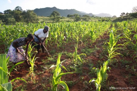


Blog Post 


Comments
A potentially valuable tool - decision makers and planners, even hydro developers can get a quick idea of the costs, impacts and potential capacity of various scenarios without expensive studies. At the Greater Mekong Forum Peter Cutter of SERVIR told me that WLE had provided the project with a great baseline of mapping data to get started. The WLE dataset was the widest and most accurate available he said, and by developing it further and in a different direction, SERVIR had been able to provide feedback and offer a complimentary service. Let's hope this is used and develops further.
A very good tool especially for decision making. I tested the tool but faced some difficulties.
The tool "Dam Tool" is not opening and once I started editing the model. I found some issues in 2 step, where the "Watershed" process starts.
Can you please modify and also upload some documentation so as to understand the background process in the model.
Thank you very much.
Regards
Zahid Wani