Sub Saharan Africa is currently experiencing a food crisis due to drought. The World Food Program estimates that 10 million people in the region will require food aid in the coming year.
How can water resources be better used to ensure food security in these arid and semi arid areas?
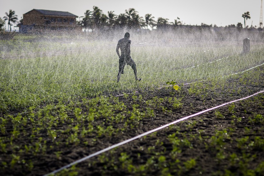
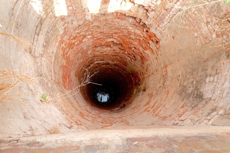
One particularly promising way is to explore groundwater irrigation. It is a growing sector, and as surface water becomes more variable and uncertain, it provides an important buffer for farmers. It also responds to their water demand in a more flexible and reliable way, which would allow them to increase their yields and mitigate the effects of extreme water shortages.
An important vehicle to promote poverty alleviation, especially in rural areas, groundwater irrigation can provide much needed food, as well as rural employment. Crop yields in areas that are currently already using this resource, either solely or in combination with surface water, are typically much higher than those using surface water irrigation alone.
At the moment, groundwater is a largely untapped resource in sub-Saharan Africa, with only 1% of cultivated land being equipped for groundwater irrigation in all of Africa, as compared to 14% in Asia. There are sufficient groundwater stores in many parts of the continent so the potential to increase use for irrigation is quite high.
Ease of extraction and demand are uneven, however, and renewability of groundwater must be considered in order to make any groundwater irrigation schemes beneficial and sustainable over the long term. This requires a good estimation of upper limits for sustainable irrigation and most appropriate geographic areas for development.
The question then is: where does it make sense to develop renewable groundwater irrigation?
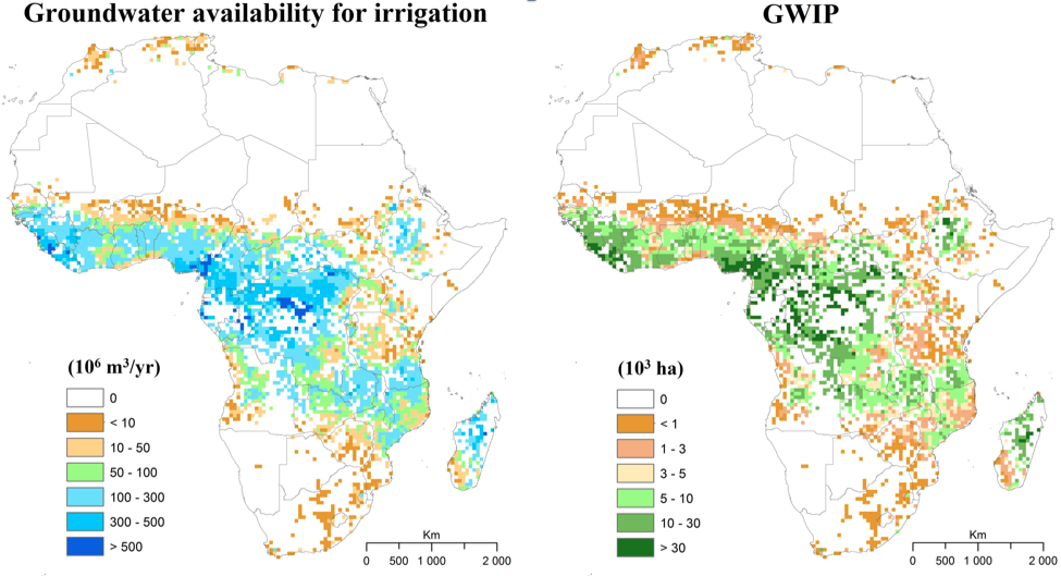
New maps produced by the International Water Management Institute (IWMI) show the irrigation potential of areas that have renewable groundwater resources. They show crop water demand, as well as availability of renewable groundwater and consider not only the demand for water for irrigation, but also for other human uses and the environment.
The maps show that this demand can be met solely through groundwater use.
Researchers were able to determine that, with 70% of the recharge going back to the environment, the area irrigated by groundwater in Sub Saharan Africa had the potential to increase by a factor of 20, from approximately 2 million to 40 million ha.
“That’s quite a bit,” you might think. “Why aren’t we using this resource more?”
There are still some factors, both environmental and socio-economic, that have significant importance for the potential of developing groundwater irrigation. For instance, if groundwater is used to produce crops, is there a way for individuals to get these to market? How feasible is installing pumps, and what is the availability and cost of electricity? Does it make sense to invest in groundwater pumping if there is already a reliable source of surface water?
The team has mapped some of these factors to give a more nuanced idea of where it would make the most sense to pursue groundwater irrigation. The final Groundwater Irrigation Potential (GWIP) map is based on five factors (besides the water availability and requirements as given above):
- Distance to surface water
- Distance to market
- Soil suitability for agriculture
- Drilling and pumping cost: depth of groundwater
- Access to electricity
Mapping and combing these in terms of low-to-high potential for groundwater irrigation development potential, the result is two maps that show how good or bad groundwater irrigation potential is in various parts of Africa, one in terms of groundwater availability, and one in terms of area that could be irrigated.
The implications are significant.
Not only do these maps allow researchers to locate and quantify the groundwater irrigation development potential in Africa, it shows investors and policy makers in each of the countries the spatial variability so they can make better informed decisions. Knowing where farmers will get the most return for investments in groundwater irrigation means that crop yields in these areas can be maximized without negatively impacting the water resource.
These maps are just a rough guide. With climate change affecting the amount of surface and groundwater that is available for farming and other uses, actual groundwater irrigation potentials may change. They will also be influenced by how efficiently this resource is used and what crops are planted. Continued monitoring of groundwater and crop yields is of course important.
However, these maps are the first continental scale maps of groundwater irrigation potential that have been produced. Using this information and planning accordingly could help ensure the food security of millions in an increasingly uncertain waterscape.
These maps and the related study were presented at a workshop to explore smallholder irrigation in Sub Saharan Africa at the Water for Food Institute at the University of Nebraska. To learn more about the maps on groundwater irrigation potential, please see the presentation that was given at the workshop.


