
This post is part of the Agriculture and Ecosystems Blog’s month-long series on Resilience.
Protecting communities from cyclones and floods requires more than shelters and embankments. It requires a landscape approach.
In October 2013, one of the fiercest cyclones in the Bay of Bengal for many years made land fall on the low-lying delta coast of the Indian state of Odisha. Many feared a repeat of super-cyclone Kalinga in 1999, which claimed more than 10,000 lives. But when the winds were stilled, only 59 deaths were reported.
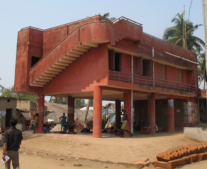 "Cyclone shelters can save lives, but not livelihoods." Pictured here is a cyclone shelter on the Mahanadi delta. Photo: Fred Pearce
It was a spectacular success for disaster planning by the government, which had built hundreds of cyclone shelters, and NGOs running a project known as Partners for Resilience (PfR), which helped equip villages to draw up their own disaster plans, complete with early warning, evacuation plans, family survival kits and grain banks.
Village flood protection measures save lives but not livelihoods
But though lives were saved, livelihoods were wrecked. For the Mahanadi delta landscape has become increasingly vulnerable both to storms surges from the sea and intense rainfall rushing down the rivers and onto the delta. And the irony is that much of the damage has been done by schemes aimed at protecting communities from floods.
Since 1975, almost a third of the delta’s wetlands have been lost. Much of this is a result of extending embankments along rivers to protect villages, farms, ports, industrial plant and prawn farms. But the water has to go somewhere, and all too often it has ended up overtopping embankments and become trapped in waterlogged fields.
As more than a million people returned to their homes after Phailan, they found large parts of the delta were flooded, with trees washed away and thousands of hectares of paddy smothered in mud and sand.
Floods are an annual event on the Mahanadi delta. They are an inherent part of a natural delta system, bringing the silt that maintains the delta itself, protecting it from coastal erosion and maintaining the fertility of the soil. Traditional methods of agriculture sought to benefit from the floods and spread both silt and risk.
However, modern river engineering redefines floods as a risk, and attempts to prevent them with high embankments that both prevent the spread of silt – which then clogs up river channels -- and ultimately increases flood risk, because the water always has to go somewhere. Since the British began installing embankments on the Mahanadi delta two centuries ago, floods have become a risk rather than a resource.
Standing on the bank of the River Dhanua, on the edge of one village near the coast, Alok Mallick, secretary of the Bhutapada village disaster resilience committee, pointed to his chest. "In the floods the water comes this high; it floods all across here. Every year we lose crops to floods.”
Improving the resilience of landscapes is a new flood management approach
In too many places, says Ritesh Kumar, director of Wetlands International South Asia, a partner in PfR that is working in Bhutapada, the destruction by human action of ecosystems is leaving communities more vulnerable to natural disasters – in harm's way. The solution, he says, lies not in a doomed effort to prevent floods, but in improving the resilience of the landscape by finding ways to embrace managed floods through reviving natural wetland ecosystems.
This is a radical departure for most humanitarian groups, which have traditionally failed to address this ecosystem dimension. They measure success in the construction of cyclone shelters, the distribution of drought resistant seeds and the establishment of community grain banks. And where they have considered the wider landscape, they have often promoted community-based schemes that protect one community, while leaving others more vulnerable.
Thus building a new embankment, or dredging a silted up river, may protect one village but increase the risk of dangerous floods in downstream communities. Collective protection cannot be achieved simply by scaling up successful examples of protecting individual communities, says Kumar.
Some villagers are well aware of this. “The floods are getting worse,” one of the elders in Bhutapada, Ramesh Mallick, told me. “Other villages are constructing their own boundary banks that cause more floods here.”
“We need to rethink embankments,” says Kumar. "Working at community level is not enough to reduce risk. Ecosystems work at a higher level. We need to link clusters of villages together to develop plans for ecological rehabilitation that work at landscape level."
During 2013, the PfR network in Odisha – one of a number of places it is working round the world -- helped villagers to plant 140,000 saplings to stabilise river banks and protect eroding coastline in 69 villages in the delta.
But none of this works unless the management of the wider landscape is right
Communities are only part of the story, however. There are other forces at work disrupting the natural processes that sustain this delta.
Along the delta coast, erosion rates are increasing because of both sea-level rise induced by climate change, and massive dredging. The port of Pradeep dredges some 2 million cubic metres of sand and silt a year and dumps it out at sea. The waves find the sediment elsewhere. The result is erosion rates nearby of up to 100 metres a year. A giant steel works planned by the South Korean company POSCO could make things yet worse.
Meanwhile inland, the Hirakud dam on the river Mahanadi now controls much of the water flow onto the delta. Though originally designed with the promise that it would banish floods, it may sometimes be increasing them. In particular by creating unanticipated sudden rises in river flows.
The problem is that the dam's engineers have a dual mandate, with competing operational needs. Preventing dangerous floods requires keeping the reservoir as empty as possible, especially during the monsoon season. But they are also encouraged to keep the reservoir as full as possible, to maximise hydroelectricity generation through the dam's turbines.
Critics say the current operational formula is skewed to power production. At times, after intense rainfall upstream, dam operators are forced to release water even when there are heavy rains below the dam. The results can be worse than if there were no dam at all. Certainly, since Hirakud’s completion, sudden floods on the delta have several times caused mayhem among ill-prepared communities.
Rather than increasing the resilience of delta communities, the operation of the dam, combined with the effect of the embankments in concentrating flood flows and misplacing silt, have ended up reducing resilience. Floods that should sustain livelihoods on the delta have instead become a cause of disaster. Silt that once sustained fields is now choking river channels.
Only a landscape approach, integrating thinking about delta processes, can once again make floods a source of resilience and prosperity. Cyclone shelters can save lives, but not livelihoods.
Related contents
Podcast 
Blog Post 

Blog Post 
Blog Post 


