The International Potato Center (CIP) has worked with Rutgers University and the University of Kansas to develop a tool to predict how water moves through soil.
The structure of soil – if it’s silt, clay and/or sand – and the size and geometry of the open spaces, or soil pores, affects how water move through it and how fast. The property that quantifies the rate of water movement is called ‘hydraulic conductivity.’
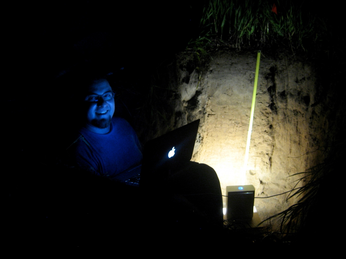
A Multistripe Laser Triangulation (MLT) scanner has been adapted to scan and accurately show large soil pores (macropores). Using the MLT scanner allows soil hydrologists to predict water movement by comparing soil when it’s dry to when it is saturated with water.
Predicting water movement in soil is important for understanding recharge rates of aquifers, making management of this resource potentially more effective and efficient. This is especially important for agriculturalists in areas that are plagued by drought.
The tool could also help scientists and farmers better understand water runoff, soil erosion, how sediment is added to the land (i.e. deposition), and sedimentation of surface water reservoirs. In addition, it could predict how nutrients are transported within the soil.
Article: Relating Quantitative Soil Structure Metrics to Saturated Hydraulic Conductivity
Press Release: Laser Reveals Water’s Secret Life in Soil
Contacts
Adolfo Posadas
Adolfo Posadas, Ph.D, is a Senior Climate Scientist at the International Potato Center (CIP), based in Nairobi, Kenya. His work focuses on Land Health Decisions and the potentials of soils to sequester carbon and mitigate the adverse effects of climate change. Access some of his publications at: https://www.livedna.net/?dna=55.10792
Lead Partner
International Potato Center (CIP)Related publications
Eight research and innovation principles for sustainable and equitable agri-food system
Commission on Sustainable Agriculture Intensification. 2021. Eight research and innovation principles for sustainable and equitable agri-food systems. CoSAI Policy Brief 6. Colombo, Sri Lanka: Commission on Sustainable Agriculture IntensificationClosing a modest investment gap will put hunger, climate and water action back on track to meet global goals
Commission on Sustainable Agriculture Intensification. 2021. Closing a modest investment gap will put hunger, climate and water action back on track to meet global goals. CoSAI Policy Brief 2. Colombo, Sri Lanka: Commission on Sustainable Agriculture IntensificationPriority investments for innovation in urban and peri-urban agriculture (UPA) and food systems in the Global South
Commission on Sustainable Agriculture Intensification. 2021. Priority investments for innovation in urban and peri-urban agriculture (UPA) and food systems in the Global South. CoSAI Policy Brief 8. Colombo, Sri Lanka: Commission on Sustainable Agriculture IntensificationInnovation in farm reward mechanisms is pivotal for transforming agriculture to protect and restore nature in the Global South
Commission on Sustainable Agriculture Intensification. 2021. Innovation in farm reward mechanisms is pivotal for transforming agriculture to protect and restore nature in the Global South. CoSAI Policy Brief 7. Colombo, Sri Lanka: Commission on Sustainable Agriculture IntensificationMining the gaps: Using machine learning to map 1.2 million agri-food publications from the Global South
Commission on Sustainable Agriculture Intensification. 2021. Mining the gaps: Using machine learning to map 1.2 million agri-food publications from the Global South. CoSAI Policy Brief 3. Colombo, Sri Lanka: Commission on Sustainable Agriculture Intensification
Blog Post 

Blog Post 


