Groundbreaking technology using soil spectral analysis enables ecosystem health evaluation on a massive scale, paving the way for better targeting of land restoration and more sustainable agriculture.
Background
Poor soil health is a major cause of decline in agricultural productivity in sub-Saharan Africa, but limited knowledge about soil health and degradation have hampered effective interventions. Surveys based on observable features often fail to capture variation in soil properties, and traditional soil sampling and test methods are costly, slow and inefficient. In the last decade, however, WLE-supported advances in technology to measure soil properties have transformed the possibilities for ecosystem evaluation.
Innovation
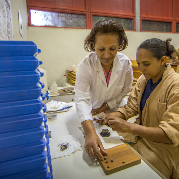
Soil spectroscopy, which uses infrared light on samples to accurately assess properties such as soil carbon, nitrogen and pH levels, represents nothing short of a revolution for soil science. The CIFOR-ICRAF Soil-Plant Spectral Diagnostics Laboratory in Nairobi, Kenya uses spectral analysis to generate data on entire landscapes – hitherto unimaginable and prohibitively costly. The digital maps produced using the Land Degradation Surveillance Framework (LDSF) bring together the biochemical analysis of the soil itself with above-ground indicators like vegetation cover and land use. These are then fed into the open-source Ecosystem Health Surveillance System (EcoHSS).
Impact
WLE’s work on using soil spectral technologies to target investments in land restoration is going global. The lab in Nairobi is now part of the Global Soil Laboratory Network (GLOSOLAN), and is the primary analytical center for the Africa Soil Information Service (AfSIS), which has launched a pioneering 500-meter resolution soil property map of Africa.
The LDSF has been used on hundreds of landscapes across 46 countries, mostly in sub-Saharan Africa. Over a thousand people in 17 African countries have been trained in use of the LDSF by WLE, and a training program tool has been launched in India; four African countries have established national digital soil information systems through AfSIS; and NGOs and the private sector are delivering soil testing services to smallholder farmers. Decision dashboards built from soil data are expected to be an integral tool for data management, evidence-based planning, monitoring and learning. Further, investors have committed US$40 million to scaling up soil spectroscopy in Africa, raising the prospect of helping countries meet their restoration targets.
The work is an important contribution to the United Nations Food Systems Summit Action Track 3 on restoration, as well as to Sustainable Development Goals 13 on climate change and 15 on life on land.
Challenges
Building on the maxim of ‘If you can’t measure it, you can’t manage it’, the success of soil spectroscopy contains several lessons on the challenges of scaling up a lab-based technology, and how to overcome them. Generating soil data has to be part of an overarching objective (to restore land while monitoring progress) rather than a piecemeal activity dependent on demand from clients. Indicators have to be developed for data collection and landscape monitoring that are:
- science-based
- readily measurable and comparable
- rapid
- based on field assessment across multiple scales
- representative of the complex processes of land degradation in landscapes.
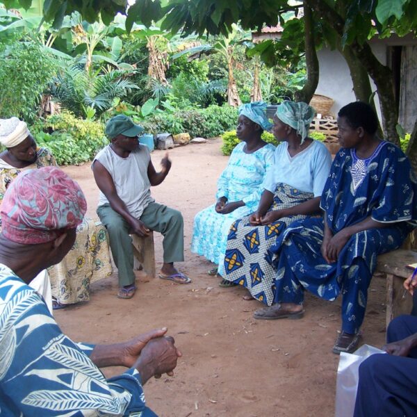
Much more capacity needs to be built in target countries so assessments can be done and the results can be interpreted. As part of this, structured stakeholder engagement can ensure that data and evidence are fed back into the decision-making cycle through a process of co-learning. Local data ultimately needs to feed into harmonized global databases that are open to national institutions and researchers so knowledge and best practices can be shared.
Next steps
Challenge and opportunity lie in the very success of soil spectroscopy. The volume of quantitative data that the technology generates demands analysis and a digital cataloguing system, which in turn requires investment in training as well as resources. New technologies require more than just new technical skills – the resulting data call for a distinctly different outlook from scientists and technicians. This will allow the labs they work in to become repositories of globally networked information that can be used across variable contexts or combined with data from different sources to assess ecosystems, target restoration interventions and monitor progress.
Resources
Al Jazeera program features the Soil-Plant Spectral Diagnostics LaboratoryBBC Focus on Africa features the Soil-Plant Spectral Diagnostics Laboratory Application of systematic monitoring and mapping techniques: Assessing land restoration potential in semi-arid lands of KenyaSpatial gradients of ecosystem health indicators across a human-impacted semiarid savannaEffects of land cover on ecosystem services in Tanzania: A spatial assessment of soil organic carbonSoil-Plant Spectral Diagnostics LaboratorySDGs supported