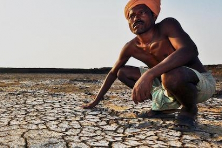
Nile Basin: The Ethiopian highlands have been one of the most affected by land degradation, erosion and water scarcity. ICRISAT and its partners have developed a watershed learning site in Yewol, Ethiopia, where the physical soil and water Management work was done in about 7500 ha of land. We have now identified niches and commodities that would facilitate sustainable intensification of the landscape while improving land and water resources management at farm and landscape scales. The research questions are 1) what are the effects of the soil and water conservation structures on upstream infield food and feed crop productivity, soil water status, erosion incidence and crop and livestock water productivity?; 2) what are the system changes that has been created/modified due to collective action in managing the Yewol agricultural landscapes , including emerging tradeoffs and conflict management strategies, shift in crop types, varieties, management options and byelaws? 3) How does the institutional and local arrangements downstream are changing due to increased provision of ecosystem services in upstream areas (e.g. increased water flow for irrigation, reduced movement of livestock downstream in search for water) ? and 4) what are the key technologies, practices and policy instruments that could be scaled up/out to another watershed site in 2015? The 2015 activities are as follows: 1. Testing the performance of food and feed crops in the various landscape niches and quantify water and nutrient productivity across scales. We will collect data related to what type of crop/variety different farmers of various social category and landscape position will choose, what type of agronomic management they will employ to which crop and the changes in water and nutrient productivity? 2. Identifying and testing various community facilitation pathways, and training methods for farmers and development agents, for improved collective action and conflict resolution; We will monitor and document emerging community issues related to development of new watering points, identify and test local rules and negotiation pathways for conflict management, use various social arrangements for group discussion and document the role of the local government and community leader in facilitating change and resolving conflicts. 3. Comparing various water sources for improving water access and productivity, particularly for high value crops and seed sources across landscape positions and soil fertility gradients. 4. Quantify farm and landscape level benefits of terraces and soil bunds across soil fertility gradients and during small and main rainy seasons. We will measure soil water holding capacity across gradients, crop performance and crop yield 5. Organize policy forums and high-level workshops for scaling-up and wider influence. We will organize a scaling-out workshop, by bring key players from the old and new watershed sites together, facilitate discussion and plan for joint action 6. Scaling out the experiences from Yewol watershed to other landscapes with similar landscapes and climatic challenges. The Haik watershed, which is in a sorghum-based systems of the basin has been identified by our National partners as a potential target watershed for joint engagement. We will test the tools and methods developed in Yewol to characterize the new watershed, create strong partnership and mobilize the local actors for collective engagement. Zambezi Basin: Zambezi Basin, Southern Africa: This is another basin, where very limited investment has been made in land and water resources management, despite high level of poverty and resources degradation. 1. Capitalizing on the review done by Amede etal., 2014 (WLE Research series 1) and the baseline information we have generated in 2014 across three farming subsystems of the Chinyanja triangle (Maize-based, Sorghum-pigeon pea based and Livestock-based), identify key entry points for landscape intensification; 2. Document local knowledge about soil and water resources management and identify indigenous drought management strategies across the three farming systems; 3. Participatory evaluation of ecosystem health from farmers’ perspectives, considering the expansion of tobacco and associated deforestation; 4. Organizing and facilitating capacity building for farmers (particularly women) in land and water management;
Contact Person
Tilahun Amede (t.amede@cgiar.org)Partners
Wollo University, Amhara Regional Agricultural Research InstituteRelated contents
Podcast 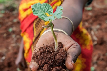
Blog Post 
Blog Post 
Blog Post 


Related publications
A collection of tools for land restoration
Pingault, N., Meybeck, A., Mehmood Ul-Hassan, M., van Noordwijk, M., Minang, P.A. and Gitz, V. 2021. A collection of tools for land restoration. FTA Working Paper 13. Bogor, Indonesia: The CGIAR Research Program on Forests, Trees and Agroforestry (FTA). https://doi.org/10.17528/cifor/008438Sharing research data in a connected world for connected decisions: Lessons learned from the CGIAR Research Program on Water, Land and Ecosystems (WLE)
CGIAR Research Program on Water, Land and Ecosystems (WLE). 2021. Sharing research data in a connected world for connected decisions: Lessons learned from the CGIAR Research Program on Water, Land and Ecosystems (WLE). Colombo, Sri Lanka: CGIAR Research Program on Water, Land and Ecosystems (WLE). 6p. [LEGACY BRIEF 2].Restoring degraded landscapes. A synthesis of evidence generated by the CGIAR Research Program on Water, Land and Ecosystems (WLE) to influence planning, investments, research, practice, capacity and policy
CGIAR Research Program on Water, Land and Ecosystems (WLE). 2021. Restoring degraded landscapes. A synthesis of evidence generated by the CGIAR Research Program on Water, Land and Ecosystems (WLE) to influence planning, investments, research, practice, capacity and policy. Colombo, Sri Lanka: CGIAR Research Program on Water, Land and Ecosystems (WLE). 8p. [LEGACY BRIEF 1].Contour Ridge Tillage for Improved Crops and Fodder Trees Production in the Villages of Kani and Noumpinesso, Southern Mali
Dembele, C. O.; Traore, K.; Karembe, M.; Zemadim, B.; Samake, O. 2021. Contour Ridge Tillage for Improved Crops and Fodder Trees Production in the Villages of Kani and Noumpinesso, Southern Mali. Journal of Agricultural Studies, 9(2):550-572. ISSN 2166-0379 doi:https://dx.doi.org/10.5296/jas.v9i2.18513
Traditional knowledge affects soil management ability of smallholder farmers in marginal areas
Occelli, M.; Mantino, A.; Ragaglini, G.; Dell’Acqua, M.; Fadda, C.; Pè, M.E.; Nuvolari, A. (2021) Traditional knowledge affects soil management ability of smallholder farmers in marginal areas. Agronomy for Sustainable Development 41: 9. ISSN: 1774-0746