
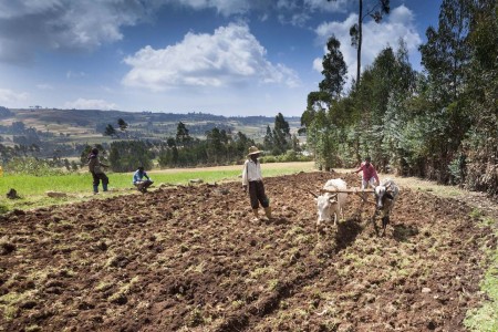
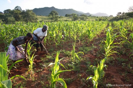
Healthy soils are a necessary foundation for plants and people. A healthy soil is one that can deliver the benefits, or ecosystem services, that millions of farmers depend on. Such benefits include the soil’s ability to retain and supply water and nutrients, without which crops, animals and people cannot thrive.
Until recently, limited knowledge about soil health and degradation has been standing in the way of effective policies and interventions. Without exact knowledge about the extent and gravity of soil issues, making smart choices to alleviate the problem, or to capitalize on existing resources, is nearly impossible.

However, timely and cost-effective soil health surveillance services that can help map soil conditions in all of Africa are now becoming available.
“In the past, soil surveyors mapped soil types based on observable features of the soil and landscape. However, even within the same mapped soil type there is a lot variation in soil properties” explains Keith Shepherd, leader of Land Health Decisions at the World Agroforestry Centre (ICRAF) and co-leader of WLE’s Decision Analysis and Information Systems research theme.
“New digital maps, based on infrared spectroscopy, can tell us precisely what we really want to know to support decision making, that is, the actual distribution of soil properties.”
The new services and maps are being developed by the Africa Soil Information Service (AfSIS), with input from scientists from ICRAF, a partner of the CGIAR Research Program on Water, Land and Ecosystems (WLE), in collaboration with the Earth Institute of the University of Columbia, Columbia Global Centres-Africa and World Soil Information (ISRIC).
Using infrared spectroscopy to analyze soil health
Recently, AfSIS, with input from ICRAF, launched a 250-meter resolution soil property map of Africa – the first baseline on soil health for the continent (Africasoils.net).
The map has been developed from a combination of existing soil legacy data and new soil samples taken across Africa characterized using soil infrared spectroscopy, a low cost technology that can predict properties related to a soil’s capacity to support essential ecosystem services such as primary productivity, nutrient and water retention and resistance to soil erosion.

An infrared spectroscopy measurement can typically be performed in about 30 seconds and costs around $1 to carry out, in contrast to conventional soils tests, which are expensive, slow and use chemicals. By measuring the amount of light absorbed by a soil sample, scientists can determine the soil’s infrared spectrum – or a kind of ‘fingerprint’.
Then, to find out which properties are associated with each ‘fingerprint’, it is compared with calibration databases. The databases contain information on how the infrared spectra – or soil fingerprints – from a range of different soil types match soil properties, and they can be used to predict the soil test values for new samples.
Further, the predicted soil properties from certain locations can be tied to information about environmental variation in landscapes collected via satellite images.
“Spatial variation in soil properties is related to landscape and vegetation features that can be sensed by satellites, so we can also build models to predict soil properties at other locations where a soil sample was not taken,” says Shepherd. “In this way, a digital map of soil properties can be constructed with an estimate of soil properties for each pixel of a satellite image.”
Infrared spectroscopy has proven to be a highly repeatable, rapid and low cost way to measure many soil properties, which can help both farmers and policy makers make better decisions about how to treat soils and reduce land degradation. Just as a doctor must know what illness a patient has before recommending a treatment, soil property maps can allow farmers and policy makers to diagnose and treat soil based on scientific diagnoses.
Open data competition improves accuracy
Last year, the team behind the AfSIS launched an open data competition to harness the global community of data scientists to find the best algorithm for predicting soil properties based on infrared spectroscopy measurements and remote sensing via satellites.
The goal of the competition was to make the algorithms that determine how infrared spectra, or fingerprints, are matched with soil properties more accurate and precise.
The competition attracted 1,233 data science teams from around the world.
“The data science teams validated much of our overall approach, provided some interesting supplementary approaches using ensembles of models to improve prediction stability and contributed improvements in the efficiency of programming code,” says Shepherd.
The competition thus led to both optimized algorithms and an active learning exchange within the data science community.
Infrared spectroscopy can improve policy and natural resources management
The scientists leading AfSIS are helping the governments of Ethiopia, Ghana, Nigeria and Tanzania to establish national soil information systems and services based on soil spectroscopy and digital soil-mapping technology.
In addition, the CGIAR’s Soil-Plant Spectral Diagnostic Laboratory, one of the founding members of AfSIS, now supports a network of spectral laboratories across ten African countries and in India.
These new, rapid and low-cost technologies and digital mapping services of soil properties hold great potential for improving planning and monitoring of sustainable agricultural intensification and natural resources management, especially in data sparse regions such as sub-Saharan Africa.


Shining a light below the surface: Mapping soil properties in Africa
Other Partners
Other partners include the Africa Soil Information Service (AfSIS), the Earth Institute of the University of Columbia, Columbia Global Centres-Africa and World Soil Information (ISRIC).
Related contents
Podcast 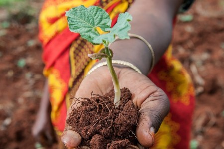
Blog Post 

Blog Post 
Blog Post 


