
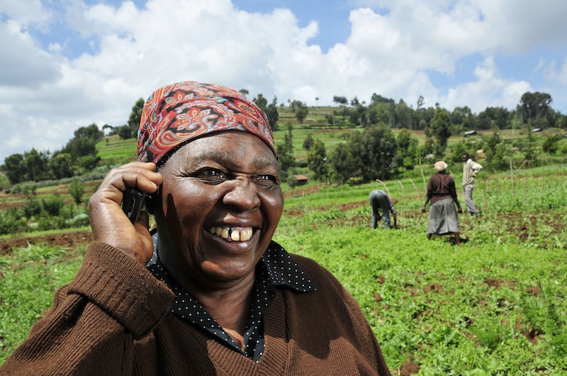
With the help of information and communication technologies, or ICTs, researchers are able to get information and data into the hands of those who need it, faster. As a result, decision makers and farmers are better-equipped to make informed decisions about cropping schedules, water use and disaster risk management.
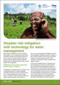
Satellites and cell phone apps help predict floods in Nigeria
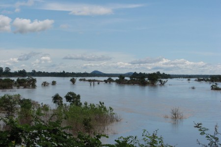
In September 2012 Nigeria’s Benue and Niger rivers overflowed their banks. As water submerged hundreds of thousands of acres of farmland, more than 1.3 million people were forced from their homes. Flooding is a regular occurrence during the region’s monsoon season, with far-reaching economic and social impacts. But Nigeria’s farmers face the opposite challenge during the dry season: a lack of water with which to grow crops and maintain livestock. As climate change continues, these variations are expected to magnify, along with their negative impacts.
That’s why the Federal Ministry of Agriculture and Rural Development of Nigeria has partnered with the International Water Management Institute on a WLE project to not only reduce the risks posed by flooding during the wet season but also increase the country’s agricultural output during the dry season. The project explores new techniques for dry-season farming, particularly flood-recession agriculture where farmers capitalize on the residual moisture and fertile soil left behind after floods recede. In 2014, the project began to integrate spatial data retrieved from satellites with other data on soil moisture, population, land use, topography and cropping patterns – overlapping this data allows scientists to assess areas at risk for flooding and identify potential locations for recession agriculture. A suite of flood forecasting tools, which will help Nigerian government officials plan for future events, are in the final stages of testing and calibration.
Dr. Akinwumi Adesina, Minister of Agriculture and Rural Development, Federal Republic of Nigeria, stated that "Through the concerted efforts of my ministry and IWMI, we will utilize agricultural water management solutions to improve food security and enhance rural livelihoods through expansion of flood-recession and dry-season farming.” Adesina noted that “To achieve this objective, we must focus on smallholder small-scale water management systems and not just on large-scale irrigation schemes."
An exciting component of the project is the development of the FloodWatch mobile phone app that would provide real-time flood warning information to farmers and government officials, helping to safeguard lives and property. The app combines satellite imagery with other data to provide five-day river height forecasts at five stations throughout the Niger-Benue river basin. Users can view graphical representations of river water levels as well as historical data, which is helpful for identifying recurring flooding patterns and better understanding the impact of climate change on water levels. Researchers hope this app can enable improved action during floods, as well as inform the country’s agricultural policies. It also has the potential to help farmers better plan and prepare for flooding cycles, increasing production and contributing to Nigeria’s food security.
Tracking groundwater supplies in Pakistan and Sri Lanka
Pakistan’s Indus Basin Irrigation System covers 34.5 million acres and is supported by 3 reservoirs, 19 barrages and 12 primary canals. It is the largest contiguous irrigation system to be developed in the world in the last 140 years , and is an entirely constructed ecosystem. The irrigation system was originally conceived to boost the agricultural production of cereal and fiber crops, and over time, its role has expanded to include the regulation of floods and droughts.
In 2014, a WLE project developed and deployed sensors to monitor groundwater usage and availability across almost 500,000 acres of the Indus Basin Irrigation System. This network of groundwater sensors provided the highest quality groundwater data to date in Pakistan, offering new insight into groundwater issues. System operators, and for the first time in Pakistan, water users, are now receiving semi-real-time information on actual water supply. The sensors are providing a basis for more informed discussions between officials and water users; the Hakra Area Water Board, for example, has already addressed inequitable water deliveries to some canals. Data from groundwater sensors has the potential to transform canal operation, making it more equitable and productive for farmers.
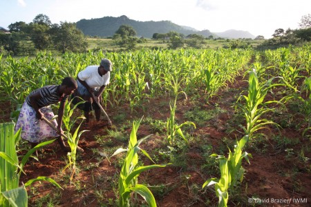
A similar canal flow monitoring system was installed in 2014 on 27,000 acres of Sri Lanka’s Right Bank Canal of the Mahaweli System H, making flow data from five locations instantly available to operators and other users. Real-time data on canal water level is freely available online with plans to make volume and discharge information available at defined time periods (daily, weekly, monthly, seasonal). Timely knowledge about water availability in the main canal will help farmers to plan cropping cycles and water usage based on the water available, and to reduce the drainage or inefficient use of water. This data will also help operators better regulate canal water flow, restoring a number of ecosystem services (such as groundwater aquifer recharge) and minimizing the negative environmental impacts of over-irrigation. Eventually, reallocation of unused water supplies could allow for the expansion of cultivated areas, with groundwater aquifers helping to minimize the risk of crop failure.
Satellites that collect spatial data in Nigeria help predict flooding, while groundwater sensors in Pakistan and Sri Lanka help inform water usage. These information and communication technologies, or ICTs, are placing information in the hands of users and helping communities from Nigeria to Pakistan to Sri Lanka adjust to and prepare for variations due to climate change.

Disaster risk mitigation with technology for water management
Related contents

Blog Post 

Blog Post 


Related publications
How can economic incentives designed for environmental conservation support a transition to sustainable and equitable agriculture?
Moros, L.; Puerto, S.; Monroy, D.; Achaval-Torre, J.; Rueda, X. 2022. How can economic incentives designed for environmental conservation support a transition to sustainable and equitable agriculture? Colombo, Sri Lanka: Commission on Sustainable Agriculture Intensification. 42p.Integrated rice and fish systems
Dubois, M.; Akester, M.; Ou, P.; Freed, S.; Leemans, K.; Mam, K.; de Silva, Sanjiv; Smith, B.; Teoh, S.J.; Aung, H.M.; Beveridge, M.C.M.; Marwaha, N.; Phillips, M. 2021. Integrated rice and fish systems. Penang, Malaysia: CGIAR Research Program on Fish Agri-Food Systems.Program Brief: FISH-2021-14
Unlocking the potential of flood farming to reduce flood risks and boost dryland production in Ethiopia
Desta, Gizaw; Legesse, Gizachew; Amede, Tilahun; van F.Rooyen, Andre; Whitbread, Anthony. 2021. Unlocking the potential of flood farming to reduce flood risks and boost dryland production in Ethiopia. Colombo, Sri Lanka: CGIAR Research Program on Water, Land and Ecosystems (WLE). 10p.
Climate migration and social transformation: The case of West Africa
CGIAR Research Program on Water, Land and Ecosystems (WLE). 2021. Climate migration and social transformation: The case of West Africa. Colombo, Sri Lanka: CGIAR Research Program on Water, Land and Ecosystems (WLE). 4p. [WLE BRIEFING SERIES NO. 33]
Virtual regional dialogue on options to promote more inclusive weather index insurance
D.Surie, Mandakini; Aheeyar, Mohamed; de Silva, Sanjiv; Raut, Manita. 2021. Virtual regional dialogue on options to promote more inclusive weather index insurance. Workshop summary report[27-28 October 2021]. 35p.