Experts in remote sensing shared the latest innovations in digital data with insurance professionals at a virtual training workshop held recently. This new knowledge will enable insurers to build better products that help more farmers in Sri Lanka cope with climate risk.
Most Sri Lankan farmers are smallholders and have faced incessant onslaughts of floods and droughts, which have destroyed crops and assets and forced them to compensate by borrowing at high interest rates they are rarely able to pay back. This has led to spiraling cycles of poverty and suicide in farmer communities. Such events have impacted poverty levels and food security of the nation, and call for timely and effective adaptation policies that enable rural households to combat weather extremes.
Giriraj Amarnath, Principal Researcher – Disaster Risk Management and Climate Resilience and Research Group Lead: Water Risks and Disasters, International Water Management Institute (IWMI), opened the training session by explaining that satellite data is an essential value addition for introducing parametric insurance in Sri Lanka. Although agriculture insurance is not in itself a new concept to the country, providing a weather-based insurance package for smallholder farmers is a new initiative, and this training program is the first of its kind to be held in Sri Lanka.
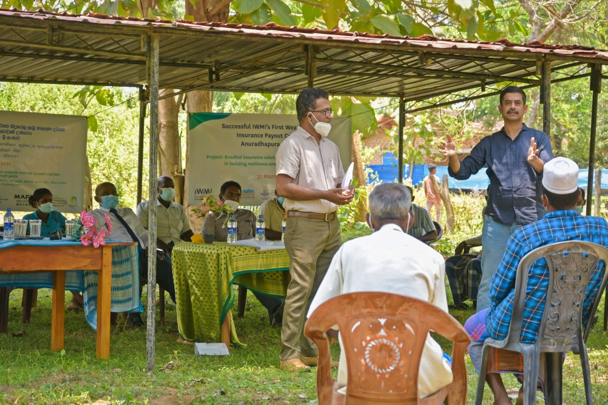
As confirmed by Mark Smith, Director General, IWMI, the workshop ties in with IWMI's role in research for development which drives impacts that make a difference, especially in the lives of vulnerable people. He stated that innovation together with partnerships that can take innovation for development to scale, is the foundation of development research.
Lack of reliable information is one of the main constraints to designing weather insurance products, due to the limited availability of weather station data and crop-related parameters. This shortfall challenges the calculations of premiums and leads to inaccurate payouts when climate disasters strike.
In this context, Simon Langan, Director Digital Innovation and Country Manager Sri Lanka, IWMI, said the workshop was a timely initiative, as 'the rapid advancements in space-based technology offers huge potential for monitoring damaged areas and also fills gaps in knowledge, which make insurance products more available and more impactful and allow for better scaling and rolling across agribusinesses.'
Ravinda Herath, Assistant General Manager, Sanasa General Insurance Co. Ltd., reiterated the importance of obtaining precise information for developing weather index insurance (WII products that meet the needs of both the farmer and the insurance industry. He said that prior to the partnership with IWMI, Sanasa used ground data that necessitated filling in numerous gaps. The satellite data supplied by IWMI has greatly improved processing time and enables the design of more responsive and accurate insurance products to farmers, at lower premiums.
The sessions commenced with a series of presentations that highlighted the usefulness of the many satellite data models available for designing and strengthening weather insurance (WII) products.
Dr. Amarnath provided an overview of the diverse data processes available on open access platforms. He explained the importance of optical data, earth observation data and modelling tools in strengthening risk solutions for agriculture, and showcased some IWMI case studies that utilised satellite data for monitoring ongoing agriculture initiatives as well as mapping damage caused by extreme weather events, which enabled the formulation of effective response strategies.
IWMI is looking to introduce open access data for agriculture insurance, in collaboration with local partners and other CGIAR centers, and is advocating for the development of easily understood analysis-ready data. A better web platform must also be developed for a more effective scaling strategy.
Daniel Edward Osgood, International Research Institute for Climate and Society, provided details of how satellite data could fill data gaps and ensure data consistency, while Surajit Ghosh, Regional Researcher – Water Risk and Data Sciences, IWMI, utilized the versality of the Google Earth Engine (GEE) to illustrate just how this data could be extracted to build scalable RS applications. He stated that GEE's unlimited cloud storage facility enabled easy access to the secure and reliable near real-time and geospatial big data necessary for designing WII, and showcased several case studies on how this data had been extracted for use in IWMI's work in Asia and Africa.
Paresh Shirsath, Associate Scientist, Climate Change, Agriculture and Food Security (CCAFS), India, demonstrated how the increased availability of open access satellite data on weather and crop indices have developed more advanced crop index insurance products, and how multi method and multi model tools are providing real time insights into crop loss monitoring for designing insurance products. He used case studies based on the Crop-loss Assessment Monitor tool and the weather based crop insurance product to illustrate his arguments. Both tools use local data sets calibrated to local conditions and can be customized to individual requirements.
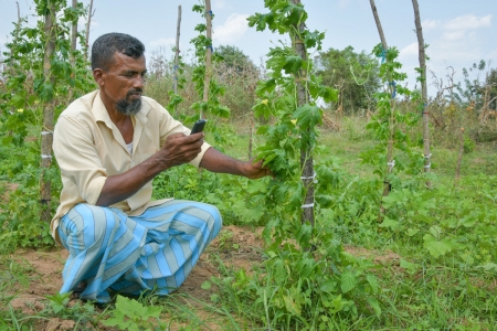
Niranga Alahacoon, Senior Research Officer, Remote Sensing and Disaster Risks Analyst, brought the presentations to a close by summarising the usefulness of various open access data for designing more informative index insurance products. He itemized the platforms from which this data could be sourced, and also demonstrated a mobile-based method of collecting field data that could be an invaluable tool for field insurance staff.
Dr. Amarnath closed the sessions by apprising participants of future opportunities for improving WII and crop loss tools, which will enable consolidation of the potential strength of a multi-institutional partnership through a pilot project designed to arrive at a workable solution.
At an evaluation on the usefulness of the workshop, the participants agreed that the training had been very informative, and expressed interest in future collaboration. Participants took away with them a renewed understanding of the potential of remote sensing for expanding their product offerings.
This training course was held on 1 June 2021 and was organized by IWMI in partnership with CCAFS, who have been involved in the bundled solutions with seed systems, index insurance and climate information to manage agricultural risks (BICSA) initiative in South Asia over the past several years. The course follows a workshop on BICSA which was held a fortnight earlier for key stakeholders in the public, private and development sectors.



/index.jpg?itok=EzuBHOXY&c=feafd7f5ab7d60c363652d23929d0aee)


