By Carolyn Fry
Having insufficient or poor-quality data is an issue for many environmental research projects. A common way to overcome this is to use proxy data or to accept less up-to-date figures. However, when IWMI researchers encountered this challenge while investigating water management in Ethiopia’s Lake Tana basin, they decided to tackle the root cause of the problem. By collaborating with the local basin development office to gather primary data, they were able to calculate the volume of water available in the basin and estimate the water demands of different sectors — and for relatively little cost. These calculations and estimates revealed patterns of supply and demand that can help underpin water-allocation planning in future.
“At the start of the project we looked for existing data that would help us to investigate the impacts that irrigation, industry, and climate change were having in the basin,” explains Meron Teferi Taye, a hydrologist focusing on transitioning landscapes at IWMI, and lead author of a new working paper published on the work. “Despite irrigation booming in the region, information on water availability and use was not available, and data collection had deteriorated due to institutional changes. Working with staff at the Abbay Basin Development Office [ABDO] and woreda (district) experts enabled us to gather streamflow data, develop rating curves, and survey water demand — shedding light on patterns of water use in relation to availability throughout the basin.”
Pressures from development
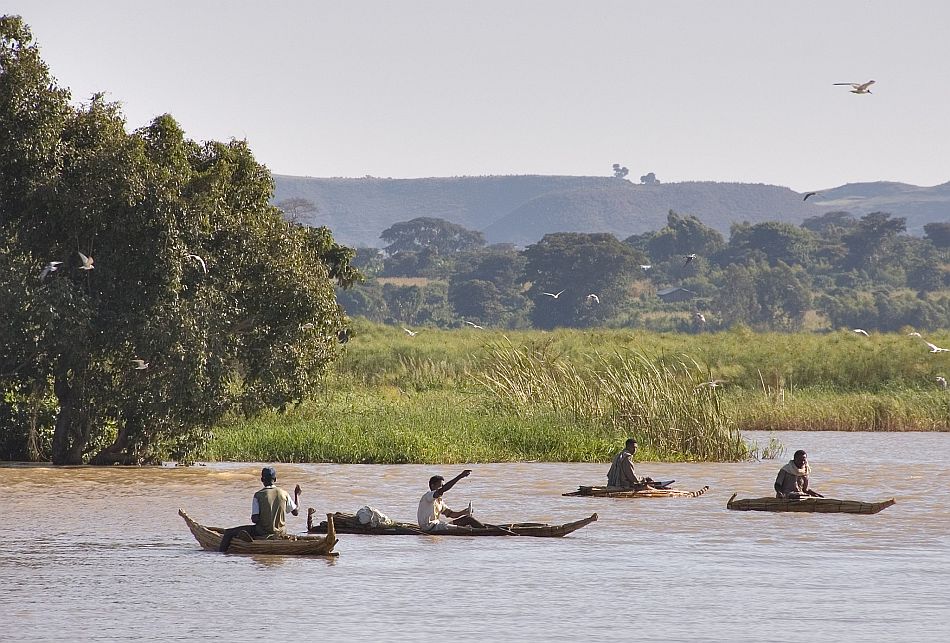
The Lake Tana basin, which is the source of the Blue Nile river, had been selected as a priority for development in Ethiopia because of its land and water resources. However, water managers in the basin were facing a multitude of challenges, which included wetlands being degraded or converted to agricultural land; increased water extraction for irrigation and more water-intensive crops being grown (leading to less water being available to other sectors); rising water scarcity and conflict among users; flooding and damage to infrastructure; and sedimentation and changes to river morphology. The lack of high-quality hydrological data, combined with a lack of clarity around institutional responsibilities and data-sharing protocols, was hindering effective management of these issues.
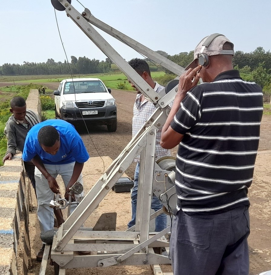
Photo: Sitot Wassie
ABDO collects hydrological data from 171 manual gauging stations and 43 automatic stations in the Blue Nile basin. Its primary focus had been to cover all river gauging stations, which limited the number of measurements that could be made at each station. For this project, IWMI and ABDO staff strategically chose to gather data from just three key gauging stations — Gilgel Abay, Gumara, and Ribb — which covered more than 80 percent of the basin. With technical support from IWMI, a data-collecting team from ABDO camped at each site for ten days during periods of peak flow, and for six days during periods of medium and low flow, taking velocity measurements twice a day. These measurements were combined with data on river width and depth to produce discharge values. Rating curves showing the relationship between discharge and river water height (stage) were then calculated to provide a time series of discharge data.
Daily monitoring of 15 small-scale irrigation schemes was carried out to estimate the amount of water withdrawn for agriculture, yielding a figure of 0.9 litres per second, per hectare. The researchers calculated that 549 million cubic meters of water were withdrawn each year to irrigate 58,873 hectares of land for two seasons. Using a variety of other methods, they also estimated the amount of water used for rainfed farming, rearing livestock, drinking water and domestic use (in towns and rural settlements), industry, and hydropower.
Challenges and opportunities
The findings of the work showed that different parts of the basin had different characteristics. For example, in the eastern part, through which the Gumara and Ribb rivers flowed, over-extraction of water for irrigation was causing the drying of waterways. However, in the southwestern part of the basin, little irrigation was taking place despite there being ample water resources. Such insights can help to guide appropriate water-management actions, such as expanding irrigation in areas where water is plentiful, opting to abstract groundwater when surface resources are low, and installing water-storage facilities to save water during rainy periods for dry-season use.
During the project, IWMI helped develop the skills of ABDO staff by providing guidance in data collection and formatting, report writing, and communicating research findings to different audiences. They also recommended that ABDO forge data partnerships with local universities to strengthen its data-gathering efforts going forward. The adoption of such data alliances has wider potential, too, so IWMI shared the findings of the project with Ethiopia’s Ministry of Water and Energy. The hope is that as climate change puts water resources under increasing pressure, the project can serve as a model for promoting more effective water management in river basins across the country.
The work was conducted through the Future Leaders – African Independent Research (FLAIR) Fellowship project.