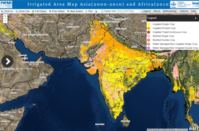
 IWMI’s mapping of irrigated areas continues on its priority continents of Asia and Africa. This product updates the previous estimates of irrigated areas by using the relatively higher resolution Moderate Resolution Imaging Spectroradiometer (MODIS) satellite data and classification methods based on the seasonal profile of vegetation, which has improved the results significantly. IWMI continues to advance its irrigated area mapping products in regions where it works as technology improves.
View the site at http://waterdata.iwmi.org/applications/irri_area/