How to know if there is enough water for the Sustainable Development Goals
In 17 broad strokes, with 169 “finishing touches,” the Sustainable Development Goals (SDGs) offer a complete picture of the better world to which nearly all nations aspire. As development experts take up the task of achieving the goals, they must now adjust their “field of vision,” so as to capture the many fine details contained in tables and maps that are necessary for grounding the goals in reality.
The International Water Management Institute (IWMI) is well prepared to assist in this task, as a new IWMI Research Report amply demonstrates. An eight-member team of Institute and partner scientists prepared the study – titled Global environmental flow information for the Sustainable Development Goals.
Keeping the “S” in the SDGs
The report aims to ensure that countries have ready access to environmental, or water, flow data, which is essential to monitor progress toward the seven SDGs that entail improved water management. Goal 6 deals specifically with water, encompassing six of the 169 SDG targets. Target 6.4, for example, underlines the importance of “sustainable water withdrawals and supply of freshwater to address water scarcity.”
This assumes, of course, that countries will have enough water to reach the goals by 2030, with adequate amounts left over to sustain the ecosystem services that societies will need to continue meeting water needs in the future. Experts can monitor water supply and use, however, only if they first establish a baseline, derived from environmental flow data linked with the SDG targets.
Most countries do not have these data available, at least not in a form that is easy to use for tracking progress toward the water-related SDG targets. Nor is there even a strong awareness of the need for such data. In response, IWMI scientists and their partners have developed an information resource that they hope will help keep the “S” in the SDGs. In order for this to happen, however, environmental flows must become an integral part of the sustainable development discourse rather than being ignored or “left to be dealt with in the future,” as the authors put it.
Fit-for-purpose data
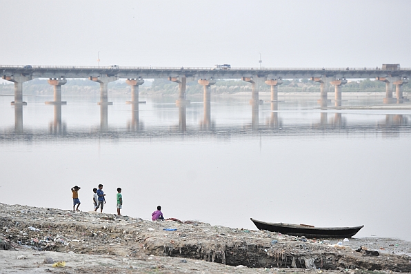
The concept of environmental flows emerged several decades ago in response to concern about the impact of dam building on game fish species, such as salmon, in rivers. Experts later broadened the analysis to encompass issues such as river connectivity, ecosystem services and human well-being. In the process, they developed many methods to quantify environmental flows, ranging from simple rule-of-thumb indices to more sophisticated analytical approaches, based on site-specific field investigations. During recent years, hydrological modeling has proved useful for assessing threats to ecosystems at the regional and global levels.
IWMI conducted its first global assessment of environmental flows in 2004, making available a wealth of data on withdrawal of surface and groundwater at the global, regional and subregional levels. More recently, our researchers have modified this information, so that experts can use it to calculate indicators for SDG targets.
Publicly available online as an interactive tool, called Global Environmental Flow Information System, this resource enables users to select areas of a country or river basin and carry out analysis for an actual or desired environmental management class. There are four main options, ranging from a natural or only slightly modified state to a serious or critical degree of modification that has severely damaged ecosystem services.
Snapshots of water needs
To illustrate how the system works, the IWMI report provides data on environmental flows and sustainable groundwater use at the continental level, offering a global “snapshot” of water needs for achieving the SDGs. The report also explains how to conduct more detailed assessments at subnational levels. Users of the system can select areas within country or river basin boundaries, indicate the appropriate environmental management class for rivers in these areas and then obtain the corresponding environmental flows.
For the selected class, users also get figures indicating approximate thresholds for sustainable use of surface and groundwater that are critical for preventing further river degradation. These estimates are sufficient for establishing a baseline of environmental flows, which countries can later refine, as their capacity for this analysis improves. The resulting information serves to calculate values for SDG indicators, providing country or basin authorities with information that can help them keep river and groundwater use within sustainable limits.